
Search found 351 matches
- Wed Jun 09, 2021 12:52 pm
- Forum: San Gabriels
- Topic: Iron Mountain #2
- Replies: 3
- Views: 113
Re: Iron Mountain #2
I think the fire crews put in extra effort at Messenger Flat and Lightning Point. They are both 'island' groves of ponderosa. Most of the nearby pondos on Gleason summit burned, but the crews managed to save a line of tall ones near the start of the summit spur. I also once (30 yrs ago) found a whit...
- Fri Jun 04, 2021 9:08 am
- Forum: News & Conditions
- Topic: Mount Gleason Road
- Replies: 11
- Views: 293
Re: Mount Gleason Road
The Santa Clara Divide Rd (3N17) is open at Bear Divide also. Looks like all of 3N17, from Three Points to Wilson Canyon Saddle is currently open.
- Wed Jun 02, 2021 4:47 pm
- Forum: General Discussion
- Topic: Finding Boulders
- Replies: 5
- Views: 181
Re: Finding Boulders
The buttress rising from Deer Flat CG to Islip Ridge has always intrigued me.
Big Buck Road (4N24) passes a 'cliff band' at about the halfway mark, with some very interesting roadside stuff. Lots of hand- to offwidth-crack things that just invite the climber's eye, also good quality rock.
Big Buck Road (4N24) passes a 'cliff band' at about the halfway mark, with some very interesting roadside stuff. Lots of hand- to offwidth-crack things that just invite the climber's eye, also good quality rock.
- Wed Jun 02, 2021 4:41 pm
- Forum: News & Conditions
- Topic: Mount Gleason Road
- Replies: 11
- Views: 293
Re: Mount Gleason Road
Privy, outhouse, commode, wc, Unincorporated Department of Sanitation...OK, now I'm trying for 'Python'-esque.Anthony wrote: ↑Loo?Tom Kenney wrote:All the recent grading work, and an upgraded loo at Messenger Flat CG would support this. Thanks!
loo = s#!++er
- Tue Jun 01, 2021 8:53 pm
- Forum: News & Conditions
- Topic: Mount Gleason Road
- Replies: 11
- Views: 293
Re: Mount Gleason Road
All the recent grading work, and an upgraded loo at Messenger Flat CG would support this. Thanks!
- Tue Jun 01, 2021 1:56 pm
- Forum: News & Conditions
- Topic: Mount Gleason Road
- Replies: 11
- Views: 293
Re: Mount Gleason Road
Trailforks report Apparently it's open in a normal seasonal way? I haven't been in a few weeks, but noticed they'd been doing grading on the western side, including brushwork on Moody Cyn. This could also be temporary to spread out traffic since the Bobcat closure area is normally high-traffic. Thi...
- Tue May 25, 2021 1:46 pm
- Forum: San Gabriels
- Topic: TR: PCT Mill Creek Summit to Soledad Canyon, April 2021
- Replies: 9
- Views: 226
Re: TR: PCT Mill Creek Summit to Soledad Canyon, April 2021
Looks like a great, and peaceful!, trip. Thanks! Strange how the trail bypasses the good water in that segment. There is reliable water at Quail Spring...at the top of Indian Cyn Rd, too far west. In the lower elevations of Moody Cyn Rd, between the locked gate and the first switchback, there is alm...
- Wed Apr 14, 2021 1:24 pm
- Forum: News & Conditions
- Topic: SAR Seeking Help Identifying Location In Photo
- Replies: 28
- Views: 1013
- Tue Apr 13, 2021 11:26 am
- Forum: News & Conditions
- Topic: SAR Seeking Help Identifying Location In Photo
- Replies: 28
- Views: 1013
Re: SAR Seeking Help Identifying Location In Photo
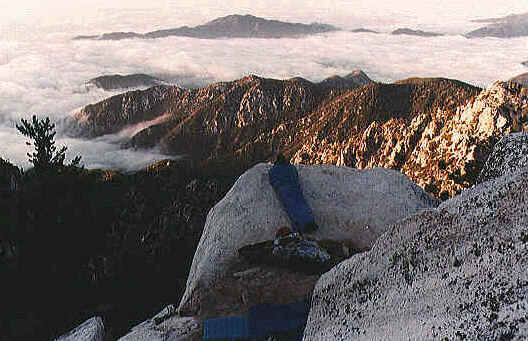
Twin Peaks, maybe? This (image below) is the saddle between the two summits, at the 'split boulder' campsite, looking south into SG Wild.
- Fri Mar 12, 2021 12:53 pm
- Forum: News & Conditions
- Topic: Bobcat Fire: closure info, what's open
- Replies: 54
- Views: 5444
Re: Bobcat Fire: closure info, what's open
According to the CalTrans Map, the CA-2 closure has been dialed back to Eagle's Roost.
NVM...seems it was mentioned above.
NVM...seems it was mentioned above.
- Thu Feb 25, 2021 7:16 pm
- Forum: News & Conditions
- Topic: Bobcat Fire: closure info, what's open
- Replies: 54
- Views: 5444
Re: Bobcat Fire: closure info, what's open
I have no info on the trails/roads within the closure, but the Mt Wilson Road is open again.
'Congressional Boundary' is probably a reference to the National Monument designation. Funny how all the signs for the new Monument are placed 'outside' the old ANF signs, so you'll see them first/earlier?
'Congressional Boundary' is probably a reference to the National Monument designation. Funny how all the signs for the new Monument are placed 'outside' the old ANF signs, so you'll see them first/earlier?
- Wed Feb 03, 2021 11:49 am
- Forum: San Gabriels
- Topic: Crystal Lake Ride and Bike Talk
- Replies: 5
- Views: 151
Re: Crystal Lake Ride and Bike Talk
In the medium-high-zoot catgory, AL and Cali built, Ventana El Comandante Ultimate
They will do custom, if you want geo change or rack/gadget mounts, threaded bb, etc. In the '90s I rode Kleins, but I coveted Ventanas!
They will do custom, if you want geo change or rack/gadget mounts, threaded bb, etc. In the '90s I rode Kleins, but I coveted Ventanas!
- Sat Jan 09, 2021 11:08 pm
- Forum: General Discussion
- Topic: History professor proposes renaming peaks in the San Gabriels
- Replies: 20
- Views: 420
Re: History professor proposes renaming peaks in the San Gabriels
Geez, I sure hope these folks don't learn about Mt. Clarence King!
- Mon Jan 04, 2021 12:50 pm
- Forum: San Gabriels
- Topic: New Year's Stroll on the 39
- Replies: 4
- Views: 128
Re: New Year's Stroll on the 39
Nice! RE: sheep, I've seen them twice, closer to Islip Saddle. One decided to kick a huge boulder down at me! RE: retaining walls/guard walls, near Islip Saddle, there are some that are about 40m/140ft high. Lovely old construction! RE: little structure, it's an old spigot hut. There was a cistern j...
- Mon Jan 04, 2021 12:26 pm
- Forum: San Gabriels
- Topic: Magic Mountain to Capra Road
- Replies: 14
- Views: 355
Re: Magic Mountain to Capra Road
Nice pics! I was just up there Sat (bike loop, 3N17 from Bear Divide to Indian Cyn, then Soledad/Sand Cyn return). The Indian Cyn Rd had much snow cover down to about 1100m/3600ft, much of it was packed/ice due to vehicle traffic, and on steep shaded sections of road. Temps should remain cool, so th...
- Sun Dec 06, 2020 11:40 pm
- Forum: News & Conditions
- Topic: Red Mountain Route Update
- Replies: 4
- Views: 149
- Mon Oct 12, 2020 8:59 pm
- Forum: News & Conditions
- Topic: Bobcat Fire: closure info, what's open
- Replies: 54
- Views: 5444
Re: Bobcat Fire: closure info, what's open
If one was in need of bagging Iron/Rabbit/Roundtop for some reason (list completionist?), now would probably be a good time. The 3N17 was open from Mill Creek to Three Points yesterday. There were lots of hunters everywhere. Somebody was exiting the Gleason seg of 3N17. Does the USFS give out the co...
- Wed Sep 09, 2020 1:46 am
- Forum: California
- Topic: PISMO & SHELL BEACHES
- Replies: 5
- Views: 125
Re: PISMO & SHELL BEACHES
@Girl Hiker re: the plane pic Did you ride a charter or do you have flying friends? My mom is a pilot and member/low-level officer in this region's chapter of The Ninety-Nines ladies' pilots association. I'll ask her if she's ever made that trip. Looks like an excellent change of pace. Thanks for sh...
- Fri Jul 31, 2020 9:04 pm
- Forum: San Gabriels
- Topic: Fall Creek fire road bike ride
- Replies: 14
- Views: 265
Re: Fall Creek fire road bike ride
Los Pinetos Trail starts at Wilson Canyon Saddle. There's a full-blown trailhead with bathroom, tables, signage. Also Viper Tr nearby, Sombrero is a good ride/hike. When temps are cooler, I'll ride from my house over to Sylmar, up May Canyon Rd, down Santa Clara to CA-14, then back over Newhall Pass...
- Fri Jul 31, 2020 7:15 pm
- Forum: San Gabriels
- Topic: Fall Creek fire road bike ride
- Replies: 14
- Views: 265
Re: Fall Creek fire road bike ride
The Santa Clara Divide Road used to be open all the way from Three Points until almost CA-14. There is an old gate just west of Sombrero that was the 'terminus' for public vehicle travel. The Pacifico section saw occasional all-year closures due to damage, but they tried to keep it open if possible....
- Mon Jul 20, 2020 1:25 pm
- Forum: News & Conditions
- Topic: permits, adventure passes
- Replies: 17
- Views: 320
Re: permits, adventure passes
I'm gonna try to avoid stepping on a landmine here, so I'll make 2 brief points: 1) @bcrowell, yes, in it's currently scaled-down form, it's fine...but it's actually a decrease in campground revenue, since the last time I paid for a campsite (Lee Vining, Sep 2000?) it was $7.00 per night. The initia...
- Mon Jul 20, 2020 12:56 pm
- Forum: San Gabriels
- Topic: Akawie Peak - 19-JUL-2020
- Replies: 1
- Views: 92
Akawie Peak - 19-JUL-2020
Wife and I took a mellow stroll up by Buckhorn CG on Sunday. We went to 'Akawie Peak' 2220m/7326ft. This is the large 'centerpiece' between Buckhorn CG and Cooper Canyon. The route follows a network of abandoned roads, starting at the second north-side turnout on CA-2 east of Mt Waterman ski lift. T...
- Sat Jul 18, 2020 9:56 pm
- Forum: Sierra Nevadas
- Topic: Kern Peak
- Replies: 8
- Views: 716
Re: Kern Peak
Nice view. The cabin is abandoned? It's a weird area. It's wilderness, yes, but there're private inholdings and grandfathered ranching operations. So you have old, abandoned cabins AND all the meadows are full of cow pies. I'm sure there're non-abandoned cabins around there somewhere. Sorry for the...
- Sun Jul 12, 2020 2:46 pm
- Forum: Flora, Fauna & Fungi
- Topic: Poisonous surprise!
- Replies: 3
- Views: 672
Poisonous surprise!
I saw dozens of these guys marching around Blue Ridge Rd last night. Size is about 6cm x 3cm. I've seen a couple other varieties of (much) smaller ones, so this came as a bit of a shock.
- Thu Jul 09, 2020 12:15 pm
- Forum: General Discussion
- Topic: Silverfish Truck Trail
- Replies: 6
- Views: 143
Re: Silverfish Truck Trail
I'm looking forward to reading of the first parrot ascent of Monrovia Peak in the next issue of the American Alpine Journal.next apex tool user species has a lot of first ascents to do.
EDIT: Oh, yeah... I Want A Parrot
- Fri Jun 26, 2020 12:10 pm
- Forum: News & Conditions
- Topic: Death at Bridge to Nowhere on 6/24/20
- Replies: 11
- Views: 303
Re: Death at Bridge to Nowhere on 6/24/20
Sounds like his life was populated with good folks. Ripples...his positivity worked it's way outward to the rest of us.
- Wed Jun 24, 2020 9:06 pm
- Forum: Out-of-state
- Topic: Panorama Point
- Replies: 9
- Views: 767
Re: Panorama Point
"I didn't actually take a panorama"
You could paste together 3 copies of that shot, and it'd fool me for sure! ?
You could paste together 3 copies of that shot, and it'd fool me for sure! ?
- Wed Jun 03, 2020 6:07 pm
- Forum: News & Conditions
- Topic: Angeles Crest Highway (CA-2)
- Replies: 639
- Views: 14771
Re: Angeles Crest Highway (CA-2)
Overnight parking has been fine, just not in any closed lots (there are still a few). To 'demonstrate,' lots of my riding is at night, so I'm frequently returning to my quite late. This has been my experience on CA-2. Not sure about Chantry or any of the others. Curfew seems to mainly be about city....
- Wed Jun 03, 2020 11:04 am
- Forum: News & Conditions
- Topic: Angeles Crest Highway (CA-2)
- Replies: 639
- Views: 14771
Re: Angeles Crest Highway (CA-2)
CA-2 is open at Islip. I had to make an interesting call into CHP last night. Apparently CalTrans sent 'the new guy' to unlock the CA-2 gate at Islip. That person also opened the CA-39 gate. It was open all day yesterday, and folks were merrily driving down...and back up, since the lower gate is sti...
- Wed May 27, 2020 3:15 pm
- Forum: Sierra Nevadas
- Topic: Kern Peak
- Replies: 8
- Views: 716
Re: Kern Peak
I agree with Rico, great pano shot. I recognize Whitney, Langley and Cirque on the far right part of it but those are the easy ones. Yeah, mind-bending! The Needles and Merlin Dome are dead-center. Merlin is the broad dome with dark cleft facing camera, The Needles are the rocks to it's right, oppo...