The pole has been accessed

TRs for the San Gabriel Mountains.
Post Reply
User avatar
dima
Posts: 1348
Joined: Wed Feb 12, 2014 1:35 am

Post by dima »

So after way too much time spent NOT doing this, I finally hit the Pole of Inaccessibility, and placed a register there. All possible approaches looked painful (almost like somebody designed it that way!), so today I took the easiest (but not easy) route. This is Vincent Gap to Mount Baden-Powell to Ross Mountain (the mountain, not the man), then dropping down to the Pole.

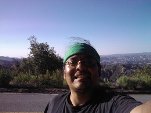
I've never climbed the switchbacks up Baden-Powell before, and that area was suprisingly nice: most of the climb is in a pine forest. Met many PCT through hikers between Vincent Gap and the Baden-Powell summit. Once on top, Ross Mountain came into view, as well as the ridge that gets you there.

Image

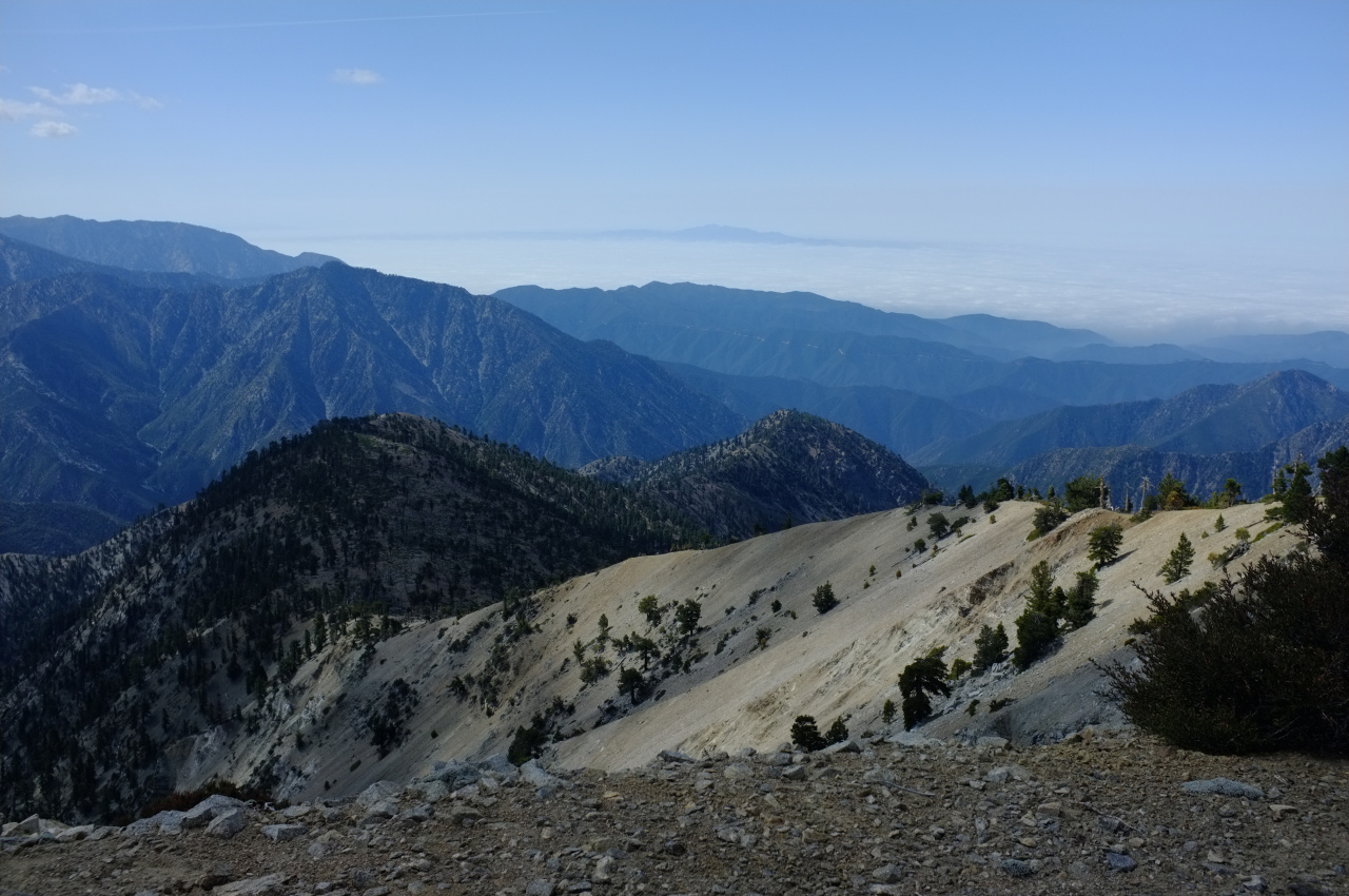
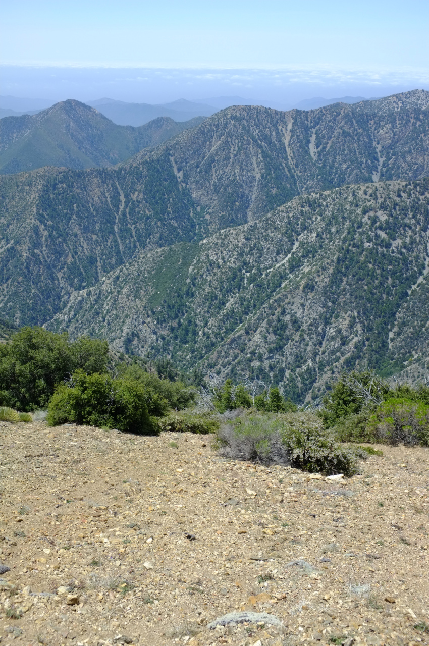
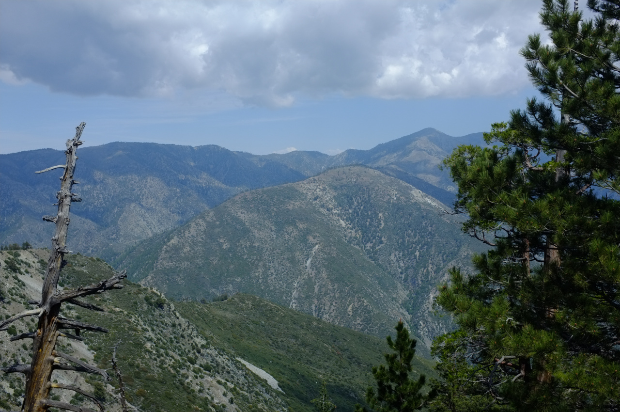
Rattlesnake Peak is visible on the right. The route along that ridge is straightforward, with a use trail present for much of it. There are some bumps, and some steep sections, but nothing remotely technical. There are some great views along the way! Here's Mine Gulch and Pine Mountain Ridge and Prairie Fork:

Image

What's the road or trail visible in Prairie Fork? Is that the route to Cabin Flat Camp?

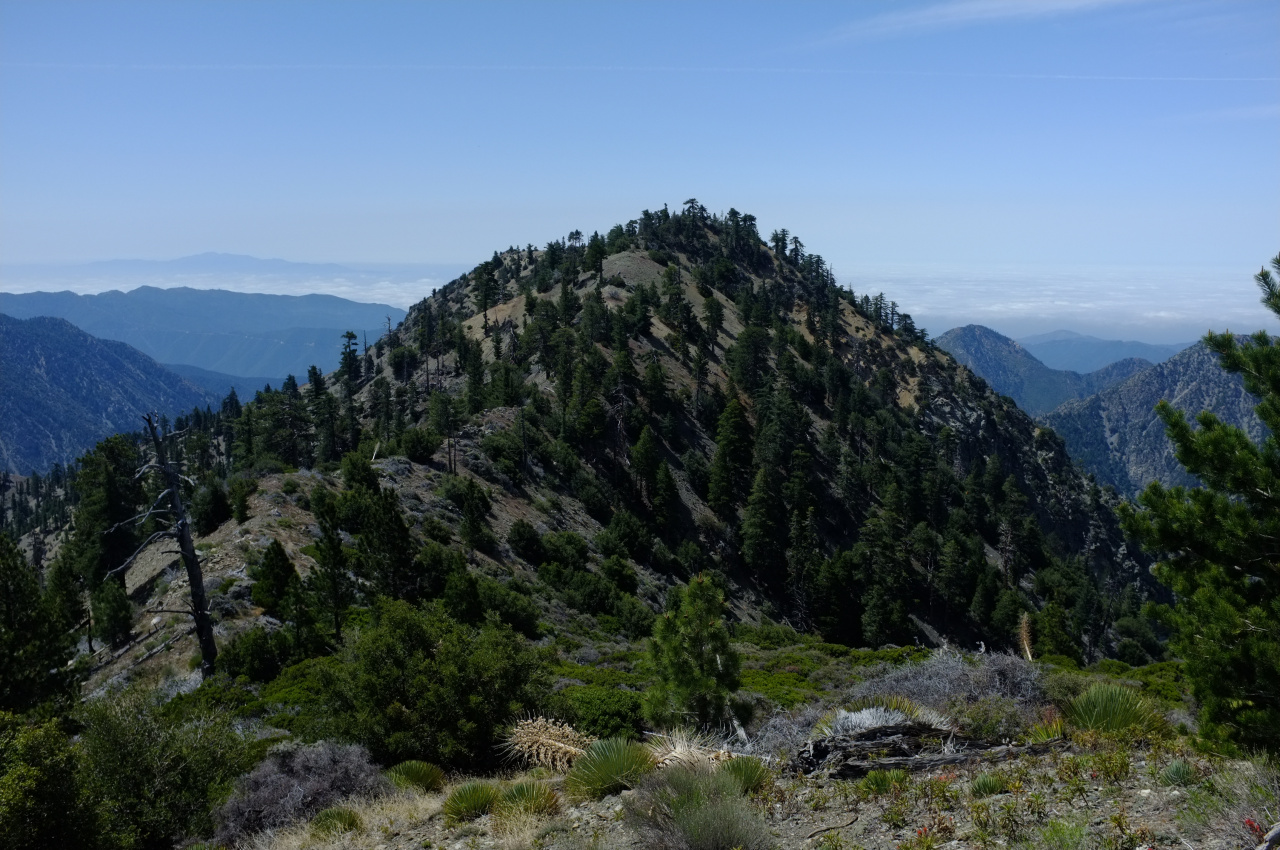
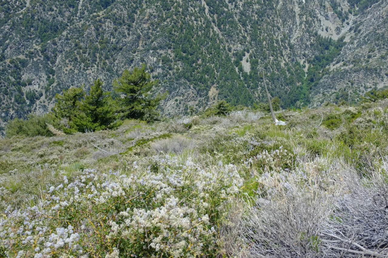
The ridge is mostly an open forest:

Image

Image

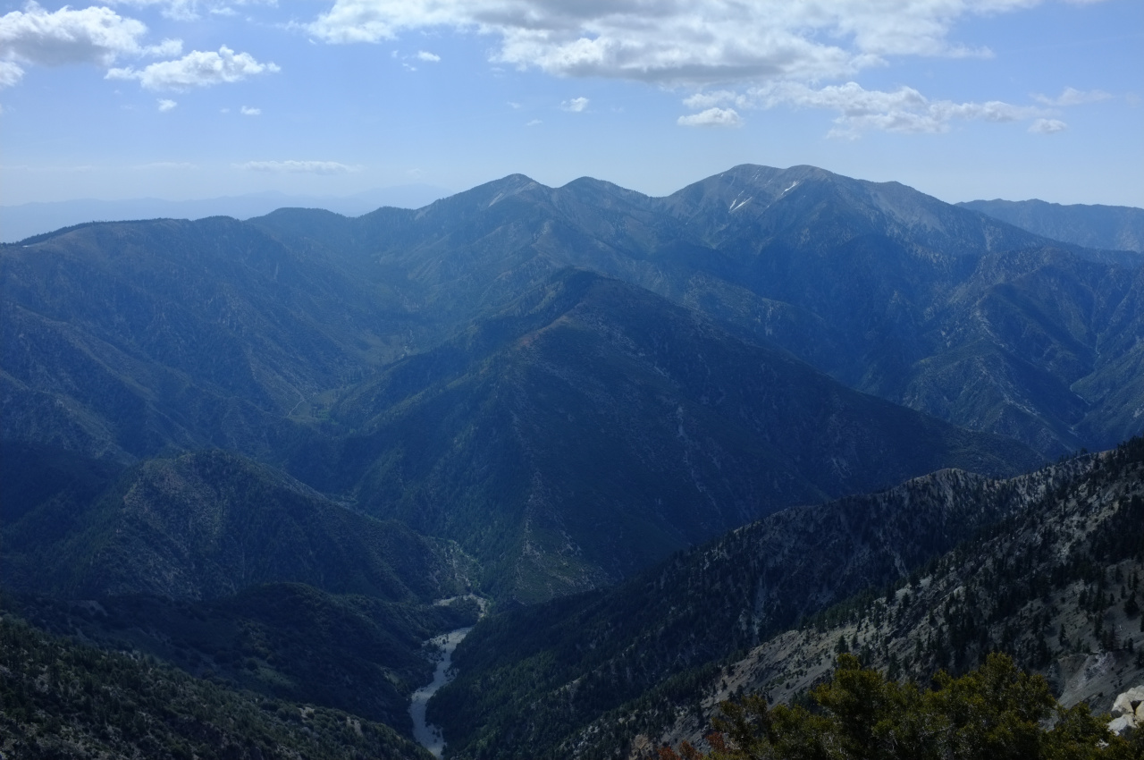
Nearing Ross, Baden-Powell looks pretty far away.

Image

Soon, I was on top of Ross Mountain:

Image

Another hiker was already there, and I caught up with another on the return trip. Three in one day seems like a lot for this one. In any case, Mars Bonfire dominated the register book, and I only saw a handful of other familiar entries, including from the trek _kick_rocks_ posted earlier.

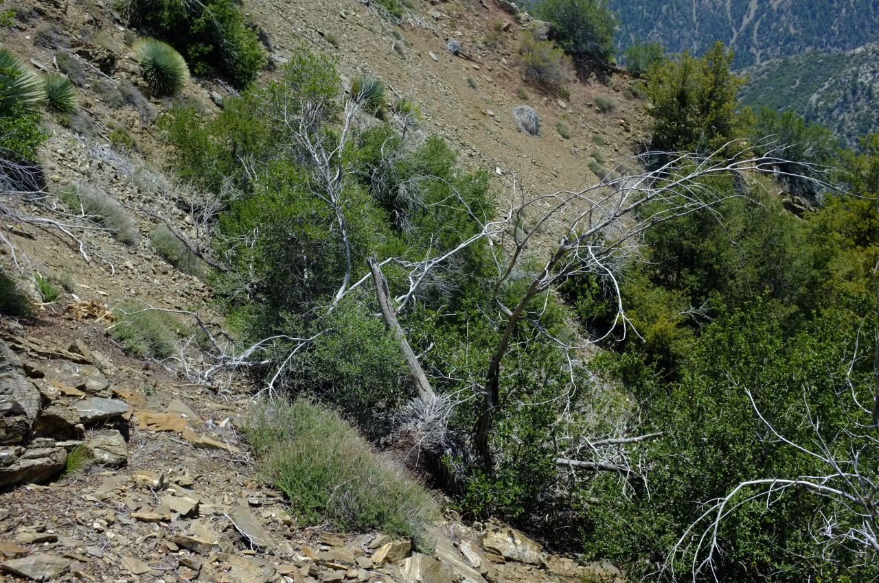
It was time to drop down to the Pole. The location can be seen on this map: http://caltopo.com/m/4N7A The topo shows steep terrain throughout, getting steeper as you descend. So the plan was to stay on the adjacent minor ridge as long as possible to reduce the grade, and then to traverse across when I got to the correct elevation of ~6000ft. At first, the terrain was mostly steep-but-not-feeling-unsafe, with small rocks and not a lot of brush:

Image

Maybe a third of the descent was like this, and it took no time at all. Then this happened:

Image

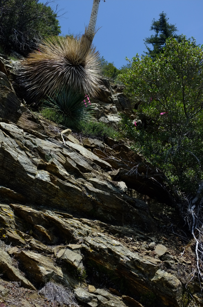
I didn't bother to study the aerial imagery, and now there was a thick carpet of brush in front of me. Half of it was manzanita, which isn't too terrible, but the other half was something sharp and poky. I also neglected to wear long pants. This slowed down progress dramatically. After much unpleasantness, I pushed through the brush. The terrain became uncomfortably steep, with multiple small gullies. There were some trees and yuccas, and there was much shale scree. Nearing the Pole, I found some birthday baloons:

Image

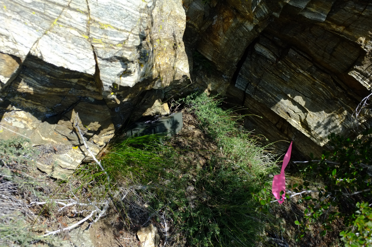
Can't get away from those things. After much circling around on the tricky terrain, I arrived at the Pole. It is roughly in this thicket of brush:

Image

I wanted to place the register somewhere stable and prominent, both of which were lacking in this area. I left it directly above this thicket, above a large block of shale, at the base of the block above it. This is on a minor ridge between two minor gullies. I flagged out the immediate vicinity to make it easier to find, but it would still be a challenge I suspect:

Image

Image

Looking up and South is this tree:

Image

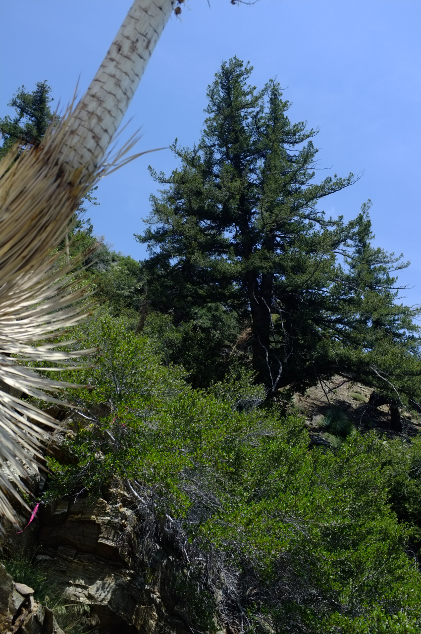
Looking down and North is this tree:

Image

Now it was time to go back up to Ross. I found some animal tracks that avoided the brush by skirting around it on the North side. This is steeper and looser, but not brushy. Here're representative photos:

Image

Image

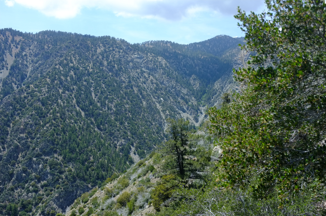
Climbing out of Ross, I was looking at Iron Mt, its North ridge and San Antonio Ridge:

Image

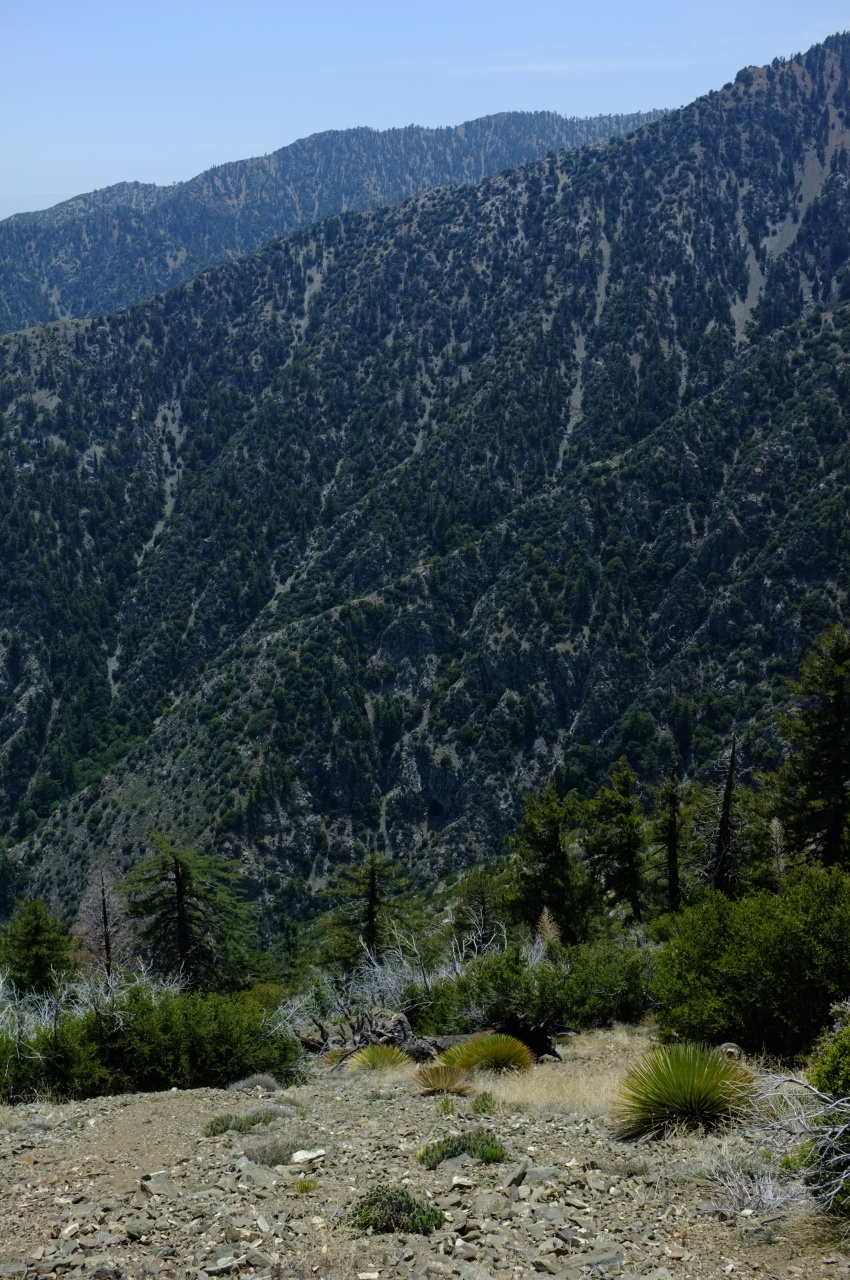
And Pine mountain with its long ridge:

Image

I then pushed through the long slog back to Baden-Powell and down to Vincent Gap. This felt like a pretty long trip and I was happy to finally get back to my car. I cribbed off Sean to bring an extra pair of socks with me, which was a brilliant idea. Next time I'm bringing two extra pairs. And the next time I go to the Pole of Inaccessibility, I'll probably approach from below. Somehow.
User avatar
Uncle Rico
Posts: 1402
Joined: Thu Mar 20, 2008 7:48 pm

Post by Uncle Rico »

Nice work and great pics dima. That seems like a tough day.

Do you have to change the name of the pole now that it's no longer inaccessible? :P
User avatar
Sean
Cucamonga
Posts: 3782
Joined: Wed Jul 27, 2011 12:32 pm

Post by Sean »

Very cool, man. Glad you got it done. I suggest building something there, like a little shrine.
User avatar
Mike P
Posts: 1005
Joined: Tue Oct 02, 2007 10:48 pm

Post by Mike P »

Nice!
User avatar
dima
Posts: 1348
Joined: Wed Feb 12, 2014 1:35 am

Post by dima »

Uncle Rico wrote: Do you have to change the name of the pole now that it's no longer inaccessible? :P
Oh, it's still pretty inaccessible. :) Approach from below would be interesting. It is STEEP.

Sean wrote: I suggest building something there, like a little shrine.
Yeah, that's a good idea. The whole area is steep, and the rock is unstable, so some care will be needed. Should be fun.
User avatar
Tom Kenney
Posts: 371
Joined: Sat Sep 29, 2007 7:51 pm

Post by Tom Kenney »

Bad enough you shame us mere mortals by documenting such a gnarly hike, but then you have to go and poke us in the collective eye with a stick by carrying a freakin' ammo box register along for the ride!!! :twisted:

WOW! And nice pics. Thanks.
User avatar
AW~
Posts: 2040
Joined: Mon Oct 01, 2007 12:00 pm

Post by AW~ »

Sean wrote: Very cool, man. Glad you got it done. I suggest building something there, like a little shrine.

Image
There was another one that is RIP...I didnt hang out to see if someone was actually buried there. I think the whole thing is very uncool for the wilderness. Even the people who left the toilet paper and human poop on the trails are less impactful.
User avatar
dima
Posts: 1348
Joined: Wed Feb 12, 2014 1:35 am

Post by dima »

AW wrote:
Sean wrote: Very cool, man. Glad you got it done. I suggest building something there, like a little shrine.

There was another one that is RIP...I didnt hang out to see if someone was actually buried there. I think the whole thing is very uncool for the wilderness. Even the people who left the toilet paper and human poop on the trails are less impactful.
Oh wow. Was that in the middle of nowhere? The way I interpreted Sean's comment was to build a large trail duck, not burying a beloved relative in the woods. So it wouldn't be terribly impactful. Not that I'm about to go out there tomorrow and do that.
User avatar
Sean
Cucamonga
Posts: 3782
Joined: Wed Jul 27, 2011 12:32 pm

Post by Sean »

I meant creating something symbolic relating to the Pole. But now that I think about it, burying a dead body there might be equally awesome.
User avatar
tekewin
Posts: 1195
Joined: Thu Apr 11, 2013 5:07 pm

Post by tekewin »

Dima, that is awesome from concept to completion!

Just to be clear, this is the pole of inaccessibility, roads + trails?
There were three poles you calculated originally.

Here are the GPS coords to save everyone the look up.
34.3204, -117.7617
11S 0429919E 3797944N

It looks unfriendly there and hard to find. Well done!
User avatar
JeffH
Posts: 1169
Joined: Sun Nov 28, 2010 7:09 am

Post by JeffH »

Damn, that is an awesome day!
"Argue for your limitations and sure enough they're yours".
Donald Shimoda
User avatar
dima
Posts: 1348
Joined: Wed Feb 12, 2014 1:35 am

Post by dima »

tekewin wrote: Just to be clear, this is the pole of inaccessibility, roads + trails?
There were three poles you calculated originally.

Here are the GPS coords to save everyone the look up.
34.3204, -117.7617
The caltopo link above ( http://caltopo.com/m/4N7A ) has the 3 points, and this is the one furthest from everything: roads, tracks and trails. You have the correct coordinates. The other points maximize any walking, not just cross-country walking. I might visit those too, but I consider this point the "main" one.
User avatar
headsizeburrito
Posts: 279
Joined: Wed Nov 15, 2017 1:18 pm

Post by headsizeburrito »

Made it to the Pole yesterday via Dawson Saddle>PCT>Baden-Powell>Ross>POI

Found the register after a bit of wandering, it seems secure and the contents are in good shape. I was the third person to sign it after Dima when it was placed and somebody named Chuck Hodi.

Here is the trip report I just posted on /r/socalhiking.

Both Ross Mountain the Pole have been on my to-do list for a while, so I figured yesterday was a good day for it since it was a reasonable length for the amount of daylight currently available. The most direct route is Vincent Gap up Baden-Powell, then down the ridge to Ross and the Pole. I didn’t feel like doing the switchbacks on that first section, so I decided to start from Dawson Saddle, join the PCT, then reach Baden-Powell that way. I figured I’d probably see fewer people, and it has nice views along the way. I saw one couple on the PCT and reached Baden-Powell uneventfully, then headed down to Ross. This involves descending the ridge about 2,000ft, and while there is no official trail there, it does have a faint use trail that is generally easy to follow. The terrain is pretty pleasant most of the way with a few steep sections, but nothing difficult. I spotted a pair of deer on the relatively flat section of the route about a third of the way in, the only wildlife I saw during the trip besides birds. The summit of Ross is basically just a bump along the ridge, which continues a little further south before it starts dropping steeply.

From here the Pole is more or less directly down a very steep slope. As long as you are pointing in the ridge direction the terrain and vegetation don’t vary that much with any particular line. The first section is mostly loose rock over dirt, which is sort of walkable but often becomes mix of plunge stepping and standing glissade. Then you get into pretty much solid thorny vegetation, so I put on the long sleeves and just forced my way through. In the final section the vegetation thins out, you encounter some larger rocks, and trees start to appear. This is where the Pole and register are, the link above gives more detail on the exact location and landmarks. When I got to the general area I was kicking myself for not saving a copy of the thread to my phone to help me find it, but a tree looked vaguely familiar so I figured I must be close. After about ten minutes of looking around I spotted a piece of flagging tape on a bush (which was pink but has faded to nearly white) and saw the ammo box tucked under a rock.

When I hiked with Dima a couple weeks ago he expressed concern about the register still being there due to possible erosion, but the area around it is in good shape so far and it tucks in fairly securely. The contents were in good condition, with a fancy laminated map of the poles based on different calculations, and a description and URL for the website with more info:

poi.secretsauce.net

I was very curious to see if anyone else had signed it since it’s not widely known, hard to reach, and has only been there about a year. Turns out I was only the second person to sign the register since it’s placement last year, with the last one being this September. I had also purchased a small toy to leave in the box for fun, but when I dug through my pack to find it I realized I had left it in the car at the trailhead…

The hard part of this whole thing is getting back up, and the first section back to the ridge with Ross took me almost an hour due to how steep it is and the thick vegetation in parts. I tried a slightly different line on my way back up to hopefully avoid some of the thorn bushes, but there didn’t manage to find meaningfully easier route. Once you reach the ridge it’s just a matter of regaining the 2,000ft back up to Baden-Powell. Great views along the way, especially of Pine, Baldy, San Antonio Ridge, Iron, and Rattlesnake. On my way back up I had to stop periodically to look at other places I still want to explore in that area (and take a little break, it’s a long climb!). On my way out I passed one more couple between Dawson and the PCT and made it back to my car with about 20 minutes of remaining daylight.

Gallery lives here

Stats: 10 hours, 16.4mi, 5,800ft gain/loss
User avatar
dima
Posts: 1348
Joined: Wed Feb 12, 2014 1:35 am

Post by dima »

Nice! Great to hear you made the trip and that the box is still there. On my trip I found an entirely brush-free line North of the direct one, but it'd be hard to find it again. Maybe I have a gps track somewhere. Thoughts about a route from Heaton Flat?
User avatar
headsizeburrito
Posts: 279
Joined: Wed Nov 15, 2017 1:18 pm

Post by headsizeburrito »

I didn't spend a whole lot of time thinking about that because from there you don't really have goods views down into the various forks, but looking at the Ross summit register, one or two people mentioned coming from Heaton. I assume they would have just followed the river then taken the ridge where Iron Fork joins up. I did see what looked like human footprints at the final tip of the Ross ridge going east, which I assume then forked SE and S to follow the ridge and connect the river.

Instead I spent most of my time thinking about the general area around Pine Ridge. I haven't been down Vincent Gulch, so I need to do that and then check out Big Horn Mine, as well as the plane wreck down there, potentially returning via Pine Ridge to Pine Mountain and back to Vincent Gap via PCT. Of course I had to look at the north ridges of Iron to do those at some point. What really caught my eye was the ridge that starts from Fish Fork and joins San Antonio Ridge in the middle. I was thinking that could be an interesting route and if you started from Heaton you could go that way, do the fun half of SAR to Iron, and return via the standard trail. Or if you were feeling extra saucy, maybe hit Baldy as part of that as well. I don't know if that particular ridge has a name, but if anyone has been that way and knows anything I'd be interested to hear about it.

I know it's further out than you usually travel to hike, but if you felt like calculating the poles for the San Jacinto and Gorgonio wilderness areas and making more of those nice print outs I'd take a shot at reaching them to place a register...

Feel free to jump in on the /r/socalhiking thread and take credit for the original idea and register placement!
sarnorthridge.jpg
User avatar
dima
Posts: 1348
Joined: Wed Feb 12, 2014 1:35 am

Post by dima »

It isn't a lot of work to compute the other poles, and maybe I'll do it at some point. I haven't been up Fish Fork, but it's supposed to be very challenging; don't know if the exciting bits are above or below the ridge you're eyeing. Do a search on the forum, or maybe somebody will speak up?

As for a southern access to the pole, I had an idea: how about taking the East Fork further north, and taking one of the gulches past Fish Fork? It's a looong approach, but looks less hairy than Iron Fork or any of the obvious ridges.
User avatar
dima
Posts: 1348
Joined: Wed Feb 12, 2014 1:35 am

Post by dima »

OK, I looked at it again, and it looks like there's a brush-free-ish line: https://caltopo.com/m/K589

If you (or anybody else) want to try it sometime, ping me.
User avatar
headsizeburrito
Posts: 279
Joined: Wed Nov 15, 2017 1:18 pm

Post by headsizeburrito »

That looks like a pretty reasonable route. Don't wait on me, but I'd probably be up for it when my schedule frees up in a couple weeks.

I did a little looking on Fish Fork, I didn't realize it was legit canyoneering stuff!

20110911-ffiad-t4148.html

I definitely don't have the experience or gear to do that on my own, but I'd love to go upstream and see how far I could get. I imagine most of the tricky parts are further up, but it's not entirely clear from what I've found. Might be worth a scouting trip at least. I wonder if some of the tough parts could be bypassed by going up the sides and traversing the slope, even if it wouldn't be as cool.
User avatar
Rudy Rodriguez
Posts: 57
Joined: Sun Mar 04, 2012 11:06 pm

Post by Rudy Rodriguez »

AW wrote:
Sean wrote: Very cool, man. Glad you got it done. I suggest building something there, like a little shrine.

Image
There was another one that is RIP...I didnt hang out to see if someone was actually buried there. I think the whole thing is very uncool for the wilderness. Even the people who left the toilet paper and human poop on the trails are less impactful.
From a Mexican POV, this cross is possibly the spot someone died at...not where they're buried. You'll see these along highways and other roads.
Post Reply