Attempted Baldy 9 Peaks Challenge, 02-Aug-2008
I was only able to get 6 of the 9 peaks. For the past month I've been working up to do this hike by doing test hikes of different portions of the route. Usually in my TR's I say I had a good time. Not this time. This was the worst, most miserable hike I've ever done.
I started at the Visitor Center at 4:30am. I was the first one there, but within a few minutes an old guy in a truck pulled up to get his permit from the bulletin board. Was this the elusive Fight On? I dunno, I didn't stick around long enough to see if he had any exposed nipples.
It was pretty warm in Bear Canyon, even in the dark. It only got cooler as I got to the ridge. Watching the sunrise was cool but I felt like a walking zombie. I only had 2 hours of sleep and was dead tired and sleepy. My time up Bear Canyon was no better than last week when I did this same hike in the heat and fighting heel blisters. I only saw 5 people on the trail: a solo hiker and 4 trail runners.
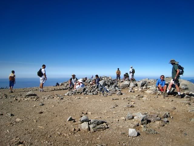
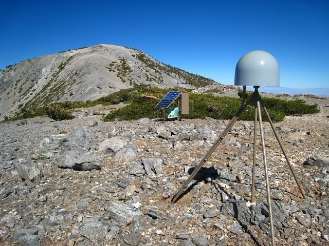
I reached West Baldy a little before 9:00am, then went over to Baldy. There were about a dozen people on Baldy. I guess the crowds were still on their way. It was a pretty clear day, especially in the direction of the high desert. I continued on the Devil's Backbone Trail to Mt. Harwood and took a look at the EarthScope station. I passed a lot of people heading up the DBB towards Baldy. Just before 11:00am I got to Baldy Notch and took a break in the restaurant. I was already feeling really tired so I had to drink a can of 7-Up that I had brought along. I sure wasn't going to pay $2.50 for one can of soda at the Notch. I also ate an orange and took some more electrolyte pills.
I walked up the road to Thunder, then continued on to Telegraph. After the saddle I met some friends who were doing the 3 T's as part of a group hike. I got energized after that and went up Telegraph pretty quickly. The steepness of that trail is a lot like going to Cucamonga and is just right for me. I met some more friends who were hanging out at the summit of Telegraph. I hurried off and tried to get Timber before 2:00pm.
When I got to the saddle before Timber, the sun was at full blast. The heat totally sapped all my energy and willpower. I started to feel really nauseated. I couldn't eat anything and drinking water made me sick. All I wanted was another can of soda or a slurpee or some ice cold watermelon. I barely managed to summit Timber and knew I had to call this off. I was so done. A friend offered me a ride back to the Village from IHC and I took it. Last weekend I walked down that road in the blazing heat from the ski lift to the Village and that was just horrendous.
I think I've found my limit when it comes to hiking. There was nothing enjoyable about this hike at all. Maybe it would be better in the fall but for now I'm sick of hiking. I'm going to ride my bike at the beach for the rest of the summer. You get plenty of nice views there too.
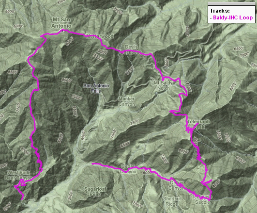
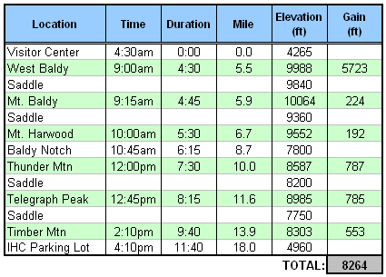
Stats:
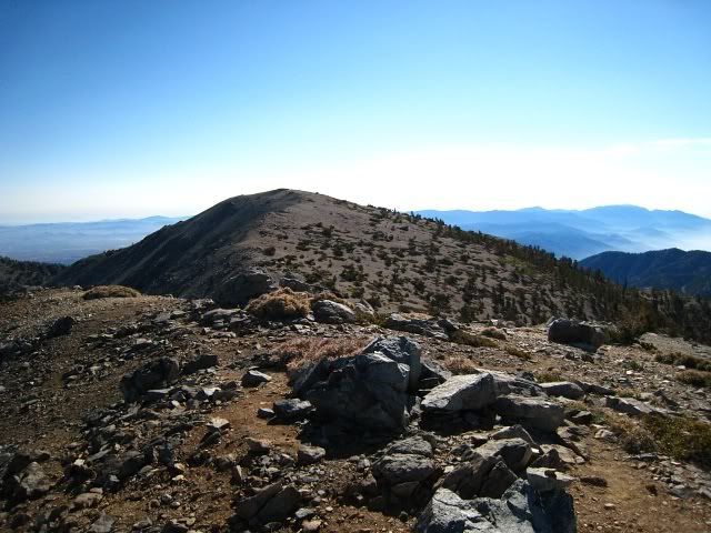
From West Baldy, looking towards Baldy
Baldy
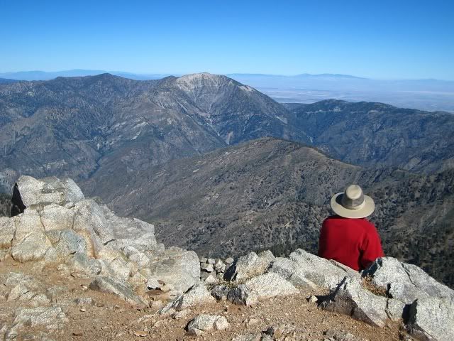
From Baldy, towards Baden-Powell
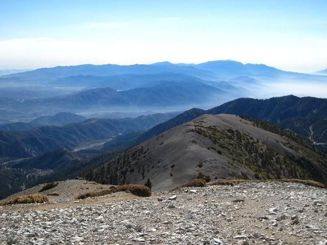
From Baldy, towards SGW
EarthScope station near Harwood
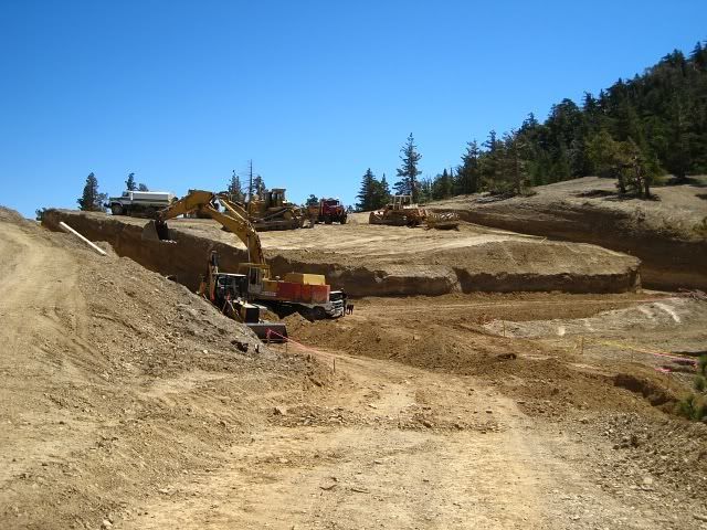
Some work being done along the road to Thunder. Just stay on the road and it goes around where they're digging.
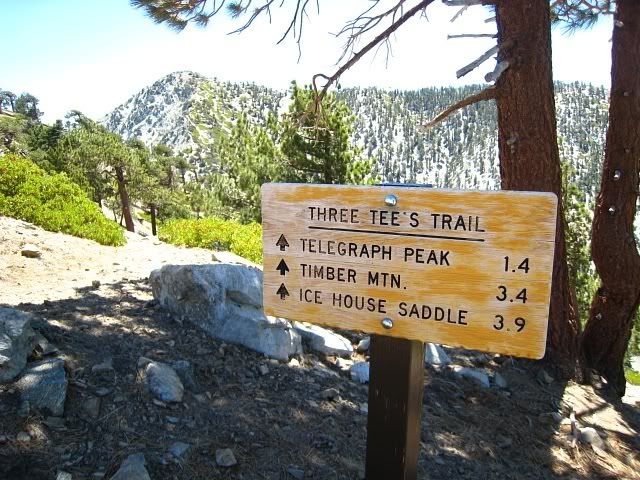
Start of the 3 T's from Thunder
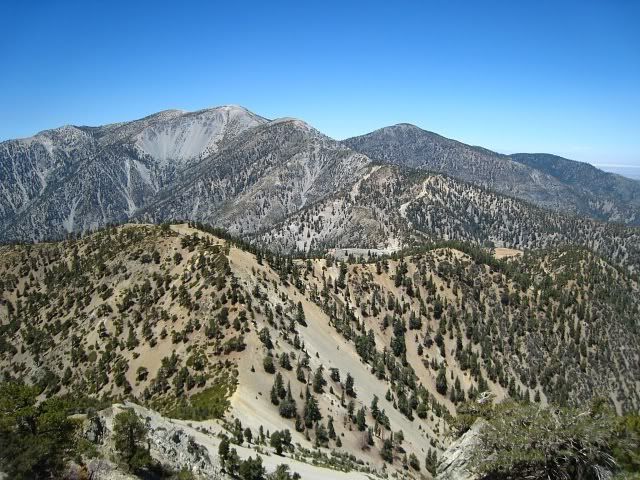
View of Baldy from Telegraph
long hike!Tim wrote:I started at the Visitor Center at 4:30am. I was the first one there, but within a few minutes an old guy in a truck pulled up to get his permit from the bulletin board. Was this the elusive Fight On? I dunno, I didn't stick around long enough to see if he had any exposed nipples.
It's not Fight On. It's FIGHT ON. dammit! use the cap lock please!
I think you saw my buddy Charles. Was he tall and ugly and skinny? Did you talk to him? What time exactly did you leave the Village? Also by your map it looks like you started the Bear Flat hike too far up. suppose to start at that white gate next to Smokey Bear. What was he wearing?
Thanks HikeUp.
FO, my car was parked outside the Visitor Center. I met a magic genie and he gave me a ride on his magic carpet up Bear Canyon Rd. My GPS could not receive any signals within the powerful anti-gravity force field of the magic carpet so it didn't start recording until he dropped me off.
Same here, Taco. I'm a fall/winter kind of guy. The only good thing about summer is being able to ogle chicks at the beach.
I think that 6 peaks are impressive in this heat!
The whole enterprise would be a lot easier if people didn't insist on starting with the Bear Flat Trail, which is a killer in its own right. And, when I say "people", I include myself.
The San Gorgonio 9 Peaks hike is easier, at least in my opinion. The Baldy version has enough additional elevation gain to put it in a different class. Both have the nice feature of having multiple bail-out points, which is nice when pushing that hard.
The bail-out points definitely make it a lot safer. I don't know how people do the Grand Canyon R2R2R in one day, which really only has one bail-out point. Pretty scary.AlanK wrote:Both have the nice feature of having multiple bail-out points, which is nice when pushing that hard.
Other people reported trouble with the Baldy 9 (or more) Peaks hike this weekend:
Baldy Peaks Posts
Rick Graham has done the 9 peaks several times in the past.
It was hot!
Baldy Peaks Posts
Rick Graham has done the 9 peaks several times in the past.
It was hot!
Tim, ya done good. Really, most people would do Baldy alone from the village and think it a challenging hike. Anything more than West Baldy, Baldy, and Harwood is a pretty good accomplishment, and you did multiple peaks after Harwood in hot weather. Good job!
That's crazy! What are the odds of that many people doing the Baldy 9 the same weekend??AlanK wrote:Other people reported trouble with the Baldy 9 (or more) Peaks hike this weekend:
Thanks HJ. I'm okay with getting just 6 peaks. There were some things I could have done better like getting more sleep and bringing flavored drink mixes, but I now realize this hike is impossible for me to do in the heat. My pace just isn't fast enough. My cold water/ice block was gone by Timber and all I had left was 1.5L of lukewarm water in external bottles. There was no way I was going to drink that.
I guess I just wanted to show that there comes a point where hiking becomes completely miserable and in my case I reached it
I forgot to mention I saw of 3 deer (looked like a momma and two babies) on Timber just as I was leaving the summit. The crossed right in front of the trail and bolted as soon as they saw me.
Tim. Not that I expect an answer but how old are you? I'm 53 just in case you wanted to say "I won't tell you unless you tell me first". See, I answered the question before you even asked it. I'm pretty smart huh aren't I?
Seriously. Are you in your 40s?
Don't quit hiking!
Thanks.
Seriously. Are you in your 40s?
Don't quit hiking!
Thanks.
Tim:
I guess that was you that I saw on The Bear Flat trail on Saturday - right around sunrise? I think I was the "solo hiker" you referred to. BTW thanks for not saying "some other old guy".
I too was headed for a variation of a Baldy big loop hike and when I got into the 3 T's, I got sun dried as well.
In fact, I changed course from Cucamonga to Ontario (Kelly Camp) to load up on water. fortunately the spring was running (about 1 liter per minute) and I managed to get to Ontario and Big Horn before heading down Ice House Canyon. Right near the ridge turnoff to Bighorn, I saw the biggest most beautiful Bighorn that I have ever seen (I wasn't hallucinating at this point). Unfortunately it was faster than my camera hand was.
Also: Don't quit hiking!
Early 30's. But age doesn't matter much in hiking. There are people twice my age that would smoke right by me.
Lik2hik, that was me. Good job on getting Ontario and Bighorn. There were two other guys doing the big Baldy loop that same day. So with you and GigaMike that's five people total. Strange how so many people chose this day to do the big loop. Maybe people do it all the time? Lots of wildlife that day too, for some reason. I'm still going to hike, just no more big hikes in the heat.
I was gonna do it too! I swear! Charles called me up on Thursday out of the blue,(I thought for sure he had been reading my posts and thought that I was REALLY crazy!, every time we hike he eventually says something like "Fight, I'm getting a little worried, are you ok?") So when he called me I realized that I am not THAT crazy! So he says he wanted to go to Cucamonga Peak! I've never been there and neither has he but I wanted to hike more than 12 miles so I tried to get him to commit to hiking maybe to Ontario too. But then I started to look at the map and realized that it was only 6 miles from the saddle to the notch and started to get excited! Because then it's only like 4 miles to Baldy AND THEN IT'S DOWN HILL BABY ALL THE WAY BACK TO THE STABLES. I WAS SMELLIN' THE BARN ALREADY I TELL YA!!!! Never looked close at this loop. or nine peaks loop. still don't know exactly what the route is.
Then he said he hadn't hiked in three months. And as we hiked up Ice house canyon I knew right away we weren't gonna do it.
I wanna do it. so we just went to coocoomunga. But it was cool up there! We saw sheep across ice house canyon.
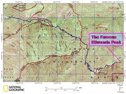
correct me if I'm wrong here. 3.4 up to the saddle, 2.5 up to coo coo munga, 2.5 back, 2.7 to ontario, 2.7 back. then 6 to the notch including the 3ts. 3.2 to baldy, 6.6 down to the visitor center including west baldy and 2 miles back to the parking lot? 31.6 miles? I'm missing some peaks? Where is Etiwanda Peak? Not on my Tom Harrison map or my john robinson map not on the internet you guys made up this peak!
Etiwanda is a bit east of Cucamonga. Basically you hike as though you were headed to the San Sevain (sp?) trailhead but go to the easternmost high point along the summit ridge. Kind of a disappointing peak in my opinion. You should look at a more detailed map than the Tom Harrison map for this one.
Ya. I expected to be able to find a map somewhere on the internet with it. BUT NO!Hikin_Jim wrote:Etiwanda is a bit east of Cucamonga. Basically you hike as though you were headed to the San Sevain (sp?) trailhead but go to the easternmost high point along the summit ridge. Kind of a disappointing peak in my opinion. You should look at a more detailed map than the Tom Harrison map for this one.
Thanks AlanK! no wonder I couldn't find it. I was looking on the one that Al Gore invented!
you thought I could read way points and a gps? I was talkin about one of those big pirate treasure maps with the big X where the peak is. Oh and a dotted line leading to it.
Oh I just read where the trail is. you make a left at that sign near the summit of Cucamonga? I remember that sign. I SAW THE SIGN. Charles wanted to go left but I saw the little arrow and saved the day! it was the blind leading the blind i tell ya! somebody needs to saw that nob off that tree that spans the trail. why don't those sign hackers do some good with those axes and improve things instead of messin up things?
But you know if HJ says it's a disappointment then I think I would just go there only as part of the peak loop.
Thanks Big Jim. You always come through!Hikin_Jim wrote:Was this helpful at all?
I was just amazed that I could not find any map anywhere that has Etiwanda Peak marked on it, Like Cucamonga Peak is.
You got a map that has it named on it?
YOU JUST MADE THAT PEAK SIGN AND STUCK IT ON YOUR MAP! I KNOW YOUR MAPS ALANK! YOU CAN'T FOOL ME!AlanK wrote:It's amazing what's out there.FIGHT ON wrote:I was just amazed that I could not find any map anywhere that has Etiwanda Peak marked on it, Like Cucamonga Peak is.
You got a map that has it named on it?