I started at the Visitor Center at 4:30am. I was the first one there, but within a few minutes an old guy in a truck pulled up to get his permit from the bulletin board. Was this the elusive Fight On? I dunno, I didn't stick around long enough to see if he had any exposed nipples.
It was pretty warm in Bear Canyon, even in the dark. It only got cooler as I got to the ridge. Watching the sunrise was cool but I felt like a walking zombie. I only had 2 hours of sleep and was dead tired and sleepy. My time up Bear Canyon was no better than last week when I did this same hike in the heat and fighting heel blisters. I only saw 5 people on the trail: a solo hiker and 4 trail runners.
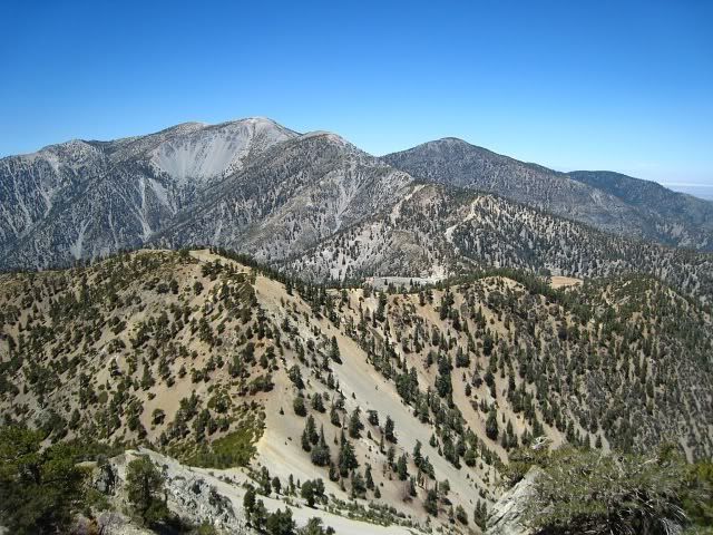
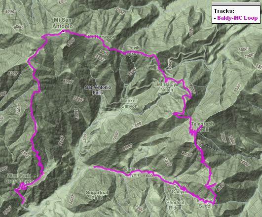
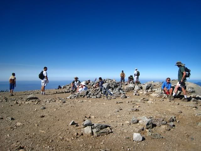
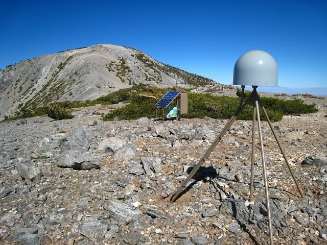
I reached West Baldy a little before 9:00am, then went over to Baldy. There were about a dozen people on Baldy. I guess the crowds were still on their way. It was a pretty clear day, especially in the direction of the high desert. I continued on the Devil's Backbone Trail to Mt. Harwood and took a look at the EarthScope station. I passed a lot of people heading up the DBB towards Baldy. Just before 11:00am I got to Baldy Notch and took a break in the restaurant. I was already feeling really tired so I had to drink a can of 7-Up that I had brought along. I sure wasn't going to pay $2.50 for one can of soda at the Notch. I also ate an orange and took some more electrolyte pills.
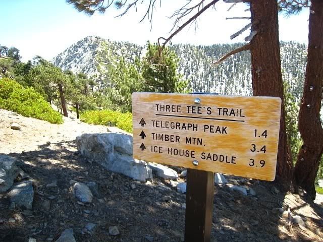
I walked up the road to Thunder, then continued on to Telegraph. After the saddle I met some friends who were doing the 3 T's as part of a group hike. I got energized after that and went up Telegraph pretty quickly. The steepness of that trail is a lot like going to Cucamonga and is just right for me. I met some more friends who were hanging out at the summit of Telegraph. I hurried off and tried to get Timber before 2:00pm.
When I got to the saddle before Timber, the sun was at full blast. The heat totally sapped all my energy and willpower. I started to feel really nauseated. I couldn't eat anything and drinking water made me sick. All I wanted was another can of soda or a slurpee or some ice cold watermelon. I barely managed to summit Timber and knew I had to call this off. I was so done. A friend offered me a ride back to the Village from IHC and I took it. Last weekend I walked down that road in the blazing heat from the ski lift to the Village and that was just horrendous.
I think I've found my limit when it comes to hiking. There was nothing enjoyable about this hike at all. Maybe it would be better in the fall but for now I'm sick of hiking. I'm going to ride my bike at the beach for the rest of the summer. You get plenty of nice views there too.
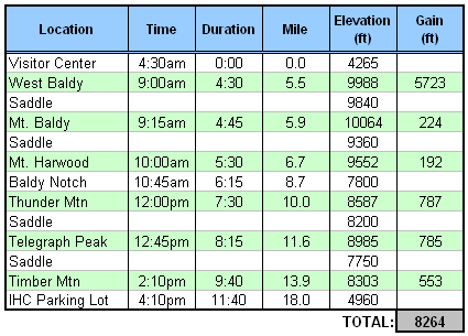
Stats:
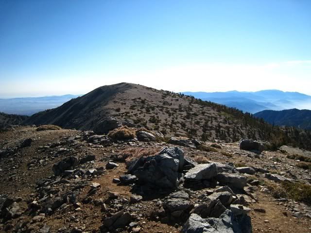
From West Baldy, looking towards Baldy
Baldy
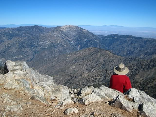
From Baldy, towards Baden-Powell
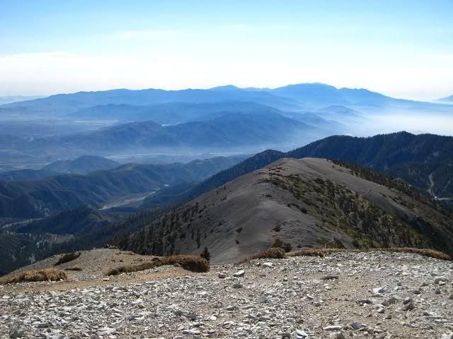
From Baldy, towards SGW
EarthScope station near Harwood
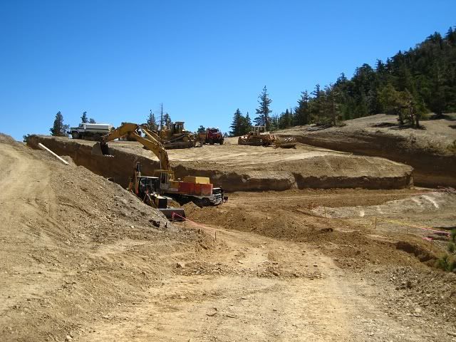
Some work being done along the road to Thunder. Just stay on the road and it goes around where they're digging.
Start of the 3 T's from Thunder
View of Baldy from Telegraph