Bobcat Fire in West Fork

Rescues, fires, weather, roads, trails, water, etc.
User avatar
HikeUp
Posts: 3855
Joined: Thu Sep 27, 2007 9:21 pm

Post by HikeUp »

Crap...I cut and pasted just as it refreshed and the plane is gone.
User avatar
maxmapper
Posts: 43
Joined: Fri Jan 17, 2020 5:50 pm

Post by maxmapper »

Here you go
Screenshot_20200909_155529.png
User avatar
AW~
Posts: 2040
Joined: Mon Oct 01, 2007 12:00 pm

Post by AW~ »

HikeUp wrote: Crap...I cut and pasted just as it refreshed and the plane is gone.
https://www.flightradar24.com/34.23,-117.91/12
Monrovia & Crystal Lake
User avatar
dima
Posts: 1349
Joined: Wed Feb 12, 2014 1:35 am

Post by dima »

Do this: https://www.flightradar24.com to track all the aircraft that are over there (thanks, stonehillnews for the pointer!)

Currently there's a big helicopter (https://www.flightradar24.com/N191CH/2574eed3) and a some sort of airplane making huge laps (https://www.flightradar24.com/AIRATT52/2574aaf3) and another helicopter (https://www.flightradar24.com/N261CG/25750e3f)

They're hovering over the top end of the open section of hwy 39 (i.e. the upper end of the firebreak from Smith Saddle)
User avatar
dima
Posts: 1349
Joined: Wed Feb 12, 2014 1:35 am

Post by dima »

Oh man. There're ALSO a heli and a plane circling around the mountains N of Monrovia. AIRATT52 is going back and forth between the two fronts.
User avatar
Sean
Cucamonga
Posts: 3782
Joined: Wed Jul 27, 2011 12:32 pm

Post by Sean »

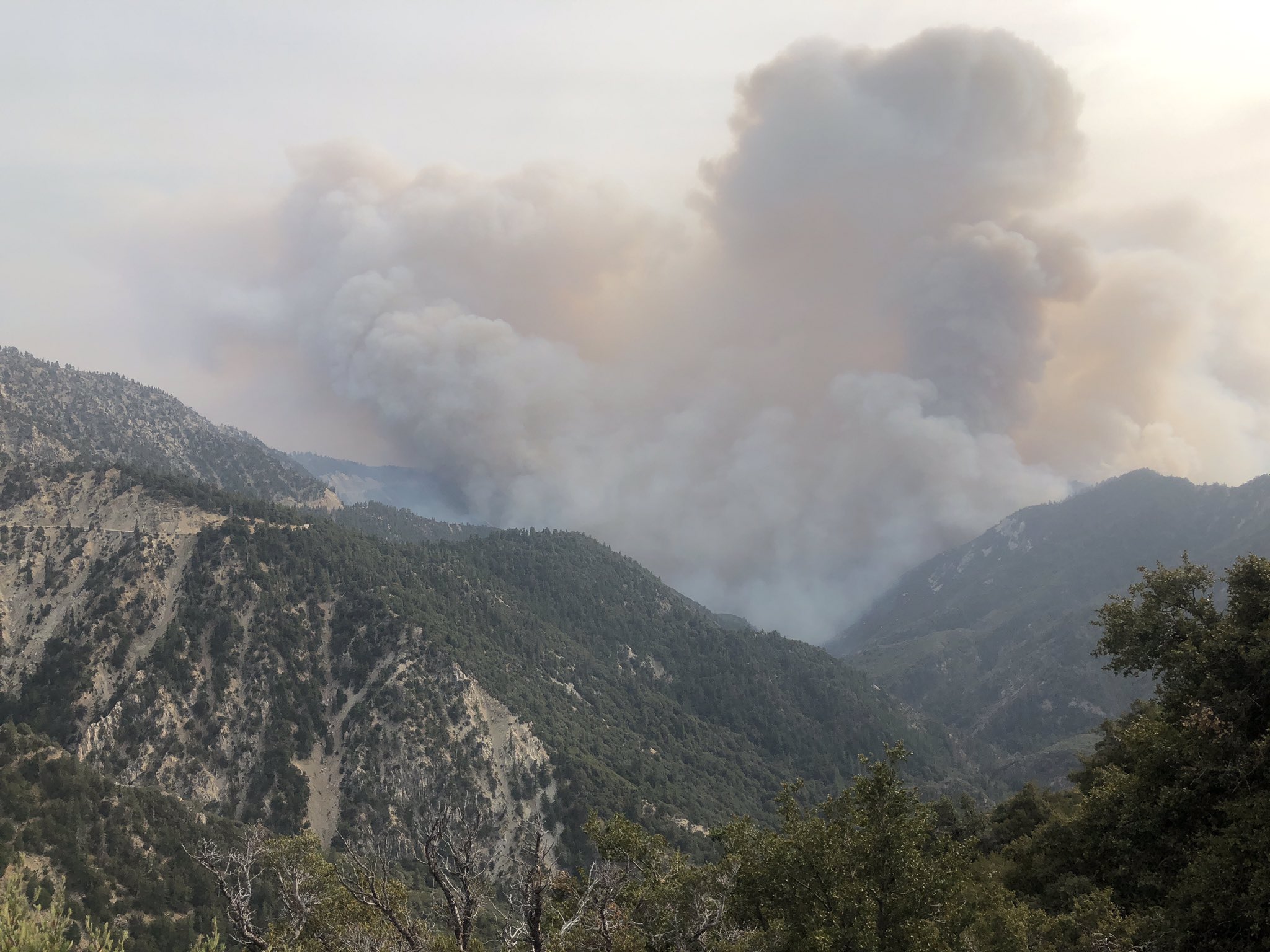
I used flightradar.com to follow a helicopter just now. It sucked water up from Crystal Lake and dropped it on the ridge about half a mile south of the 39.

Screenshot_2020-09-09-17-12-30.png
User avatar
AW~
Posts: 2040
Joined: Mon Oct 01, 2007 12:00 pm

Post by AW~ »

User avatar
AW~
Posts: 2040
Joined: Mon Oct 01, 2007 12:00 pm

Post by AW~ »

Should say in current image fire is like 5ft from highway 39.
User avatar
HikeUp
Posts: 3855
Joined: Thu Sep 27, 2007 9:21 pm

Post by HikeUp »

Some time around 5pm tonight I watched them drop a line of phos chek (in two passes) on what I think is the ridge south of Clamshell.
User avatar
HikeUp
Posts: 3855
Joined: Thu Sep 27, 2007 9:21 pm

Post by HikeUp »

Some "Private Plane" is flying over the fire in a systematic way...
Screenshot_2020-09-09 Live Flight Tracker - Real-Time Flight Tracker Map Flightradar24.png
User avatar
HikeUp
Posts: 3855
Joined: Thu Sep 27, 2007 9:21 pm

Post by HikeUp »

8pm Wednesday and not a breath of wind...still. Santa Ana's out my ass are more severe than this supposed event. Last night and this morning they issued evac orders for Monrovia, Sierra Madre, NE Pasadena and Altadena. Crying wolf doesn't help.
User avatar
HikeUp
Posts: 3855
Joined: Thu Sep 27, 2007 9:21 pm

Post by HikeUp »

He moved on to Yucaipa...now somewhere else...
Screenshot_2020-09-09 Live Flight Tracker - Real-Time Flight Tracker Map Flightradar24.png
User avatar
HikeUp
Posts: 3855
Joined: Thu Sep 27, 2007 9:21 pm

Post by HikeUp »

And another interested party...I guess those that can't fly drones over the fire, fly their private aircraft over the fire...
Screenshot_2020-09-09 Live Flight Tracker - Real-Time Flight Tracker Map Flightradar24.png


Actually this guy is with the Forest Service.
User avatar
HikeUp
Posts: 3855
Joined: Thu Sep 27, 2007 9:21 pm

Post by HikeUp »

And continuing our story...
Screenshot_2020-09-09 Live Flight Tracker - Real-Time Flight Tracker Map Flightradar24.png
User avatar
AW~
Posts: 2040
Joined: Mon Oct 01, 2007 12:00 pm

Post by AW~ »

Hmm, that smoke so thick its distorting the terrain and the fire size. Not a steady cam whatsoever right now...x,y,&z changing.
Untitled.png
User avatar
AW~
Posts: 2040
Joined: Mon Oct 01, 2007 12:00 pm

Post by AW~ »

HikeUp wrote: And continuing our story...Screenshot_2020-09-09 Live Flight Tracker - Real-Time Flight Tracker Map Flightradar24.png
Could be a contracted pilot? I think this is restricted airspace.
User avatar
AW~
Posts: 2040
Joined: Mon Oct 01, 2007 12:00 pm

Post by AW~ »

Adding a photo from twitter earlier of the north main fire....taken from Jarvi@Hwy 2.
iImage
User avatar
Girl Hiker
Posts: 1330
Joined: Fri Apr 04, 2014 7:46 am

Post by Girl Hiker »

Skies above the 210/605 fwy this afternoon.
20200909_145225.jpg

Resized_20200909_144403.jpg
User avatar
Sean
Cucamonga
Posts: 3782
Joined: Wed Jul 27, 2011 12:32 pm

Post by Sean »

HikeUp wrote: Some "Private Plane" is flying over the fire in a systematic way.
Taking FLIR imagery?
User avatar
davidwiese
Posts: 88
Joined: Mon Jul 30, 2018 4:00 pm

Post by davidwiese »

RIP Mermaids and Triplet Rocks.

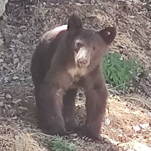
Might be easier to get to the Mermaids now with all the brush gone. Triplet on the other hand... some of that brush was essential to use scrambling down some chutes.
User avatar
AW~
Posts: 2040
Joined: Mon Oct 01, 2007 12:00 pm

Post by AW~ »

Fire final approach to Hwy2/Islip...aka high desert people say 'so thats the bobcat fire'. Fire on Islip ridge from yesterday squashed per FS tweet. Just sayin, cause people get obsessed over red dots or crazy google map for Bobcat. Crystal Lake safe. At least as of this morning. Everything seems to be in order? This basically over tonight?
bobcat.png
User avatar
dima
Posts: 1349
Joined: Wed Feb 12, 2014 1:35 am

Post by dima »

What twitter feeds you're looking at? The red dots are very accessible and easily interpretable, but not entirely correct sometimes.
User avatar
AW~
Posts: 2040
Joined: Mon Oct 01, 2007 12:00 pm

Post by AW~ »

dima wrote: What twitter feeds you're looking at? The red dots are very accessible and easily interpretable, but not entirely correct sometimes.
#bobcat fire. They post mappingsupport, google.....heres the google map, supposedly updated hourly.
https://www.google.com/maps/@34.3193729 ... 11hnw__rgj
Waterman, n of cedar springs burnt, east of Hwy 39. High temps on those red or forget about it. 170 or more, preferably 200+.
User avatar
dima
Posts: 1349
Joined: Wed Feb 12, 2014 1:35 am

Post by dima »

Thanks. That map says it jumped the ACH and burned Buckhorn. Is that what we believe?
User avatar
AW~
Posts: 2040
Joined: Mon Oct 01, 2007 12:00 pm

Post by AW~ »

dima wrote: Thanks. That map says it jumped the ACH and burned Buckhorn. Is that what we believe?
Public....they need to come here..we set em straight from their old or unreliable maps ?
User avatar
dima
Posts: 1349
Joined: Wed Feb 12, 2014 1:35 am

Post by dima »

Hah. Yeah. How dare they. Something definitely IS going on in that area right now. AIRATT52 is flying back and forth in an arc: Twin Peaks, Waterman, Buckhorn, Islip, Windy Gap
User avatar
maxmapper
Posts: 43
Joined: Fri Jan 17, 2020 5:50 pm

Post by maxmapper »

The google map uses GOES-17 which updates every 10 minutes, but googles derived map updates hourly. It's a geostationary satellite so it can monitor the whole west coast continuously (unlike the other infrared sensors VIIRS, Aqua and Terra on sun synchronous orbits which update once daily for us (around 10:30 for Suomi NPP and Aqua and 1:30 for Terra... if I remember correctly). The issue with GOES-17 is the resolution... it's much lower, see here: https://rammb-slider.cira.colostate.edu ... 48&y=10848
User avatar
dima
Posts: 1349
Joined: Wed Feb 12, 2014 1:35 am

Post by dima »

Right. caltopo can display the GOES data as well, and the pixels are indeed giant.
User avatar
Sean
Cucamonga
Posts: 3782
Joined: Wed Jul 27, 2011 12:32 pm

Post by Sean »

dima wrote: The red dots are very accessible and easily interpretable, but not entirely correct sometimes.
Do you mean that the satellite misdetected fire activity?
User avatar
Sean
Cucamonga
Posts: 3782
Joined: Wed Jul 27, 2011 12:32 pm

Post by Sean »

The DC-10 Air Tanker just unloaded on the crest west of Islip. The fire must be threatening Buckhorn.

Screenshot_2020-09-10-18-33-09.png


Screenshot_2020-09-10-18-31-24.png
Post Reply