Pacifico Mountain Road (3N17)
Taco:
Unless they've repaired it in the last year, that road is impassable near Alder Saddle. There's a wash out that's a little hairy to traverse on foot. I believe the road is open to the summit of Mt. Pacifico, but you had better verify that. They do close the entire road, even parts that are passable from Nov - May (or something like that, not sure of dates).
BTW, normally, it's passable via non 4WD vehicles, although higher clearance would help. It's mostly a dirt road, although the last mile or so is paved near ACH. The pavement starts around the group campground (Bandido?).
HJ
Hey Taco,
The road is open as of this last Sunday. I think the sign says its open May15 - Nov15 but I've seen it close/open late or early. The only sketchy spots are near the top/campground area. I have a sub outback and its just fine. Some clearance is good, but 4wd isn't needed. This is kinda one of my fave local spots. Bouldering? Looking for a crag?
The road is open as of this last Sunday. I think the sign says its open May15 - Nov15 but I've seen it close/open late or early. The only sketchy spots are near the top/campground area. I have a sub outback and its just fine. Some clearance is good, but 4wd isn't needed. This is kinda one of my fave local spots. Bouldering? Looking for a crag?
I think Mike is talking about from Mill Creek Summit up to Pacifico. To continue eastward from the Pacifico area towards ACH (at 3 points?), you'll run into the washout that HJ is referring to just before you reach Alder Saddle.
I think if you look at the satellite view, you can see where the road is washed out. I could be wrong though - after all, the picture was taken from space with my point and shoot cam at maximum zoom.
I think if you look at the satellite view, you can see where the road is washed out. I could be wrong though - after all, the picture was taken from space with my point and shoot cam at maximum zoom.
Yeah, wanted to chill up near Horse Flats and do some bouldering with my buddies. My car is low so I don't know if I could make it. Guess we'll take the SUV's instead. I looked at the entire road on Google Earth, up close, and didn't see anything out of the ordinary. Looked nice.
Hey Mike, any TR or trad'able crags in that area that are lazy-man distance away from a vehicle?
Hey Mike, any TR or trad'able crags in that area that are lazy-man distance away from a vehicle?
Horse flats has the Top Rope wall. Short steep hike up, I can't remember but I think it takes a full 60m rope. Anchor is an obvious tree. There is also a nice 5.7 crack that would make a good lead (I think it only goes halfway up) You can also top rope some of the high ball bouldering routes in the Romeo Void area off a pinch behind the obvious lieback. http://www.rockclimbing.com/routes/Nort ... rse_Flats/
Pacifico has a few crags away from the summit that have TR potential but I don't have experience with them. On the ridge leading to Granite there is one large crag, hard to find on google earth though. On the way to the campground the road makes a 180degree turn. On that turn there is a large formation with some old chopped bolts, might require gear to set up a TR, mostly face climbing.
Pacifico has a few crags away from the summit that have TR potential but I don't have experience with them. On the ridge leading to Granite there is one large crag, hard to find on google earth though. On the way to the campground the road makes a 180degree turn. On that turn there is a large formation with some old chopped bolts, might require gear to set up a TR, mostly face climbing.
If you go in to Horse Flats from the ACH side, there's really no reason to have a high clearance vehicle. It's paved far enough in to provide access.TacoDelRio wrote:Yeah, wanted to chill up near Horse Flats and do some bouldering with my buddies. My car is low so I don't know if I could make it. Guess we'll take the SUV's instead. I looked at the entire road on Google Earth, up close, and didn't see anything out of the ordinary. Looked nice.
Hey Mike, any TR or trad'able crags in that area that are lazy-man distance away from a vehicle?
I know it's an old thread but...TacoDelRio wrote:Is high clearance/4WD required to go from Mill Creek Summit to ACH and vice versa? Gates? Dirt?
The road has been repaired and is open between Mill Creek Summit and Alder Saddle - Three Points
OTOH it will be closed on 11/15 thru 5/14/09 (Seasonal closure)
Matt
Hey, anybody know if the road to Pacifico Mtn is open? I've got a friend who wants to camp at the camp ground on the summit, but they're not in a position to do it as a backpack.
Is either (or both) route (from Mill Creek Summit or Alder Saddle) open all the way to the top?
Thanks!
HJ
Is either (or both) route (from Mill Creek Summit or Alder Saddle) open all the way to the top?
Thanks!
HJ
I believe the road from Alder Saddle has in fact been repaired, at least that's what I last heard. I guess I could just go drive up there and see.HikeUp wrote: Has the road from Alder Saddle ever been open?
Don't know the answer Jim, but the road from Mill Creek to Alder Saddle is currently the northern border of the closure area. 60-40 chance that it is closed for that reason alone
The PCT is currently using the road from Pacifico to Mill Creek as their official route, so the road itself is apparently not in the closure area.
HJ
- hillbasher
- Posts: 61
- Joined: Thu Sep 27, 2007 8:58 pm
HJ, were you able to find out anything about being able to drive to Pacifico?
I tried finding out info on that a few weeks back and seemed that I could get no OFFICIAL answer about being able to drive to the campground on top. I was told that the CG was at least open to hiking in and spending the night.
I tried finding out info on that a few weeks back and seemed that I could get no OFFICIAL answer about being able to drive to the campground on top. I was told that the CG was at least open to hiking in and spending the night.
- cougarmagic
- Posts: 1409
- Joined: Wed May 07, 2008 5:21 pm
Friends of mine hiked there from the Alder Saddle side Friday night. They had a great time, said it was nice up there and they had the place to themselves. I have to ask if they noticed if the gate was open though.hillbasher wrote: HJ, were you able to find out anything about being able to drive to Pacifico?
Was at Alder Saddle 2012-09-08 (Saturday) with Elwood. While we turned right and drove northeast to Pinyon Flats, I don't recall seeing a gate at Alder that would have prevented further westward travel toward Pacifico.cougarmagic wrote:Friends of mine hiked there from the Alder Saddle side Friday night. They had a great time, said it was nice up there and they had the place to themselves. I have to ask if they noticed if the gate was open though.hillbasher wrote: HJ, were you able to find out anything about being able to drive to Pacifico?
Elwood may have a firmer recollection...
- cougarmagic
- Posts: 1409
- Joined: Wed May 07, 2008 5:21 pm
Is the dirt road to the top of Pacifico open to vehicles now? From either end - Mill Creek side or Alder saddle, anything would be fine.
If nobody knows for sure I'll drive up sometime this week and check.
If nobody knows for sure I'll drive up sometime this week and check.
I was in the area of Mill Creek Summit 2 months ago, but for what it's worth...
https://eispiraten.com/viewtopic.php?t=5133
Road to Pacifico (and to Gleason for that matter) were closed. Could not tell about from the Alder side.
https://eispiraten.com/viewtopic.php?t=5133
Road to Pacifico (and to Gleason for that matter) were closed. Could not tell about from the Alder side.
FWIW
It was still closed today. Maybe the FS would loan you a key if you had a good enough reason. They can do that if they want.
I've driven it a dozen times this year, from MCS to the 2. The road is fine. I've seen FS crews cutting burned but standing trees but not much else is going on. The power line construction work and vehicles are working in the area but not on the road.
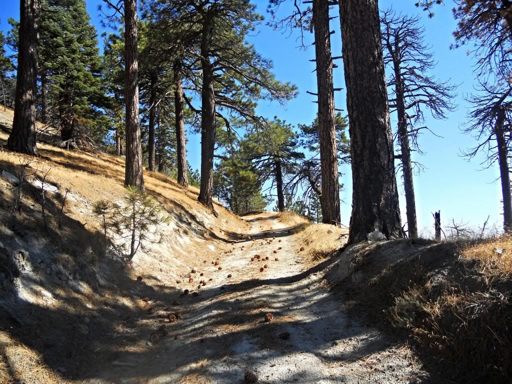
I have recently (in the past month) hiked both roads. I called the ranger station and they said they are both open to hiking but not driving. The roads are in excellent shape and the signage at junctions has been replaced. There were fresh tire tracks on both roads, so someone is driving them.
- Uncle Rico
- Posts: 1466
- Joined: Thu Mar 20, 2008 7:48 pm
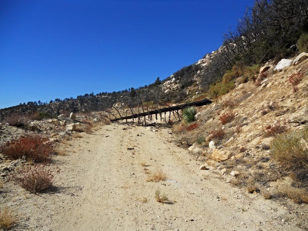
In late August I went up that road to release a bear at the Pacifico intersection. I came across a tree just like the one in your pic. After I pulled it out of the way and went by I just about ran over two guys who had set up camp in the middle of the road. 
They had the gall to tell me off for driving on a closed road and moving the downed tree.
They had the gall to tell me off for driving on a closed road and moving the downed tree.
- Uncle Rico
- Posts: 1466
- Joined: Thu Mar 20, 2008 7:48 pm
Proof positive that no good deed goes unpunished.They had the gall to tell me off for driving on a closed road and moving the downed tree.


