
San Sevaine Road (1N34)


T McPherson wrote:
For all vehicles, be advised that Whitethorn (Ceanothus Leucodermis) narrows up the road in many places. If you are worried about the paint on your vehicle, don't use this road.
i need ta get a second car for going offroading....or even if i just wanna get over a speedbump or in a steep driveway,lol

Took the road up today all the way to Joe Elliot, where the heck is the tree that is so famous? I couldn't find it
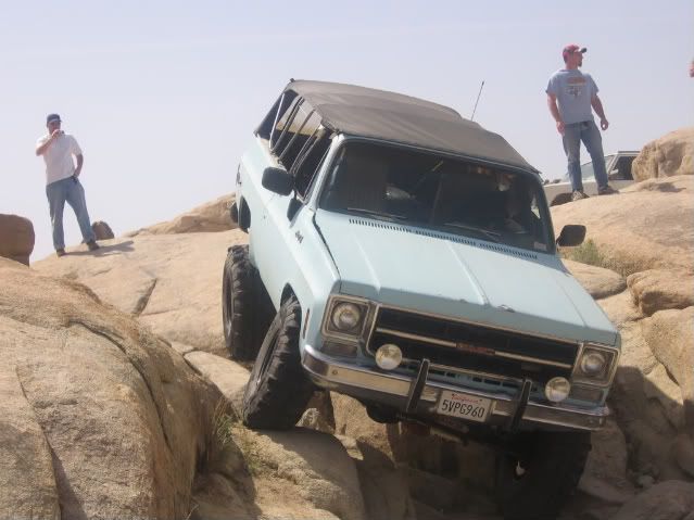
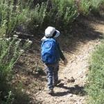
Definately high clearance necessary, scraped a branch on the washout right before the campsite. 4WD handy if you get stuck there.
Heres some pics of the washout(with tree branches placed to drive over)
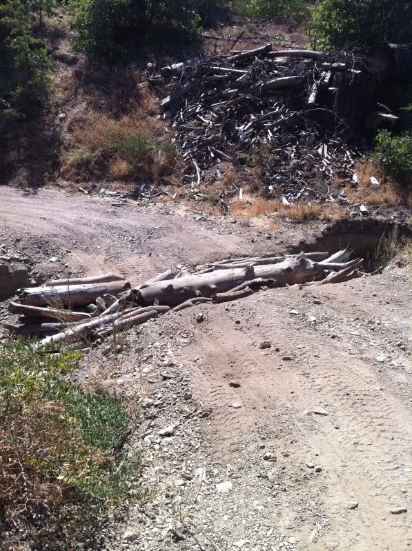
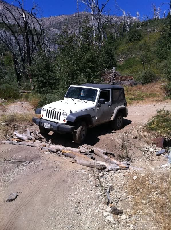
Definately high clearance necessary, scraped a branch on the washout right before the campsite. 4WD handy if you get stuck there.
Heres some pics of the washout(with tree branches placed to drive over)

The road is officially open - the FS tries to get it open for deer hunters - but it may close at any time if we get some Santa Ana wind "Red Flag Warning" conditions.
Be aware that this is a popular area with hunters! Wear orange!
The Joe Elliot tree fell, and then burned in the Grand Prix Fire.
Be aware that this is a popular area with hunters! Wear orange!
The Joe Elliot tree fell, and then burned in the Grand Prix Fire.

-
Slowest_Hiker
- Posts: 258
- Joined: Sun Jul 31, 2011 12:31 pm
Has anyone been on San Sevaine Rd in the last few months? Looking for info on road condition, specifically whether a regular passenger car can get part way down it (e.g. to San Sevaine Flats). Thanks
Internet reports including this one indicate that passenger cars would have serious problems on this road. That report is 3 years old, but it's doubtful that 1N34 has received any maintenance since then.
In any event, the road is closed.
In any event, the road is closed.
1N34 - San Sevaine Road - Closed
Date(s): Mar 17, 2013
Forest Road 1N34 (San Sevaine Road) is closed until further notice. For more information, please call the Lytle Creek Ranger Station at 909-382-2851 (closed Tues/Wed).

-
Slowest_Hiker
- Posts: 258
- Joined: Sun Jul 31, 2011 12:31 pm
I think that web page may not be current, because when I talked to the ranger station they told me it was closed due to the wind event, but said I could call back later to see if it had been opened.
"Reasonable ground clearance"...hmmm ... I will have to think about that.
"Reasonable ground clearance"...hmmm ... I will have to think about that.
-
fadingfastsd
- Posts: 8
- Joined: Fri Dec 27, 2013 12:01 am
Hi guys,
Was thinking about taking a camping trip to Joe Elliott Campground this coming weekend Sat-Sun 5/10-5/11. Does anybody know if the road is open all the way through to there from Lytle Creek?
Thanks!
Was thinking about taking a camping trip to Joe Elliott Campground this coming weekend Sat-Sun 5/10-5/11. Does anybody know if the road is open all the way through to there from Lytle Creek?
Thanks!
-
fadingfastsd
- Posts: 8
- Joined: Fri Dec 27, 2013 12:01 am
It was open last December, I rode it on my motorcycle. I'm pretty sure the FS website said it was closed then too, but it was wide open and multiple people driving it. I'll call and ask. Thanks!

-
T McPherson
- Posts: 17
- Joined: Thu Aug 25, 2011 10:30 am
1N34 has been "officially" closed for the season, till September that is. The gate has not been open for the last six or eight weeks. However, you are welcome to walk or bicycle to the campground any time of the year.
-
HikeEnthusiast55
- Posts: 30
- Joined: Tue Jan 28, 2014 4:12 pm
Is lytle creek -> cucamonga canyon via the 1N34/San Sevaine Trail definitely get-throughable with a machete?
Does anyone know if the trail is walkable/hikeable?
I want to know there aren't major pieces of the road missing or something. Let me know, thanks.
Thanks

Does anyone know if the trail is walkable/hikeable?
I want to know there aren't major pieces of the road missing or something. Let me know, thanks.
Thanks

-
HikeEnthusiast55
- Posts: 30
- Joined: Tue Jan 28, 2014 4:12 pm
Thinking about making a trek from Lytle Creek -> San Sevaine -> Barret Stoddard -> icehouse -> lytle creek again with a friendPat wrote: I know some people went through on MBikes recently, so shouldn't be a problem on foot.
From your posts, you looking to start at Stoddard-Barret and end up in Devore?
is that even doable?
Doable? Yes.
@Icehouse you can go down the Middle Fork Trail. Quite a hump back to Nealeys Corner.
Another option would be to take the Cucamonga Peak trail all the way to Joe Elliot which puts you back on the truck trail.
Water is the biggest issue. Middle Fork gives you more options on the return, I don't know if any of the drainages along the truck trail have any water between your start and Cucamonga Canyon.
And don't leave a car @ B-S parking or any of the turnouts below the village overnight unless you like that stripped down/broken window look.

Friends did a little recon via motorcycle earlier this year. The road is easily passable although in a wide truck you will get a little "cowboy pinstriping". No machete needed. No major washouts. Better to go up in a Jeep or something...
The trail up to Etiwanda and Cucamonga looks passable by looking at Google Earth but I haven't been up there.
The trail up to Etiwanda and Cucamonga looks passable by looking at Google Earth but I haven't been up there.
-
HikeEnthusiast55
- Posts: 30
- Joined: Tue Jan 28, 2014 4:12 pm
is the 1n34 road/san sevaine open to driving up on?
if so how long will it be open?
if so how long will it be open?
-
HikeEnthusiast55
- Posts: 30
- Joined: Tue Jan 28, 2014 4:12 pm
o and at what point does it become bad/difficult for driving and better for just walking/hiking?HikeEnthusiast55 wrote: is the 1n34 road/san sevaine open to driving up on?
if so how long will it be open?
thanks all