
The Station Fire Thread

-
PackerGreg

- Posts: 623
- Joined: Sat Sep 12, 2009 9:31 pm
So is nuclear winter - y'spose that's what they're up to in the Middle East?Zach wrote: My brother was telling me that eruptions like the one in Iceland recently are actually effective at curbing global warming.

From: act-bounces at fourpalms.org [mailto:act-bounces at fourpalms.org] On Behalf
Of Mitch Marich
Sent: Tuesday, April 12, 2011 11:39 PM
To: act at fourpalms.org
Subject: [ACT] Station Fire Update Meeting
Marietta Kruells and I attended this meeting at the Eaton Canyon Nature
Center Wednesday, March 30th. Here are my notes. Keep in mind that I did
not take notes on all the remarks made. My comments are in brackets []:
The meeting was hosted by the Sierra Club, which opened by pitching their
hiking and volunteering opportunities and their support for a National
Recreation Area in the San Gabriels. [This is directly related to the
National Park Service San Gabriel Watershed and Mountains Special Resource
Study and the Rim of the Valley Corridor Special Resource Study. These
studies will not do anything by themselves, but will make recommendations
that Congress could act on. While most outdoor organizations support the
goals of the studies, it is important to remember that the Sierra Club and
some other organizations almost always seek to increase wilderness areas and
decrease access for mountain biking, off highway vehicles, hunting, and
certain other uses.]
Marty Dumpis, the Acting Forest Supervisor, opened with a review of efforts
since the fire. Among other things, he mentioned the area closures, road
closures (often State or County controlled but related to fire effects),
structure rebuilding projects, condor micro trash ,
hazardous material abatement, mine hazards, and invasive plant removal. On
the positive side, the mainly gentle rains since the fire have produced some
good re-growth without as many mudslides as expected. 110 miles of trails
have been surveyed and some stabilization and repair work done. Continuing
issues include habitat disturbed by dozer lines, gully and rill networks,
sediment washed into streams, areas where soil was so heated it is
hydrophobic, completely washed out or buried trails, many standing dead
trees near trails, and invasive species. If chaparral burns too often, it
can be replaced by non-native grasses, which has happened in Highland Park
and other urban open spaces.
The Forest Service is trying to make the best of the situation with three
main initiatives:
1. Ecological restoration. Some of the burned areas had been planted or
replanted with non-native plants, restoration of all areas will attempt to
restore them to a more natural and sustainable condition.
2. Increased Recreation. [It was not clear to me what this will mean in
practice.]
3. Increased partnerships with various organizations. He talked about
seeking increased grant funding and having an Angeles Forest Foundation.
[The obvious example of new partnerships is with the Tree People, who have
the lead on replanting trees. I suspect there is some concern from
long-time volunteer groups about being preempted by larger, well funded
groups eager to help but with less knowledge of local conditions. There is
already a National Forest Foundation which has taken on the Station Fire as
one of its projects, so I am not sure if he was referring to this group, or
mentioning another foundation just focusing on the Angeles National Forest.]
In relation to opening more of the forest, he said their goal was to slowly
(his word) open more areas during the next year, specifically the front
range and around the West Fork of the San Gabriel River. He repeated their
stated concerns about safety and invasive species. He said that besides
helping repair trails, they would like groups to assist them in monitoring
conditions in the opened areas and educating the users. He mentioned that
the USFS was ready to open the Crystal Lake area, and CalTrans had just
opened SR 39 up to Crystal Lake. There was a lot of audience reaction to
that.
Marty was followed by Katie VinZant, who led a team working on removing
invasive plants in the burn area. Invasive plants such as grasses, mustard,
Spanish Broom, and others can dominate an area once established and reduce
both plant and animal diversity. After a fire clears the chaparral, dozer
lines, roads, trails, and streams can become channels that spread the
invasive. Machinery and people can bring seeds that would normally not
compete into disturbed areas where they can become established.
Katie was followed by Andrew Fish, who had a short presentation with no
maps, so it was a little hard to follow. His remarks were consistent with
what had been put out at the Volunteer meetings lately. They would like to
open up the Arroyo to the Paul Little Picnic area by Memorial Day. [After
the meeting, a person told me that section was in very bad shape.] They
will open at least part of Brown Mountain Road and the Mt. Lowe Fire Road to
Inspiration Point. They are considering opening Sunset Ridge Trail. [I
think Mt. Lukens is also on the opening list. On Sunset, I have not been
over the whole trail, but from what I have seen, there is no reason not to
open Sunset. From talking to Andrew on another occasion, they want to open
Brown Mountain only to the saddle where it connects to Millard just to keep
people away from hiking down the pretty much wiped out Ken Burton, and they
wanted to keep people away from the Mueller Tunnel until it is repaired. I
don't think this is realistic, people are going to both areas now. They
should post the Ken Burton and rebuild the west side of the tunnel ASAP.]
They will open Switzer Campground, they need to accept work already done by
a contractor. They are not planning on opening the Gabrielino from Red Box
to Switzer in this phase but would like to open the Gabrielino from Switzer
to Bear Canyon. [They are leaving most of the Gabrielino between Switzer and
Paul Little closed, so I don't know if they will open Bear Canyon, or just
let the crew work on it.] They are looking for a group to "adopt" the
Strawberry Peak trail. [My understanding is that it was too damaged to open
this year, but they want to start work on it.] Big Tujunga Canyon would be
worked on after the above areas. Mike McIntyre, L.A. River District Ranger,
also made a few remarks. [Some of the notes I took on the trail openings
came from the Q & A and conversations after the meeting.]
The L.A. Times had a brief report on the meeting which is available here:
http://latimesblogs.latimes.com/outpost ... -forest-tr
ails-update.html
After the USFS speakers, a Sierra Club couple gave a nice presentation on
fire associated plants that you could expect to see in the recovery area.
Unfortunately, that left little time for questions after they finished.
[One that I have noticed, and fortunately did not touch, is called Poodle
Dog Bush or turricula and is worse than poison oak, so you might want to
look it up on the www.]
Mitch Marich

-
cougarmagic

- Posts: 1409
- Joined: Wed May 07, 2008 5:21 pm
Tuesday, April 26, 2011
Contact: Maureen Shanahan (202) 225-4176
***ADVISORY***
Schiff to Host, Moderate Station Fire Update
Pasadena, CA - Since the Station Fire hit Southern California in August 2009, devastating 250 square miles, killing two firefighters and leaving many people homeless, Rep. Adam Schiff (D-CA) has worked with local fire agencies, the US Forest Service and many others to learn from what went wrong in the effort to extinguish the fire and implement changes to make sure those mistakes are not repeated. There has been some progress, although much more needs to be done, and Rep. Schiff is hosting a meeting with representatives of the Forest Service and the Government Accountability Office at the Altadena Library to inform residents about these efforts.
Moderator: Congressman Schiff
Speakers: Tom Harbour, Director of Fire and Aviation, U.S. Forest Service
Stephen Gaty, Assistant Director, Government Accountability Office, Natural Resources and Environment Team
When: Thursday, April 28
10:30 a.m. – 12 p.m.
Where: Altadena Library
600 East Mariposa St.
Altadena, CA 91001

-
robnokshus
- Posts: 130
- Joined: Fri Apr 04, 2008 7:25 am
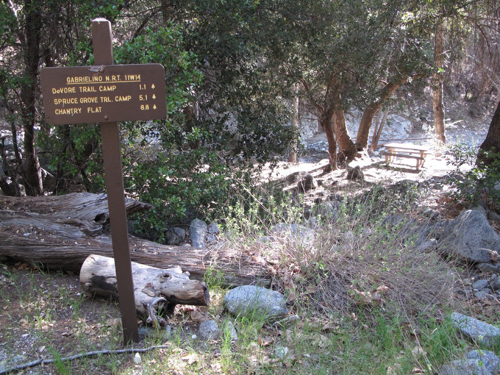
I was looking at this map http://maps.fs.fed.us/stationfire/ that Ze posted a link to in another thread and it looks to me as if a lot of areas have opened up! For instance, it looks as if the Gabrieleno Trail from Camp Sturtevant is now open to Red Box! Also the Rim Trail, Devore Trail and Valley Forge Trails all appear to be open now. Anyone have any first hand knowledge?
Think I'll have to do some 'sploring this weekend!
Think I'll have to do some 'sploring this weekend!

From newcomb saddle to red box is in decent shape. From red box down to devore is in need of work. The first half mile from red box down is okay, once you crest the ridge and pass the burnt manzanita its about a foot wide and covered in fallen oak leaves till you get to the bottom of devore.
Devore wasn't hit by the station fire though and it looks really nice.
Devore wasn't hit by the station fire though and it looks really nice.


Nice. Was there even any sign of fire at the trail camps?
How bad did the back slope (north face) of Wilson get hit by the fire? I haven't been up since the fire. The trail from Eaton Saddle to Valley Forge used to be (is?) really nice as was (is?) the Rattlesnake/DeVore trail.
HJ
How bad did the back slope (north face) of Wilson get hit by the fire? I haven't been up since the fire. The trail from Eaton Saddle to Valley Forge used to be (is?) really nice as was (is?) the Rattlesnake/DeVore trail.
HJ
how EXCITING!!!!!
and yes -- how about eaton saddle thru' mueller tunnel around mount lowe east trail down to the camp lowe fire road junction and up the west trail and back??
this has been one of my most favorite hikes in the front range (for the views) -- and i've been mourning it ever since the fire...
also: the bit of hwy 2 between clear creek station and red box is still closed, yes?
hh
-
VermillionPearlGirl
- Posts: 239
- Joined: Wed Apr 06, 2011 9:57 am
I'm planning to do this (or Red Box to San Gabriel & Disappointment) tomorrow. It'll definitely be interesting to see what's there.harper wrote: and yes -- how about eaton saddle thru' mueller tunnel around mount lowe east trail down to the camp lowe fire road junction and up the west trail and back??
-
Layne Cantrell

- Posts: 127
- Joined: Tue Sep 01, 2009 5:20 pm
Nope all good to go.harper wrote: also: the bit of hwy 2 between clear creek station and red box is still closed, yes?
hh
The whole eastern side of Lowe and surrounding areas were destroyed by the fire.VermillionPearlGirl wrote:I'm planning to do this (or Red Box to San Gabriel & Disappointment) tomorrow. It'll definitely be interesting to see what's there.harper wrote: and yes -- how about eaton saddle thru' mueller tunnel around mount lowe east trail down to the camp lowe fire road junction and up the west trail and back??
The western side of lowe is still in good shape, The campgrounds is also in good shape.
-
VermillionPearlGirl
- Posts: 239
- Joined: Wed Apr 06, 2011 9:57 am
So I did most of this hike today and was going to actually write a TR, but then upon closer inspection of the map it looks like some of it is still part of the closure area (at least the way I went which was majority fire road).
Oops.
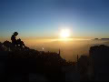
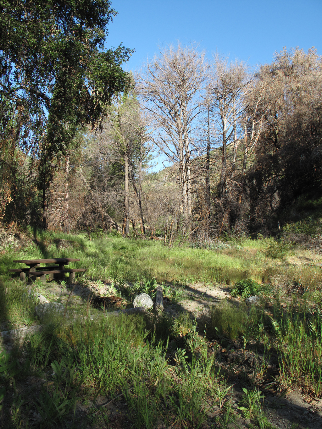
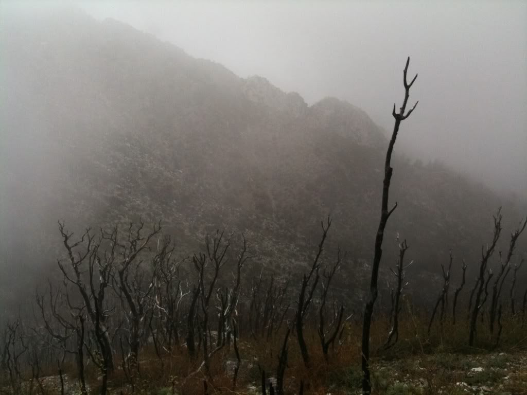
As the picture above shows, the whole back of the mountain is burned, but once you get to Tom Sloan Saddle it's all good on the front side.
From Eaton Saddle, Mt. Lowe Fire Road is closed for a stretch because of two big washouts, and I assume it'll remain closed even though it's in the open area (but who knows?). But I found the washouts easier to cross than the ones on Windy Gap-->Islip that made me turn around.
The parts of Mount Lowe East I did were overgrown but not terrible (I didn't do the whole thing). But if only Mount Lowe West is open, and they're not opening the fire road (again, don't know that for sure, but the signs are still up), looks like you have to get up there from like Sam Merrill?
I didn't expect to write so much, I probably should have just done a TR
Oops.
As the picture above shows, the whole back of the mountain is burned, but once you get to Tom Sloan Saddle it's all good on the front side.
From Eaton Saddle, Mt. Lowe Fire Road is closed for a stretch because of two big washouts, and I assume it'll remain closed even though it's in the open area (but who knows?). But I found the washouts easier to cross than the ones on Windy Gap-->Islip that made me turn around.
The parts of Mount Lowe East I did were overgrown but not terrible (I didn't do the whole thing). But if only Mount Lowe West is open, and they're not opening the fire road (again, don't know that for sure, but the signs are still up), looks like you have to get up there from like Sam Merrill?
I didn't expect to write so much, I probably should have just done a TR
Good info; thanks.
HJ
-
PackerGreg
- Posts: 623
- Joined: Sat Sep 12, 2009 9:31 pm
Thanks to a friend for reminding me that "Today marks the second anniversary of the Camp 16 Burn Over and the loss of Los Angeles County Fire Captain Edmund “Ted” Hall and Fire Fighter Specialist Arnaldo “Arnie” Quinones during the Station Fire of 2009."


-
EManBevHills

- Posts: 387
- Joined: Fri Sep 28, 2007 12:40 am
I got this from someone who is a member of HPS:
HJUNSUSPENSIONS: Due to the reduction in size of the Station Fire closure, a few
more of our peaks are available for visits and thus have been unsuspended:
09A Mount Gleason
09B Iron Mountain #2
09C Condor Peak
09D Fox Mountain #2
Both the Condor Peak and Trail Canyon Trail have reopened, but expect
rough conditions, wash outs, etc. The Mt. Gleason Road is closed to
driving but open for mountain biking and hiking. This means the usual
route for Gleason (1/2 mile and 100' gain) won't work: you'll need to
add 18 miles round trip and 1600' (or more) gain and hike in from Mill
Creek Saddle on either the Mount Gleason Road or the Pacific Crest
Trail or some combination (as the PCT crosses or nudges the road in
multiple places).
These peaks remain SUSPENDED:
On private land:
03B Black Mountain #3
In area still closed due to Station Fire:
10E Granite Mountain #1
10F Rabbit Peak #1
10G Iron Mountain #3
10H Round Top
11A Josephine Peak
11B Strawberry Peak
11C Mount Lawlor
11D Barley Flats

This is very interesting. It's neat to see the recovery. I live in the foothills so these make the dramatic regrowth more obvious to me. The chaparral seems to grow back relatively quickly. The loss of all those trees still bums me out. Thanks for sharing this!