Vincent Gap - Cabin Flat

TRs for the San Gabriel Mountains.
Post Reply
User avatar
Elwood
Posts: 612
Joined: Fri Aug 15, 2008 5:23 pm

Post by Elwood »

Saturday morning, I parked at Vincent Gap and headed down the gulch. I hit the trail around 0710 after the longish haul from Simi Valley. A few hikers were headed up Mount Baden-Powell as I got my gear together. Since I didn't know what to expect from the remaining snow, I opted for crampons. These turned out to be quite unnecessary. The trail down the gulch was in good shape, save for a few trivial deadfall bypasses. I cleared as much debris as I had time, patience and leverage for. There was plenty of water flowing down the guts of the gulch and a few of the normally dry side canyons were flowing as well. The stretch of trail from Vincent/Mine Gulch up to Cabin Flat presents some navigational challenges. It's choked in spots with downed trees and brush. The Prairie Fork is flowing vigorously in spots and a little tricky to get across. It is possible to stay on the north side of the fork and make a single crossing before final crossing at Cabin Flat, though this requires some minor scrambling, and lots of climbing over/under/across dead trees. Sad to say, the largest mammals I saw were squirrels. I did see tons of sheep tracks however.


Image
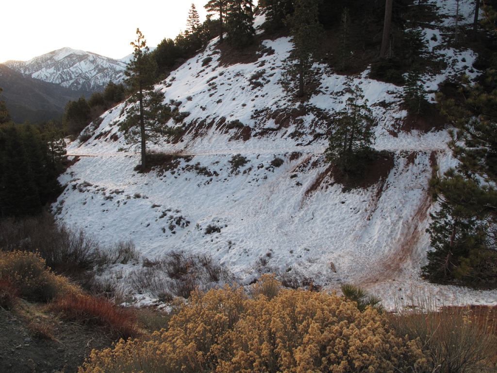
General conditions near the trailhead. I started the morning in crampons, ditching them after around a half-mile.

Image
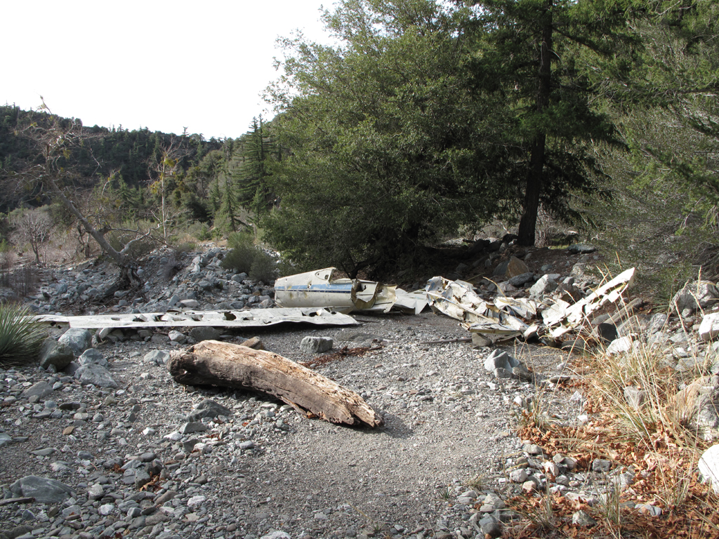
Everybody's favorite wreck, down in Vincent Gulch.

Image
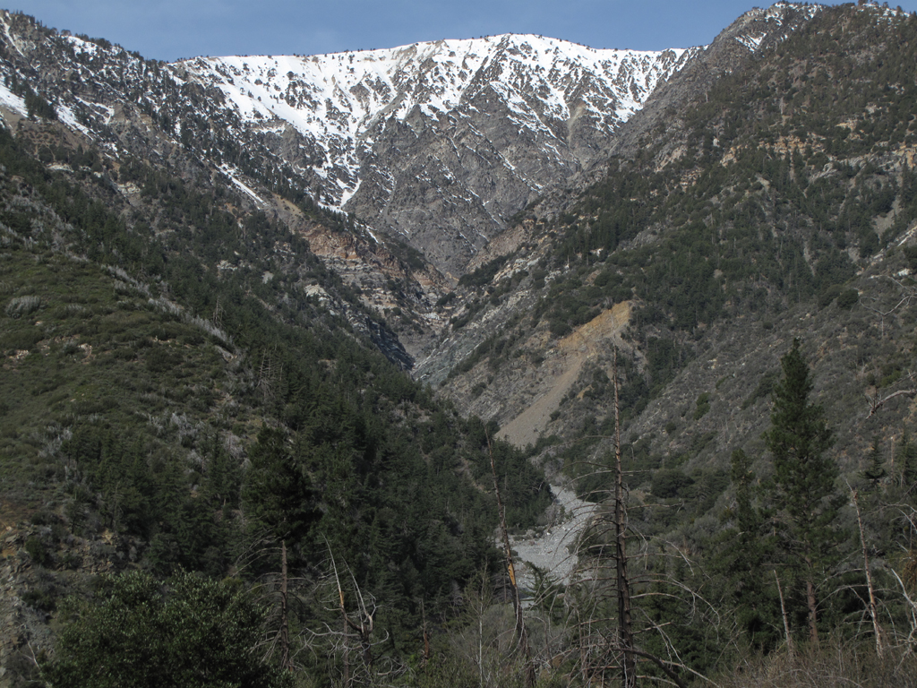
View up Mine Gulch towards Baden-Powell's summit.

Image
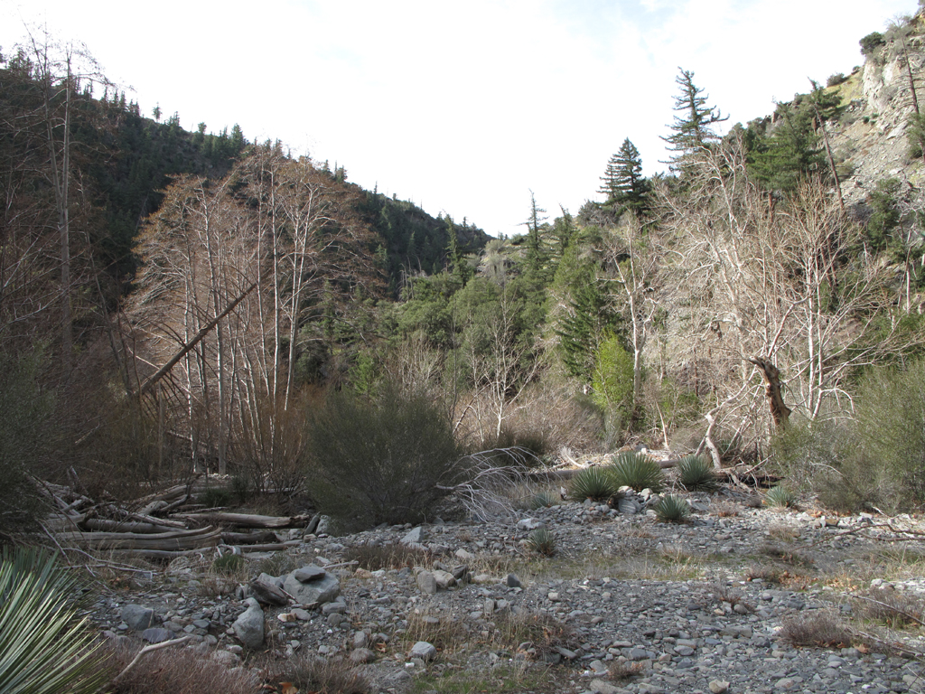
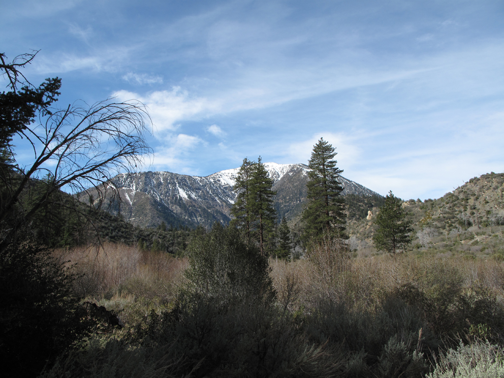
Very typical view of terrain from Vincent Gulch to Cabin Flat, around Prairie Fork.

Image
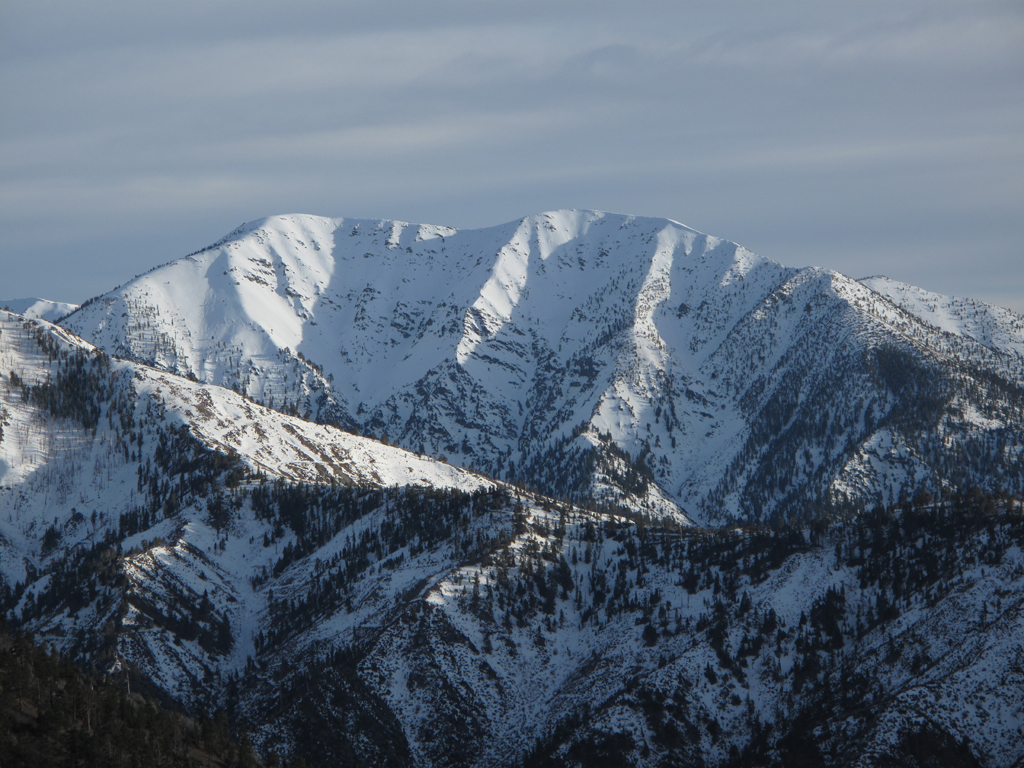
View of Baden-Powell from Cabin Flat.

Image
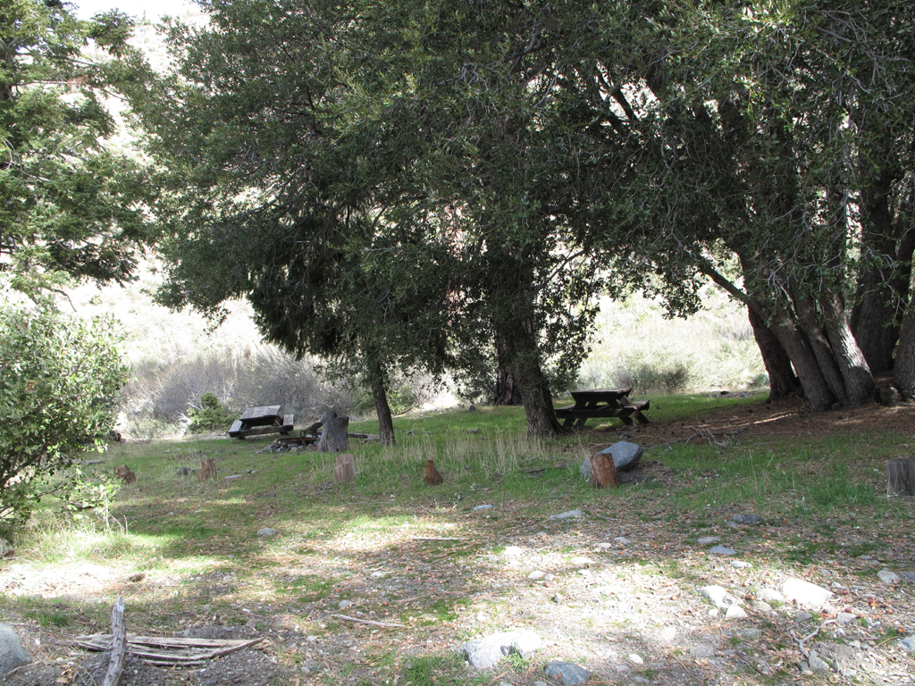
Pleasant spot for a Clif Bar and some dried fruit at Cabin Flat.

Image
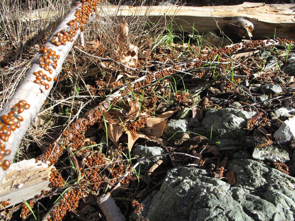
Now I know for certain where where lady bug has been.

Image
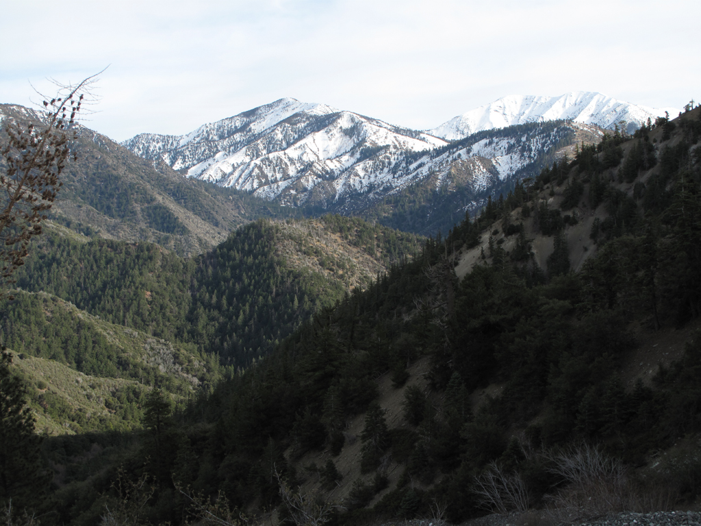
View down Vincent Gulch towards Pine and Mount San Antonio.


Image
Pine's long ridge and San Antonio.

Image
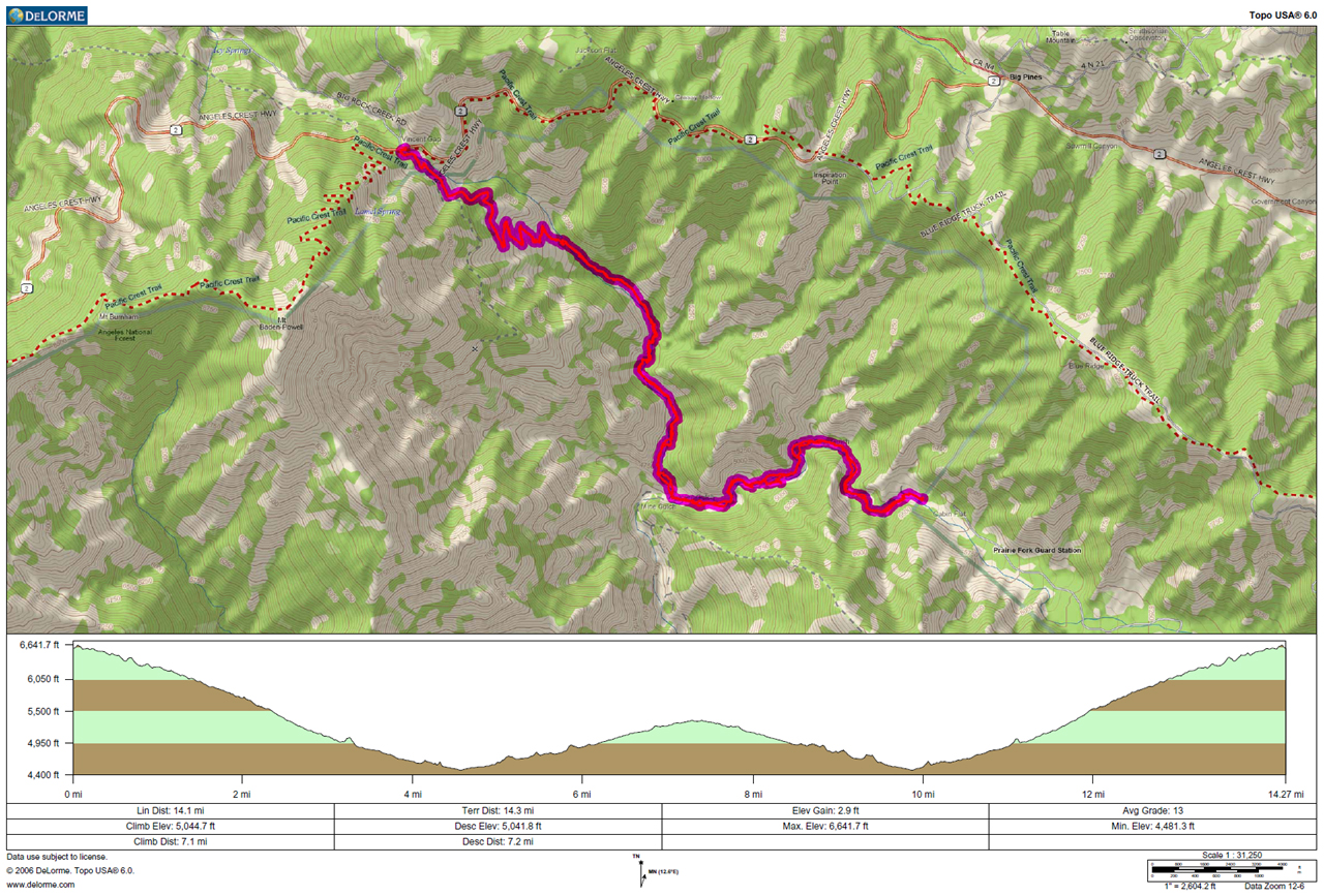
GPS track and elevation plot.
User avatar
Hikin_Jim
Posts: 4686
Joined: Thu Sep 27, 2007 9:04 pm

Post by Hikin_Jim »

Nice. Been down to where Mine Gulch comes in but haven't gone up to Cabin Flat. I'll have to check that out some time.

HJ
User avatar
lilbitmo
Posts: 1092
Joined: Tue Mar 04, 2008 9:44 pm

Post by lilbitmo »

Great shots and TR Elwood (and his not so evil friend Jake), backside of Baldy is looking nice :D
User avatar
He219
Posts: 386
Joined: Thu Sep 27, 2007 11:18 pm

Post by He219 »

Thanks for the TR! That's a whole lot of Ladybugs ..
lilbitmo wrote: .. backside of Baldy is looking nice :D
Seriously, lookin' really nice.
User avatar
Taco
Snownado survivor
Posts: 6010
Joined: Thu Sep 27, 2007 4:35 pm

Post by Taco »

If only, Mine Gulch... gimme some weather.
User avatar
cougarmagic
Posts: 1409
Joined: Wed May 07, 2008 5:21 pm

Post by cougarmagic »

Really nice. Makes me want to go there! I'm sort of surprised at the lack of snow down in there - I always considered that rather inaccessible in the winter.
User avatar
TracieB
Posts: 216
Joined: Mon Feb 22, 2010 8:57 am

Post by TracieB »

Oh Winter, why hast thou deserted us so soon? :cry:

Nice photos Elwood! Love that one of the back side of Baldy.
User avatar
MattCav
Posts: 356
Joined: Thu Sep 23, 2010 4:13 am

Post by MattCav »

awesome tr, elwood! i feel inspired to get down that way.
User avatar
norma r
Posts: 707
Joined: Thu Nov 06, 2008 4:22 pm

Post by norma r »

Elwood, as always, great photos! You have a good eye. Thanks for posting about a trail less traveled.
User avatar
tpfishnfool
Posts: 62
Joined: Sun Feb 20, 2011 10:50 am

Post by tpfishnfool »

Nice report and pics. If were to continue could you go to fish fork and back up to blue ridge ? Are there any streams down there that hold fish ? Thinking about a hike/Fishing trip.
User avatar
Hikin_Jim
Posts: 4686
Joined: Thu Sep 27, 2007 9:04 pm

Post by Hikin_Jim »

tpfishnfool wrote: Nice report and pics. If were to continue could you go to fish fork and back up to blue ridge ? Are there any streams down there that hold fish ? Thinking about a hike/Fishing trip.
You can go via an old trail from Lupine Campground to Little Fish Fork Camp and Fish Fork. That trail trail down into Fish Fork is pretty followable to the junction of the trail that goes to Upper Fish Fork Camp and the trail that goes up the flanks of Dawson Peak. The trail ceases to be easily followable at that point. If you're handy with maps, it's not that hard to get down to Upper Fish Fork Camp. I haven't tried going up from the aforementioned junction to Dawson Peak in a very long time, but in talking to people, the trail is a little hard to find. Might be fun if you're a good navigator.

Can't comment on fish. I've never seen any. The water in Prairie Fork has a lot of white crap in it, making the water a milky gray. Not sure how many fish would live in it.

HJ
User avatar
tpfishnfool
Posts: 62
Joined: Sun Feb 20, 2011 10:50 am

Post by tpfishnfool »

Thanks Jim.. Getting to know that area. Love it.
Post Reply