Sep 5-6 2026
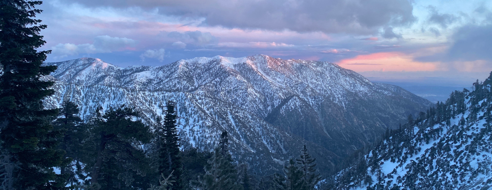
I was planning to go camp out somewhere local over the holiday weekend and when Matthew sent me a message mentioning this I quickly decided to make this the destination. It's a 3.5 mile walk up to the water tank so I was able to leave later in the day after finding a parking spot at Chantry Flat which took just two laps of the lots. I hit the trail around 5:30, the road is paved up to the helicopter pad and then becomes easy fire road. I was still a little jumpy after my bear encounter a couple weeks ago, when one of the mules down at Adams Pack Station brayed I quickly looked around to find the critter. After that it was an uneventful although warm walk up, the clouds made things much more humid than usual for SoCal. I was treated to some really nice sunset views and got up to the tank just as the sun was disappearing behind the mountains.
It's possible to make this a big loop by going over the ridge near the water tank.
Clouds made for a bit more drama in the photos.
During this part I kept thinking this is why I love living here.
Bonus triangular marker below the tank.
I wandered around a bit, soaking myself while discovering that the tank contains water and the valve below works quite well. I brought my chair so I sat on top which gives outstanding views from Mt Wilson to Catalina, while eating a spicy ramen dinner and settling in to do some reading.
In the semi-darkness below I heard a few footsteps, so I stood up to see what wildlife was in the neighborhood and it turned out to be a human wearing some kind of mask. After saying hello he answered "Jeff??" and it turned out to be Sean with a bug net on! Pretty cool to see him out on the trail so we spent the next hour or so catching up while waiting for the rest of the group to ride bikes from Arcadia Metro station. Matthew, Taco and Ollie soon arrived with Dima following a little later so we all sat around on the tank chatting the night away. I had only planned to cowboy camp, as did Sean and we were not happy with the rain starting at 3:15am. I quickly climbed down underneath where I had some shelter, although the rain stopped soon I didn't want to move again. Less than an hour later I was startled by Sean dropping his backpack down, pretty quickly followed by everyone else. I guess we all got some fitful sleep then because there wasn't any level ground and everyone was up and about by 6am. Since it was still raining off and on we all packed up to try getting out during one of the dryer periods. It didn't work for Sean and I as we left at 7, getting some rain for about half the walk down. The mechanized group passed us shortly afterward, and we made it to the parking lot safely to cap off another great time in the San Gabes.
San Olene
-
JeffH

- Posts: 1419
- Joined: Sun Nov 28, 2010 7:09 am
You do not have the required permissions to view the files attached to this post.
"Argue for your limitations and sure enough they're yours".
Donald Shimoda
Donald Shimoda
-
HikeUp

- Posts: 4127
- Joined: Thu Sep 27, 2007 9:21 pm
As far as road-walking, that one 's a pleasant walk. I ran into bow hunters up there once - full camo, etc.
There is (or was in 2008) a use trail that goes straight down the ridge to the upper heliport. It's steep and probably slippery when wet...so not sure this is a helpful comment . The ridge starts at Point 3583' (just north of the water tank), crosses the road and drops down to the helipad. A very quick way down.
There is (or was in 2008) a use trail that goes straight down the ridge to the upper heliport. It's steep and probably slippery when wet...so not sure this is a helpful comment
. The ridge starts at Point 3583' (just north of the water tank), crosses the road and drops down to the helipad. A very quick way down.You do not have the required permissions to view the files attached to this post.
-
Sean

- Cucamonga
- Posts: 4525
- Joined: Wed Jul 27, 2011 12:32 pm
Thanks for the report and pretty pictures. It was fun hanging out again and getting rained on while trying to sleep.
You do not have the required permissions to view the files attached to this post.
-
Matthew

- Supercaff
- Posts: 698
- Joined: Mon Nov 30, 2015 8:25 am
- Location: Pasadena
San Olene is the answer!
You do not have the required permissions to view the files attached to this post.
stoke is high
-
JeffH
- Posts: 1419
- Joined: Sun Nov 28, 2010 7:09 am
It's still there and really obvious from the fire road above, we bypassed it because things were pretty wet and we didn't want to inadvertently take the really fast way down.HikeUp wrote: Sun Sep 13, 2026 1:35 pm As far as road-walking, that one 's a pleasant walk. I ran into bow hunters up there once - full camo, etc.
There is (or was in 2008) a use trail that goes straight down the ridge to the upper heliport. It's steep and probably slippery when wet...so not sure this is a helpful comment
IMG_2514.jpg
"Argue for your limitations and sure enough they're yours".
Donald Shimoda
Donald Shimoda