

One other hiker and myself hit the trail at 5 AM, plus my girl Dog Lucy.
By the time we climbed up past Bear Flats we could see the damage on all the hillsides above us but the flat itself was fairly undamaged. Once we reached the upper area of the switchbacks above Bear Flats we could see how much work the Firefighters had done to keep it from spreading all the way to the summits. The damaged area extended all the way to the 7,800 to 7,900 foot range and most of the deadfall had already been cleared.
As we reached that area I noticed that there was smoke far off to my left (west) and I thought at first it was coming from Mount Wilson - little did I know that it was Sylmar as I went to bed before 10 PM and missed the news telling me where it was. As we reached the 9,000 foot area I could tell that the fire to the west was bigger than I had first thought it was still only 8:45 AM - at this point the other hiker decided that she has enough and headed down.
I countinued to the summit and (without looking behind me) turned around to look at the view and to my great shock I could see smoke coming from the south - another fire. I looked closed and realized that the ridgeline it was coming over was "Chino Hills State Park" and that the other side of that was "Home to Me", Yorba Linda. It was 9:30 AM and I knew is was growing by the size of the smoke coming over that ridgeline.
Needless to say I raced down the mountian to turn on the radio to confirm my fears - Yorba Linda was on fire in two locations. The radio indicated that the 57 and 91 Freeways were closed so it was time to take side streets thru Diamond Bar, Walnut, La Puente, Hacienda Hieghts, La Habra, La Mirada, Buena Park, Fullerton, Placentia and home - just in case the traffic pushed off the freeways tied things up to a crawl I wanted to be as far away from the trouble spots as possible. It took 1.5 hours to get there but well worth going out of my way. Smoke was everywhere, the wife was fairly scared and one friend of my wife's who suffers from Mannic Depression and she was in full blown manic attack as she was out shopping when the fires broke out and could not get home - I don't know if you have ever experienced this but for someone who suffers from mental illness, fires create a significant amount of anxiety. Needless to say the day became more interesting with those panic attacks.
Anyways I sat on my roof for sometime watching "Chino Hills State Park" burn to a crisp - it was sad. I wondered how the animals would fair and hoped for the best.
We were grateful that we were spared any direct damage and prayed that the families of those that lost their homes would be ok.
Pictures and notes below.
Just above Bear Flat where the rocks stick out. Look closely there are four deer in this picture.
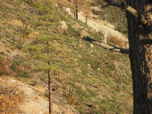
First real sign of the damage above Bear Flat in the switchbacks that face southeast.
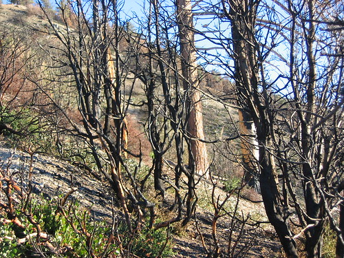
On top of the first big ridgeline where the pine tree forest is you can see that the fire was burning hot, fast and low from the wind as it burned the lower section of the tree but not the branches hanging down.
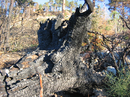
One of the big trees that did get completely consumed just off the trial - up close and personal.
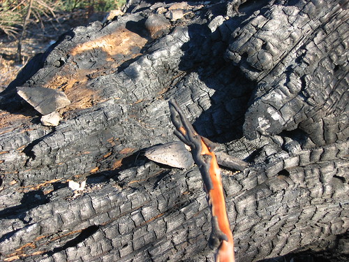
The bottom of the same tree as above - notice that some of the plants are starting to recover around this.
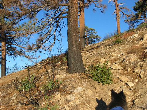
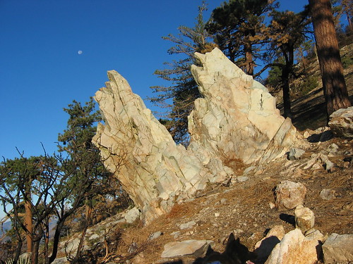
Some of you will recognize these two rocks right around the 7,400 foot mark leading up to the second ridgeline.
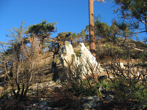
The fire damage area ends just above this.
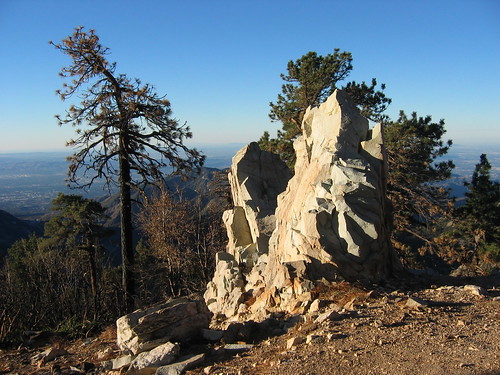
This is above that same set of rocks looking south - notice that it's still early enough that no smoke appears to the south (on the lefthand side of this picture) which is looking directly to where I live - it's still only 7:45 AM.
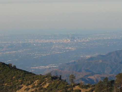
Looking at downtown Los Angeles from the 8,000 foot area, just above the fire damage.
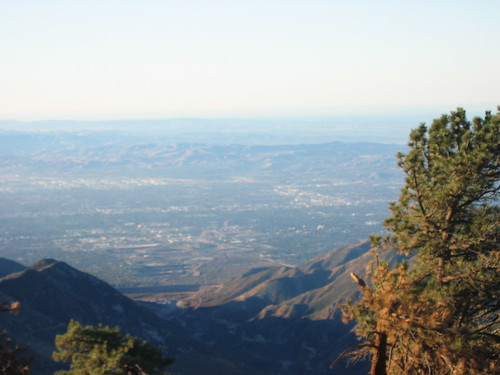
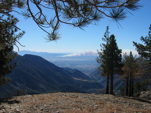
Last Picture looking due south at 8:30 AM before I realized that Yorba Linda was on fire.
Lucy looking up at me saying "What Kind of Snacks you got for me today Pops"?

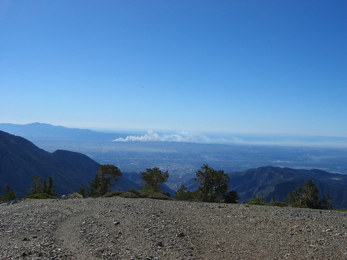
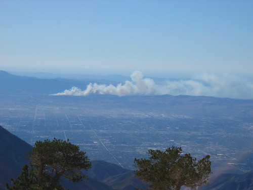
Heading down now, knowing from the location of Saddleback and the small ridgeline in front of the smoke (Chino Hills) that it's the East end of Yorba Linda/West Corona.
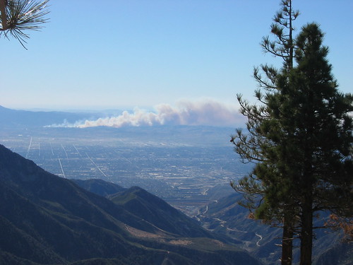
It's building and I'm moving faster.
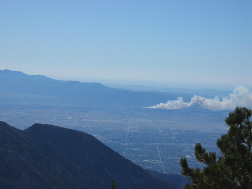
Further down the mountian.
Still further down.
And the last one I captured
To complicate matters it was the first hike out with Lucy since she ran into trouble back in the Spring where she started showing signs of Heat Stroke so I had to back off my speed and keep her from "Panting too Hard". She was consuming tons of water and we stopped at the Bear Canyon Flats Creek where I soaked her down, feed her more food and got her ready for the last section. The weather report said it was going to be 65 degrees all day that day in the Village and by 11 AM it was already in the low 80's. Needless to say we were ok and heading out of there by 12:30.
What I really want to say is "Thank You" to all the fire fighters, Police, National Forest Fire Fighters, the emergency response folks and everyone else that responds to these traggedies. They do one hell of a job and I appreciate all they do.
God Bless - lilbitmo


