San Francisquito dam site

TRs for ranges in California.
User avatar
dima
Posts: 1933
Joined: Wed Feb 12, 2014 1:35 am
Location: Los Angeles

Post by dima »

I just biked up San Francisquito, to Lake Elizabeth, Lake Hughes and up to Sawmill camp. Then over to Libre mountain and down the ridge route. Libre is magnificent. The Ridge Route is now all paved, and even open to cars; I saw zero cars. It is great.

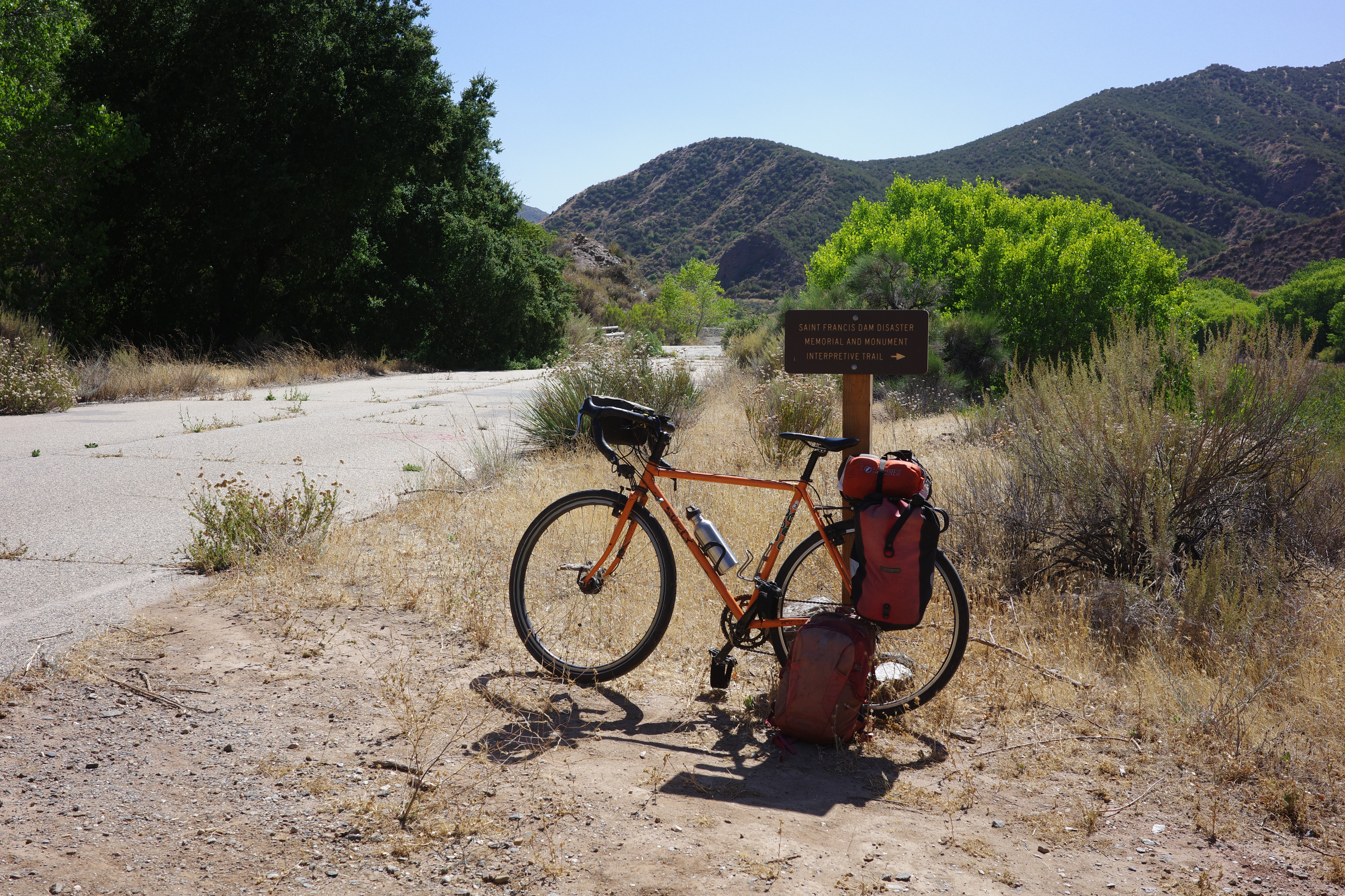
Of note is the San Francisquito dam site. I've been here a few times before. This time I biked the old road, which turns right just above Power Plant No. 2. It's paved, partially eroded into the canyon below, definitively closed to cars, and is a great bike ride.

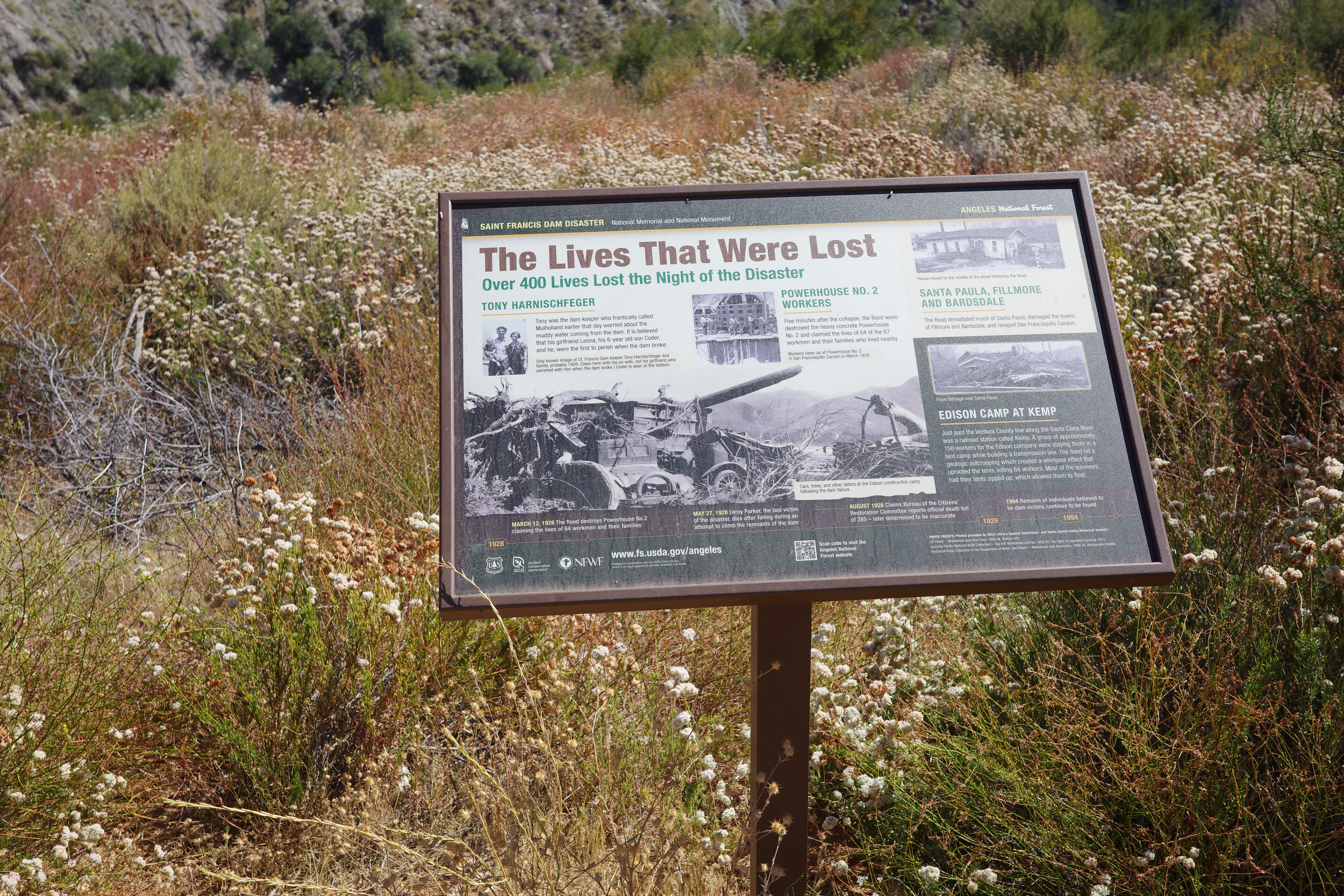
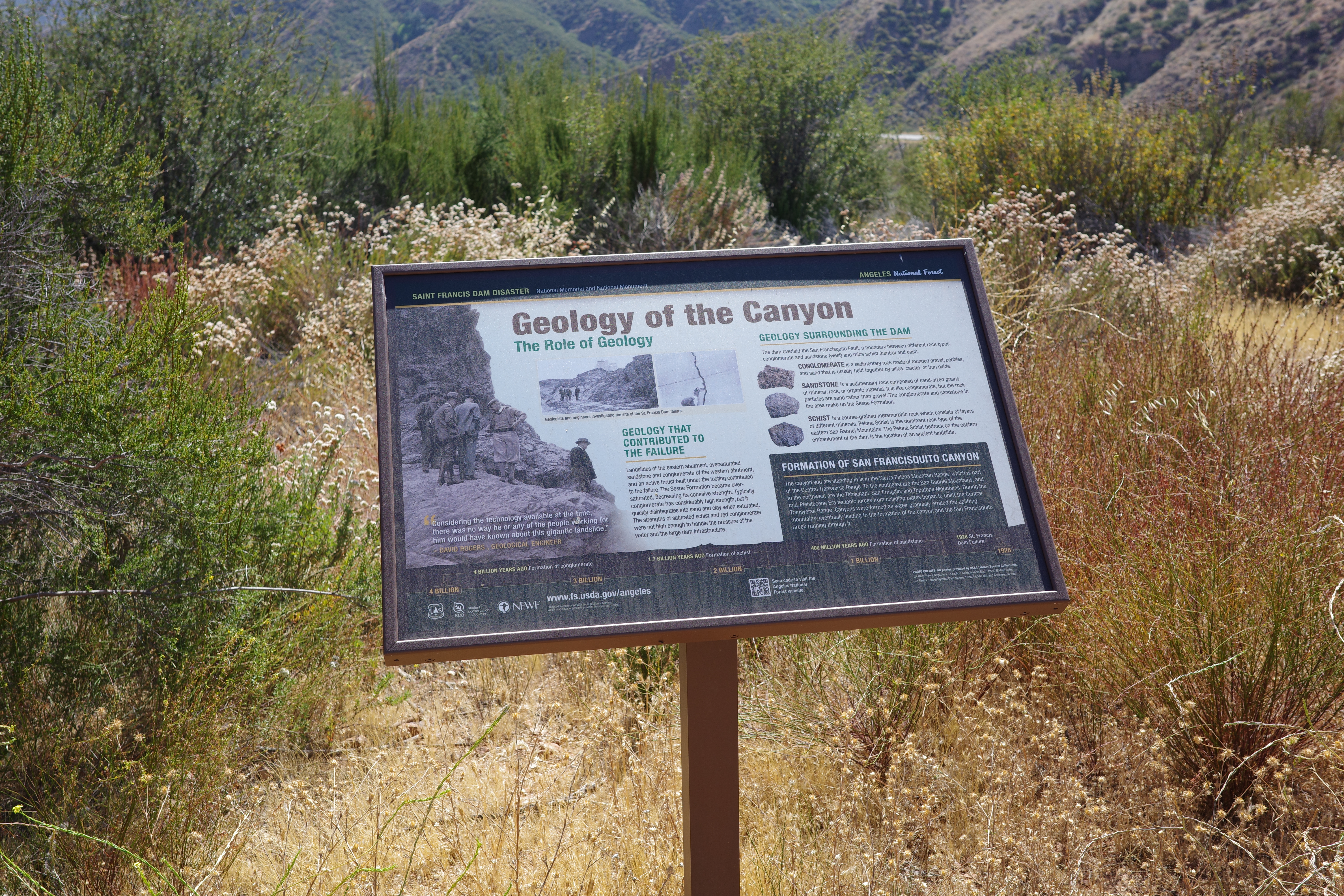
In the middle of this road is the dam site, which is now some sort of official landmark. There's signage:

Image

and an unofficial trail that goes to a big chunk of old concrete

Image

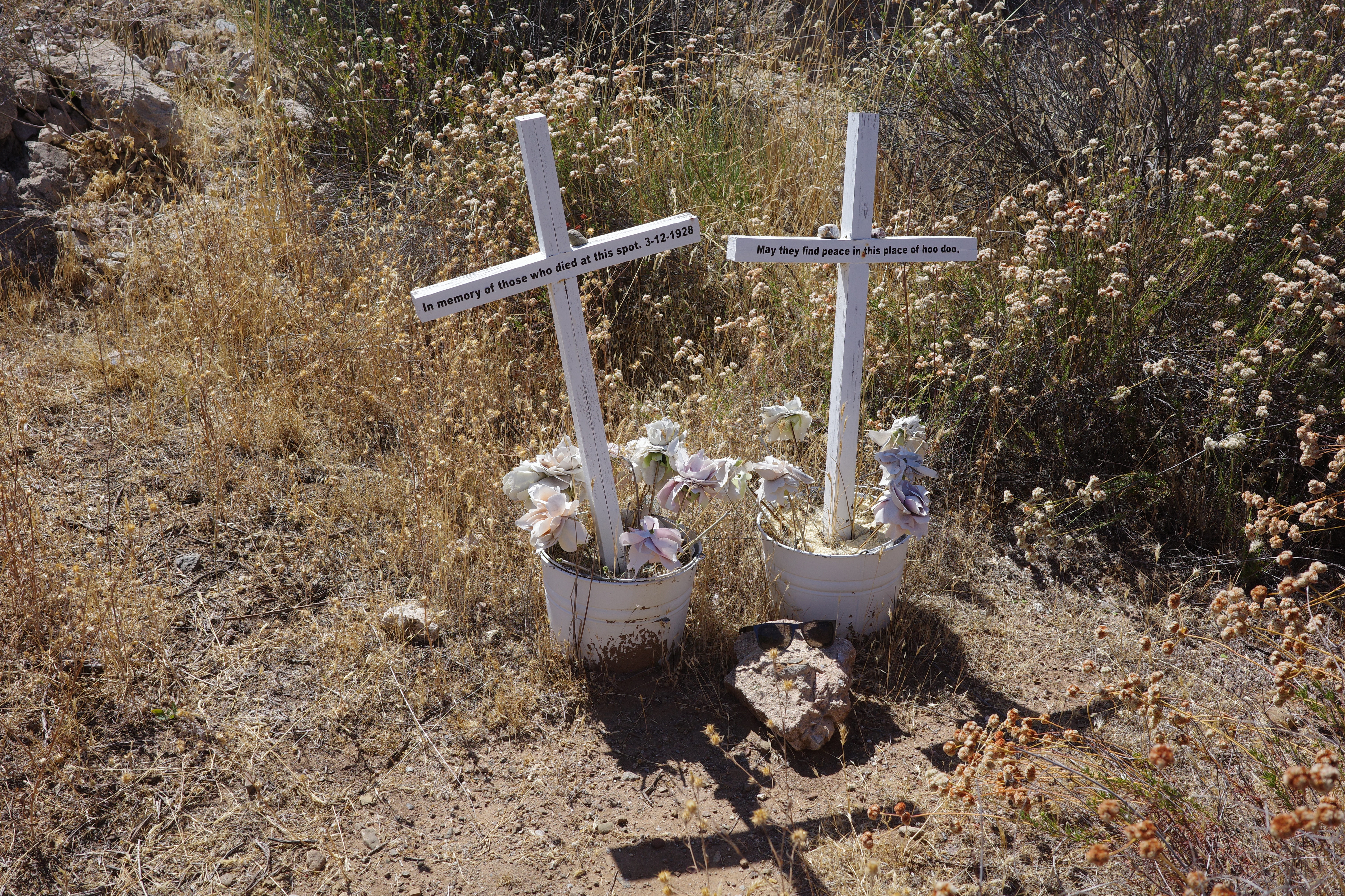
and a small monument

Image

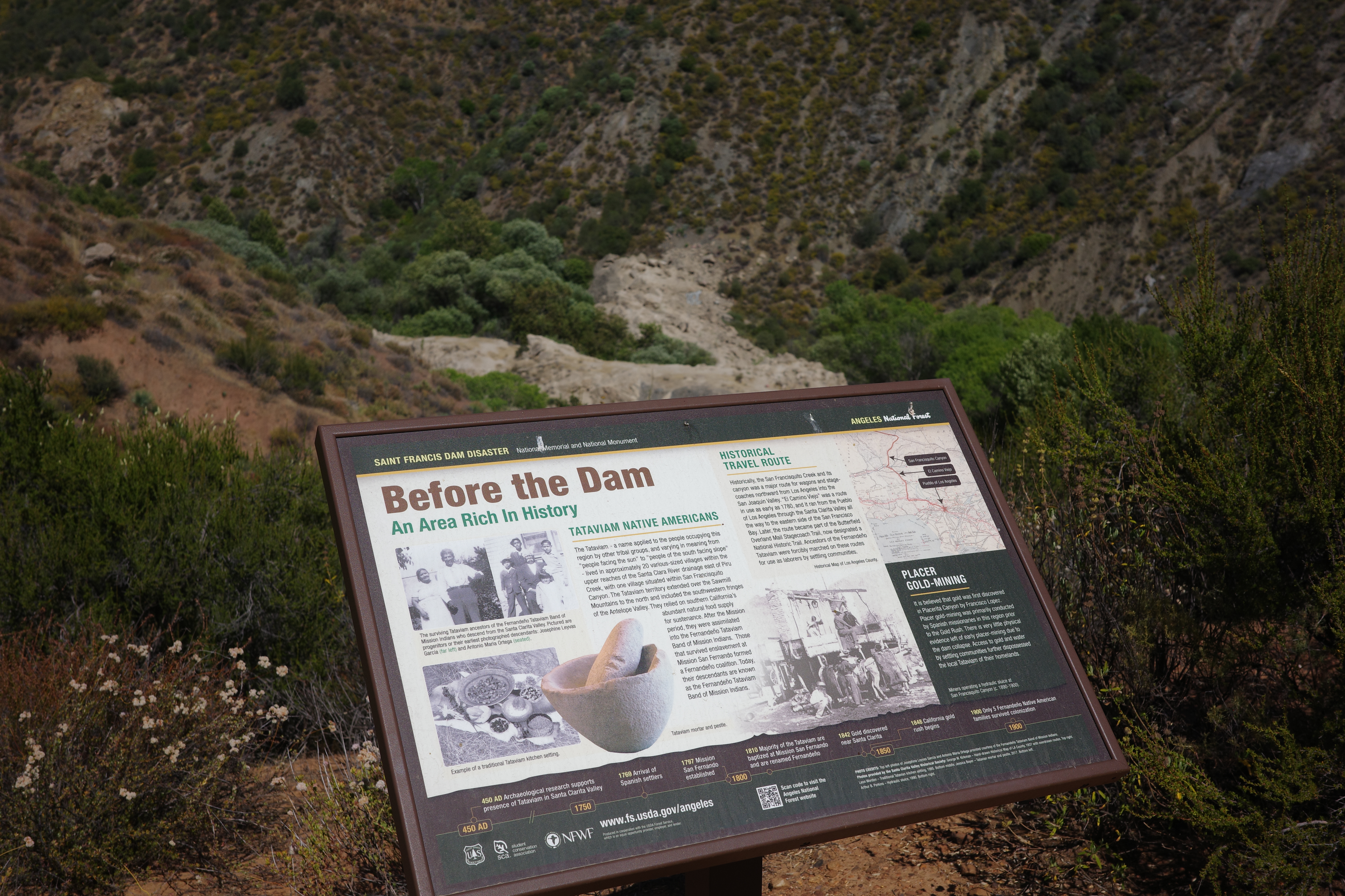
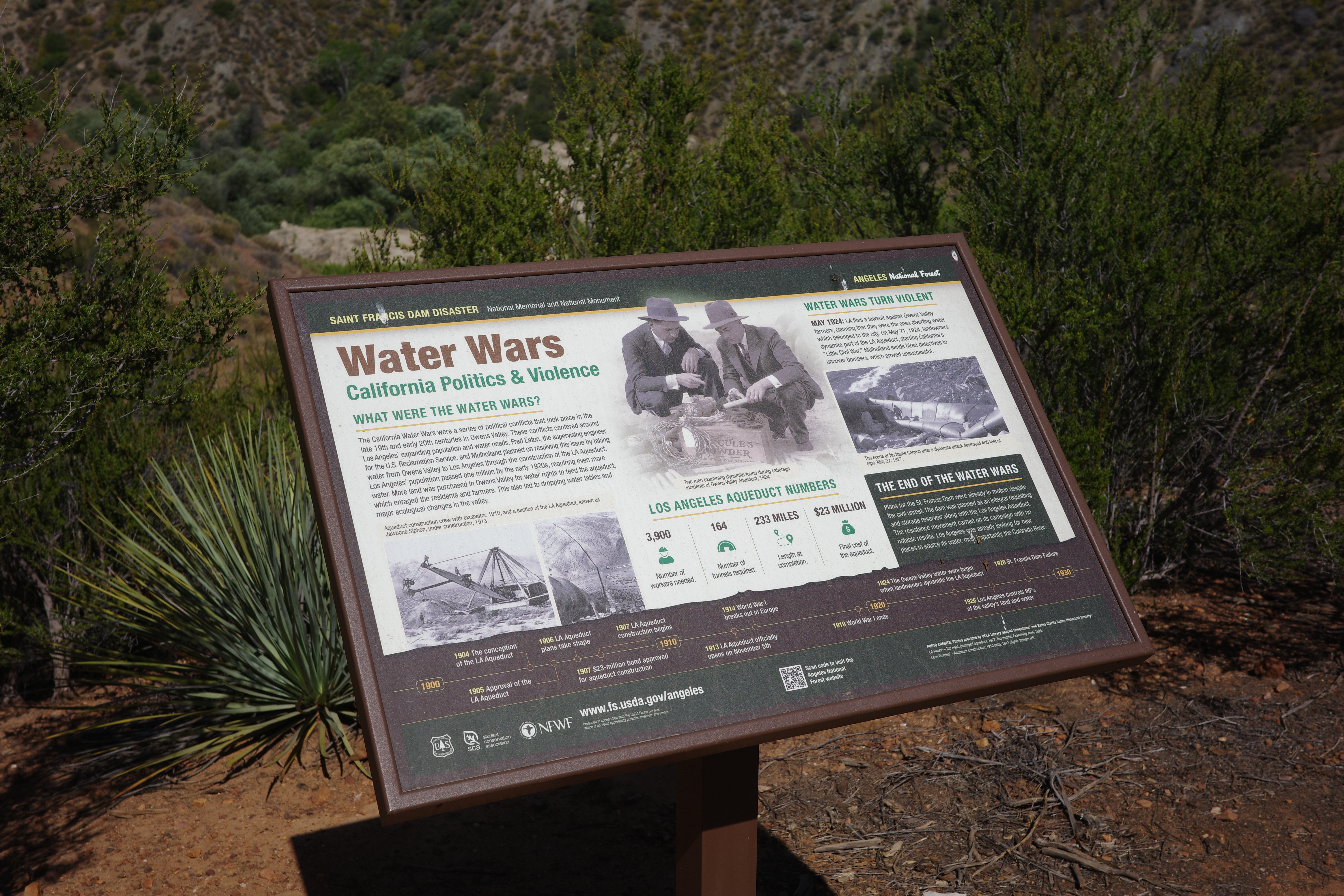
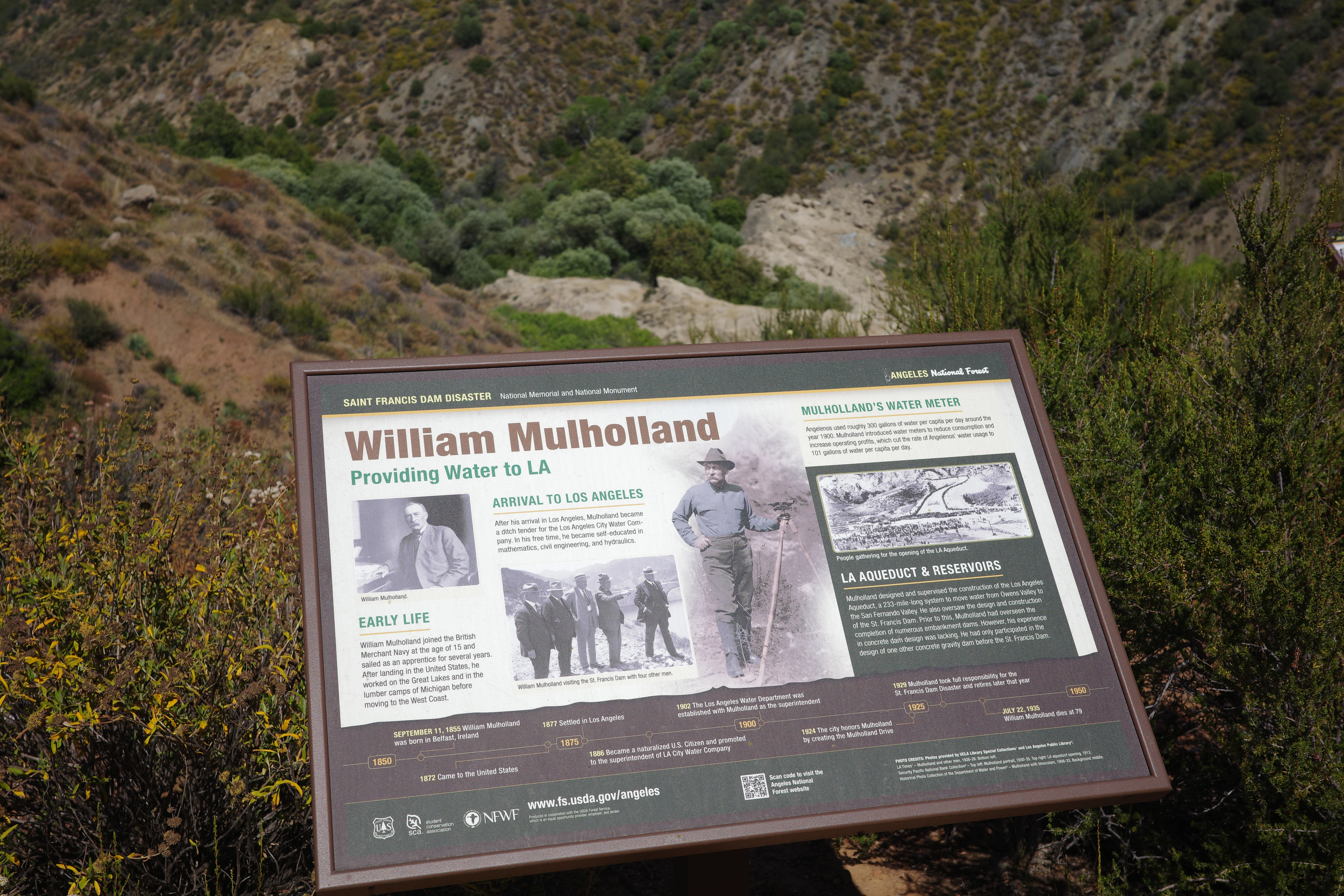
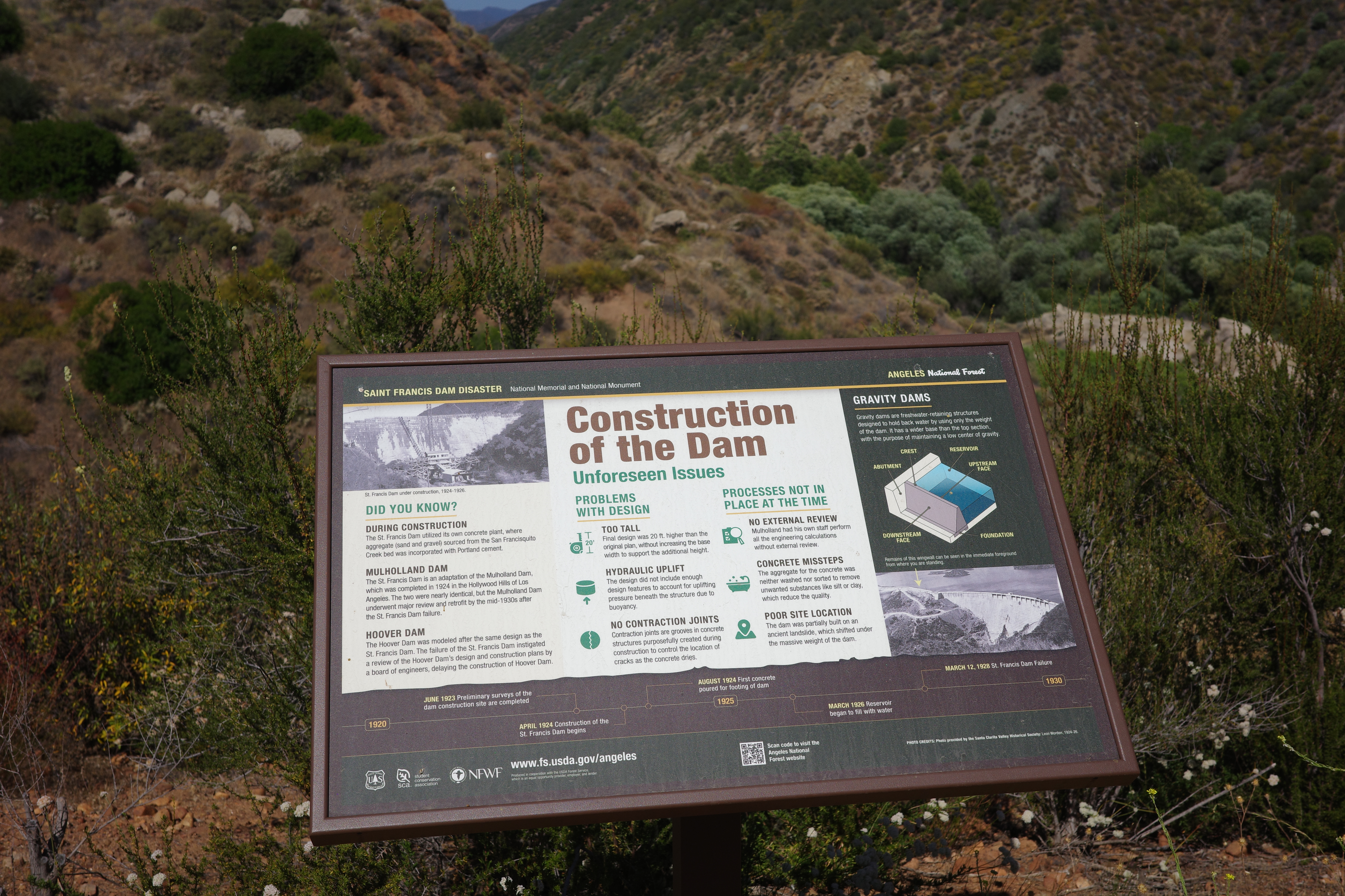
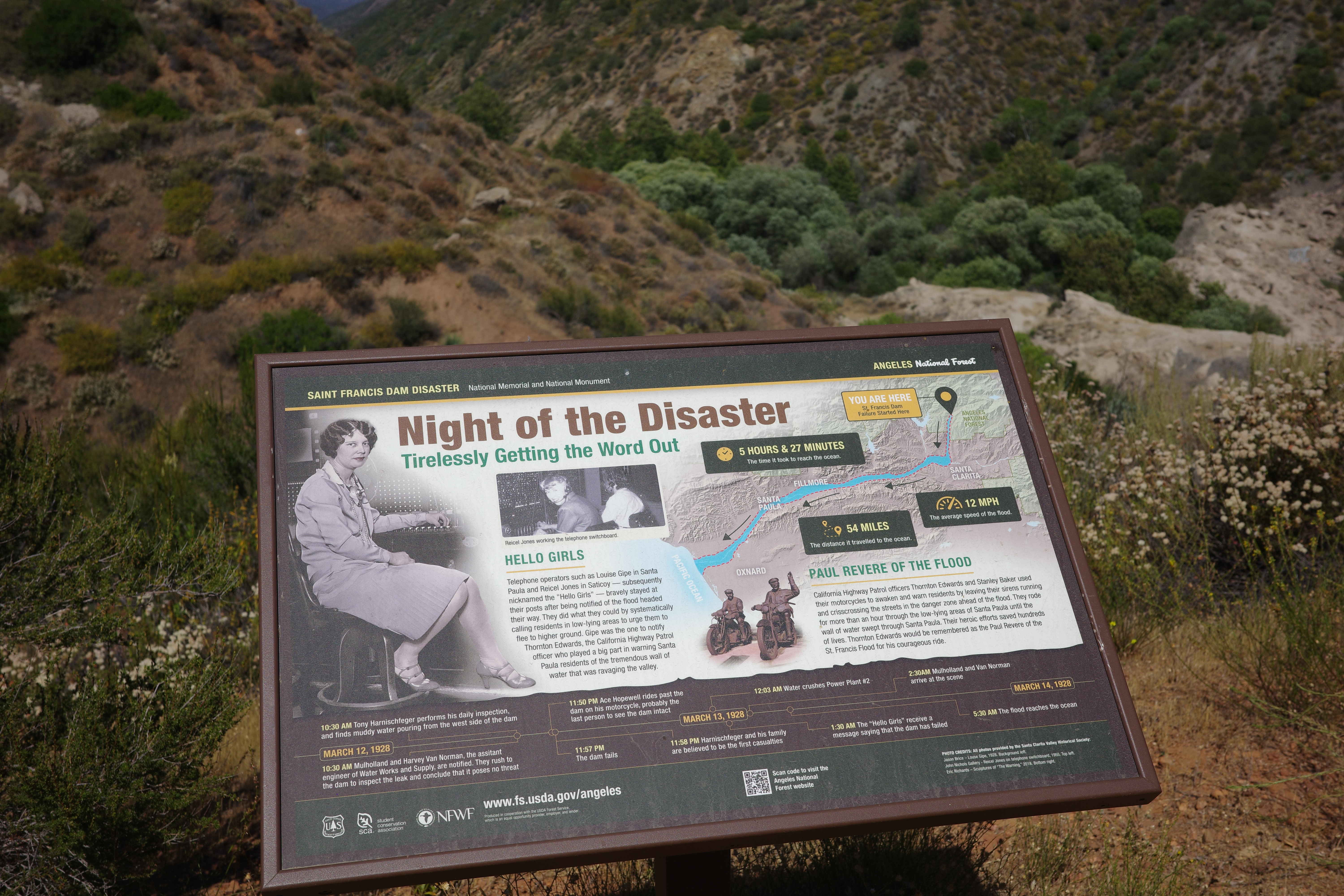
There's also an official, signed trail that climbs up to an overlook of the old dam, and has lots of informational panels

Image

Image

Image

Image

Image

Image

Image

Image

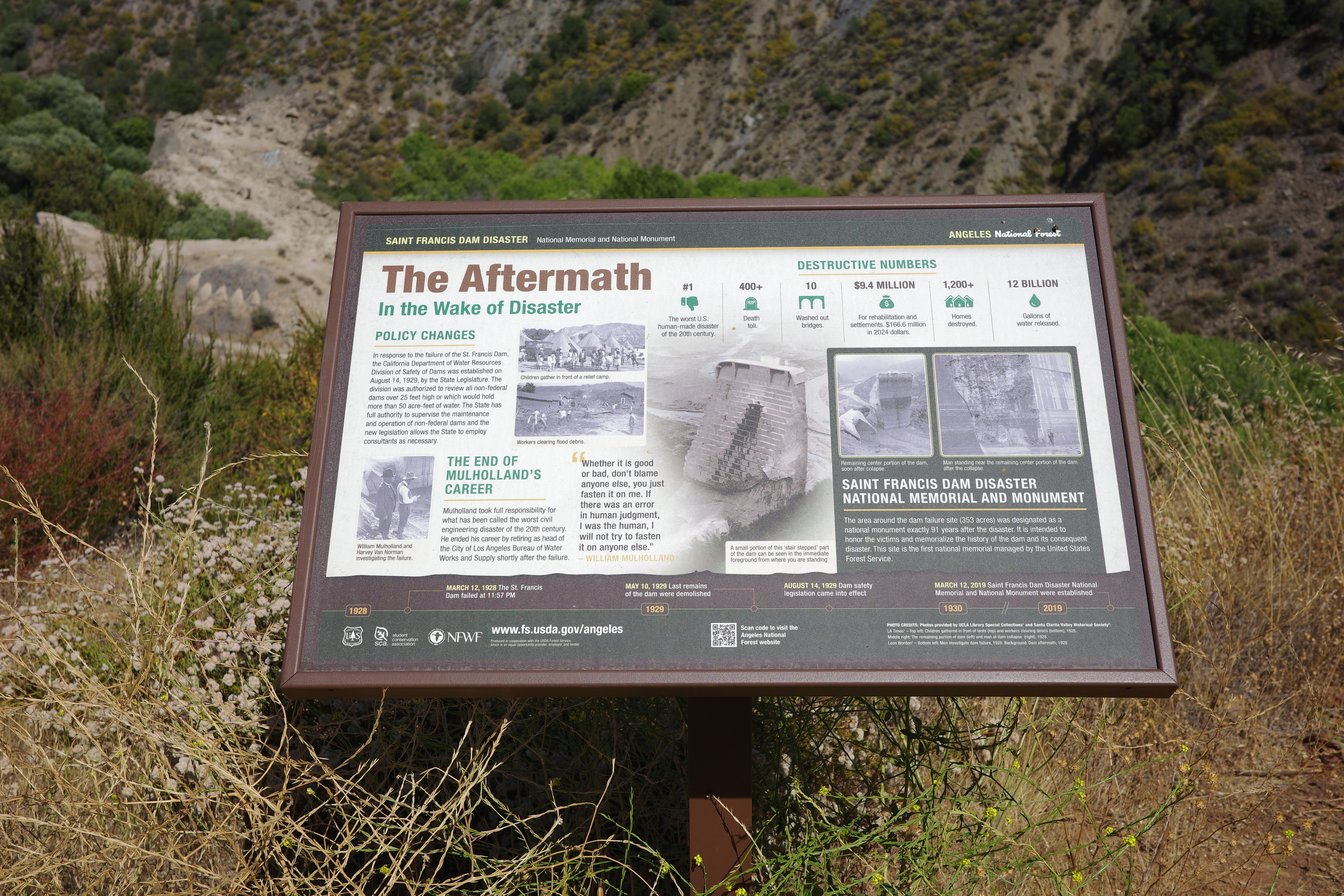
There still isn't really anything remaining here to look at. Here's what's left of the dam:

Image

Bike the old road next time you're here!
User avatar
Sean
Cucamonga
Posts: 4419
Joined: Wed Jul 27, 2011 12:32 pm

Post by Sean »

Thanks for the report and photos. Surprising that Mulholland's name wasn't erased from the face of Southern California after this disaster.
User avatar
Matthew
Supercaff
Posts: 637
Joined: Mon Nov 30, 2015 8:25 am
Location: Pasadena

Post by Matthew »

Sean wrote: Sun Jun 28, 2026 7:22 am Thanks for the report and photos. Surprising that Mulholland's name wasn't erased from the face of Southern California after this disaster.
I was surprised too seeing the timeline. They clearly state that he inspected the leak and said there's no threat. I guess the forest service doesn't fw LADWP lol
stoke is high