
Was out at Mt-Lowe-ish today. The sun mid-day makes the barges near the port stand out:
And the following day you could clearly see Santa Barbara island and San Nicolas island, behind and to the right 105 miles away!
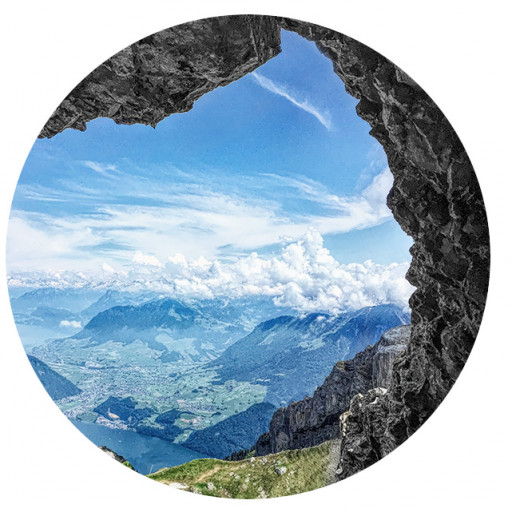
Good views today!
-
dima

- Posts: 1930
- Joined: Wed Feb 12, 2014 1:35 am
- Location: Los Angeles
You do not have the required permissions to view the files attached to this post.
-
David R
- OG of the SG
- Posts: 687
- Joined: Sun Jun 12, 2011 10:28 pm
Here's my Sunday picture
You do not have the required permissions to view the files attached to this post.
-
Nate U

- Posts: 679
- Joined: Wed Apr 05, 2023 7:38 pm
Here's one from Sunday just north of Dayton Canyon. Breezy and beautiful.
Only a rough use trail to this waterfall in the Chatsworth Formation.
Only a rough use trail to this waterfall in the Chatsworth Formation.
You do not have the required permissions to view the files attached to this post.
-
JeffH

- Posts: 1399
- Joined: Sun Nov 28, 2010 7:09 am
I could see the ocean and Catalina on Sunday afternoon from CHWP.
You do not have the required permissions to view the files attached to this post.
"Argue for your limitations and sure enough they're yours".
Donald Shimoda
Donald Shimoda
-
David R
- OG of the SG
- Posts: 687
- Joined: Sun Jun 12, 2011 10:28 pm
Los Padres looking out to Anacapa and Santa Cruz Islands.
You do not have the required permissions to view the files attached to this post.
-
JakubRZ

- Posts: 56
- Joined: Sat Jun 11, 2022 4:08 pm
You do not have the required permissions to view the files attached to this post.
-
David R
- OG of the SG
- Posts: 687
- Joined: Sun Jun 12, 2011 10:28 pm
More views of Baldy on Sunday, 10x up there.
You do not have the required permissions to view the files attached to this post.
-
dima
- Posts: 1930
- Joined: Wed Feb 12, 2014 1:35 am
- Location: Los Angeles
Wow. So little snow. I guess it has been far too warm?
-
David R
- OG of the SG
- Posts: 687
- Joined: Sun Jun 12, 2011 10:28 pm
You do not have the required permissions to view the files attached to this post.

-
David R
- OG of the SG
- Posts: 687
- Joined: Sun Jun 12, 2011 10:28 pm
You do not have the required permissions to view the files attached to this post.
-
dima
- Posts: 1930
- Joined: Wed Feb 12, 2014 1:35 am
- Location: Los Angeles
What's that flat area in the middle of your photo?
-
carl swindle
- Posts: 65
- Joined: Wed Jan 31, 2024 8:52 pm
The flat area looks like one of the "Potholes" on the Pothole Trail loop near Lake Piru.
Here is one of the lower ones. I had I few pictures of one of the upper ones (I think it was the one in the picture), but I didn't save it. The first one you see on the descent sort of looks like the picture that was shared. I heard that some of them flooded in 2023 from all the rain that year. Is that where this is?
Here is one of the lower ones. I had I few pictures of one of the upper ones (I think it was the one in the picture), but I didn't save it. The first one you see on the descent sort of looks like the picture that was shared. I heard that some of them flooded in 2023 from all the rain that year. Is that where this is?
You do not have the required permissions to view the files attached to this post.
-
carl swindle
- Posts: 65
- Joined: Wed Jan 31, 2024 8:52 pm
These link have some other images of the potholes from different perspectives:
https://songsofthewilderness.com/2020/0 ... cove-camp/
https://www.hikelospadres.com/pothole-trail.html
https://valhikes.blogspot.com/2015/03/p ... trail.html
https://songsofthewilderness.com/2020/0 ... cove-camp/
https://www.hikelospadres.com/pothole-trail.html
https://valhikes.blogspot.com/2015/03/p ... trail.html
-
dima
- Posts: 1930
- Joined: Wed Feb 12, 2014 1:35 am
- Location: Los Angeles
Oh yeah. I walked around with the horizonator. This is a view to the N from above "the Pothole". Slide Mountain is the big bump in the background
-
David R
- OG of the SG
- Posts: 687
- Joined: Sun Jun 12, 2011 10:28 pm
You do not have the required permissions to view the files attached to this post.
-
David R
- OG of the SG
- Posts: 687
- Joined: Sun Jun 12, 2011 10:28 pm
Just before I got drenched.
You do not have the required permissions to view the files attached to this post.
-
David R
- OG of the SG
- Posts: 687
- Joined: Sun Jun 12, 2011 10:28 pm
Almost at the top of the spur, that was when the clouds came in and was socked in for the rest of the ascent and most of the descent. 46th time up to the top, almost time for 50th ascent party.
-
dima
- Posts: 1930
- Joined: Wed Feb 12, 2014 1:35 am
- Location: Los Angeles
Yeah, that is amazing. There's only one place in the mountains I've been to this many times.
-
David R
- OG of the SG
- Posts: 687
- Joined: Sun Jun 12, 2011 10:28 pm
Lukens is now #1 now that it is winter, Baldy is close behind at about 42, Wilson is in the low 30s.
-
HikeUp

- Posts: 4098
- Joined: Thu Sep 27, 2007 9:21 pm
Nice views from Luken's. I'm right behind you though, at a whopping 3 times!
My max is 14x each to Hastings and Jones. 8x to Baldy. Most every other peak were just 1-timers.
My max is 14x each to Hastings and Jones. 8x to Baldy. Most every other peak were just 1-timers.
-
Elwood

- Posts: 627
- Joined: Fri Aug 15, 2008 5:23 pm
I barely outran this in the Verdugos yesterday. Lightning and thunder in Brand Canyon was kind of exciting though.
You do not have the required permissions to view the files attached to this post.
-
Taco

- Snownado survivor
- Posts: 6218
- Joined: Thu Sep 27, 2007 4:35 pm
I did not outrun it!
You do not have the required permissions to view the files attached to this post.
-
David R
- OG of the SG
- Posts: 687
- Joined: Sun Jun 12, 2011 10:28 pm
I finally got there, thanks for all the hard work, that brush was much more thick then when I hiked the ridge 10 years ago. Only disappointment was finding that massive cement pipe on the rim of the flats,not sure why that was there.
You do not have the required permissions to view the files attached to this post.
-
Matthew

- Supercaff
- Posts: 635
- Joined: Mon Nov 30, 2015 8:25 am
- Location: Pasadena
YES LET'S GO BABY!!!!!! Write a full report!David R wrote: Mon Apr 20, 2026 2:03 pm 5b0a6871-6f4e-49eb-aad4-577c0bf9c951.jpeg
I finally got there, thanks for all the hard work, that brush was much more thick then when I hiked the ridge 10 years ago. Only disappointment was finding that massive cement pipe on the rim of the flats,not sure why that was there.
stoke is high
-
Nate U
- Posts: 679
- Joined: Wed Apr 05, 2023 7:38 pm
Glad all that cutting got enjoyed by someone else. Massive cement pipe on the rim? Am I forgetting about this?David R wrote: Mon Apr 20, 2026 2:03 pm Only disappointment was finding that massive cement pipe on the rim of the flats,not sure why that was there.
Where did you start from?
-
David R
- OG of the SG
- Posts: 687
- Joined: Sun Jun 12, 2011 10:28 pm
I started from Baldy Road at the Potato Mtn TH. I had to walk .5 mile on the road because fuck City of Claremont. I took the fire break up to the fire road where the trail branches off to the top of Potato. Totals stats were about 14.1 miles with 4,600 feet elevation gain in 6.75 hours with .5 spent in the flats.
The cement pipe was near the weather station in the NW section just outside the flats where there was no brush. It was at least 30 feet long with a three foot circumference, it looked quite new.
The cement pipe was near the weather station in the NW section just outside the flats where there was no brush. It was at least 30 feet long with a three foot circumference, it looked quite new.