PHOTOS - Post or link to pictures!
-
HikeUp

- Posts: 4099
- Joined: Thu Sep 27, 2007 9:21 pm
That is hilarious. I lost count after 1 too f*&@ing many.
-
friendowl

- Posts: 137
- Joined: Fri Sep 28, 2007 9:23 am
my daughter and i were walking along..we were the only ones around.
it was quiet and peaceful...a gentleman walks by me and non-chalantly
tells me "theres about 250 kids behind me" he laughed a lil and kept walking...i thought he was kidding
it was quiet and peaceful...a gentleman walks by me and non-chalantly
tells me "theres about 250 kids behind me" he laughed a lil and kept walking...i thought he was kidding
-
Rob
- Posts: 158
- Joined: Thu Sep 27, 2007 9:26 pm
If they had been chanting, it would have been scary.
-
Augie

- Posts: 345
- Joined: Fri Sep 28, 2007 2:17 pm
F***ing amazing footage! One: what a battery pack your camera has. Two: your daughter was very patient before wanting to know what the H was going on. Three: what was going on? Who was that group? They hiked at such a steady pace. A well disciplined company sized patrol. Maybe a new military recruiting program?
-
friendowl
- Posts: 137
- Joined: Fri Sep 28, 2007 9:23 am
it was a geology class from USC.
they had just gotten back from camping out at joshua tree that morning
and were headed to lake castaic for more learning
what a neat class
i took that video on our way to millard falls in pasadena.
they had just gotten back from camping out at joshua tree that morning
and were headed to lake castaic for more learning
what a neat class
i took that video on our way to millard falls in pasadena.
-
Tim

- Posts: 560
- Joined: Tue Apr 08, 2008 8:55 pm
Wow, who knew that many kids were into geology. Man, I wish my college classes were like that. The closest thing was AP Bio in high school. We were suppose to spend the night at Lake Fulmor in the San Jacintos but due to budget cuts it was only a day outing. Come to think of it, that was my first hike. We hiked up the stream into the foothills and crossed several logs. I've always wanted to repeat that hike but the area is closed now.
-
He219

- Posts: 386
- Joined: Thu Sep 27, 2007 11:18 pm
Nice video.
It looked like the Trojan Marching Band on a camp or something ..
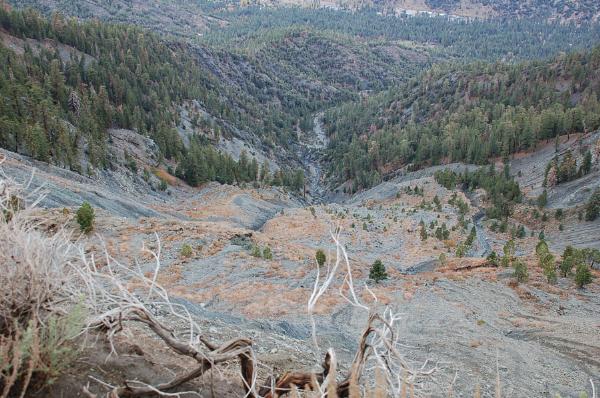
Reminds me of an SC Engineering Geology field-trip we took to Landers back in '92. There were only 20 of us ..
We rode an old yellow schoolbus down a dry riverbed and ended up embedded in an off-road motorcycle race.
Eventually the bus couldn't go anymore ..

(going by memory, could have been just east of pictured location)
We were glad to get off as the bus had no offroad suspension. We humped a couple of miles and saw the fault propagation of the Landers Quate and measured the distance 2 ton boulders were hurled by the vertical accelleration of the surface fissure.
It looked like the Trojan Marching Band on a camp or something ..
Reminds me of an SC Engineering Geology field-trip we took to Landers back in '92. There were only 20 of us ..
We rode an old yellow schoolbus down a dry riverbed and ended up embedded in an off-road motorcycle race.
Eventually the bus couldn't go anymore ..
(going by memory, could have been just east of pictured location)
We were glad to get off as the bus had no offroad suspension. We humped a couple of miles and saw the fault propagation of the Landers Quate and measured the distance 2 ton boulders were hurled by the vertical accelleration of the surface fissure.
-
brian90620

- Posts: 123
- Joined: Sun Jan 27, 2008 8:34 pm
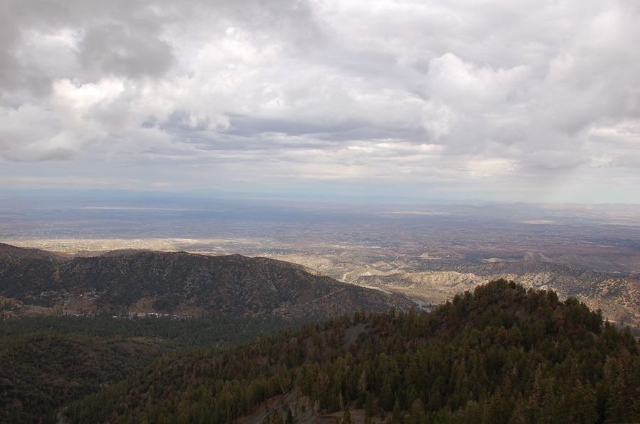
I took a Physical Geography lab class at Cerritos College this spring semester and went on a 3 day camping trip to Owens Valley this past April. Was pretty cool saw Mount Whitney, the Sierra Nevada, Convict lake, Mono Lake and various other geological sites along the way. Was very cool, the whole bus ride there I couldnt take my eyes of the jagged granite peaks of the high sierra, would love to go backpacking up there someday.......the best part of the trip was it didn't cost me anything other than the regular class fee 
-
kgw
- Posts: 133
- Joined: Fri Jul 18, 2008 11:48 am
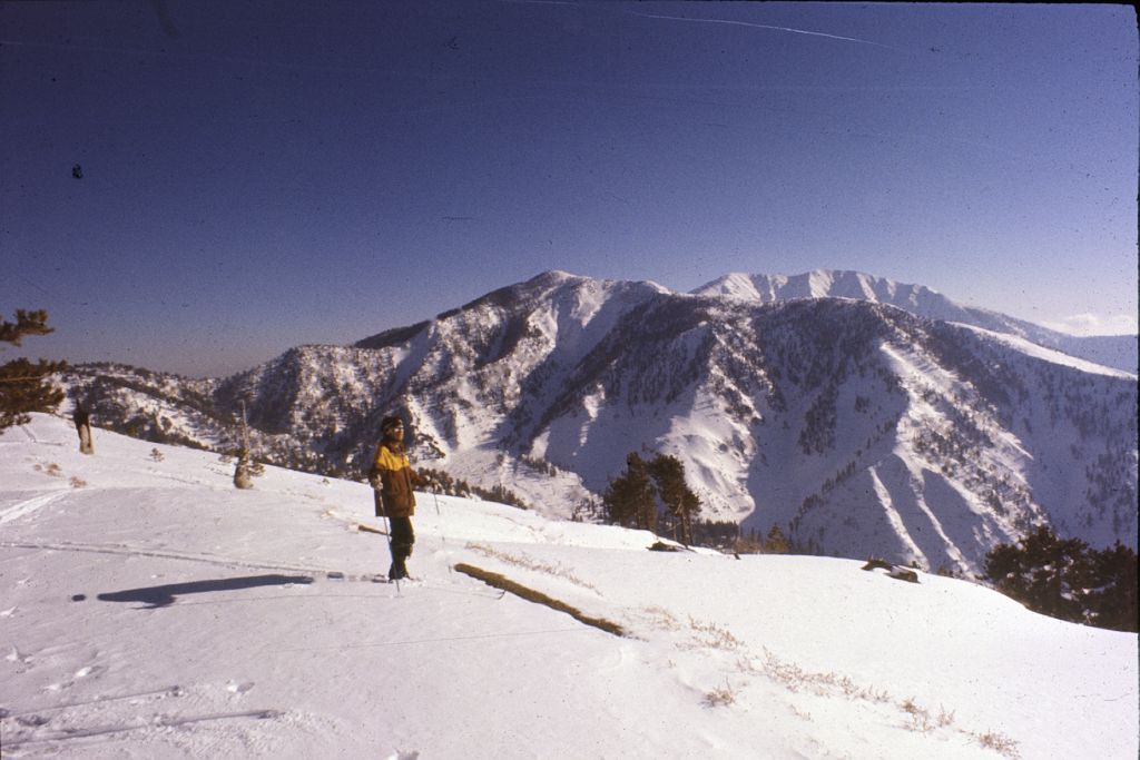
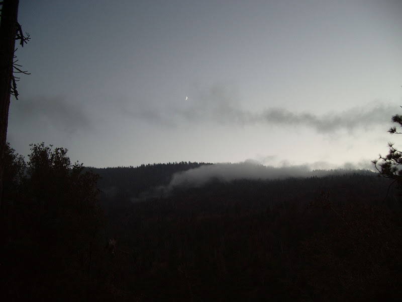
Snow is thin here on the ridgetop, but it was thick elsewhere; a new storm came in the night before we left. As we were skiing out, we had 3-4" of snow on our shoulders, it was really coming down!
-
kgw
- Posts: 133
- Joined: Fri Jul 18, 2008 11:48 am
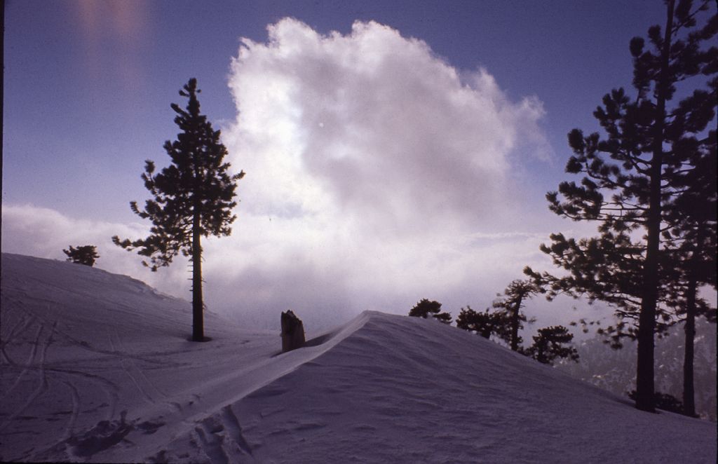
That looks to be very close to where the picture was taken. . .Here's another as the storm rolls in from the south:FIGHT ON wrote:kgw? was you right about here?
http://mapper.acme.com/?ll=34.34351,-11 ... twood%20CA

-
kgw
- Posts: 133
- Joined: Fri Jul 18, 2008 11:48 am
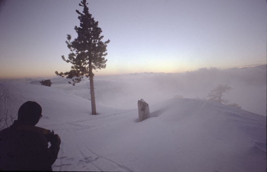
These are all I can find of this great trip. It was a 3 day x-country ski trip: we took the Mountain High ski lift up, got real strange looks from the downhill skiers while we stood in line for the lift with our packs and funny skis  Then we skied further east down the ridge. Two vegetarian friends took UNCOOKED beans to eat: I warned 'em. My rations were simpler: cognac and tinned ham, instant oatmeal, etc.
  We had parked one car near Mountain High, and another in a Wrightwood neighborhood that would let us ski down the side of a steep spur of Blue Ridge from our camp right to this car. Fun! Steep! The uphill leg was in snow almost up to the crotch; the nubee I was with thought it was too hard and decided it would be easier to walk out. When he took a step off the skis, he plunged in up to his waist
  He put the skis back on.
It really looked like this as the sun set:
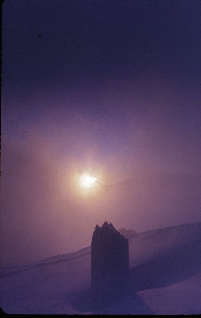
It really looked like this as the sun set:
-
Taco

- Snownado survivor
- Posts: 6218
- Joined: Thu Sep 27, 2007 4:35 pm
FUCKING COOL!
Really beautiful shots!
Really beautiful shots!
-
Dudley Heinsbergen
- Posts: 109
- Joined: Tue Jan 22, 2008 9:02 pm
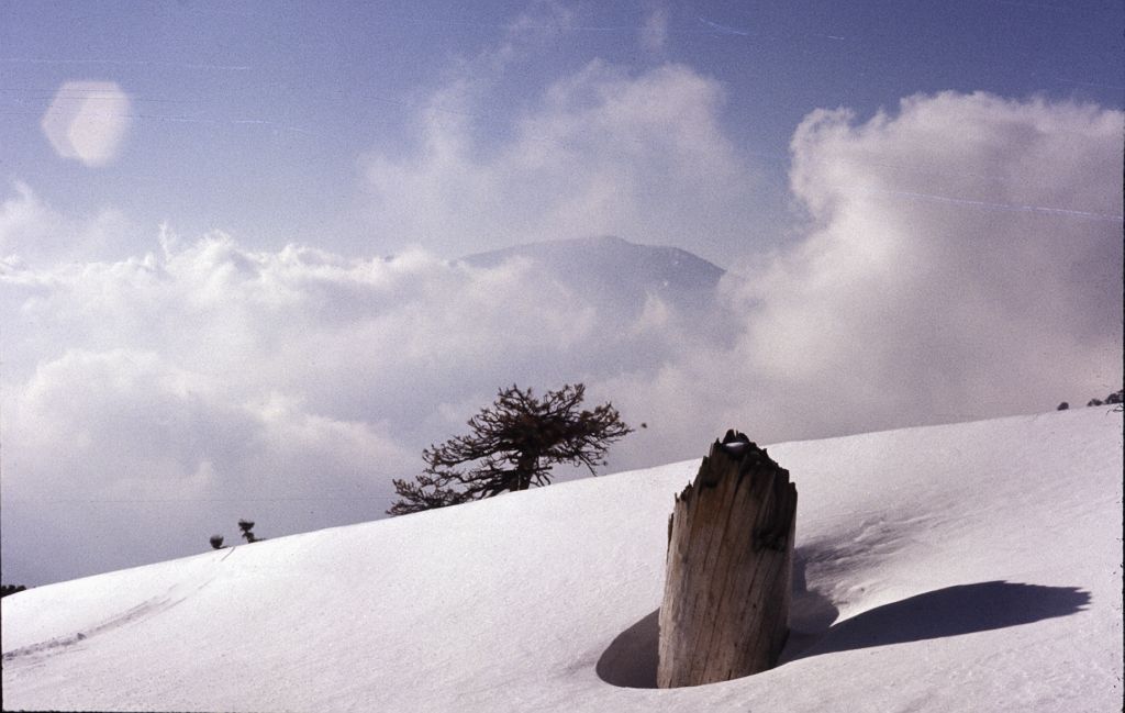
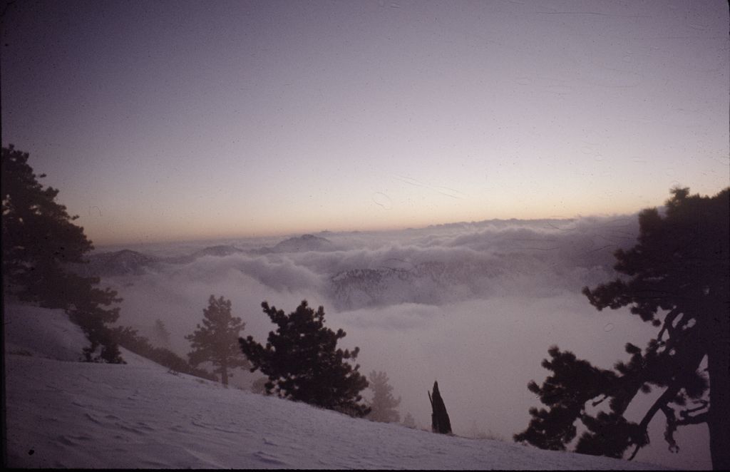
theres nothing i love more about the snowy san gabriels than the inversion layer that sits at 4000 ft. it is my favorite!
THATS ME!
THATS ME!
-
Taco
- Snownado survivor
- Posts: 6218
- Joined: Thu Sep 27, 2007 4:35 pm
Makes me even more eager to start winter. COME ON WINTER!

-
Funyan005
- Posts: 203
- Joined: Tue Apr 01, 2008 11:17 pm
Looks beautiful. Can't wait to have my first winter of mountaineering! Crampons/ice axe/backpack in a month! Woohoo
-
Taco
- Snownado survivor
- Posts: 6218
- Joined: Thu Sep 27, 2007 4:35 pm
It's awesome. just going up to see a completely different world is amazing. Nothing can replace going down the Devils Backbone or any other ridge after a storm, at sunset. The clouds, etc.
-
kgw
- Posts: 133
- Joined: Fri Jul 18, 2008 11:48 am
Mind Altering without a doubt!
Always take good care as you enjoy yourself, so you can do it again.
Always take good care as you enjoy yourself, so you can do it again.
-
simonov

- Posts: 1110
- Joined: Tue Nov 27, 2007 5:44 pm
- Location: Reno, NV
An on-line friend of mine complained about the photo Wikipedia was using for their Mt Baden-Powell entry, so I mentioned I had a better one. He edited the article and - voilà! - my photo is now there instead.
I bet there are a lot of Wikipedia articles that could be better illustrated by us folks on this forum.
This is only acceptable to Wikipedia if your photo are licensed Creative Commons.
I bet there are a lot of Wikipedia articles that could be better illustrated by us folks on this forum.
This is only acceptable to Wikipedia if your photo are licensed Creative Commons.
Nunc est bibendum
-
Hikin_Jim

- Posts: 4688
- Joined: Thu Sep 27, 2007 9:04 pm
Lol, but that "Park Service" map is totally bogus. It shows the trail up from Dawson Saddle (which is inaccessible due to road closure) calls it the "Scout Trail." There's no mention of this little thing called the PCT, either.
-
simonov
- Posts: 1110
- Joined: Tue Nov 27, 2007 5:44 pm
- Location: Reno, NV
Last week I got myself a registration on Wikipedia. I've been thinking of fixing some of that stuff.
Nunc est bibendum
-
Taco
- Snownado survivor
- Posts: 6218
- Joined: Thu Sep 27, 2007 4:35 pm
A few forums I'm on have a "post yer latest picture" thread. I figured since I'm in the mountains a few times a week, but a trip report isn't always appropriate, this might be a good idea. Excellent for keeping track of conditions as well.
Post away...
Post away...