The trail up then down to Idlehour from Mt. Wilson Toll road is in great shape - I'd bet that someone has done some maintenance recently. The trail gains 2 to 3 hundred feet before dropping about 750' into the canyon bottom - all in 1.5 miles. The mosquitoes were horrendous at the trail camp and in the shaded sided canyons along the trail - plenty of incentive to hike back up the steep 750' to get out of there.
Couple of rain showers that lasted less than a few minutes. Saw what I will assume was a hunter in full camo at the top of Henninger Flats (on the road out to the heliport) who was surveying the flats with his binocs. I didn't see a gun but he was sitting next to what looked like a bunch of gear (or another person in camo!). I paused to make sure he knew I was there (nod, nod), then headed down through the flats. *shrug*
Signage at the camp (there was one tent off to the left of this pic)...

Looking up towards Markham, San Gabriel and the headwaters of Eaton Canyon...

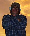
Sunrise over the sprawl...