Big Iron
-
Anthony
- Posts: 333
- Joined: Mon Jun 05, 2017 11:53 am
I'm turning 40 this month so I decided to bag Iron Mountain as part of the celebration (my first time doing it). I knew I had to train, so I hiked the Old Baldy Trail the week before. The strategy served me well because I was more tired after Baldy than Iron.
My buddy and I got to the East Fork parking lot at 5:30am and hit the trail soon after. The lot was about 80% full. I'm used to seeing it overflowing with people and trash.
The Heaton Flat Trail was a bit overgrown and I'm glad I decided to wear pants. We pushed to Allison Saddle/Heaton Saddle (which is it?) pretty quickly, where we stashed our water and rested.
We then climbed the "stairway to heaven" and embarked on the toughest part of the trip. By this time it was sunny and pretty hot.
The views from the summit are indeed worth the effort. It was cool seeing all of the surrounding peaks I've bagged over the years from a new perspective. A took a long gaze at Ross Mountain, which is one of the few peaks in the area that I haven't completed. I hope to visit it soon.
The descent, which some people say is the most difficult part of the hike, wasn't so bad. I actually don't mind the ups and downs because it mixes things up, whereas on the Old Baldy Trail, it's just straight down. If anything, the sun/heat bothered me the most, but it wasn't too bad.
In the end, it took us about 12.5 hours and 5 liters of water. I imagine I'd be quicker on a cooler day.
You do not have the required permissions to view the files attached to this post.
-
David R
- OG of the SG
- Posts: 643
- Joined: Sun Jun 12, 2011 10:28 pm
I've been up there three times but nothing recently. I remember the first time I did it the trail to Coldwater Canyon was the clearest, then the one to Allison Mine and the one to Iron was the faintest, things have certainly changed up there. I disliked the descent immensely which is why I haven't been back.
-
Nate U

- Posts: 598
- Joined: Wed Apr 05, 2023 7:38 pm
Question to the Gabes experts around here. (of which I know there are a few)
Is Iron Mt worthy of its reputation as the most difficult peak to summit in the Gabes that has an actual trail of some kind up it? Anyone think there is a more challenging summit?
Of course anyone could MAKE a peak a bigger challenge with a convoluted route, but I'm talking about if someone says "I want to summit peak X in the San Gabriel Mts" and takes the easiest way to hike there that they can from a drivable trailhead, up some kind of use or official trail that could be followed by eye, is the most challenging option they have Iron Mt?
-
HikeUp

- Posts: 4062
- Joined: Thu Sep 27, 2007 9:21 pm
My thinking is that it is the toughest by the easiest route up it. You can make it harder too by choosing other routes (north face, the ridge to Baldy, etc.). And it's not an "official" trail btw. Next in my opinion would be Rattlesnake...again, the easiest way up is tough because of length, exposure, up-down-ness, elevation gain.Nate U wrote: Question to the Gabes experts around here. (of which I know there are a few)
Is Iron Mt worthy of its reputation as the most difficult peak to summit in the Gabes that has an actual trail of some kind up it? Anyone think there is a more challenging summit?
Of course anyone could MAKE a peak a bigger challenge with a convoluted route, but I'm talking about if someone says "I want to summit peak X in the San Gabriel Mts" and takes the easiest way to hike there that they can from a drivable trailhead, up some kind of use or official trail that could be followed by eye, is the most challenging option they have Iron Mt?
Other peaks can be made difficult as you say. Cucamonga from the south for instance.
Just my thoughts.
Nice hike @Anthony ! Nice TR.
-
David R
- OG of the SG
- Posts: 643
- Joined: Sun Jun 12, 2011 10:28 pm
Yes it is clearly the toughest official peak via its easiest route with 7,200 feet elevation gain and a use trail that for all intents and purposes is a trail at this stage.
-
JeffH

- Posts: 1378
- Joined: Sun Nov 28, 2010 7:09 am
Good day out there, early enough start so you could get a parking spot is a bonus. Those are more rare these days on weekends. I like that first light picture.
"Argue for your limitations and sure enough they're yours".
Donald Shimoda
Donald Shimoda
-
Anthony

- Posts: 333
- Joined: Mon Jun 05, 2017 11:53 am
The Old Baldy Trail is up there, but Iron takes the cake for me given the trail condition, steepness, and exposure.Nate U wrote: Question to the Gabes experts around here. (of which I know there are a few)
Is Iron Mt worthy of its reputation as the most difficult peak to summit in the Gabes that has an actual trail of some kind up it? Anyone think there is a more challenging summit?
Of course anyone could MAKE a peak a bigger challenge with a convoluted route, but I'm talking about if someone says "I want to summit peak X in the San Gabriel Mts" and takes the easiest way to hike there that they can from a drivable trailhead, up some kind of use or official trail that could be followed by eye, is the most challenging option they have Iron Mt?
I haven't done the North Backbone to Baldy but that sounds pretty hard too.
-
dima

- Posts: 1817
- Joined: Wed Feb 12, 2014 1:35 am
- Location: Los Angeles
Did you see any people after leaving the river? This peak became oddly popular during the pandemic. Did it calm back down by now?
-
Sean

- Cucamonga
- Posts: 4283
- Joined: Wed Jul 27, 2011 12:32 pm
There are several factors that combine to make Iron the hardest trail hike in the Gabes, if not all of SoCal. The elevation gain, steepness, sun exposure and lack of water are bad. The mileage is not so bad, but poor trail conditions make it seem longer than it is. It's been awhile since I did Iron, but that's what I recall. Happy birthday! You chose wisely for your fortieth celebration.
-
JeffH

- Posts: 1378
- Joined: Sun Nov 28, 2010 7:09 am

"Argue for your limitations and sure enough they're yours".
Donald Shimoda
Donald Shimoda
-
AW~

- Posts: 2108
- Joined: Mon Oct 01, 2007 12:00 pm
To be fair..its to be done is 4-4.5 hours up. You'll have to do it again 
-
tekewin

- Posts: 1392
- Joined: Thu Apr 11, 2013 5:07 pm
Congrats! It is my namesake mountain and I think the hardest (via easiest route) with a trail. It's also in contention for the hardest peak via the hardest route (north ridge). Triplet Rocks isn't a true "peak", <300' prom, more like a point.
I've bagged Iron a couple of times via San Antonio Ridge, one of the most interesting and fun hikes ever. I plan to do the southwest ridge early next year. Not sure about the north ridge, unless I do it as an overnight.
Baldy north backbone is not as hard, but it does mess with you if you return the same way because there is a lot of gain to get back over Dawson and Pine. I would probably rate north backbone the same difficulty as Bear Canyon.
Iron #1 is a classic and great confidence booster.
-
tekewin

- Posts: 1392
- Joined: Thu Apr 11, 2013 5:07 pm
Yesterday was my fourth summit of Big Iron. Twice by trail, twice by San Antonio ridge. My last visit was six years ago.
I had forgotten how awful the trail past Allison was in places. Although, for an unmaintained trail, it's pretty good. Also, I noticed how nice upper Iron is. Somewhere above 6500', it opens up and big pines take over. Register was placed in 2022 and getting full. I found a red sign in the ammo box made for social media posts and other geocache like things. Good to see the W15 post standing tall.
Great trainer for other big hikes. 7000' gain is always 7000'. It doesn't lie.
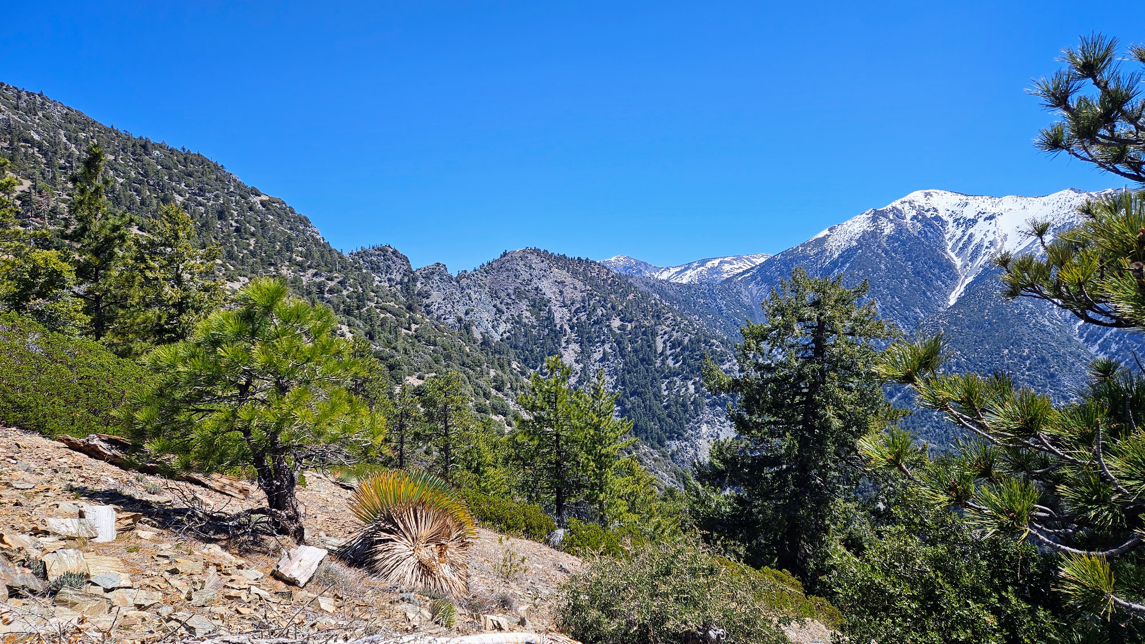
Gunsight Notch
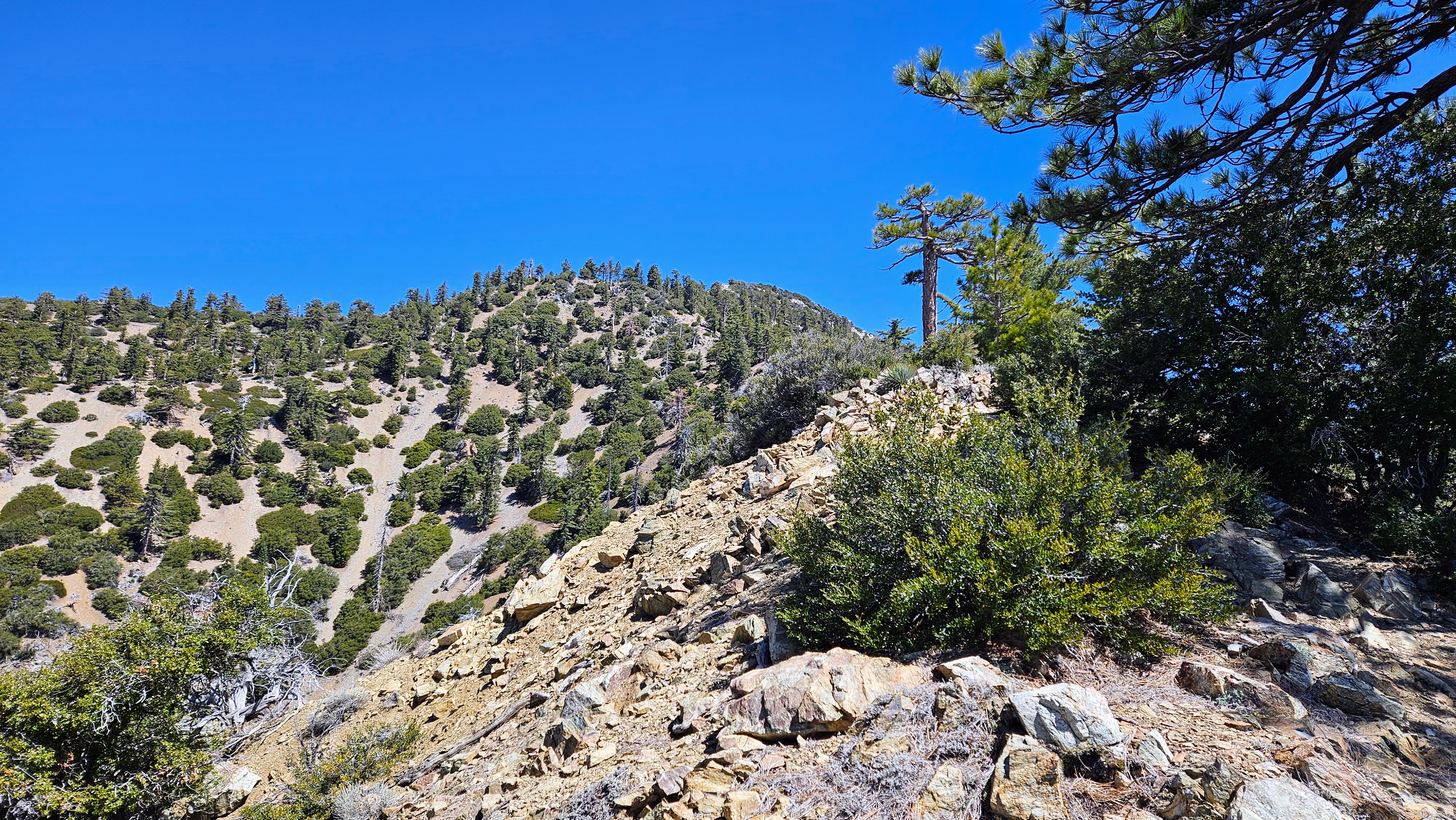
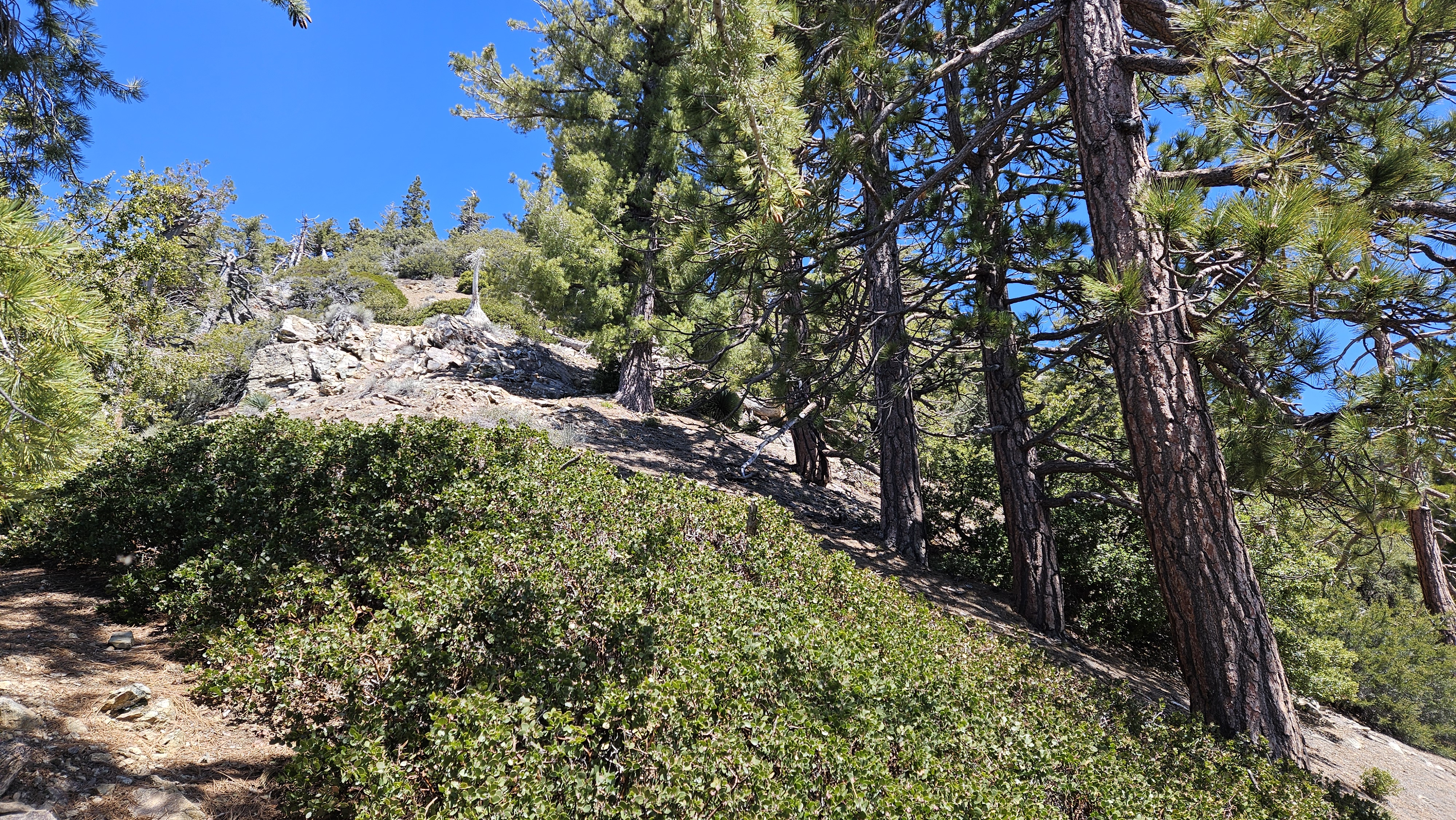
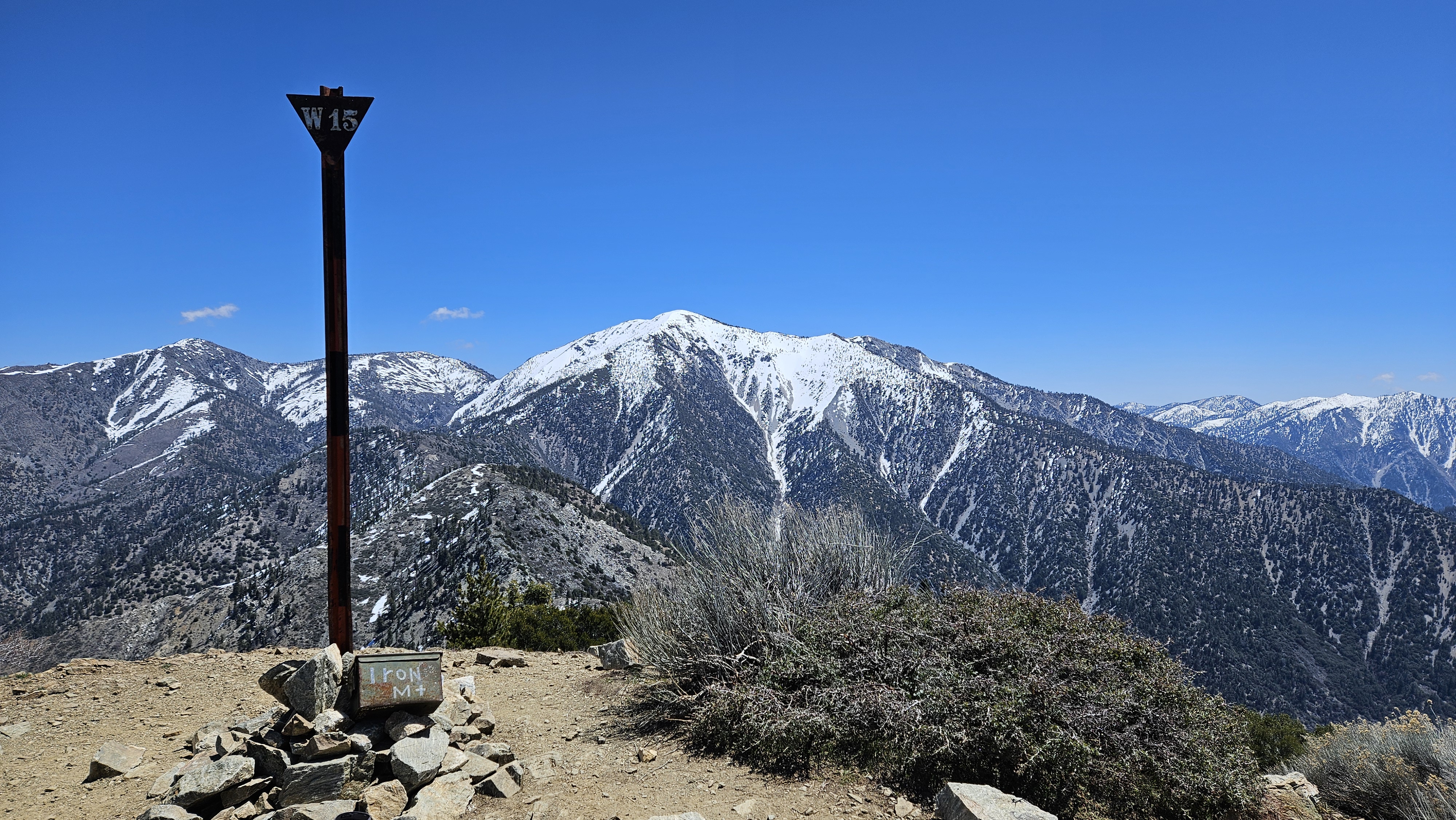
I had forgotten how awful the trail past Allison was in places. Although, for an unmaintained trail, it's pretty good. Also, I noticed how nice upper Iron is. Somewhere above 6500', it opens up and big pines take over. Register was placed in 2022 and getting full. I found a red sign in the ammo box made for social media posts and other geocache like things. Good to see the W15 post standing tall.
Great trainer for other big hikes. 7000' gain is always 7000'. It doesn't lie.

Gunsight Notch


