
Going through some old family photos, I came across some photos from my great-grandmother's hikes in the late 1910s and early 1920s. I believe they are from either the San Gabriel or San Bernardino mountains based on the look of the terrain and a post card from Big Bear. They're from different times and locations, not all one trip. Can anyone identify where they are located?
#1
#2
#3
#4
#5
#6
[Added numbers for easy referencing. - Admin]
Identifying Locations of 1910s-1920s era photographs
-
Blaise
- Posts: 45
- Joined: Sat Nov 17, 2018 5:46 pm
You do not have the required permissions to view the files attached to this post.

-
HikeUp

- Posts: 4099
- Joined: Thu Sep 27, 2007 9:21 pm
First impressions...
#1 is a waterfall (genius!)
#2 is somewhere in the high country (perhaps Buckhorn/Pallett/Will Thrall area).
#3 Mt. Lowe RR right-of-way maybe (from echo to Dawn Mine?)
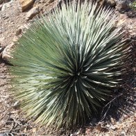
#4-#6 Lytle Creek area?
#1 is a waterfall (genius!)
#2 is somewhere in the high country (perhaps Buckhorn/Pallett/Will Thrall area).
#3 Mt. Lowe RR right-of-way maybe (from echo to Dawn Mine?)
#4-#6 Lytle Creek area?
-
walker

- Posts: 248
- Joined: Mon Apr 08, 2013 11:14 pm
Wow, those are great!
For #1 - Any waterfall experts in the house? Canyoneers?
For #2 - Maybe near Kelly Camp or Ontario Peak looking northwest towards west Baldy and register ridge?
For #3 - I agree it's lower altitude, maybe just a reinforced section of a high-use trail in the front range? Seems like a bridged drainage crossing that continues with foot tread - could that be some kind of flume?
For #4-#6 - I agree with HikeUp - looks like Lytle Creek area, unless all of these are in the San Bernardinos after all.
Thanks for sharing those here!