So anyway. I started from HWY 39 just above the West Fork, where the first few inhabited cabins are. This is just NW of Burrito. I crossed the river, and aimed for the gully coming off the saddle just NE of Burrito. Looks like this:

Burrito is the thing on the right. The gully isn't too choked with brush, and I made it to the tunnel pretty fast

I've been here once before. I crawled in and walked through this thing. It's pretty long: several hundred ft probably. Both ends have dirt partially blocking them. The front one is a crawl. But the back one is too tight to even crawl through. It needs to be dug out, and there's even a shovel provided in the tunnel. But it'd take an hour probably, and I didn't want to burn an hour doing that today. So I just walked back, and gained the ridge the normal way. It's brushy above the tunnel, but doable.
The top of the ridge is far better. There's a use trail or something, and soon I was standing on top of Macho Taco (point 2589). There's no register on top; only a little pile of rocks. There are some bolts stuck into the ground for some reason:

Looking back to Burrito:

At this point I'm leaving the EW ridge I'm on to jump two ridges to the N to the EW ridge with Burro, which (eventually) connects to Rattlesnake. This ridge switch is really steep:

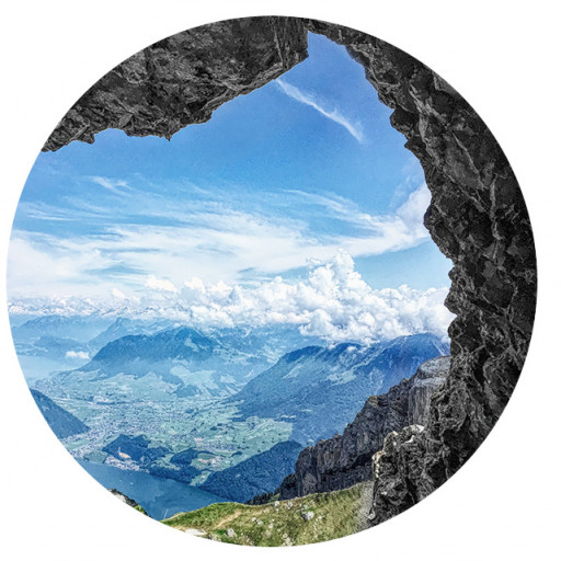
Burro is the big thing in the back, with steep slopes and alarming amounts of brush. The bump in-between is nameless, and it looks like there's an old firebreak on it. The descent to it does too (view back from the middle bump)

The firebreaks made this simple, and I was done pretty quickly. Good thing too, since I was being serenaded by the guns at the shooting range the entire time:

And from the middle bump, the brush on Burro looks more manageable

Clearly there's no fire break up Burro. But what about the descent down to it? Is there a fire break? There is not:

It is, in fact, as hellacious as it looks. After lots of crawling I emerged in the gully at the base of Burro. The climb up is really steep. There's enough brush that I was never concerned about falling very far, and had plenty to hold on to, but not so much to impede progress. Eventually I was on top

No register, but I'll take a numbered triangle any day. The route ahead:

Burro isn't really a "peak", but a minor bump on a bumpy ridge. The route to the next bump (point 3580 or so) is brushy, but there was a firebreak here at some point, so it's not too bad. On top of Point 3580 I found a little register box.

There's no notebook or anything to write with. Just a few loose pieces of paper with names on them. I don't think this is a very popular peak. I know that those reading this report have gotten the impression that this whole trip so far was fun and easy. That ends here. Progress slowed to a crawl (literally!) and I started considering bailout options. Here's a photo I took during a water break:

I was already on my butt trying to get through the growth, so I didn't need to sit down to take a break. Very convenient. The next point where a bailout could happen would be point 3403 (ridge to the S) or the saddle right past it (3200ft or so; ancient trail to the N). I made it to the saddle. Here's where I came from

By the time I got to the saddle, it was 13:00. I've been walking for 4.5 hours, and wasn't half-way there yet. There were 2600ft of net gain left, and the ridges I could see looked overgrown. And then I'd need to descend Rattlesnake (likely in the dark), and walk the roads all the way back to where my car was, by Burrito. It was certainly doable with sufficient motivation, but I was by myself, and there wasn't anybody around to explain to me why exactly I was doing this. I decided that I'd try the ridge past the saddle, and if it wasn't increadibly awesome, I'd bail. It was not incredibly awesome.
The ridge from 3403 looked clear-ish in spots, but I had no idea where it ends up. The ancient trail from 3200 is on the topos. It switch-backs across a gully to drop into Bichota canyon. I know that Bichota is passable-enough, so I turned left to the gully trail.
The trail down in Bichota canyon is abandoned, and trails coming down into it from abandoned ridges are also very abandoned. I could maybe see signs of the old trail here and there, but the big challenge here wasn't terrain, but brush. So the trail wasn't really helpful. The upper 100-200ft or so are very thick. Below that the slope consolidates into a gully that's relatively clear, and I took that all the way down into Bichota canyon. There's black tubing (also abandoned) just above the canyon. There was water in the creek. I tried to dunk as much of me as I could, and walked out to Chimneyville and back to my car.
On the walk down hwy 39 I was thinking about how this whole trip was kinda a dumb idea. But then some guy on a skateboard flew by me on the highway, and I felt better.