Towards West Mermaid

TRs for the San Gabriel Mountains.
Post Reply
User avatar
dima
Posts: 1319
Joined: Wed Feb 12, 2014 1:35 am

Post by dima »

So I'm facing a bit of a dilemma. It's hot. But the higher elevations still hold a lot of snow, so starting up high isn't happening. And we just got some rain, so the rivers are very high, making canyon travel difficult. Today I tried a canyon.

Back when headsizeburrito lived here, he placed a register on West Mermaid. So I thought I'd go sign in. Really wasn't feeling an alpine start, so I started walking from the West Fork confluence at 9:30. The place is a ridiculous zoo. The parking lots are closed. But the hordes are still there, parking on the side of the road just outside the lot. Walking into the West Fork drainage, I lost 90% of the humans. And by Bear Creek I was all by myself.

I haven't been here for a while, and had forgotten just how much this trail likes to cross the river. At times the river moves to the other side of the canyon, which necessitates a crossing. But many many other times the trail crosses the river for no apparent reason. The river is high. I had to wade in pretty much immediately, and spent the whole day in soaked shoes. Most of the crossings were ~ knee high, but a few in the wilder upper section were waist-high. Water temps were nice; that part was actually quite pleasant.

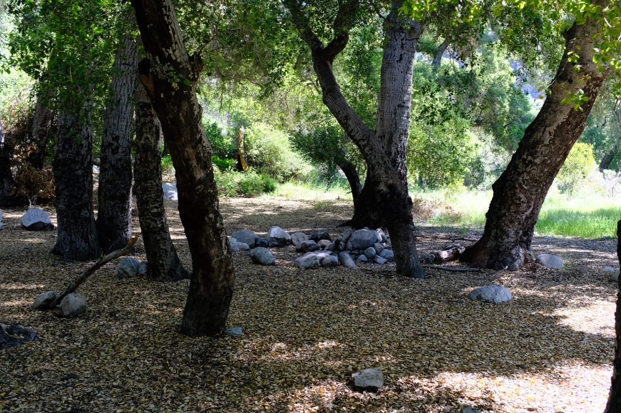
Alright, so Lower Bear and a bit before that have several nice wide camp areas. This is Lower Bear camp:
Image

If you don't like the fire ring, you can use the fireplace:

Image

Found one of these here:

Image

Is this what I want? There were more in West Fork.

Up to this point, the trail is decently well-defined, between the river crossings. Obviously. Right after the camp the SG Wilderness starts:

Image

Here the trail becomes more sporadic. But there's a nice view of Triplet rocks and (I think) Twin Peaks

Image

After countless river crossings and brush battles I finally arrived at the West Fork Bear creek confluence, 2.5 hours after I started (includes one break). There're some nice open camp areas around the junction. There's plenty of water in this fork too, but there's less of it, so boulder-hopping is actually possible. Initially the going is easier than in Bear Creek proper, partly due to to terrain, and partly due to some faint narco use trails. There's a cool narrows section near the start, with cool sheer cliffs

Image

Image

After a mile or two the trails die out, and the brush intensifies. There's poison oak absolutely everywhere, and other exciting things. Like stinging nettles that go right through my pants. The only obstacle worth mentioning is here:

Image

A series of 2 small waterfalls fill deep rock pools. There's an easy bypass. I arrived at the creek junction at ~ 2900ft 2 hours after leaving Bear Creek. I'd take the left branch, which was actually dry. But it was now my turnaround time. So I kicked back in a patch of poison oak to eat some granola and drink some water. No other type of patch was available.

The peak would need to wait until next time. I'm going to wake up earlier, and maybe show up at a drier time of the year.

There's some narco stuff happening in this canyon; the details are hazy. In the middle is lots and lots of black tubing, coiled up, and cut up. This wasn't deployed yet, but somebody cut it up! Upstream of that (nowhere close) there's some gardening junk, and a network of trails on the slope above. I would guess that's an old grow. Way older than the hoses. And downstream of the hoses (again, not close) is a recent abandoned camp. Lots of trash. Two pickaxes, a shovel, some beefy loppers, sprayer, etc. There's no grow nearby; the camp is next to a cliff in fact. I guess this is a commuter camp?

So let's see. There were 2 Mallard ducks in Bear Creek. They're all over the parks in the city, but I've never seen one in the mountains. There was a cool frog on one of the rocks in the middle of the river; too busy not drowning to take a photo. Countless lizards everywhere, both land ones and aquatic. Lots of squirrels. TONS of ants and flies that really wanted to get into my eyes. Found this guy in the West Fork drainage (photo after I cleaned him up):

Image

This is my 3rd scalp. Anybody know what's going on here? I guess these are some sort of mountain lion kill, or something? It's the same skull fragment each time.

Saw one of those 2-yellow-stripe snakes dart off as I approached. Then there was this guy:

Image

And this guy:

Image

ID? The first one was maybe 1.5" thick; the second was much smaller, maybe 0.5" thick.

This was a day full of solid type-2 fun, and next time maybe I'll even bag the peak!
User avatar
AW~
Posts: 2038
Joined: Mon Oct 01, 2007 12:00 pm

Post by AW~ »

Nice report..there is no nice way to West Mermaid for sure. I bivyed in the exploration zone(in the northern portion of the creek) a few years back...I think it was before west mermaid was peaked...and your trip was about the same..just faster! West Mermaid is basically a curse to me lol...attempts but no success. I still have it on my list as an overnight.

One of the updates is for the confluence of WF & Bear Creek is that youtube pharroah located the ruins of the fishing club there.
footage is about 21 mins in.
User avatar
Sean
Posts: 3749
Joined: Wed Jul 27, 2011 12:32 pm

Post by Sean »

Cool antlers.

ssquatch.jpg
User avatar
wesweswes
Posts: 54
Joined: Tue Feb 12, 2019 10:59 pm

Post by wesweswes »

That mushroom looks like Lactarius sp. and probably not particularly worthy of taking home. Neat looking area.. particularly that (climbing??) wall
User avatar
headsizeburrito
Posts: 279
Joined: Wed Nov 15, 2017 1:18 pm

Post by headsizeburrito »

West Mermaid is definitely a bit tricky to get to. My two trips took 13 and 15.5 hours and benefited from lower water levels than it sounds like you dealt with.

Here are my reports for those that haven't seen them:

west-mermaid-peak-4654-via-west-fork-be ... t7681.html

viewtopic.php?p=58144#p58144

The tubing I cut up and camp downstream are still there from the grow site, kind of a bummer it hasn't been cleaned up after I reported it way back in 2018, but I guess they don't have a lot of resources to work with and it's hard to get to so it's a low priority since it wasn't active.

It's a bit of an ordeal to get there, but hopefully you or somebody else here will get to it at some point. I want to know how my register is doing and if anyone else has signed it!

Great snake pics!
User avatar
Taco
Posts: 6001
Joined: Thu Sep 27, 2007 4:35 pm

Post by Taco »

Cool pics of the cliffs. I’ve wanted to go back and see if I can’t climb em. Thanks for that.

AW and I went up east mermaid a while ago. There is a Rocky Buttress which I’ve been eyeing for years but really have no intention of climbing which might provide access to west mermaid. Goes up the north side. Probably awful. :)
User avatar
dima
Posts: 1319
Joined: Wed Feb 12, 2014 1:35 am

Post by dima »

My trip was 9 hours long. This wasn't even close to enough, and I can believe the 13 hours number. hsb: I had forgotten that you made a separate post about the narco artifacts. Looks like we found the same sorts of things, and they were in pretty much the same state. And you just wait; I'll sign your book! The cliffs look like they could be fun to climb if the rock was solid. I will make no such claims, but yall can go try it :)
User avatar
Taco
Posts: 6001
Joined: Thu Sep 27, 2007 4:35 pm

Post by Taco »

Was the rock real crumbly?
User avatar
dima
Posts: 1319
Joined: Wed Feb 12, 2014 1:35 am

Post by dima »

Asking the $1M question over here. I didn't test it, but it looked like the normal crumbly stuff you'd expect
User avatar
wesweswes
Posts: 54
Joined: Tue Feb 12, 2019 10:59 pm

Post by wesweswes »

A lot of the lesser climbed rock I've run into in the santa monicas and angeles forest is pretty dang chossy. After doing one of the backcountry crags near circle x and removing a hand hold on lead, I'm a little nervous... Then again, if it's a decent looking crack, might be worth bringing the cams and nuts along next time
User avatar
Taco
Posts: 6001
Joined: Thu Sep 27, 2007 4:35 pm

Post by Taco »

I might hike up there in the nearish future. I have climbed stuff most people wouldn’t touch, but I am older now...
User avatar
dima
Posts: 1319
Joined: Wed Feb 12, 2014 1:35 am

Post by dima »

Let's coordinate. I need to take care of my unfinished business.
User avatar
JeffH
Posts: 1154
Joined: Sun Nov 28, 2010 7:09 am

Post by JeffH »

Nice snake. Could have been the perfect photo if you had moved the leaf on the rock. Hope you managed to wash off all the poison oak juice afterward.
"Argue for your limitations and sure enough they're yours".
Donald Shimoda
User avatar
davidwiese
Posts: 88
Joined: Mon Jul 30, 2018 4:00 pm

Post by davidwiese »

dima wrote:
Saw one of those 2-yellow-stripe snakes dart off as I approached. Then there was this guy:

Image

And this guy:

Image

ID? The first one was maybe 1.5" thick; the second was much smaller, maybe 0.5" thick.
Two-yellow stripe guys are called Striped Racers. Their diet primarily consists of lizards so you'll see a lot of them. I saw four today myself along Mendenhall Ridge.

That second snake looks a lot like a Southern Pacific Rattlesnake to me.

Third one is a Glossy Snake.

I'd also be down for a West Mermaid attempt if a trip materializes with a cool weather window!
User avatar
CrazyHermit
Posts: 343
Joined: Mon Sep 07, 2015 1:03 pm

Post by CrazyHermit »

That deer scalp is bizarre. Doesn't look like something a mountain lion would do.
User avatar
dima
Posts: 1319
Joined: Wed Feb 12, 2014 1:35 am

Post by dima »

CrazyHermit wrote: That deer scalp is bizarre. Doesn't look like something a mountain lion would do.
Yeah, I've no idea. But I've now found 3 just like that one.
User avatar
dima
Posts: 1319
Joined: Wed Feb 12, 2014 1:35 am

Post by dima »

davidwiese wrote:
Two-yellow stripe guys are called Striped Racers. Their diet primarily consists of lizards so you'll see a lot of them. I saw four today myself along Mendenhall Ridge.

That second snake looks a lot like a Southern Pacific Rattlesnake to me.

Third one is a Glossy Snake.
Thanks for the ID. I found another Southern Pacific rattler today. Stepped next to it, which he didn't appreciate.

davidwiese wrote: I'd also be down for a West Mermaid attempt if a trip materializes with a cool weather window!
Oh, man. Too late! I just went back out there (TR coming). There wasn't any cool weather, however
User avatar
davidwiese
Posts: 88
Joined: Mon Jul 30, 2018 4:00 pm

Post by davidwiese »

dima wrote:
davidwiese wrote: I'd also be down for a West Mermaid attempt if a trip materializes with a cool weather window!
Oh, man. Too late! I just went back out there (TR coming). There wasn't any cool weather, however
No worries. I'll prob wait for a coolish weekend and give it a shot with your new beta. Get that TR up soon! ;)
User avatar
headsizeburrito
Posts: 279
Joined: Wed Nov 15, 2017 1:18 pm

Post by headsizeburrito »

This is my 3rd scalp. Anybody know what's going on here? I guess these are some sort of mountain lion kill, or something? It's the same skull fragment each time.
Saw this today and was reminded of your post so I took a pic:

antlerskull.jpg


A little searching suggests chunks of skull attached are a sign of a brain abscess(!) but that seems to just be about protruding chunks, not a plate like this:

https://www.qdma.com/6-things-you-can-l ... -you-cant/

This article about collecting sheds suggests any time the skull plate is attached the deer died of some cause rather than shedding them naturally, since that would obviously be a big bit of skull to lose! Seems strange that it would be just part rather than the whole skull, but maybe that part is just more durable.

https://www.sltrib.com/news/2018/02/06/ ... t-started/
User avatar
dima
Posts: 1319
Joined: Wed Feb 12, 2014 1:35 am

Post by dima »

I want to say there's no brain abcess involved... The reason I was thinking of these as cougar kill is that one of them (the one in Wildcat Gulch) was gnawed:

Image

Look at the tip on the left. Could have happened after the scalp was detached, I guess.
Post Reply