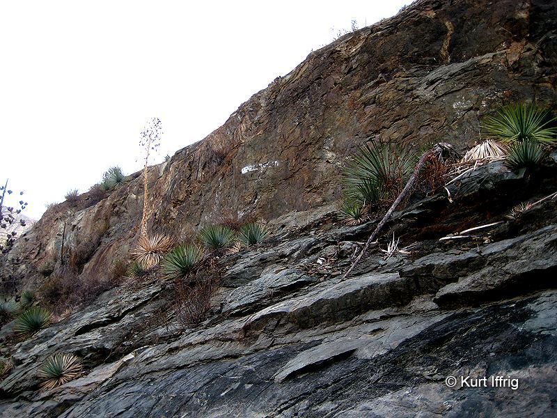
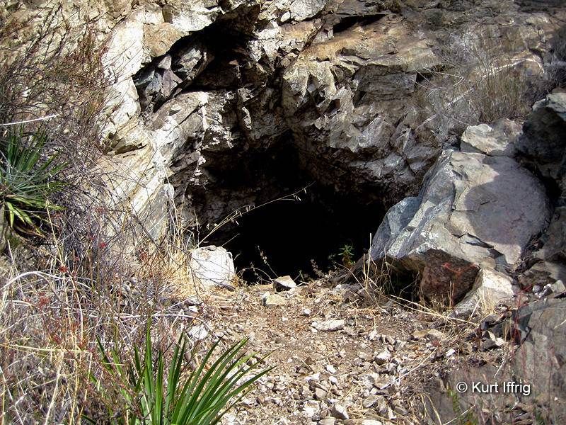
Goal #1 - Find Oliver Justice's First Mine - 6:30 am
Going by an old hand drawn plat map I started looking around. I wasn't sure whether this would be a placer mine or hard rock, but I followed the clues. Eventually I did find a shallow mine, measured at 43 feet. A few weeks later I explored the area further with my new bud Alan, King of the East Fork, who recorded it on video. I usually hike solo, but I thought he might want to see this. We never did find the main mine, but it's buried up there somewhere.
Although it wasn't very deep it was somewhat of a historic find. I wasn't the first, there were some old beer cans up there, but nevertheless it was a good start to the day. About 50 feet above the mine there were some old initials hand painted with a brush. I couldn't quite make them out.
Additional Photos
Goal #2 - Sneak Into Follows Camp and Get Some Shots - 8:00 am
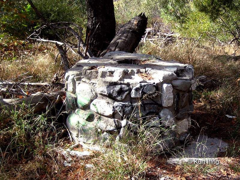
By the way, this is illegal so don't go here, but it's the oldest building in the San Gabriel Mountains. It was wiped out by a flood and is now owned by a politician in the City of Industry who has allowed it to fall into ruins.
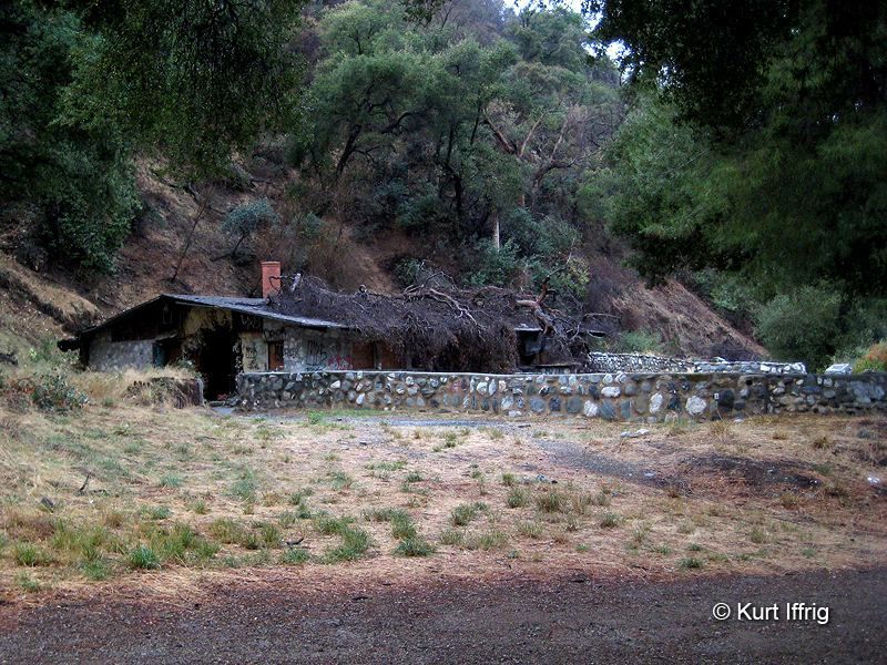
This building was known as The Fort. Sedley Peck was good friends with Ralph Follows, and Sedley's grandson, Billy Heaton used to hang out here as a kid. It was a recreation camp, the largest in this area. Just upstream Judge O'Melveny opened a fishing pond. You might know that name from O'Melveny and Myers, one of the largest law firms in L.A.
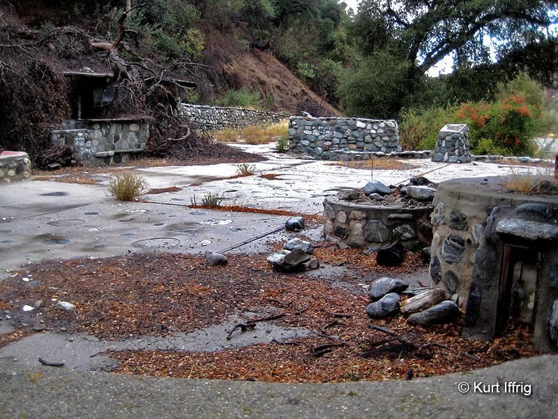
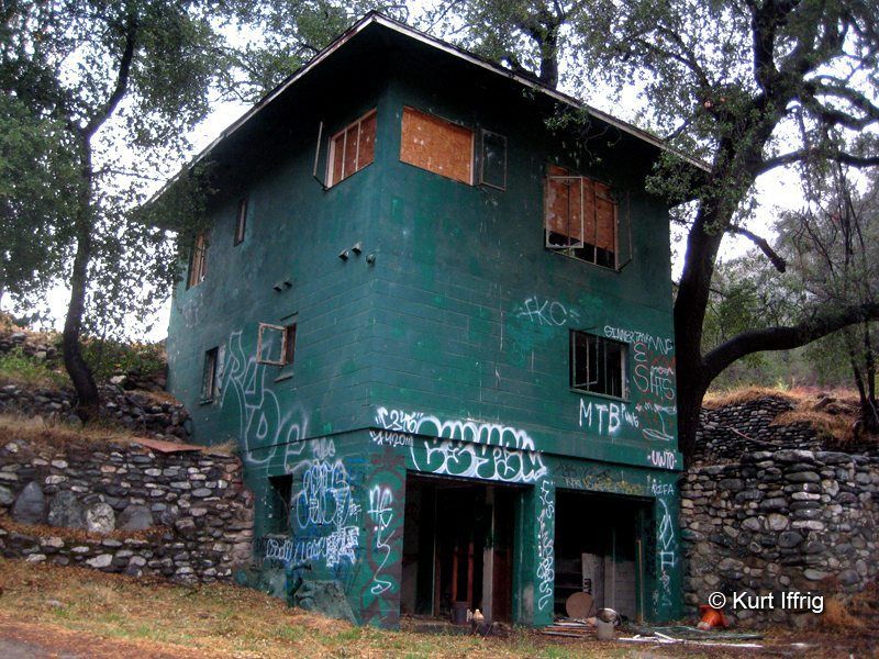
There used to be multiple buildings here but most were washed away. If you look up Follows Camp on Google Earth you can still see some of what used to be here. Here's another building, not that old, that's been thrashed by vandals.
Additional Photos
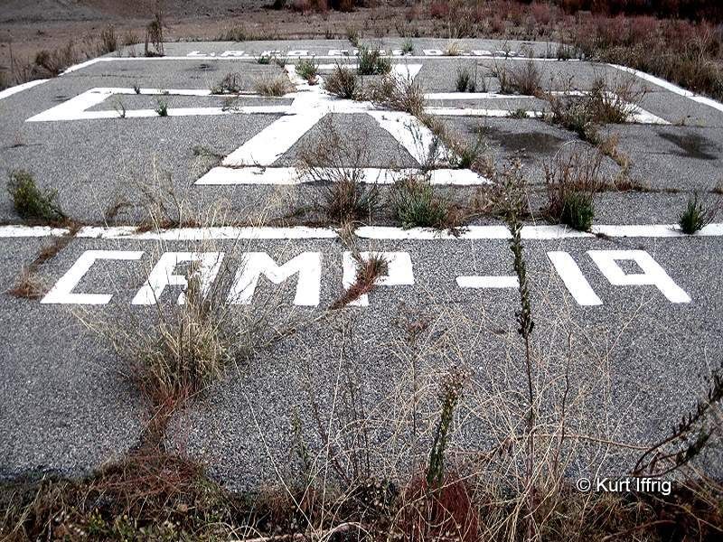
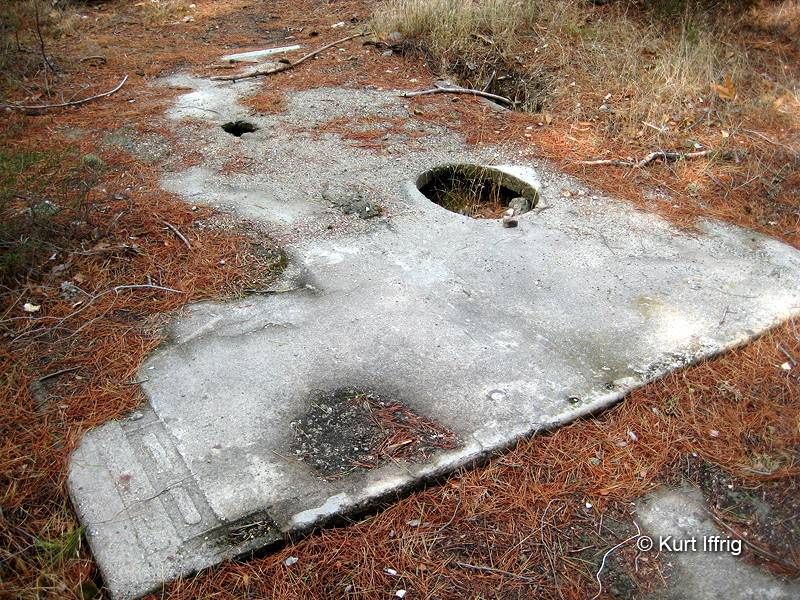
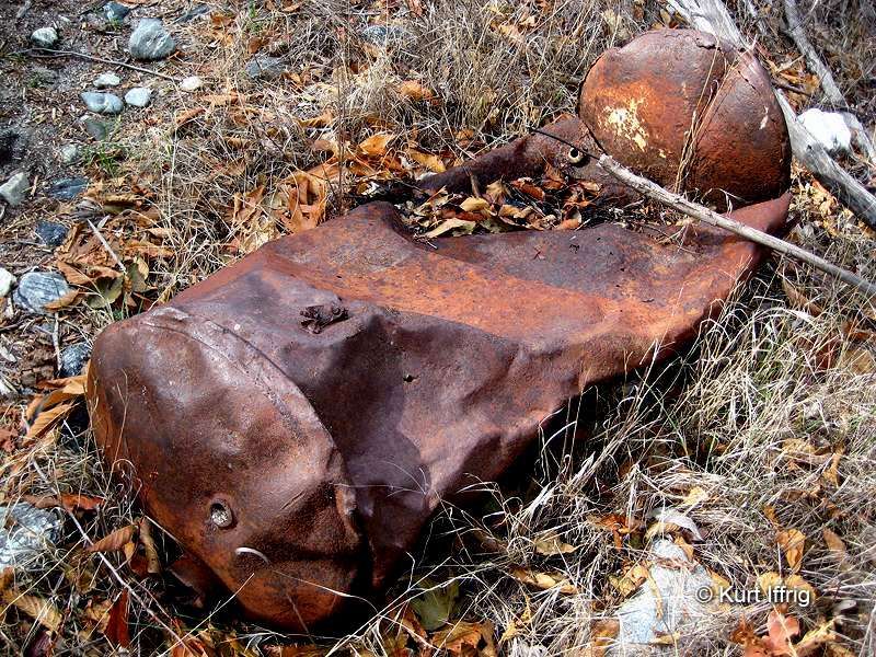
Goal #3 - Find An Abandoned Barn Near Shoemaker Road - 8:30 am
I had heard about this previously, but couldn't imagine where a large flat field would be in this area, so I started poking around and eventually found it. It's not a barn, but some sort of gigantic shed, probably used to house machinery sometime back in the day.
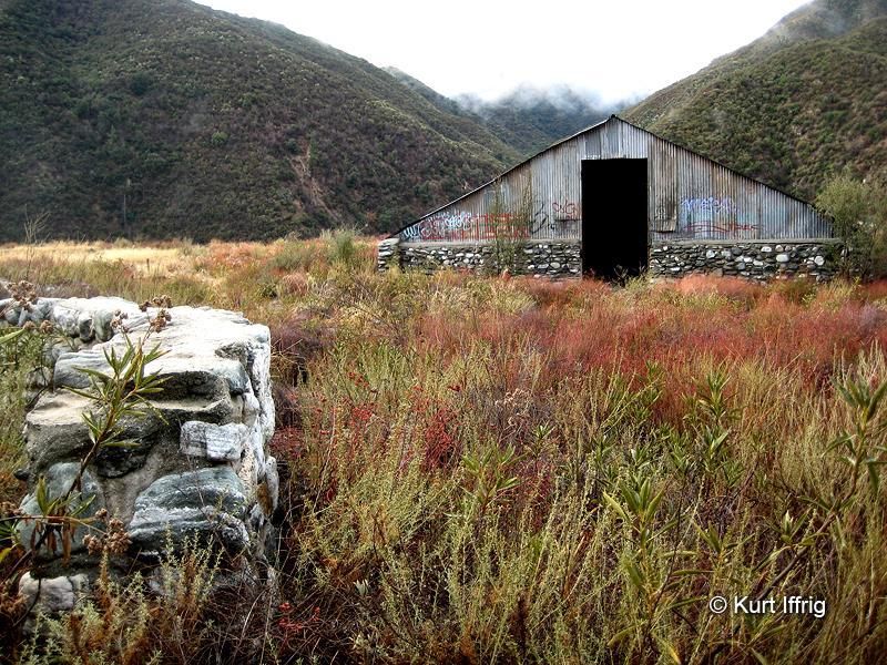
There's also an old helipad and a grave up there. If you look very carefully on Google Earth you might find it. It's close to Shoemaker Road (the Road to Nowhere).
Additional Photos
Goal #4 - Try To Find Some Old Hillside Crosses - 9:00 am
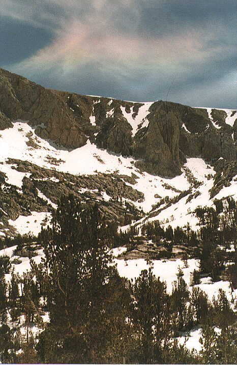
If you've ever hiked to the Bridge To Nowhere you will have seen several large crosses, some of them perched in seemingly impossible places. I wanted to know what they were. There were three large crosses in the area I explored. I don't think they're graves, more like memorials for several people, but the center one is quite interesting.
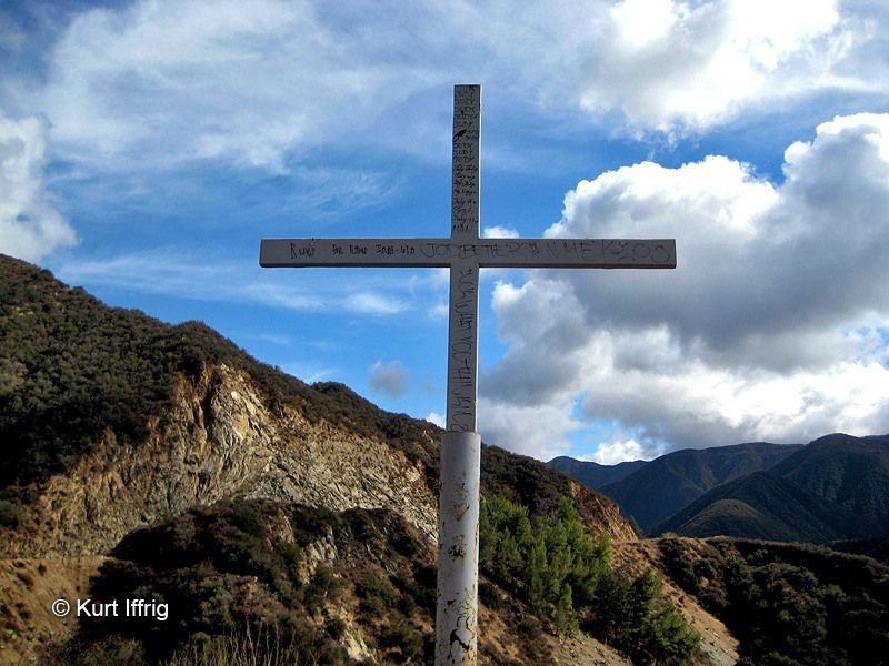
The second cross was the largest. It appeared to be constructed by AA for former alcoholics who had died. I can't say that for a fact, but there were some sobriety chits embedded in it.

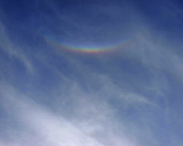
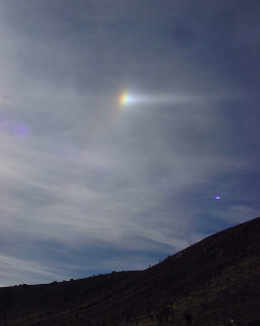
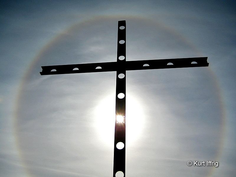
At a later date I came back to get more photos and came upon a very unusual phenomena, something I had never seen before, called a sun halo. Apparently they're caused by ice and refraction.
Additional Photos
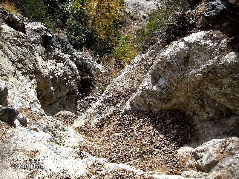
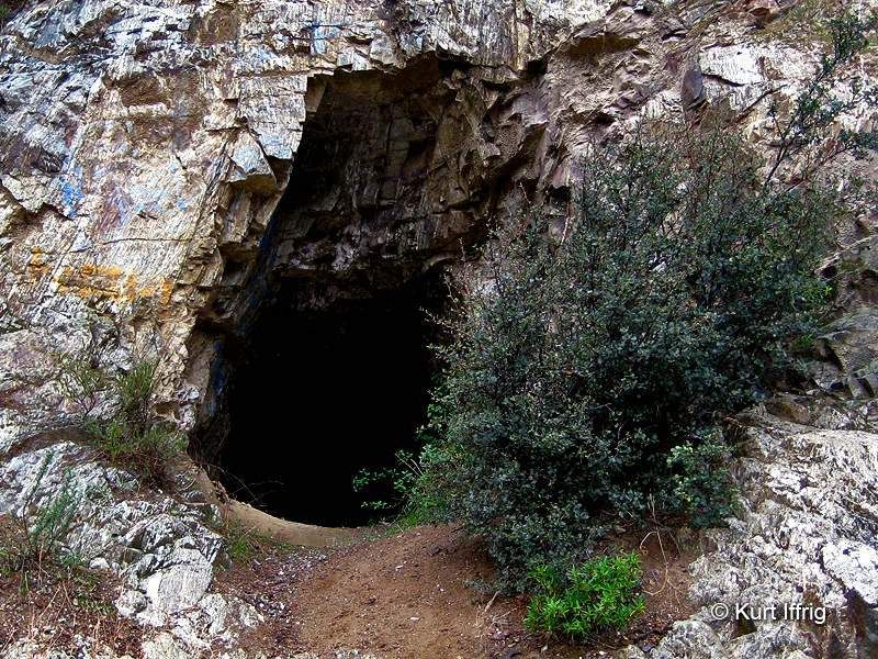
Goal #5 - Get Inside The Camp Williams Tunnel - 9:30 am
This is another one that you should not attempt. The front side is on private property. The first time I tried this I lost my grip on the camera I was carrying and it got smashed into a million pieces. I'm sure you've noticed this tunnel, it's right across from the Camp Williams Cafe.
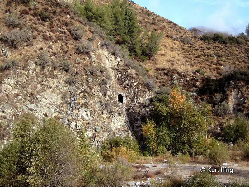
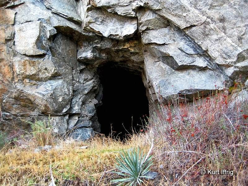
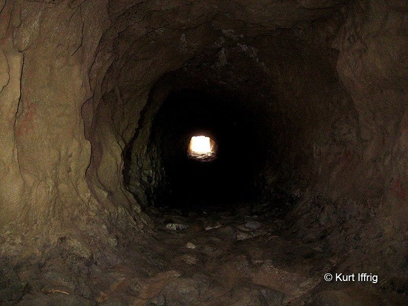
This time I found a way in from the back side. This is a long drainage tunnel that looks like a mine on the inside, about 700 feet long. Here's a view from the front.
This one is cool if you like exploring tunnels. Just don't do it when it's raining. I've counted six others that run underneath Shoemaker Road so far.
Additional Photos
Goal #6 - Explore The Site of Eldoradoville - 10:15
Eldoradoville was an old mining town in the canyon. Originally there was a mining camp here called Prospect Bend that got wiped out by a flood in 1858. A month later Eldoradoville was built on the same spot (how stupid can you get?), and that was wiped out by another flood in 1862. There was one more settlement here in the 1930s during the depression called Klondike. It was more of a ragtown than anything else. In fact, it was originally called Ragtown, and it was split into two areas, Upper and Lower Klondike. These sort of temporary settlements popped up all over the United States at that time, known as Hoovervilles after President Hoover. Everyone was out of work, so they tried their hand at mining. I thought that there would be no traces left of the town, but there are still a few cement foundations.
It's hard to say whether these remnants date all the way back to the 1800's but as far as I know there has been nothing built here since.
Most of Eldoradoville is probably at the bottom of Morris Dam by now, but you can still find a few remnants of the mining days.
I found a little bonus prize downstream. It's a shallow prospect about 50 feet up the hillside.
Additional Photos
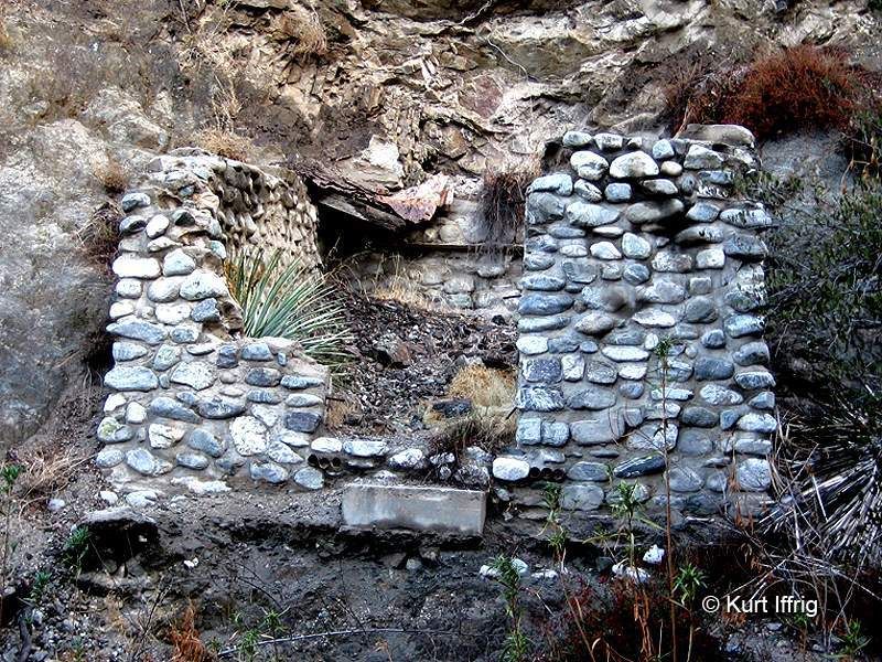
Goal #7 - Reshoot Heaton Mine - 11:00
I still need to sort out the unwanted photos, but I went back to Heaton and Holly Mines, both worked by Billy Heaton to get some better shots. Here's the portal, 127 feet deep.
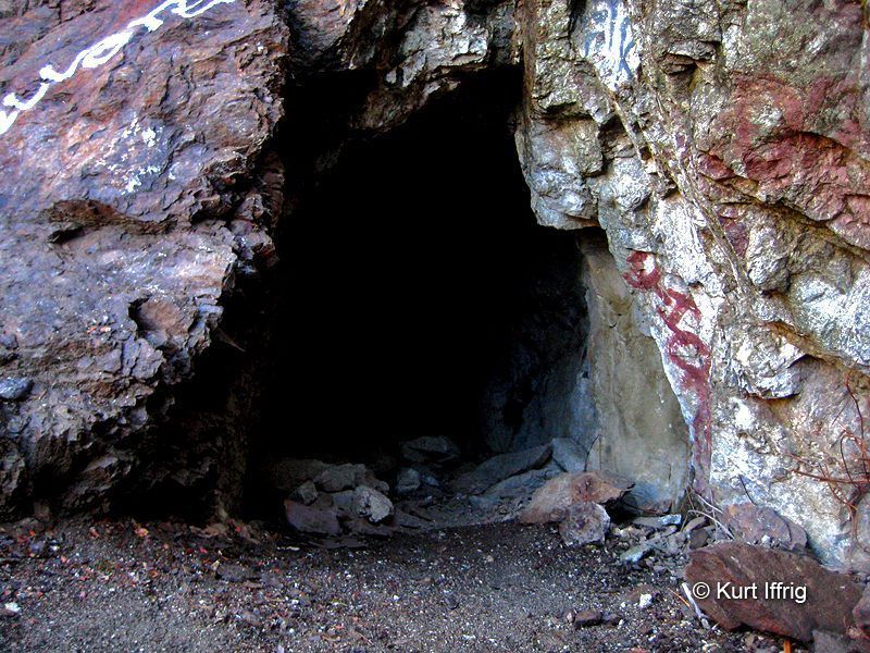
Billy supposedly worked the mine seven days a week from 1902-1924. It looks like he was simultaneously working on the Holly, which was once connected to it by a trail. These structures were probably used for storage. Billy's actual cabin was down where Heaton Flats are (called Peachtree Flats at that time)
Additional Photos
And here's the nearby Holly Mine, a very shallow gold mine.

Additional Photos
Goal #8 - Reshoot Mine On Glendora Road - 12:15
This is a mine most people drive by every day and don't even see. It's up about 10 feet above the road, but easy to miss if you're not looking.
There's a bum whose been living in the back. This one is between 50 and 60 feet deep.
Additional Photos
Goal #9 - Turkey Time, Head For Home - 12:30
On the way back I took Glendora Road and got out to stretch my legs when I got near Glendora. I took a five minute hike on the Lower Monroe Truck Trail (whatever that is) and goddam if I didn't find another mine, completely unexpected. I might post that one at a later time. If you would like to see some of these places on video, I showed a them to Pharroah on YouTube. I'm the fat old man whose pants don't fit right. Seriously, I'm a wreck. LOL