

My friend Kris found an interesting-looking mtb route from Big Bear Lake to Pasadena, staying in the mountains, off pavement as much as possible. The guy who put together this route did it in "3 full days and two short days", but who has time for that? And who wants to haul camping equipment with them, anyway? Clearly doing it in a single day (or in one go) would be a much smarter thing to do.
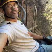
So on Saturday morning we posed for a photo in Big Bear, ready to set off on our trip:

Kris is an actual mountain biker, so he brought his mountain bike. For whatever reason, I don't want a quiver, so I brought my cross-check. I installed bigger tires and interrupter brakes a few days before, and in the end it worked out I think. A beefier bike would have been nice; a better rider would have been even nicer. (The following is all written from a non-mtber perspective, so the exciting-ness may be overstated)
I got coffee

and we set off. The route wraps around to the North side of the lake, follows a nice bike path for a bit, and then leaves highway 38 on Coxey truck trail. It's a well-maintained dirt road initially. At Holcomb Creek we turned West, following a jeep trail along the creek.

This is nice and chill for a bit


But then it turns into an ATV trail, and things get more spicy


Eventually we popped out at Lake Arrowhead. The technical riding mostly ends here, with the rest (100+ miles!) mostly a long, climby slog. Which is just as well, since I had two minor crashes and one flat at this point. We grabbed some lunch in town, and set off again. Pretty soon we were standing at an overlook, looking at Baldy for the first time

The bump in front of and to the right of Baldy-Dawson-Pine is Cleghorn Peak, which we would be climbing later. We descended down one of the headwater channels of the Mojave river to hwy 138 and Silverwood Lake. The forest road before the 138 is mostly dirt, but periodically gets pavement for some reason. We got water from the Silverwood Lake visitor center, and started the long climb to Cleghorn Peak. This ridge has nice views of the lake we just came from

and of the desert

Good times

The road contours pretty close to the peak, so I made us take a minor bushwhacky detour to sign the book. Mars Bonfire has been here 25 times. As we were wrapping our heads around this fact, the sun set over the San Gabriels

We pulled out our lights, descended down to the Cajon Pass, and meandered the railroad tracks until we got to the convenience stores at the 15-138 junction. Felt pretty gassed at this point, but we weren't even half way done yet, not by distance nor gain! We ate some snacks, filled up on water, and I read some email about somebody being attacked by a bear. Asked Sean about the road conditions ahead, and he was surprised to hear that this information would be put to use immediately. Eventually we took off to the West, and after some time ended up at Lytle Creek. Would have taken less time, except I got another flat

The paved road along the North Fork Lytle Creek is nice. The unpaved road less nice. It's just rocky enough to make it rideable only at walking speeds, or at least it felt like it. So we ended up walking huge chunks of it. The road surface improved as we left Lytle Creek to climb up to Baldy Notch, but it was steep and we were tired; so we ended up walking chunks of that too. Eventually we made it to the Notch. A not-very-good photo:

The moon was out, with an odd-looking halo around it. So I took another terrible photo

We descended down to the village. I vaguely recalled somebody saying that the lodge opens at 5:30AM on weekdays, which made us excited. Apparently I had made this up, however, since it actually opens at 9AM. Unwilling to wait 4 hours for coffee, we climbed up to Cow Saddle, and rode down Glendora Ridge Road.

At this point the sun has come up, I started to see stuff that wasn't there, and became generally concerned that I would fall asleep while riding. We needed coffee. By some minor miracle the Camp Williams store was open

and was selling some pretty fantastic coffee (disclaimer: may be less than fantastic if you aren't sleep deprived). Recharged, we dropped down to the confluence, found the start of the Rincon-Red Box road, and started climbing again.

This is a looong slog, but the views are nice.

This is a very indecisive road. It keeps gaining and losing elevation. Eventually you can see Monrovia Peak, and get an idea of where the crest of the road is (North of the peak).

After some work, we topped out, descended to West Fork camp, and climbed back up to Red Box saddle. Then we rode up to Eaton Saddle and took an (almost) victory photo

The descent around Mt Lowe and down the Sunset Ridge road was full of great views


Soon we were down in Altadena, 8 short miles away from the finish.
Final stats: 162 miles, 19000ft gain, ~34 hours
I had 3 minor crashes and 2 flats. Kris had none of those and probably could have ridden another century.


 ...
...  ...
... 


