Page 1 of 1
Eastern San Gabriels Flyover
Posted: Wed Sep 03, 2008 2:04 pm
by Taco
135Driver took me on a flight over the Baldy area this morning. Loads of fun! Got some great shots in preparation for this winter season of climbing.
Our flight path led us east out of Upland, parallel to the ridge that is Ontario-Cucamonga Peaks, over the east face of Cucamonga, then back towards San Antonio Canyon, flying over Baldy Road. Flew over Cow and Cattle Canyon and got some cool shots. Headed over the north face of Baldy, then back to Cucamonga, over to Telegraph, to Harwood, and out.
Rather than put all the pics on here, I'll linkto the album, and then post a select few on here. I should have a video up soon on Youtube, but it might have failed to upload. We'll see later, and I'll upload it Thursday if it didn't make it.
Album:
http://s6.photobucket.com/albums/y222/T ... 20Flyover/
Some selected pics:
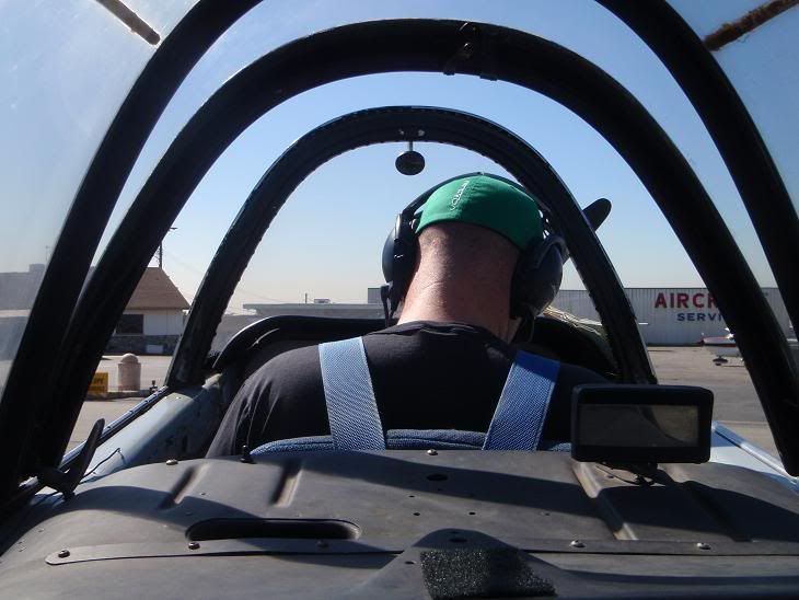
135Driver setting up
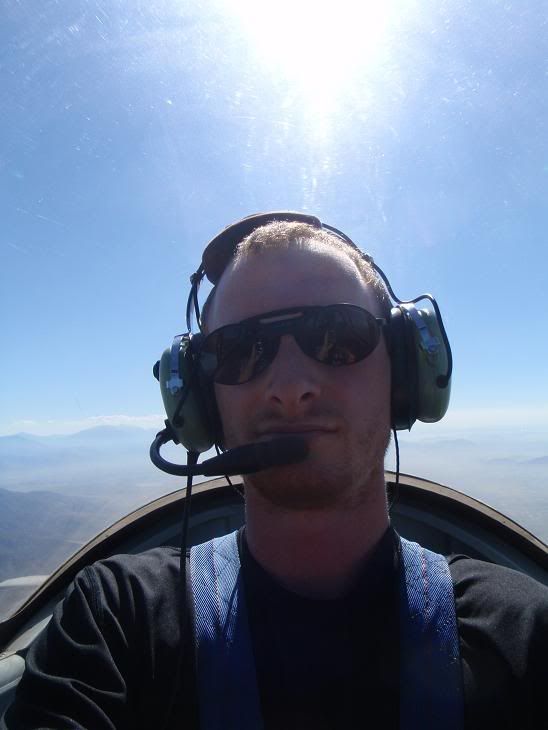
Myself
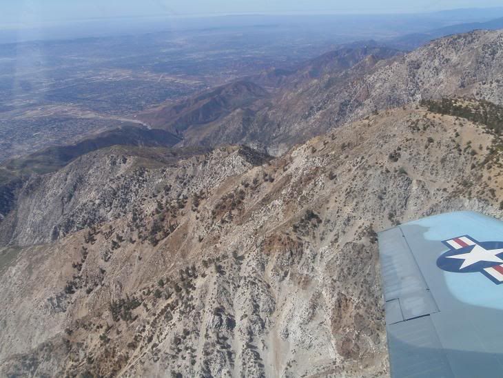
Cucamonga Peak with the various southern ridges dropping down into the valley
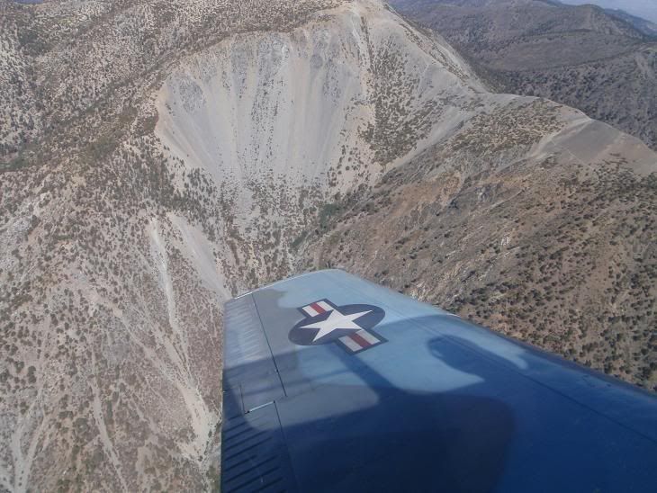
Baldy Bowl
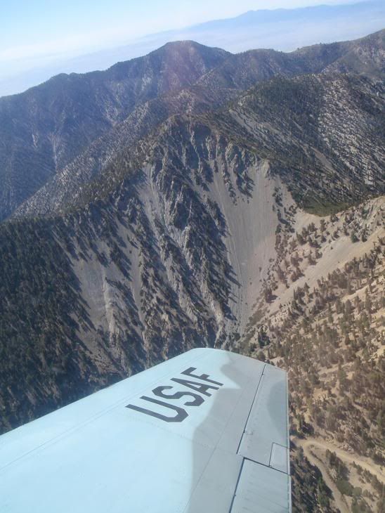
My mountain!
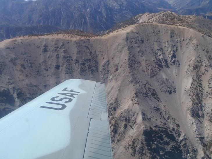
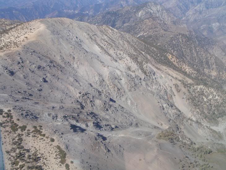
Baldy North Face
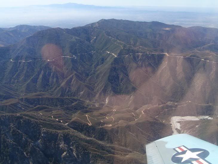
Glendora Ridge Road
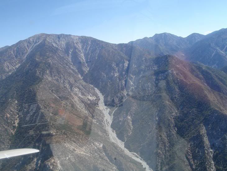
Baldy's South Face Couloirs, and the jagged and awesome looking west face and ribs of Lookout Mountain Ridge
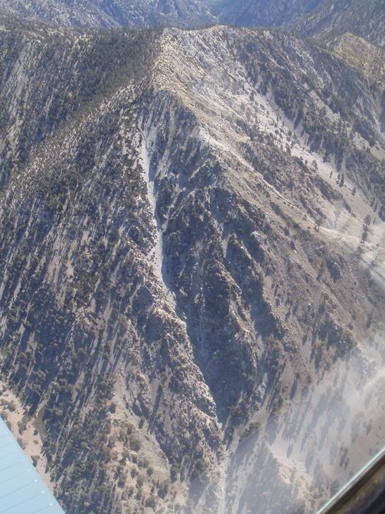
Telegraph Peak's West Face Couloir, attempted twice, should go this winter since I found a better method of getting there.
Thanks again dude for the badass flight! Tons of fun! Get ready to tear it up in winter!
Re: Eastern San Gabriels Flyover
Posted: Wed Sep 03, 2008 2:26 pm
by AlanK
Now that looks like a good time!
Re: Eastern San Gabriels Flyover
Posted: Wed Sep 03, 2008 3:41 pm
by Funyan005
That look's awesome. Baldy's northface looks kinda mean/fun in the winter.
Re: Eastern San Gabriels Flyover
Posted: Wed Sep 03, 2008 3:42 pm
by 406
very cool.
Re: Eastern San Gabriels Flyover
Posted: Wed Sep 03, 2008 3:42 pm
by 135driver
Dude,
That was cool. I have never had such a calm clear day to go get those pics. Now I know my route up the s. face of cucamonga for sure.
Had fun, more to follow I hope.
k

Re: Eastern San Gabriels Flyover
Posted: Wed Sep 03, 2008 3:52 pm
by 406
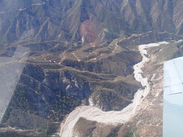
The road in the foreground seems to be BLM-4527:
http://maps.google.com/maps?f=q&hl=en&g ... 4&t=h&z=17
Is that open to vehicles? Bikes? foot?
Re: Eastern San Gabriels Flyover
Posted: Wed Sep 03, 2008 4:08 pm
by lilbitmo
Nice shots - makes me want to climb and fly.
Gives better perspective than Google earth.
Great job - I'm jealous sitting in my office watching the clouds form over the summit of Baldy right now.
Re: Eastern San Gabriels Flyover
Posted: Wed Sep 03, 2008 4:19 pm
by HikeUp
Cool stuff. The flying Taco? The flying Ice Pirates?
406 wrote:The road in the foreground seems to be BLM-4527:...Is that open to vehicles? Bikes? foot?
It's a private road behind a locked gate. I hiked down it a ways earlier this year - see the Big Horn Ridge
thread for the info (page 10 or so). Seems hikers and bikers aren't harassed but be considerate of the owners' privacy.
Re: Eastern San Gabriels Flyover
Posted: Wed Sep 03, 2008 4:36 pm
by 135driver
Oh, Now that sounds like a new name for you Taco. The flying Taco, Leader of the Fearless Ice Pirates. It's gotta a bit of a ring to it eh? (rich british accent of course)
Re: Eastern San Gabriels Flyover
Posted: Wed Sep 03, 2008 4:57 pm
by FIGHT ON
135driver wrote:Oh, Now that sounds like a new name for you Taco. The flying Taco, Leader of the Fearless Ice Pirates. It's gotta a bit of a ring to it eh? (rich british accent of course)
Mr. Driver. Can you make a map and show the entire route that you guys went on? Would be nice. Must have been fun Taco!
Re: Eastern San Gabriels Flyover
Posted: Wed Sep 03, 2008 5:55 pm
by JMunaretto
awesome!
Re: Eastern San Gabriels Flyover
Posted: Wed Sep 03, 2008 6:54 pm
by 135driver
FIGHT ON wrote:135driver wrote:Oh, Now that sounds like a new name for you Taco. The flying Taco, Leader of the Fearless Ice Pirates. It's gotta a bit of a ring to it eh? (rich british accent of course)
Mr. Driver. Can you make a map and show the entire route that you guys went on? Would be nice. Must have been fun Taco!
Damn,
I was going to bring my GPS to post the track on GoogleEarth but I forgot it.
Do you know If I can draw a line in the sky on GoogleEarth to show what we did?
kelly
Re: Eastern San Gabriels Flyover
Posted: Wed Sep 03, 2008 8:38 pm
by FIGHT ON
135driver wrote:FIGHT ON wrote:135driver wrote:Oh, Now that sounds like a new name for you Taco. The flying Taco, Leader of the Fearless Ice Pirates. It's gotta a bit of a ring to it eh? (rich british accent of course)
Mr. Driver. Can you make a map and show the entire route that you guys went on? Would be nice. Must have been fun Taco!
Damn,
I was going to bring my GPS to post the track on GoogleEarth but I forgot it.
Do you know If I can draw a line in the sky on GoogleEarth to show what we did?
kelly
If I did I would be on top of the world! The only thing I can do with google earth is zoom up Kings canyon and up to Reflection Lake. (soooooooooooo awesome dude!) (check out the sphinx!!!!!!!) I was thinking of that acme mapper but it wouldn't show lines.
Do you believe that google earth could have shown a 3d line??????? Actually where your plane flew. Not just an areal view? Now that would have been cool!
Somebody knows how. Not me. Sorry.

Re: Eastern San Gabriels Flyover
Posted: Thu Sep 04, 2008 12:19 am
by Taco
Good name.

Glad you guys like the pics.
Re: Eastern San Gabriels Flyover
Posted: Thu Sep 04, 2008 1:13 am
by 135driver
FIGHT ON wrote:135driver wrote:FIGHT ON wrote:
Mr. Driver. Can you make a map and show the entire route that you guys went on? Would be nice. Must have been fun Taco!
Damn,
I was going to bring my GPS to post the track on GoogleEarth but I forgot it.
Do you know If I can draw a line in the sky on GoogleEarth to show what we did?
kelly
If I did I would be on top of the world! The only thing I can do with google earth is zoom up Kings canyon and up to Reflection Lake. (soooooooooooo awesome dude!) (check out the sphinx!!!!!!!) I was thinking of that acme mapper but it wouldn't show lines.
Do you believe that google earth could have shown a 3d line??????? Actually where your plane flew. Not just an areal view? Now that would have been cool!
Somebody knows how. Not me. Sorry.
Yeah Fight ON,
If I had brought the GPS, It would paint the track in the sky just like it puts the tracks on hikes. It would have been pretty cool, but I am dumb and forgot to do it. Next time I will for sure.
k
Re: Eastern San Gabriels Flyover
Posted: Thu Sep 04, 2008 5:48 am
by FIGHT ON
135driver wrote:Yeah Fight ON,
If I had brought the GPS, It would paint the track in the sky just like it puts the tracks on hikes. It would have been pretty cool, but I am dumb and forgot to do it. Next time I will for sure.
k
I'm sure Taco thanked you more than enough. A real nice thing to do Mr. Driver Man!
Re: Eastern San Gabriels Flyover
Posted: Mon Sep 08, 2008 12:10 pm
by He219
Very awesome Taco & 135driver!
We could use some good winter recon help in the near future!
Re: Eastern San Gabriels Flyover
Posted: Tue Sep 09, 2008 1:43 am
by Taco
I've got some gold!
Re: Eastern San Gabriels Flyover
Posted: Wed Sep 10, 2008 8:34 pm
by AW~
TACO & DRIVER!!!!!!!
"09/10/2008 15:15 ANF-3407 Airplane doing acrobats over my house Miscellaneous Big T Cyn / Ottie Rd "
Re: Eastern San Gabriels Flyover
Posted: Wed Sep 10, 2008 10:20 pm
by Taco
HAHAHA I wish!