
On Sunday, driving back from Baden-Powell, I noticed that the San Sevaine Road was open, which motivated me to return the next morning and see about bagging some peaks above Lytle Creek. Overnight a storm had sprinkled the road with fresh snow, and the freezing breeze was maintaining iced-up tree branches, making the whole scene no doubt prettier than the day before.
My first stop was 7.7 miles from the entrance gate. A service road branched to the right, heading up to some towers.
Nearby I found a use trail dropping off the roadside. This led to the abandoned road to San Sevaine Lookout.
The segment of road between the trail and the lookout kind of sucked, but it didn't suck as much as the segment returning to the towers, which I'll get to in a bit. First, let's talk about the lookout...
The lookout ruins provided a great spot for taking a break and enjoying the vast vistas.
The storm and wind had cleared the air of junk, so Lytle Creek appeared to be within stone-throwing distance. I scrambled to the highpoint and found a water-soaked Sierra Club register inside a cracked PVC container. I guess I was the first signature for 2018.
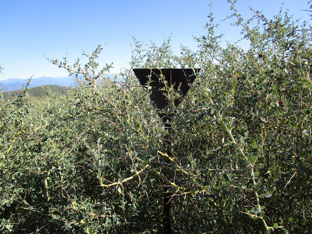
I felt like being "a rebel just for kicks," so instead of the use trail, I decided to try the abandoned road the whole way back. I don't recommend this route unless you really enjoy being impaled by thorns. It got so bad that I had to crawl through the mess many times like a wild animal.
The only redeeming aspect of this horrible route choice proved to be the old sign that I found.
Unfortunately I couldn't read the faint lettering, so the thrill of my discovery soon faded, and it was back to belly-crawling through thorns. Little did I know that this would be the easy part of my day. For, next up was a frustrating and stupid attempt at Buck Point. Frustrating, because I failed from two directions, making it to within a few hundred feet before hitting an impenetrable wall of thorns. And stupid, because I later spotted a much better route from a nearby vantage point, but by then it was too late in the day to try another direction.
From the east, I hit the first wall of thorns covered in ice.
From the west, I took a clear gully before being stopped again.
By now a storm had decided to add to my troubles by blessing me with freezing wind, light snowfall, and reduced visibility. As I desperately searched for a way, I took note of an interesting mix of impalement, numbness, and disappointment. Finally I gave up and turned around. Of course, the storm ended once I was safely back in the warm car.
I made a quick stop at Joe Elliott, just because.
I still had a couple hours of daylight and one more thing to try. I started back down the road and parked at a saddle east of Buck Point.
Another thornwhack, yes, but this time rendered doable thanks to someone who had done a bit of clipping recently. Unlike Buck Point, I reached my goal and found Rafael Benchmark, a triangulation station from 1934.
A geocache log contained only two names in six years.
I managed to make it back to the car a little before sunset. One of the many thorns embedded in my body bothered me more than the others. It chose to settle in my right knee cap. In the frozen twilight, I worked on this menacing plant fragment with some tweezers, but it was buried too deeply in the flesh. Removal would have to wait until I could get home and dig it out with a needle.
As a distraction from pain, I cranked up the heavy metal music for the slow, two-hour drive down the mountain.
San Sevaine LO and Rafael BM
-
Sean

- Cucamonga
- Posts: 4345
- Joined: Wed Jul 27, 2011 12:32 pm
You do not have the required permissions to view the files attached to this post.

-
tekewin

- Posts: 1402
- Joined: Thu Apr 11, 2013 5:07 pm
Great report! You confirmed everything I've read about the San Sevaine Lookout use trail and road. Everyone says avoid the road.
Bummer about Buck Point. It is short but tricky. I had a good GPS track and did it on the way back from Etiwanda. I went up from the road over some rocks where a ducked use trail weaved through the mess. Here was the witness post:
I don't know where Rafael is. Couldn't find it on the USGS map. Is it Peak 6321? It is tempting to head up there when the road is open.
-
Sean
- Cucamonga
- Posts: 4345
- Joined: Wed Jul 27, 2011 12:32 pm
Yeah. I only knew it as Peak 6321, until I got up there and found the mark. Nobody on Peakbagger had logged a successful summit, so they probably don't know that it has a BM name. Not even the geocaching world cares much for it. Only the two entries in the log. I think if we call it Rafael Benchmark more bushwhackers will make the trip. Bring clippers though!tekewin wrote:I don't know where Rafael is. Couldn't find it on the USGS map. Is it Peak 6321?
-
tekewin
- Posts: 1402
- Joined: Thu Apr 11, 2013 5:07 pm
How would you compare it to Calamity?Sean wrote:Yeah. I only knew it as Peak 6321, until I got up there and found the mark. Nobody on Peakbagger had logged a successful summit, so they probably don't know that it has a BM name. Not even the geocaching world cares much for it. Only the two entries in the log. I think if we call it Rafael Benchmark more bushwhackers will make the trip. Bring clippers though!tekewin wrote:I don't know where Rafael is. Couldn't find it on the USGS map. Is it Peak 6321?
-
Sean
- Cucamonga
- Posts: 4345
- Joined: Wed Jul 27, 2011 12:32 pm
From where we left the road and thornwhacked up the ridge, Calamity Peak was about 0.3 miles with 400' gain, and it took four of us working on the trail to make it passable within an hour or so. Whereas from my parking spot on San Sevaine, Rafael BM was about 0.2 miles with 325' gain (shorter but steeper than Calamity), and I found the benchmark within 45 minutes (under a rock cairn), after utilizing a minimally clipped route from November 2017. I did no clipping myself, and had to push through some thorns. The clipped route isn't the easiest to follow, but basically it weaves a path straight up from the saddle.tekewin wrote:How would you compare it to Calamity?
-
Tom Kenney

- Posts: 386
- Joined: Sat Sep 29, 2007 7:51 pm
Heavy metal...huh. And to think I refrained from making a "Man on the silver mountain" joke in one of your previous threads.
Thanks for the pics. I've been meaning to try San Sevaine (by bicycle), but have been wondering if it's worth the 2+ hr drive.
Thanks for the pics. I've been meaning to try San Sevaine (by bicycle), but have been wondering if it's worth the 2+ hr drive.
-
Sean
- Cucamonga
- Posts: 4345
- Joined: Wed Jul 27, 2011 12:32 pm
I'd say no. You wouldn't be able to bike even the normal route. The use trail portion is crappy with deadfall on the path, and the old road portion is choked with thorns and brush that you have to push or crawl through. It's a mess out there.Tom Kenney wrote:I've been meaning to try San Sevaine (by bicycle), but have been wondering if it's worth the 2+ hr drive.
-
Tom Kenney
- Posts: 386
- Joined: Sat Sep 29, 2007 7:51 pm
Clarification: I'm interested in doing the main road, as far as I can get past Joe Eliot. I've done my share of "dragging my bike through miles of devil's club." I may be losing my taste for certain kinds of Type II fun.Sean wrote:I'd say no. You wouldn't be able to bike even the normal route. The use trail portion is crappy with deadfall on the path, and the old road portion is choked with thorns and brush that you have to push or crawl through. It's a mess out there.Tom Kenney wrote:I've been meaning to try San Sevaine (by bicycle), but have been wondering if it's worth the 2+ hr drive.
-
Sean
- Cucamonga
- Posts: 4345
- Joined: Wed Jul 27, 2011 12:32 pm
Ah, that's a slightly better idea. Though I imagine it starts getting awful around Day Canyon. I can confirm that it's non-existent at the Deer Canyon crossing, and flat-out dangerous through Calamity Canyon. Of course that's only if you make it through the thorns first.Tom Kenney wrote:Clarification: I'm interested in doing the main road, as far as I can get past Joe Eliot.
-
Tom.Kane
- Posts: 11
- Joined: Fri Feb 23, 2018 3:18 am
I also noticed the open gate leading up to San Sevaine Flats. Rode my Mtn bike up to the Native American campsite in this area, a long ride for sure, but with the cool temps as of late it was the right time for some uphill punishment. Sean your pictures tell me you were right by the campsite/Acorn milling site used by the Native Americans for MANY generations. The site is just blow the radio towers, just past the bullock spur.
-
tekewin
- Posts: 1402
- Joined: Thu Apr 11, 2013 5:07 pm
I was looking around for a quick HPS peak and decided to go for San Sevaine. I checked the 1N34 road status and it was only going to be open until 3/1, then closed until September. The drive took about an hour to get to the radio towers. I recommend 4x4 for the ruts, rocks, and mud puddles. I found the use trail heading down to San Sevaine along the road about 100' below the towers. It started out pleasantly, but the vegetation got worse as I went along. While there were signs of clipping, I had to do quite a bit of my own to get through some areas. On the way up the knob, the use trail went through 4 tunnels cut in the whitethorn. I had to crawl anywhere from 10' to 40' at the longest. The last tunnel was not even visible until I cleared the opening of branches. Loppers were a must. At the very top was a small boulder pile. Two registers were in a PVC pipe with a lid, but both were soaked and mostly ruined. San Sevaine needs a new register. Nice look at Etiwanda and Cucamonga, but this was not an HPS peak that will wow you. It was easier on the way back with fresh cuts, but no faster. It's about a 600' climb back up to the towers. When Sean was there in 2018, there was a lot more of lookout ruins. Now, it's a couple of flat, square, cement floors.


Tunnel time!


Tunnel time!
-
Sean
- Cucamonga
- Posts: 4345
- Joined: Wed Jul 27, 2011 12:32 pm
Thanks for the report. That place is a mess. Someone go up there with a beefy hedge trimmer and an ammo box!