For the last couple of months I have been exploring a historic trail that descends from the parking lot opposite Angeles Crest Forest Station at Milepost 27.7, Angeles Crest Highway. The trail gets you to Paul Little in less than 1/2 hour and has a nice cabin site to visit near the bottom. The trail is well marked with orange tape down to the cabin site. From there, currently, you can scramble down a use trail to the Gabrielino off the 60' high promontory the cabin sits on.
3-13-2017 PART WAY VIEW.JPG
View from about 1/3 down Station Ridge Trail showing Promontory Cabin
and Paul Little
x1938 Station Ridge.jpg
1938 aerial view of Station Ridge Trail.
xIMG_9098.JPG
Jim at collapsed fireplace, Promontory Cabin; the trail that passes over the Brown Canyon Debris dam can be seen behind.
You do not have the required permissions to view the files attached to this post.
I actually think it was a response to the 1938 flood. After 3/1938 there was no way for cabin owners to access their cabins as Arroyo Rd. was wiped out; I think the cabin owners at, below and above Paul Little built the trail to get to their cabins. A very clear 11/8/1935 aerial clearly shows the Promontory Cabin, but no trail
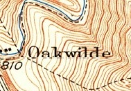
PAUL LITTLE-1.jpg
The trail appears in the original post 7/1938 aerial. Interestingly, by 5/6/1941, the course of the trail has changed and additional switchbacks installed.
5-6-1941-Station Ridge-001.jpg
Shortly thereafter the Forest Service revoked all the cabin and resort permits and I assume that is when the trail went into decline.
You do not have the required permissions to view the files attached to this post.
My friend Bob and I hiked that area last year. We saw your orange tape but went in the opposite direction. Next time we will have to check out the fireplace.
"Never limit yourself to what you can do!"
--Bart Yasso, my hero InstagramMy Blog