Black Star Canyon

Archived TRs for ranges in California.
Post Reply
User avatar
CrazyHermit
Posts: 343
Joined: Mon Sep 07, 2015 1:03 pm

Post by CrazyHermit »

Black Star Canyon is located in the Santa Ana Mountain range, about 10 miles east of Angel Stadium in the Cleveland National Forest.
It's a limestone canyon, long rumored to be haunted, with a bloody history to fortify the claim.
Image
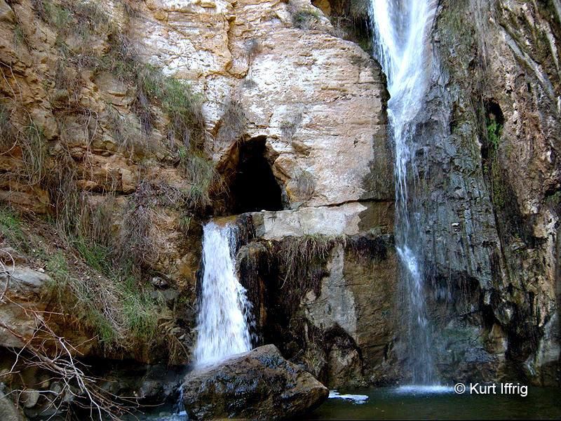
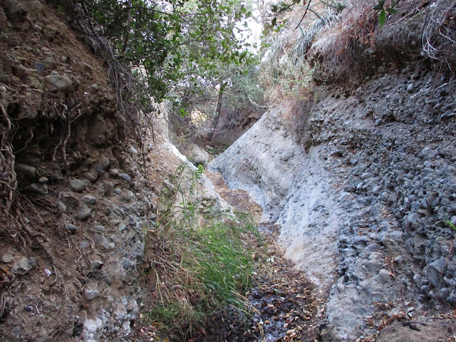
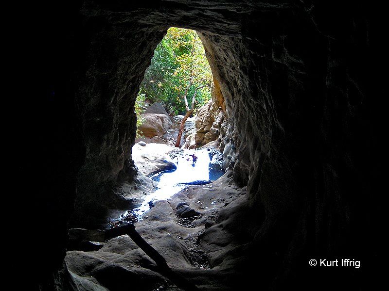
Most of the year the waterfall is dry, but occasionally it flows strong, through an old mine portal cut into the cliff face.
This area is part of a region known as Silverado, close to a silver mining boomtown that sprang up in the 1800's.
Image
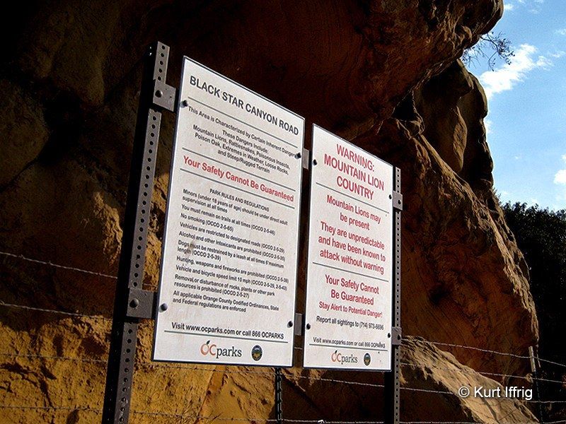
Seems like Orange County wants to cover their asses in every way, shape and form. There are two cats that roam the
area. No people have been attacked as far as I know, but several pets in Silverado Canyon have been killed.
Image
Near the parking area is the site of a second boomtown that sprang up around the same time as Silverado. This one
was called Carbondale, a coal mining settlement. The name Black Star comes from the name of the coal mining company.
Whatever is left of it is on private property, but the mine consisted of a single shaft, 900 feet deep.
Image
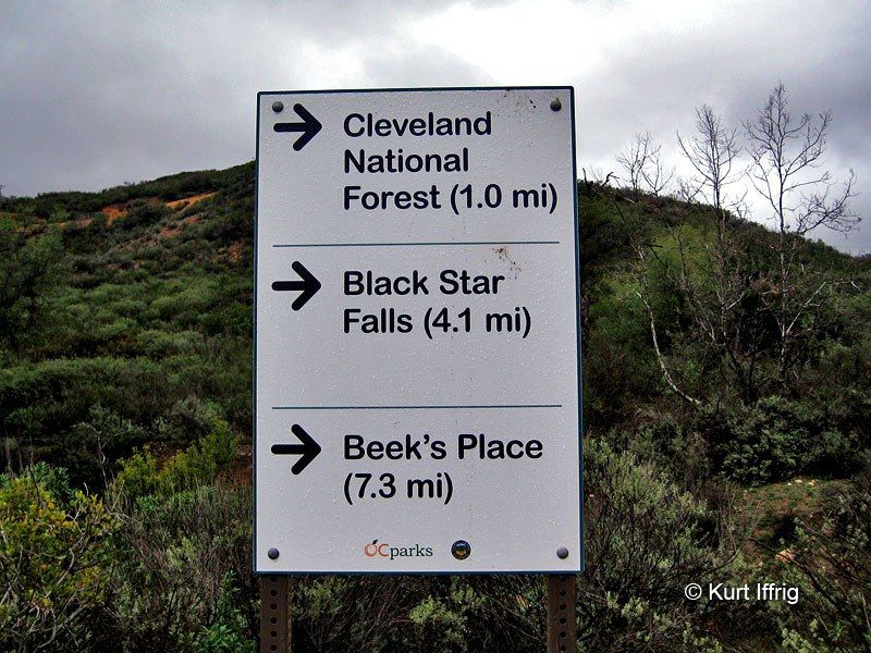
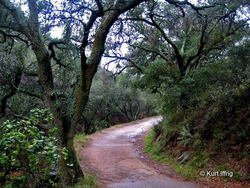
The first part of this hike is an easy walk down a dirt county road. If you bypass Black Star Canyon you can go to Beek's
Place, the ruins of an old summer cabin once owned by a harbor master of Newport Beach.
Image
There used to be a lot of crime in this area, which has largely been eradicated. Car break ins were common, as well as
a crazy guy who used to shoot at hikers, and an old, overturned school bus in the creek bed (which remained there until recently).
All of the kids, as well as the driver and school teacher were reportedly killed in that accident.
Image
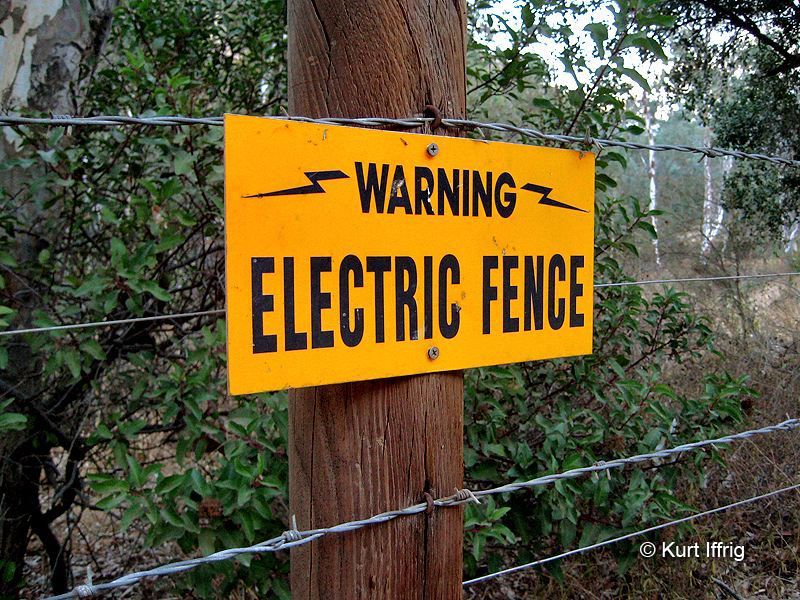
The county road is not on private property, but the ranches on both sides of it are. And they're not kidding about the
electrified fence. One of the ranches was the site of a discovery of old Indian caves, in which beautiful baskets were
found. They're now on display as the Bowers Museum.
Image
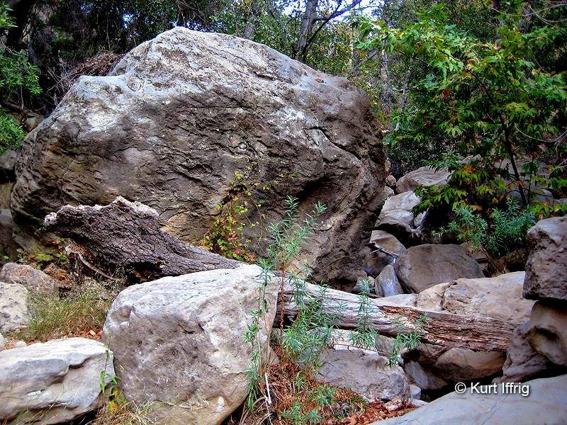
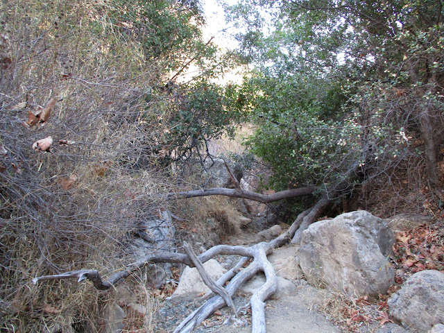
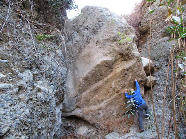
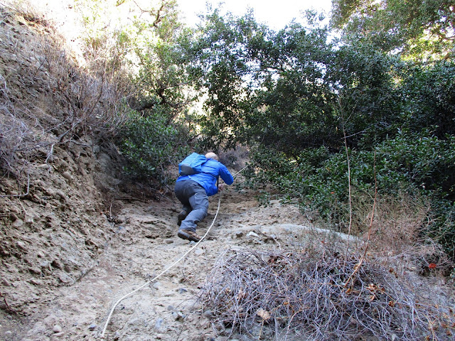
When you get into the actual canyon there's a lot of bouldering involved in getting to the falls, but nothing you guys can't handle.
This canyon was the site of a bloody Indian massacre back in 1831, when a band of Shoshone horse thieves were chased
into it by ranchers. Nearly all of them were slaughtered, adding fuel to the modern day haunted canyon legend.
Image
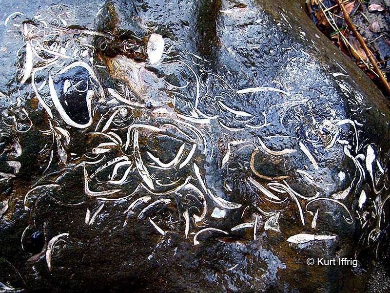
This area was once deep below the sea. These are megadolus fossils (sea worms) that date back 215 million years.
If you look hard you can also find old Indian mortar stones (metates) used for grinding acorns.
Image
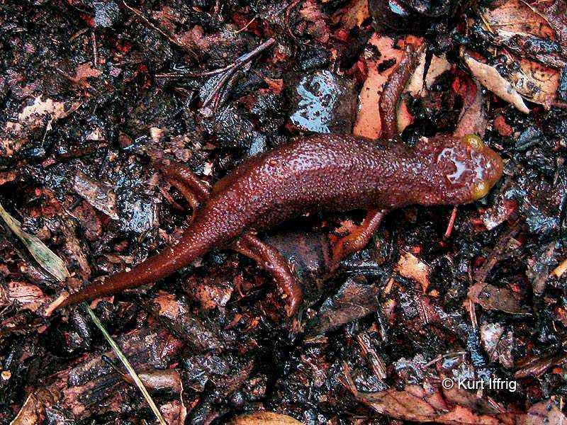
The first time I visited this canyon it was pouring rain and I was the only one up there. These California Newts were
everywhere, but you probably won't see them in the dry season. There's also a snake in this area that you won't see
in the San Gabriels called the Red Diamond Rattlesnake.
Image
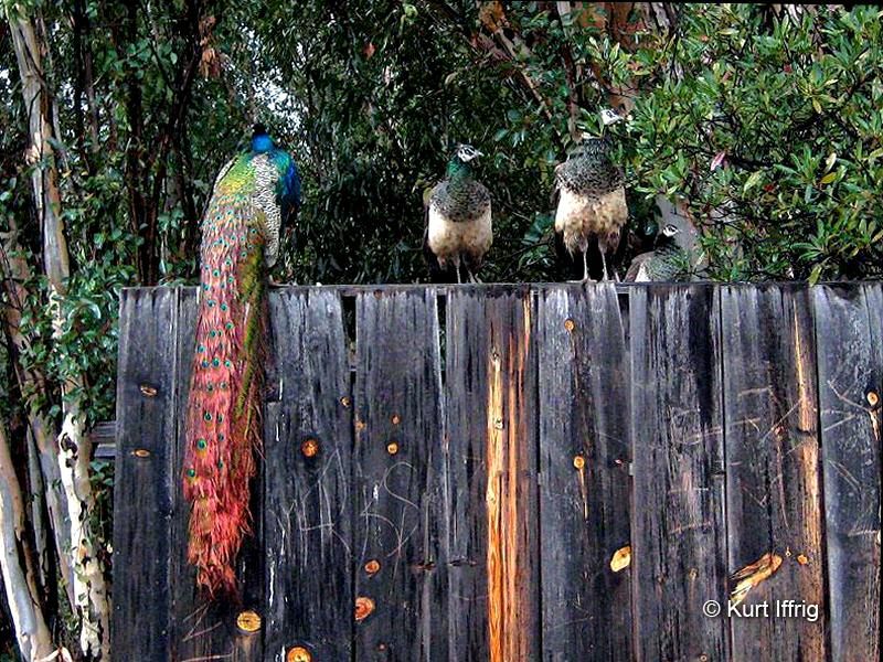
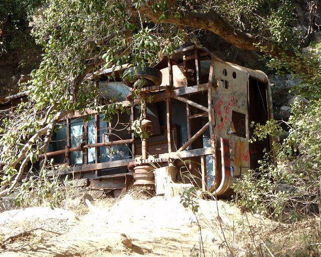
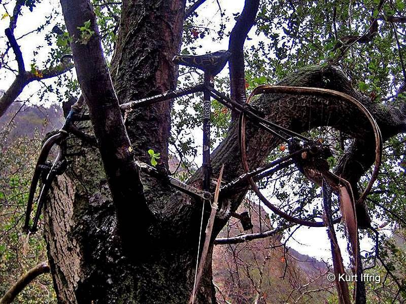
Along the county road there used to be a lot of abandoned junk and a spooky shack on the outskirts. And lots of these
semi feral peacocks. The junk has since been removed, as has an overturned bus and the spooky shack.
Unfortunately the peacocks have seemed to disappear as well.
Image
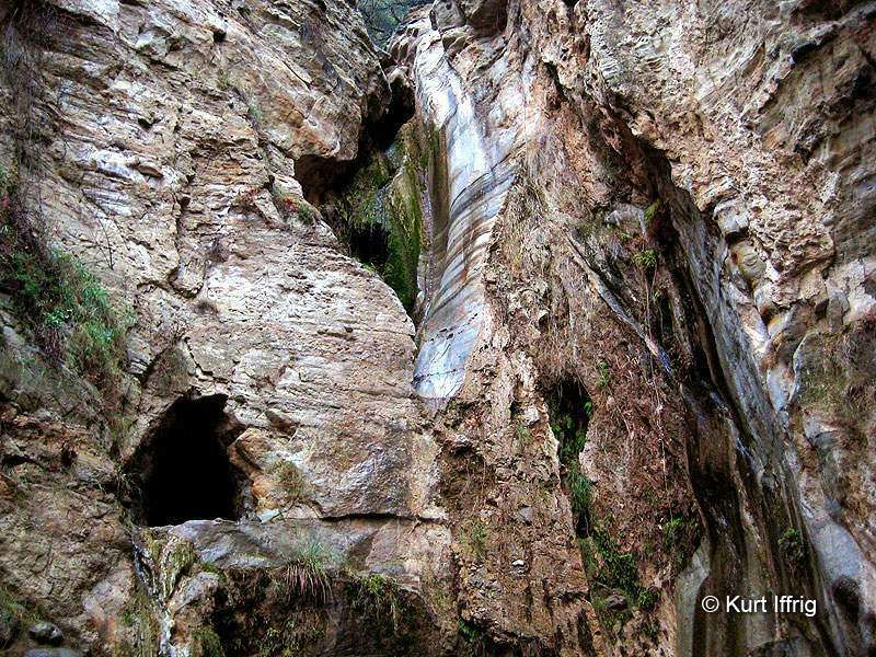
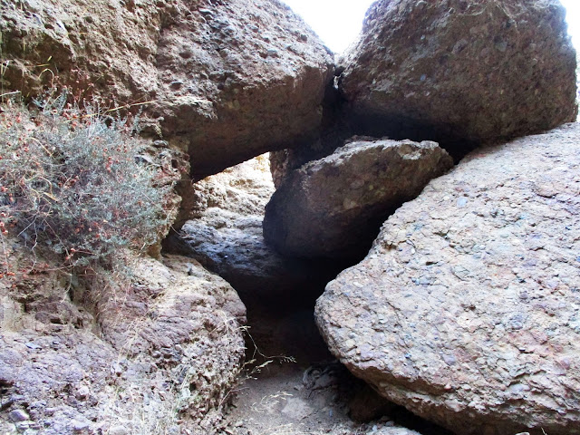
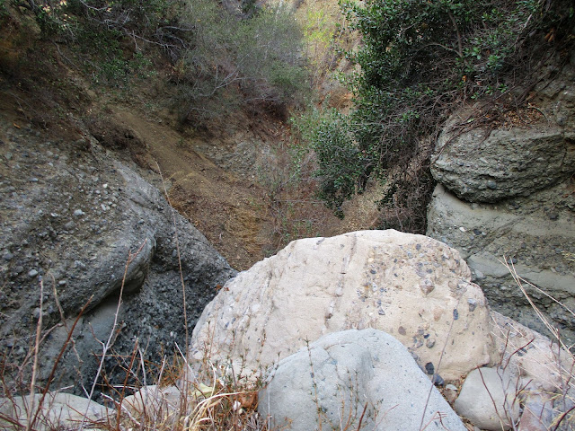
Here's a view of the falls and the mine during the dry season. The natural slot in the rock intersects with the mine,
and recently someone has hung a rope down from the top of the cliff, that drops directly into the mine. It's possible
to get up above the falls via a small gully on the right side. As of yet I haven't been up there.
Image
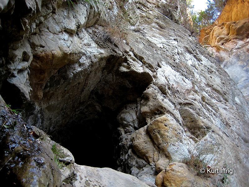
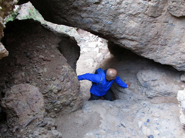
It's a little tricky climbing up to the mine, and almost impossible when the water is flowing strong. This was almost
certainly a silver mine from the 1800s, but I don't know its name. The mine is shallow, about 30 feet deep.
Image
Here's a view from the inside. Off to the left there's a small side tunnel with a rope hanging down. This was taken
when the mine was relatively dry, but this area gets flooded after heavy rain storms.
Image
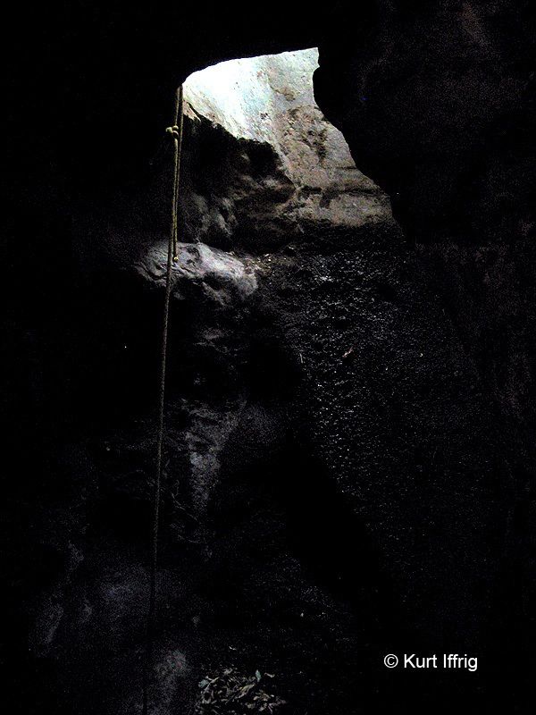
I don't put much faith in other people's equipment, so I opted not to climb this rope, but
I've seen kids doing it on YouTube videos. It goes directly up the waterfall slot to the top of the cliff.
Image
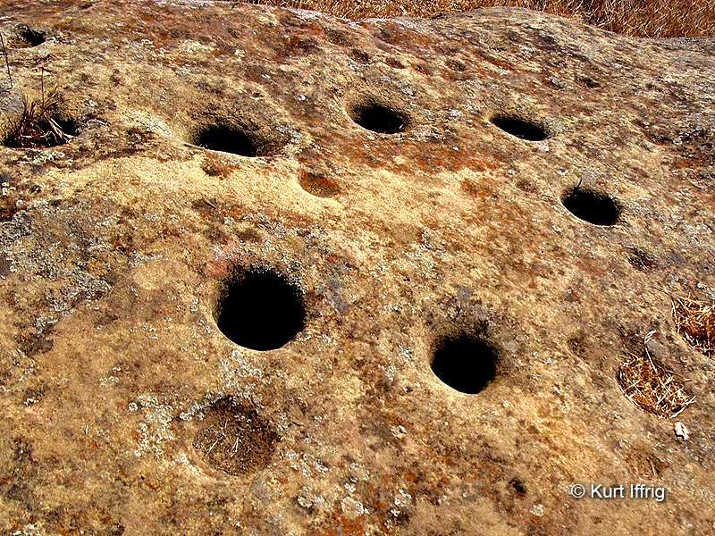
This is an old Indian mortar rock (metate) found at the site of an indian village further up the county road, on the way
to Beek's place. On the other side of the divide there are tin mines galore, which were almost all unsuccessful.
Black Star Canyon is not a secret location. If you want to visit it just look it up online. And if you want to learn more
about the history of this area and mines in the San Gabriels check out my website at secretmines.com
User avatar
Uncle Rico
Posts: 1394
Joined: Thu Mar 20, 2008 7:48 pm

Post by Uncle Rico »

Very interesting Crazy Hermit. Thanks for the post. One of these days I'm gonna have to get down to the OC to do some exploring.
User avatar
CrazyHermit
Posts: 343
Joined: Mon Sep 07, 2015 1:03 pm

Post by CrazyHermit »

Uncle Rico wrote: Very interesting Crazy Hermit. Thanks for the post. One of these days I'm gonna have to get down to the OC to do some exploring.
It's a very cool mountain range, and surprisingly large. 65 miles of protected open space that ranges all the was from Orange to Riverside County. And only about 45 minutes from L.A.
User avatar
Girl Hiker
Posts: 1318
Joined: Fri Apr 04, 2014 7:46 am

Post by Girl Hiker »

CrazyHermit wrote:
Black Star Canyon is located in the Santa Ana Mountain range, about 10 miles east of Angel Stadium in the Cleveland National Forest.
Nice Trip Report. I've heard that this was cool place to hike. The pictures are awesome! A little creepy regarding the school bus incident but this looks like something I would like to check out.
Thanks
User avatar
RichardK
Posts: 727
Joined: Sun Sep 30, 2007 12:33 pm

Post by RichardK »

Really nice pictures. Thanks for posting. I never made it into Black Star. I always heard that some locals never accepted that the forest service had an easement for public access.
User avatar
CrazyHermit
Posts: 343
Joined: Mon Sep 07, 2015 1:03 pm

Post by CrazyHermit »

RichardK wrote: Really nice pictures. Thanks for posting. I never made it into Black Star. I always heard that some locals never accepted that the forest service had an easement for public access.
That's true. There was one guy in particular who used to wave a gun around and actually shot at a few hikers (or so they say)
Eventually he was arrested and Orange County cleaned up their act. Now things seemed to have calmed down quite a bit.
User avatar
dima
Posts: 1319
Joined: Wed Feb 12, 2014 1:35 am

Post by dima »

Thanks a lot for the posts. I really like these.
User avatar
Rumpled
Posts: 271
Joined: Mon Feb 25, 2008 10:57 pm

Post by Rumpled »

I ride my MTB up BStar fairly often and have seen most of theses sights. Though, I've never gone to the falls - though my daughter has taken my dogs there twice.
Lots of legends and myths of the area.
I think the bus legend is one of those. Some reports have it that one of the property owners just had an old bus and ended up crashing it in the ravine.
I think any really tragedy as described would be easy to find in newspaper archives.
User avatar
CrazyHermit
Posts: 343
Joined: Mon Sep 07, 2015 1:03 pm

Post by CrazyHermit »

You could be right about the bus. Some sites report that it crashed in the 1970s, when the driver of the school bus lost control and went over a cliff in the canyon, killing most of the children. However these are not newspaper sites, so the validity of the claim is still up in the air. Here's what it looked like before it was removed...

Image
User avatar
tekewin
Posts: 1194
Joined: Thu Apr 11, 2013 5:07 pm

Post by tekewin »

What awesome photos! Thanks! I was just there two weeks ago and your photos make everything look better. After visiting the Falls, we returned a little bit and went up the east fork of Black Star (the route to the falls takes the west fork). I found a nice use trail, a natural rock cave and a mostly clear narrow canyon.

Image

Image

Image

We also ran into a serious boulder obstacle. We didn't want to risk climbing it on crumbly terrain, but someone had placed a rope bypass on the left side. We could not see what or how it was anchored, but decided to try the rope. It was tied, or more like just tangled, around a healthy 4" tree branch and held our weight. The rest of the canyon was clear all the way to the next major fork. We had to turn around for time, but both forks continued to look clear at least as far as you could see. The east fork is a fun side strip next time you are there.

Image

Image

Image

Image
User avatar
CrazyHermit
Posts: 343
Joined: Mon Sep 07, 2015 1:03 pm

Post by CrazyHermit »

That wedged boulder looks incredible. I've never been up that canyon before, but it looks sweet.
Thanks for posting those photos.
User avatar
Sean
Posts: 3749
Joined: Wed Jul 27, 2011 12:32 pm

Post by Sean »

Thanks for the great write-up. I love all the historical information and little details.
Post Reply