Register Ridge Trail
-
friendowl

- Posts: 137
- Joined: Fri Sep 28, 2007 9:23 am
ive seen where the trail starts and id like to take this route.
is is straight forward when it comes to route finding..is it had to get lost
also....is it possible to "boot ski" down baldy bowl ?
is is straight forward when it comes to route finding..is it had to get lost
also....is it possible to "boot ski" down baldy bowl ?
-
Taco

- Snownado survivor
- Posts: 6175
- Joined: Thu Sep 27, 2007 4:35 pm
Yes yes and yes.
The trail might be hard to follow (I don't remember), but if you keep on truckin' up the ridge, you'll be on-line and good to go. Good way to get up there.
The trail might be hard to follow (I don't remember), but if you keep on truckin' up the ridge, you'll be on-line and good to go. Good way to get up there.
-
AlanK

- Posts: 1069
- Joined: Thu Sep 27, 2007 9:28 pm
The trail is pretty easy to follow until you get pretty high. At that point, it's hard to go too wrong because you are going to hit the trail if you keep going up.friendowl wrote:ive seen where the trail starts and id like to take this route.
is is straight forward when it comes to route finding..is it had to get lost
also....is it possible to "boot ski" down baldy bowl ?
Heading down the scree slope is pretty popular among a certain crowd.
-
Taco

- Snownado survivor
- Posts: 6175
- Joined: Thu Sep 27, 2007 4:35 pm
I'd say the only thing ya need to worry about is coming back down Register Ridge, if you ever chose to do so (it's a fast way down if weather is inbound, and you're on Harwood).
Just recognise the ridge itself, mark it on a map, remember the certain tree near it, or whatever. It can be easy to get disoriented.
Just recognise the ridge itself, mark it on a map, remember the certain tree near it, or whatever. It can be easy to get disoriented.
-
bsmith

- Posts: 119
- Joined: Wed Oct 28, 2009 7:36 pm
how well trod is the register ridge trail?
easy to see since rain / snow?
any places to keep an eye out for where it might be possible to get off trail?
they may be silly questions, but one never knows.
thank you in advance.
easy to see since rain / snow?
any places to keep an eye out for where it might be possible to get off trail?
they may be silly questions, but one never knows.
thank you in advance.
-
cab

- Posts: 23
- Joined: Thu Nov 11, 2010 7:45 am
I went up Register Ridge a couple of years ago and don't remember any routefinding issues (my memory isn't that great though). I seem to remember there being a decent use trail most of the way.
One thing I do remember is that if you plan on descending that way as well, it can be difficult to find the start of the route at the top of Register Ridge, so you may want to leave a cairn.
One thing I do remember is that if you plan on descending that way as well, it can be difficult to find the start of the route at the top of Register Ridge, so you may want to leave a cairn.
-
Taco

- Snownado survivor
- Posts: 6175
- Joined: Thu Sep 27, 2007 4:35 pm
Exactly what Cab said. It's very easy up. If you lose the trail ont he way up, simply go straight up and you will eventually hit the Devils Backbone Trail.
Make a cairn or two at the top where it hits DBB trail, so that you can easily find your way back if you plan on returning the same way.
Make a cairn or two at the top where it hits DBB trail, so that you can easily find your way back if you plan on returning the same way.
-
bsmith

- Posts: 119
- Joined: Wed Oct 28, 2009 7:36 pm
cab:
thank you for that. i'll leave a cairn at the dbb junction if we plan on returning that way.
taco:
thank you, too, taco. have been up ski hut and dbb, just never this way. my questions will probably seem silly once i see the route, but silly is the unasked question.
thanks again, and thank you for your website. i've learned a lot lurking.
-
So.BayMark
- Posts: 58
- Joined: Mon Dec 14, 2009 5:04 pm
when you going up? I'm going up R/R this weekend just not sure when...
mark
mark
-
Taco

- Snownado survivor
- Posts: 6175
- Joined: Thu Sep 27, 2007 4:35 pm
It isn't silly. I had a tough time finding the right ridge on descent once or twice before. It's easy enough in that if you go down in that ballpark, you will hit the Ski Hut Trail, but still, when you're there and you have a certain time you hafta be back, it matters.
Cheers
Cheers
-
bsmith

- Posts: 119
- Joined: Wed Oct 28, 2009 7:36 pm
hey mark, monday, depending on traffic, maybe 0800 + / - 30 mins. hard to say from ventura county.
-
walker

- Posts: 248
- Joined: Mon Apr 08, 2013 11:14 pm
I took a trip up Register Ridge after the first storm and spent a couple days with the family near Big Bear Lake this weekend and the contrast in quantity of snow in each place is remarkable. It seems that the SBs got a far greater amount of snow out of these storms than the SanGabes and down to lower elevations as well. Not entirely surprising given the varied geographies, however, one thing seemed consistent in both places. The snow in both places is incredibly light, dry, powdery, unconsolidated- pretty much the opposite of what I've normally seen in SoCal. In Baldy and vicinity it doesn't seem that it ever stuck and just got wind drifted off the bowl onto the backsides of boulders and into crevices. Around Big Bear, the coverage was extensive, but it was practically impossible to make snowballs or snowmen out of the stuff, just as loose as sand. I don't know if the same is true of snow conditions on San Gorgonio, but if so, I might be concerned about the potential for slab release conditions if later storms were to drop a more typical consolidated layer on top of this stuff. It will be interesting to see how this snowpack stacks up.
-
mattmaxon

- Posts: 1137
- Joined: Mon Mar 24, 2008 12:48 pm
Very cold temperatures make dry powder or so it seems to me.
It can be snowing above the ground and raining down lower and everything inbetween
It seems to me generally we do not have the very cold temperatures to get powder say 15° F But this time we had cold temps on the ground during and after the storm
This was an unusual storm where there was no (almost) snow in the north part of the local mountains
-
Taco

- Snownado survivor
- Posts: 6175
- Joined: Thu Sep 27, 2007 4:35 pm
The SB's typically get more snow than us. I would say from my experience the dry powder snow isn't the norm, as or maybe it happens half the time or so. YMMV.
-
bcrowell

- Posts: 228
- Joined: Sun Dec 30, 2012 9:51 am
Went up Harwood Ridge today (Dec. 23) and came down the Ski Hut Trail. Yesterday's storm seems to have deposited zero snow. The whole route could have been done in tennis shoes. The bowl is completely bare. The summit is only about 50% covered with patches of thin snow.
-
bcrowell

- Posts: 228
- Joined: Sun Dec 30, 2012 9:51 am
I love your optimism. I asked Santa for an epochal El Nino year in the San Gabriels with Donner Party levels of snow as low in elevation as Baldy Village, not melting out until June.Mike P wrote: Baldy shouldn't be snow-bare for long!!!!
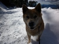
Back in reality...I did the Harwood Ridge/Ski Hut route again today, accompanied by my dogs. There's no snow left on Harwood Ridge. The summit of Baldy has maybe 10% snow coverage. There is quite a bit of ice, however, under the trees where the summer trail comes up on the climber's-left side of the Bowl. My terrier decided to treat the icy switchbacks as a toboggan run. The spaniel was more conservative. Because of the ice, microspikes were helpful. (For me, not the dogs.) I saw a guy coming up with YakTrax on his shoes, and he was slipping a lot, but that tells us nothing because YakTrax are useless.
-
Taco

- Snownado survivor
- Posts: 6175
- Joined: Thu Sep 27, 2007 4:35 pm
By Harwood Ridge, do you mean Register Ridge? The one just uphill from the register when hiking up the start of the Ski Hut trail?
-
AW~

- Posts: 2108
- Joined: Mon Oct 01, 2007 12:00 pm
Descended Register Ridge "trail" 4/21/17. Encountered parties coming up, all of whom advised the trail was only for ascending and urged me to turn back. Basically an abomination of a use trail up or down....and more or less a dirt gully that is f**d. 99% of users going up were using trekking poles and making it way worse....minus'll say its the worst eroded trail(sans snow) in the mountains.
-
psykokid
- Posts: 80
- Joined: Fri Mar 18, 2016 1:15 am
I laugh at this one... RR is my favorite route up and down Baldy. The "trail" conditions vary throughout the year, and I would expect it to be in pretty poor shape for a while with all the rain and snow we got this winter..
I went up RR last in October on my Birthday and since I hadn't been down the backbone trail for a while I decided to give it a go. Regretted it as once you clear the backbone portion the rest of the way down is pretty dreadfully boring..
I went up RR last in October on my Birthday and since I hadn't been down the backbone trail for a while I decided to give it a go. Regretted it as once you clear the backbone portion the rest of the way down is pretty dreadfully boring..
