
I was a little depressed that I missed the awesome get together yesterday where it looks like many hijinks occurred. I was thinking of drinking away my sorrow but decided hiking would give me a better high. I started a bit late like usual and got caught behind a nasty car/motorcycle crash right before Red Box. A helicopter airlifted the cyclist away and then the two tow trucks took care of the vehicles. Not sure what shape the guy was in. The cop mentioned that another accident happened in Big Tujunga and he was going there next. I was entertained with two motorcyclist talking in loud voices completely oblivious to the rest of us about their sexual conquests in colorful and graphic language only being interrupted with daps.
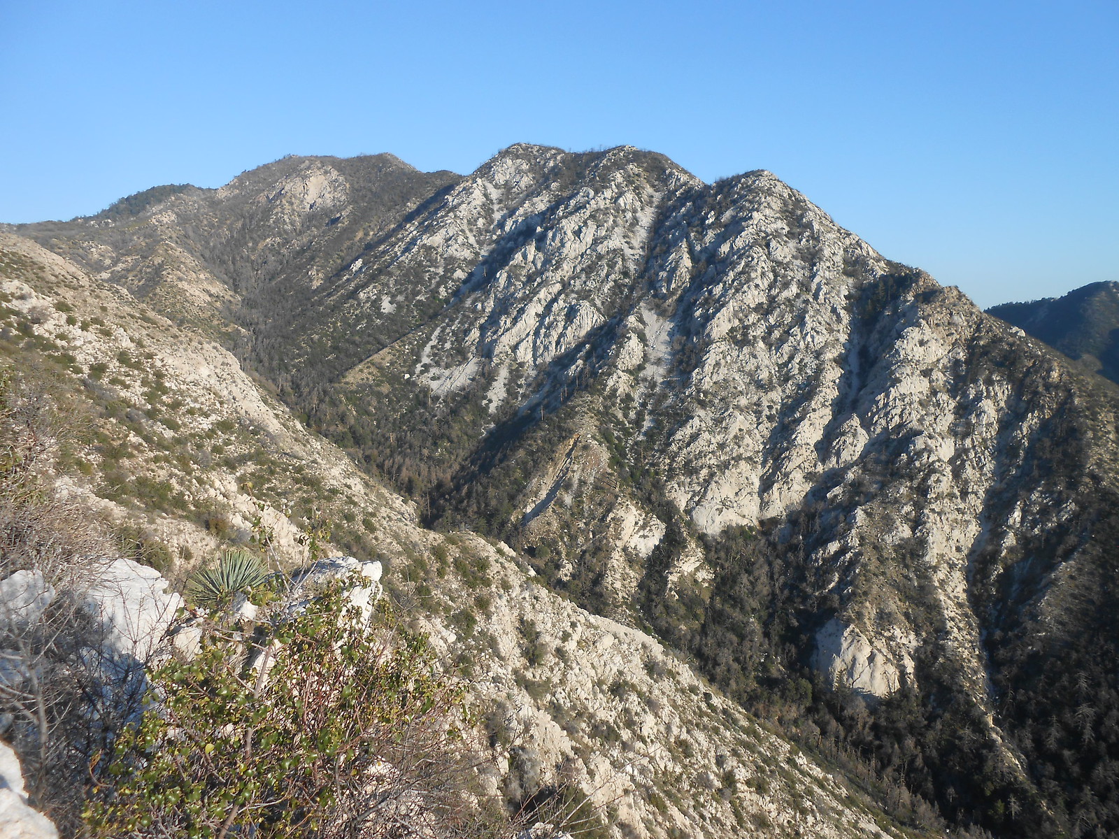
I finally got to the Deception TH and started on the trail switchbacking up. The trail quickly meets the road again and I left and took the road to the start for Deception. A quick climb up and a couple of bumps later I was on the top. There was no register as I continued down the ridge. It steepens and narrows as you circle around Supercloud, a supposed great canyoneering adventure. There was still a little poodledog on this ridge and lots of yucca. The ridge widens again and quite quickly you get a view of the hollow. I noticed one of those triangle signs laying on the ground here which I know will excite some of you. I continued along the ridge which was a mistake. You soon reach a rock outcropping and the decent use trail disappears. I made my way down a steep slope slipping between buckthorn. When it flattened out the brushwhacking began for 15 minutes through head high manzanita and buckthorn. I pushed into the hollow to check if this was going to be my lot today or if there was going to be another easier option. Looking back I realized that the firefighters had dropped the break directly into the hollow leaving the ridge about 100 yards before the rock outcropping. My bushwhacking had been in vain but it is very difficult from above to realize this.
I went to the end of the hollow and saw the cut continued down the ridge from there. Buckthorn and yucca were here but at a much more manageable level. You drop about 300 feet to the hollow and then about 500 feet to the saddle before Pk. 5,058. After the first drop from the hollow the rest of the route is quite evident and the brush only looked problematic on the climb up 5,058. As I got closer I could tell that the right side up 5,058 had a viable clear route. The ridge narrows as you get closer and sometimes you need to drop off it, in order to get around brush typically to the south side. A quick 200 foot climb and you're on top with a benchmark and some weathered wood that may have been a stake left by others. The views are cool and it feels remote even though the noise of others is all around you. The most interesting view was of Brown ridge.
The hike back while uphill was much easier with knowledge of the route and the escape cut out of the hollow. I decided to call it a day as I've been to all the peaks in this area more times then I can count and reversed my tracks the same way back to the car. I quickly Googled this hike before posting this to see if others had been here before recently and noticed that Walker did this from the bottom which was a thought for me to continue my descent and to make this a loop hike. Reading his description I'm happy I turned around and went back the same way. This is a great cross country moderate hike that allows a feeling of remoteness in the front range.
Mt. Deception, Supercloud Hollow, and Pk. 5,058
-
Sean

- Cucamonga
- Posts: 4286
- Joined: Wed Jul 27, 2011 12:32 pm
Triangle sign! This is going to the top of my to-do list now. It was already on the list before, but I was thinking of starting at Switzer's. Do we have a name for 5058?
-
walker

- Posts: 248
- Joined: Mon Apr 08, 2013 11:14 pm
Nice one! Glad you made it up there! I love the calm and remote feeling around the hollow and the peak itself is a really cool and peaceful spot. By the way, peak 5,058 looks stunning from other angles. Probably should have a proper name, but it's relatively well hidden from view most of the time.
Did you happen to notice what that bench marker said? I sure remember reading something on it, but I was pretty near bonking at that point after the climb up and snapped a totally blurry shot of it to boot.
Sean, if you're inclined to ascend from below, I recommend making a few recon trips to get familiar with the approach to the ridge as well as the exit route. To make a loop, you either have additional off trail travel over some rough terrain to reach the Gabrieleno trail just west of supercloud or you have to add a number of trail miles to reach redbox and then hike the Gabrieleno all the way to Switzer's.
While I was grunting up the ridge I kept thinking it could be called Deception Ridge or something like that. I like thinking of the hollow as Lake Disappoinment or Lake Deception. When you get there, you sure wish there was some water in it!
-
David R
- OG of the SG
- Posts: 651
- Joined: Sun Jun 12, 2011 10:28 pm
I didn't really look closely at the BM but it was quite worn. I also took a picture of it and it was unreadable. If the peak needs a name, I would go with Bear Divide Peak as it sits between the two Bear Canyon tributaries.
-
Uncle Rico

- Posts: 1484
- Joined: Thu Mar 20, 2008 7:48 pm
I made a go of Pk. 5058 yesterday and failed miserably. Just above the hollow, the use trail petered out and I ran into an impenetrable head-high wall of brush and I couldn't locate the old fire-break. I didn't want to forest-bathe in buckthorn, yucca, manzanita, poodle and an assortment of other flesh-ripping flora, so I back-tracked to a rock out-cropping for a snack and some Zen. Temps were relatively pleasant but skies were super hazy. Went up to Disappointment on my way back because it seemed appropriate given the way the day turned out.
Here's a couple of pics from the ridge.
Here's a couple of pics from the ridge.
You do not have the required permissions to view the files attached to this post.
-
Girl Hiker

- Posts: 1458
- Joined: Fri Apr 04, 2014 7:46 am
David, please post a pic of the BM. I love finding them that's my thing besides waterfalls and registers 
I would like to bag that peak one day! It sounds like my kind of hike with bushwacking and all the things that Uncle Rico mentioned haha!
I would like to bag that peak one day! It sounds like my kind of hike with bushwacking and all the things that Uncle Rico mentioned haha!