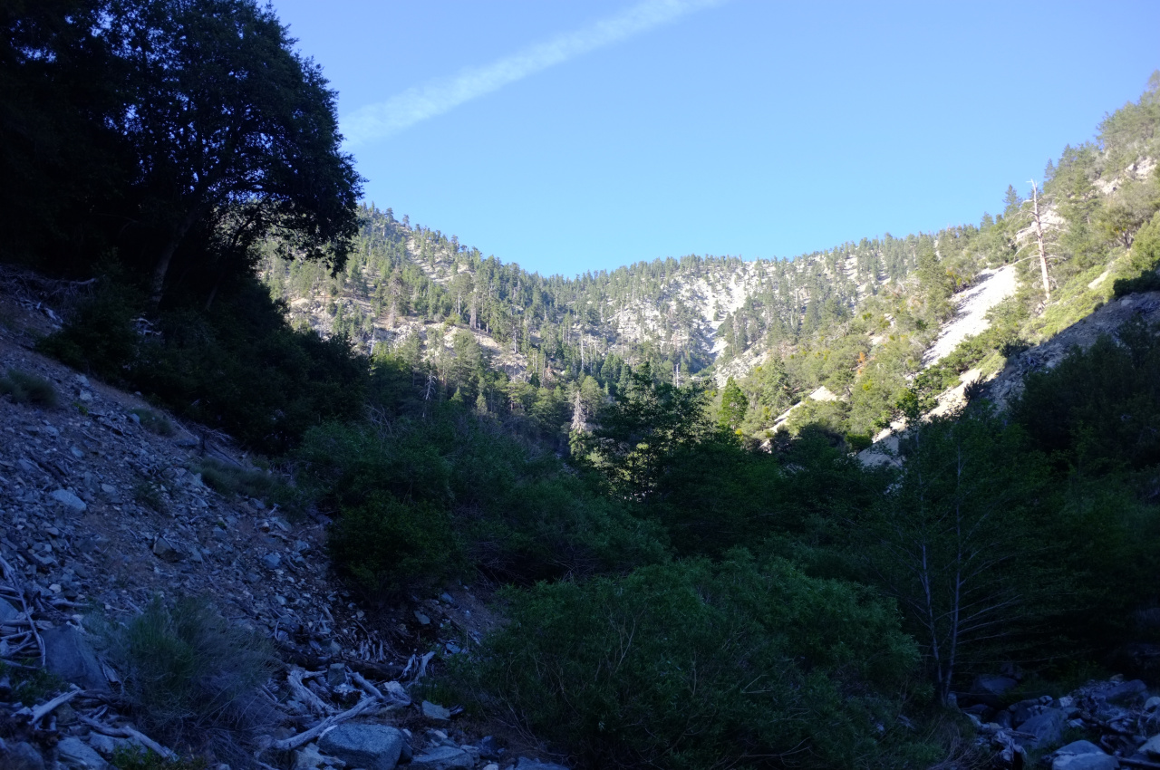
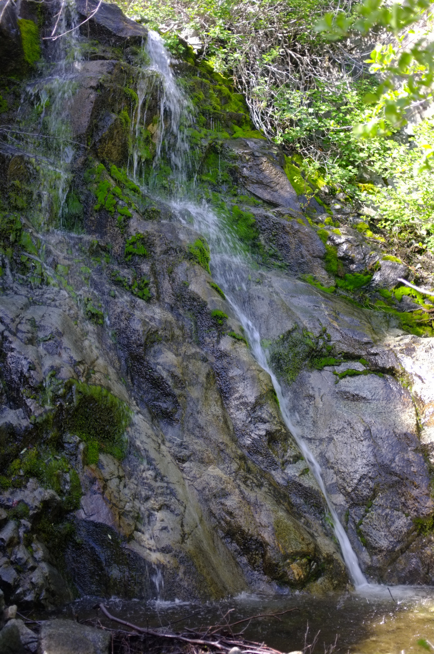
So, early in the morning on Saturday, Sean and I arrived at the Devil's Punchbowl, and started walking. We took the trail towards the Devil's Chair, but split off where it crossed Punchbowl Creek, following the creekbed upstream. Initially there's a use trail, but this becomes more and more faint as you ascend. The canyon is actually really nice. There's currently a good flow through it, and it's a pleasant (and steep) boulder hop. Looks like this from the bottom:
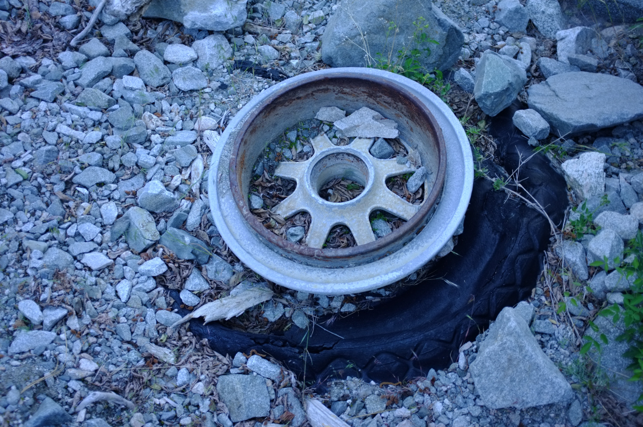
We're going to not-quite-the-top of the main ridge in the photo. As you ascend, you quickly start seeing scattered pieces of the airplane. Most are generic parts of the body: aluminum sheets held together with rivets, but some are more interesting. Relatively close to the main trail crossing is this wheel:
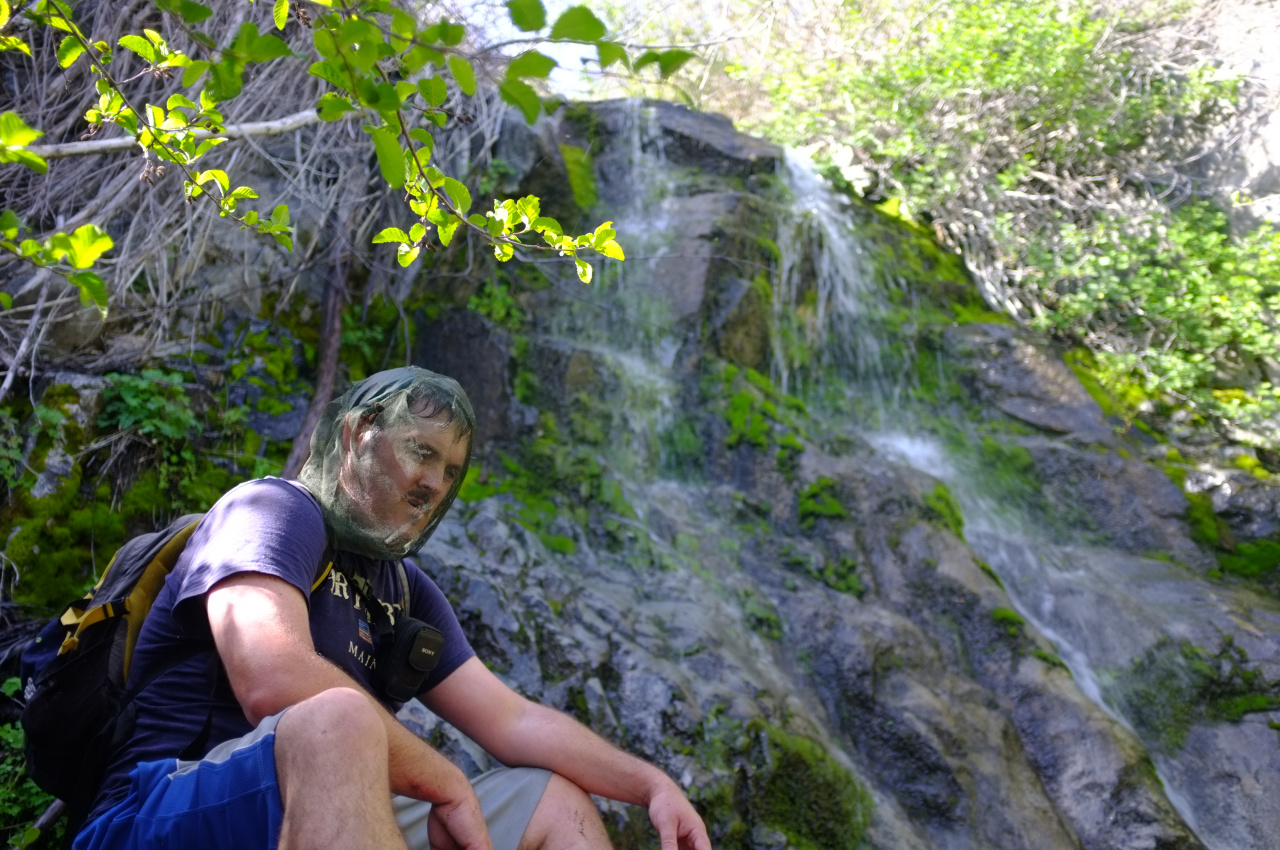
We ascended the creek, and went right at the first major split. Soon after, we hit first waterfall.

It's nice! There's a bypass on the climber's right. We kept climbing and would encounter more wreckage pieces regularly. We went left at the next canyon split, and immediately hit another waterfall. Sean was unimpressed
but it really is nice.
There's a bypass on the left, complete with a faint use trail. This use trail navigated a brushy area, and seemed to lead upwards on the ridge, instead of dropping back down into the canyon. This is the ridge that held the wreckage, according to the imagery, so we just kept climbing. The brush soon subsided, but that isn't the problem here, which is that this area is STEEP.
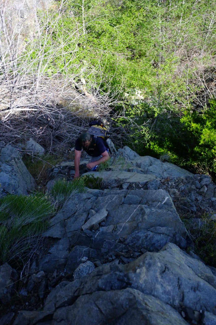
The terrain here rises towards a main ridge at ~8000ft. The South side of this ridge contains the C119 wreckage, which is also an off-trail scramble, but a much safer one. The North side of the ridge (which we're ascending) is steep scree for the most part. The minor ridges between the scree chutes are made of unstable granite, so they're arguably more dangerous than the chutes.

Eventually, we came up on the tail:
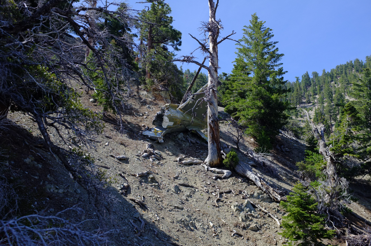
This thing is HUGE. It's on a very loose slope, and the only thing holding it up is the tree that impaled it on impact. The tree is long dead, and this whole thing will slide down into the canyon eventually.
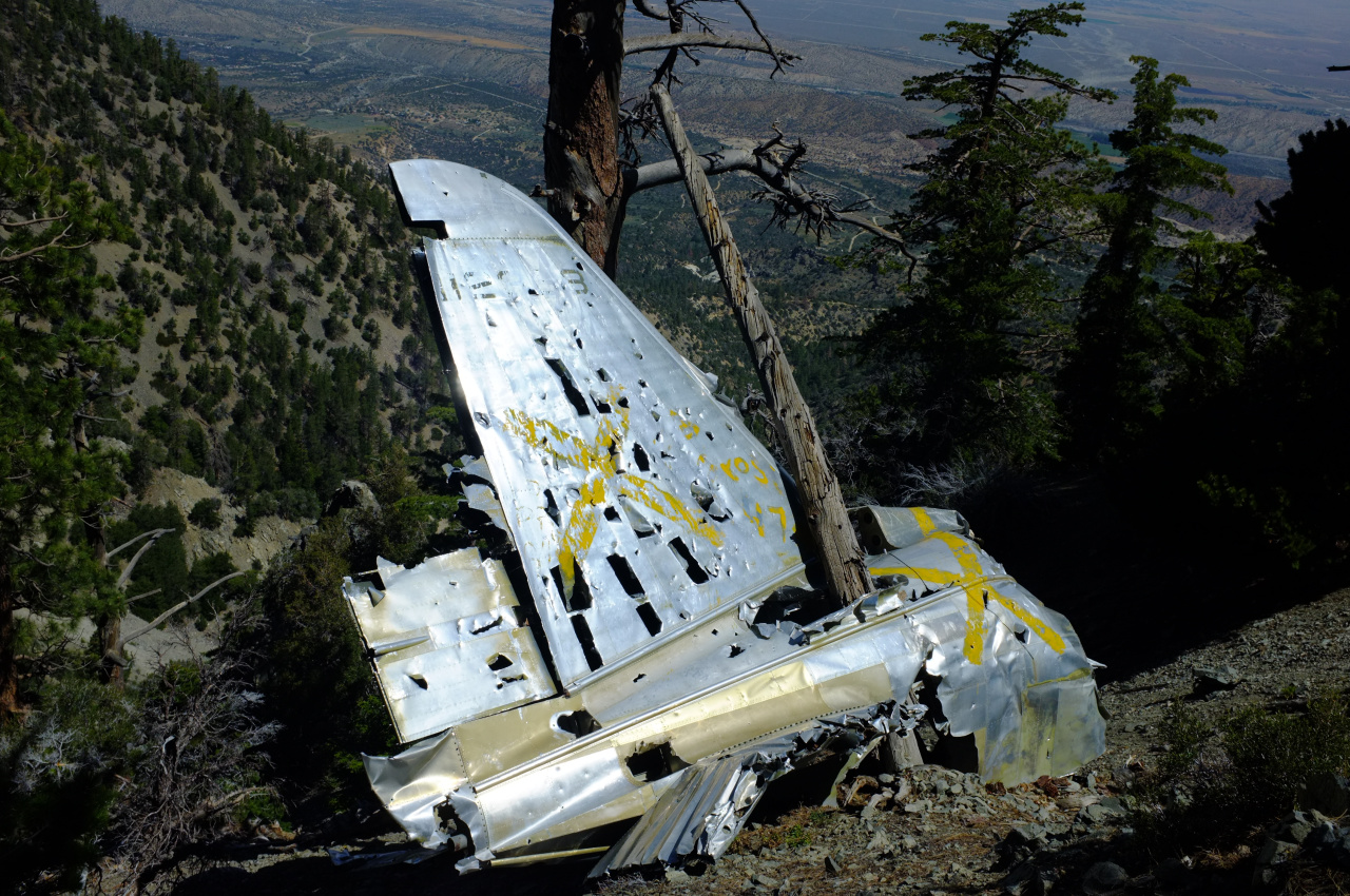
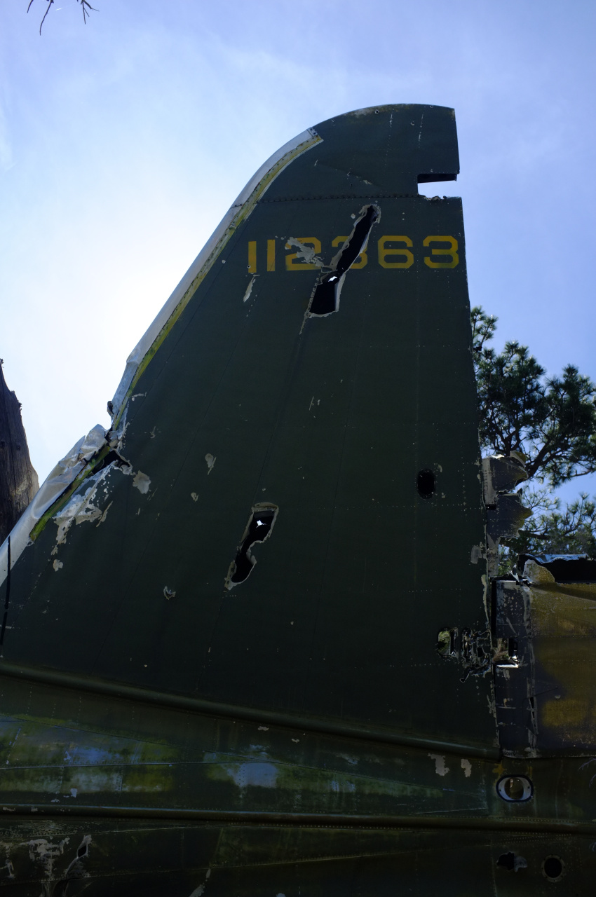
The South side of the tail still has the green paint
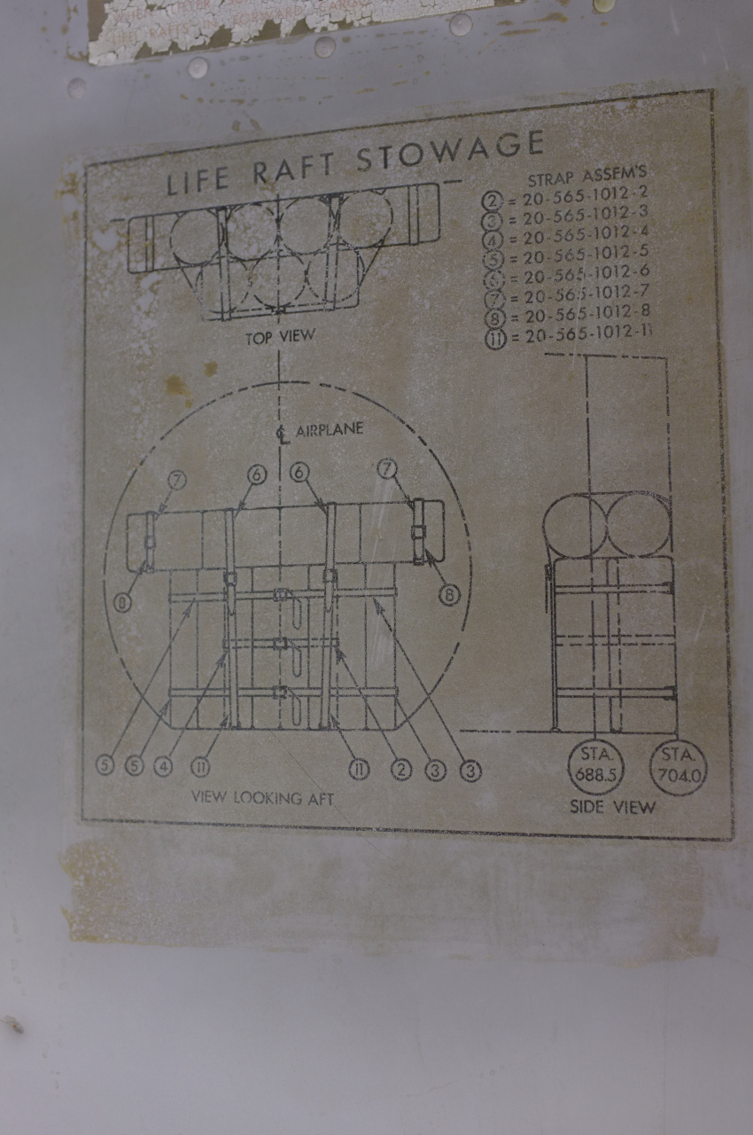
Did I mention this thing is huge? You can climb inside it, and it's a nice shaded spot to eat lunch. You can also examine the life raft diagram
or read the scrawlings left by previous visitors

We attempted a timed group photo. It took me a few tries to successfully scramble down from the camera to the tail in the 10 seconds my camera gave me, but eventually I made it in time.

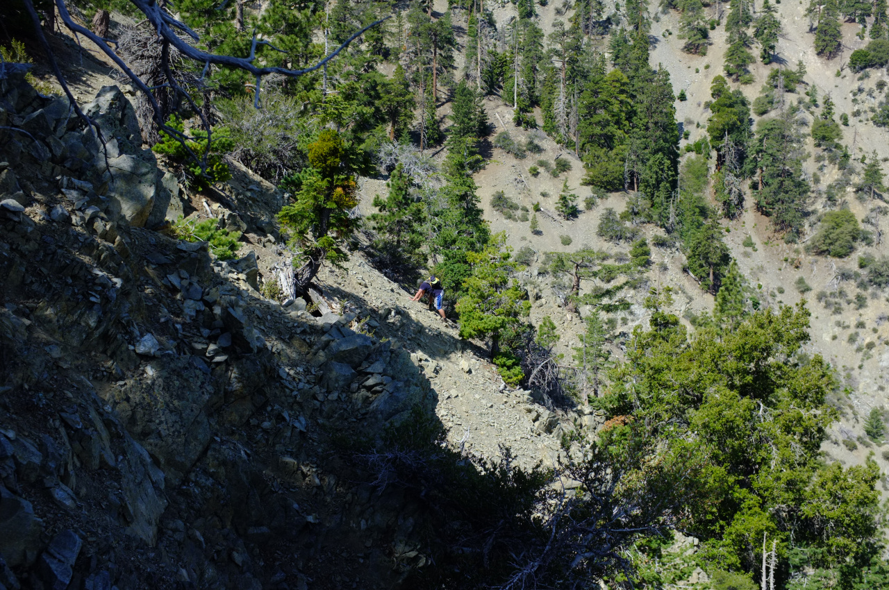
We were still about 1000ft below the main ridge. Above, there were a few more areas that the aerial imagery indicated could contain wreckage. I climbed up the sketchy terrain, and found some more stuff, just a little bit below the ridge. The biggest pieces were this fuselage-looking thing:

and these wing-looking things:
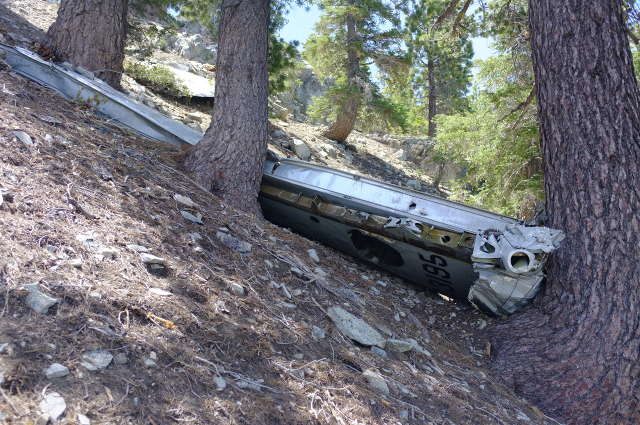
Note the number on the wing. This isn't the C-46A #41-12363, but rather it's the C119 #53-3195 that lies mostly on the other side of the ridge. The C119 must have clipped the ridge traveling South, and left debris on both sides. While the C-46A impacted lower, and ALL of its debris is on the North side of the ridge. It is interesting that the two debris gullies are directly opposite the ridge from each other. It is also interesting that other than the tail, there were relatively few big pieces of the C-46A. It could have broken up into a large number of small pieces, or much of it could be buried in the scree or in the canyon below.
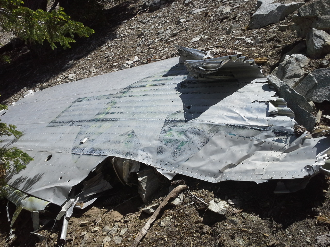
I topped out on the ridge among the scattered C119 debris I saw the last time, enjoyed a few minutes of flat ground, and then descended back down towards the desert. My camera ran out of juice at this point, so all the remaining photos are Sean's. Descending the scree fields was significantly easier than climbing up. On the descent we faithfully followed the gullies from the tail, so we'd walk by everything that slid down the hill. This was the biggest non-tail piece we found:
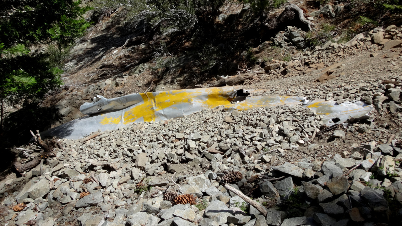
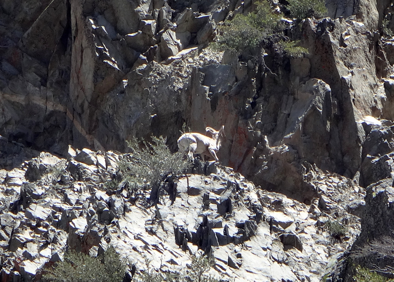
It was half-buried already, and the scree we pushed down on our descent buried it a bit more. We dropped down into the canyon, and walked in the main channel, hoping to see more stuff. I was hoping to see some bighorn, and then there they were
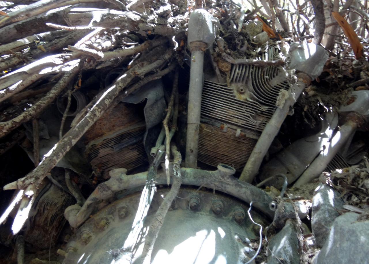
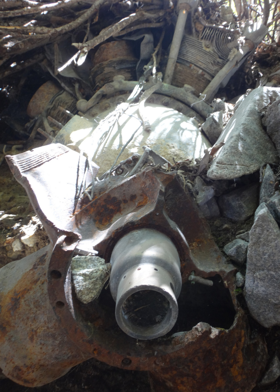
I also wanted to see an engine, and then there it was, half buried in the dirt on the side of the canyon, one prop blade still attached:
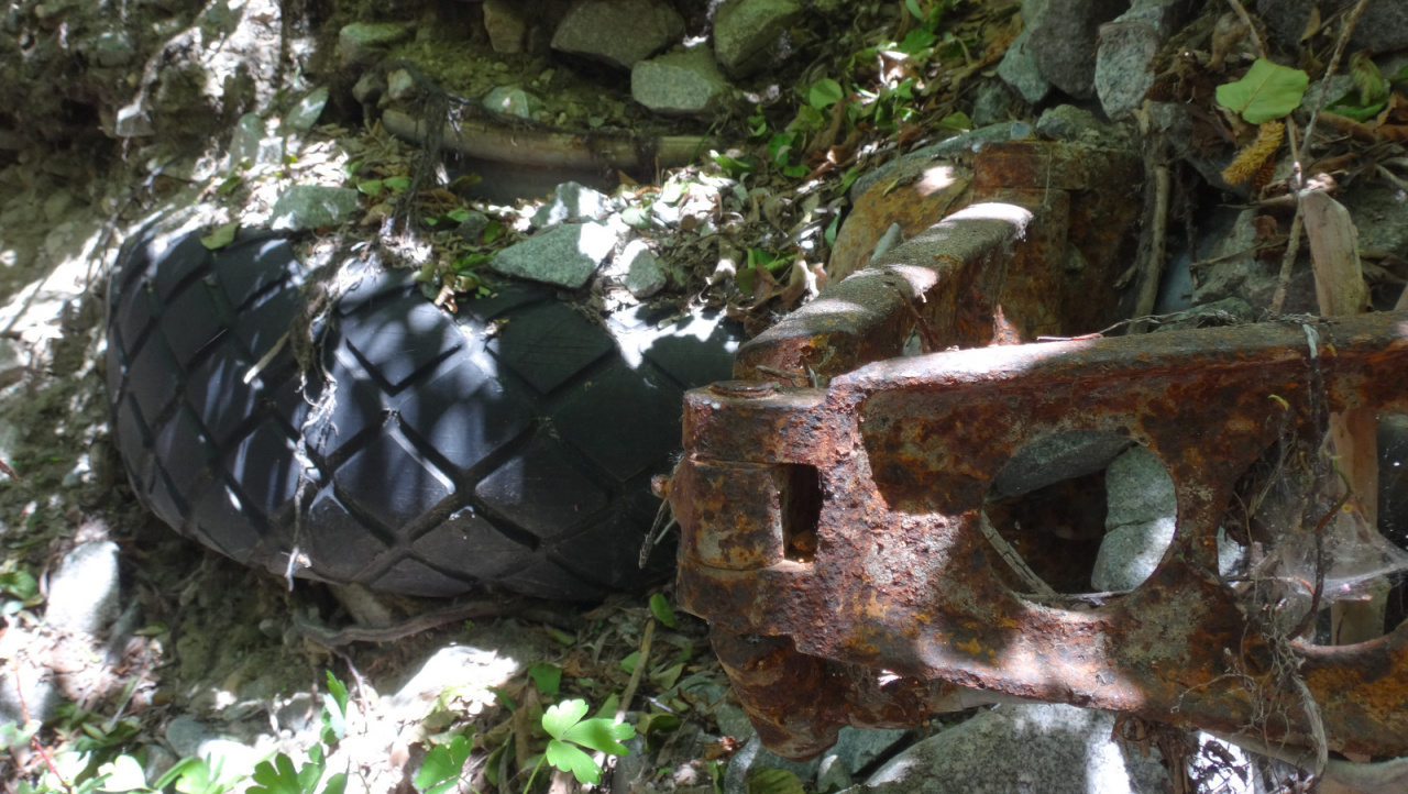
Then I wanted to see a landing gear, and bam! There it was, complete with wheel and tire, also buried in the dirt on the side of the main channel:
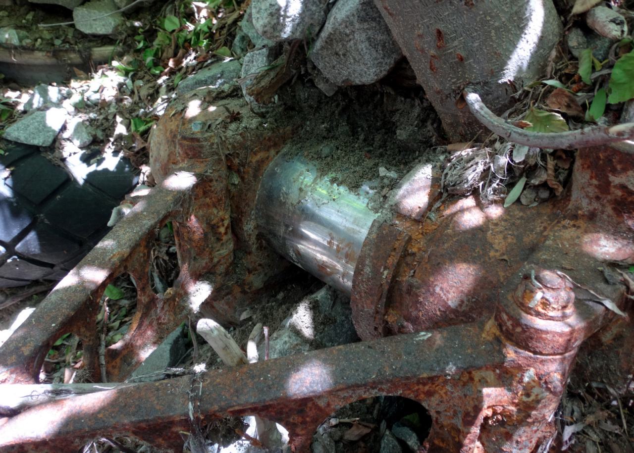
Other things buried in the canyon were a loose propeller blade, and this thing:

This was all above the second waterfall, where we split off on the way up.
Then I wanted to be done, and this wish came true also, albeit hours later.
This was a great trip. The debris is scattered over a massive area, spanning over 1000ft of elevation. Distance-wise, it's relatively close to the main trails, but these are tough miles, and took a while.
Wilderness factor: 8 birthday baloons
Rated: R
Total distance covered: ~ 6 miles
Net gain: ~ 3000 ft
Total time: 9-10 hours