
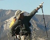
although written as a survey for the usfs, this hopes to show that the southern los padres has great multi-day loops when (a) it is not too hot and (2) when there's lots of water. and right now is a great time to come and enjoy before we hit our high temps.
must carry water from ladybug camp to junction of lion canyon / east/west fork lion camps junction. water there.
oh, and plans germinating to remove the obstructions.
https://flic.kr/s/aHskSMdKny
sespe river / red reef / lion canyon trails
-
Uncle Rico

- Posts: 1484
- Joined: Thu Mar 20, 2008 7:48 pm
Excellent bardley. I've wondered about how passable the Red Reef Trail was from Ladybug to the ridge. Never been out that way.
Is that table in your pics on the ridge where the Nordhoff Road ends and the Red Reef Trail begins? Looks like a fine, but dry place to spend an evening.
Is that table in your pics on the ridge where the Nordhoff Road ends and the Red Reef Trail begins? Looks like a fine, but dry place to spend an evening.
-
bsmith
- Posts: 119
- Joined: Wed Oct 28, 2009 7:36 pm
that is actually a usfs car camp called "elder camp".
and yes, it is on hines peak road (aka nordhoff ridge road) between the end-of-the road barrier and the intersection of hines peak road / red reef trail where it heads down / south to white ledge camp, then sisar canyon road and finally reaches highway 150.
ladybug is sweet.
and yes, it is on hines peak road (aka nordhoff ridge road) between the end-of-the road barrier and the intersection of hines peak road / red reef trail where it heads down / south to white ledge camp, then sisar canyon road and finally reaches highway 150.
ladybug is sweet.