

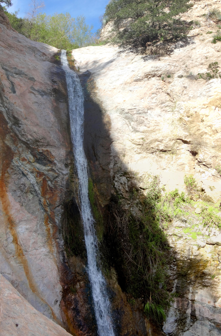
We climbed up the left side of the falls. You can get to a really nice overlook area, but getting up and over requires crossing a section that I wasn't comfortable with. Today I came back to ascend this whole canyon. The falls were nice as before. This time I went up the right side. Like the left, this is loose and steep, but it's wider and has more dirt and plants, and less rock. After a wide detour and some very steep bushwhacking I reconnected with the canyon above the falls:
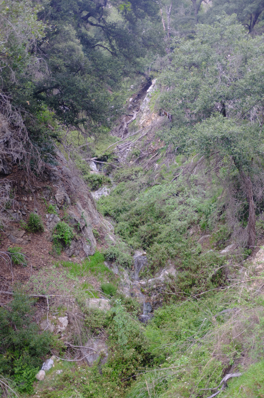
This section is very verdant (meaning full of plants that impede progress) and very steep. So there're many little waterfalls. Ascending above the creekbed is preferable here, but it's very steep, so I spent much time studying the flora. The canyon is straight-ish so you can see out into the trails and road above Millard Creek:

The going is very slow here except in the sparse places where there's a use trail from canyoneers. Or bears:

At around 2800ft the creek goes underground and the brush subsides a bit, which speeds up upward progress. I didn't do my research beforehand, so I had no idea where the mine or the plane crash or the cabin ruins are. So when I accidentally took a side gully at 3200ft I decided to just continue towards point 4187, since here was a section of brush-free high-quality rock. It didn't last. Soon it was back to light bushwhacking and dealing with steep, crumbly rock. At some point a particularly large boulder broke off and pinned my knee. I was able to push it off without anything getting seriously crushed. With all that excitement behind me, I was soon standing on top of point 4187. This is a mostly unremarkable summit with nice views. Brown Mountain ridge looks close.

The view to the East is this:
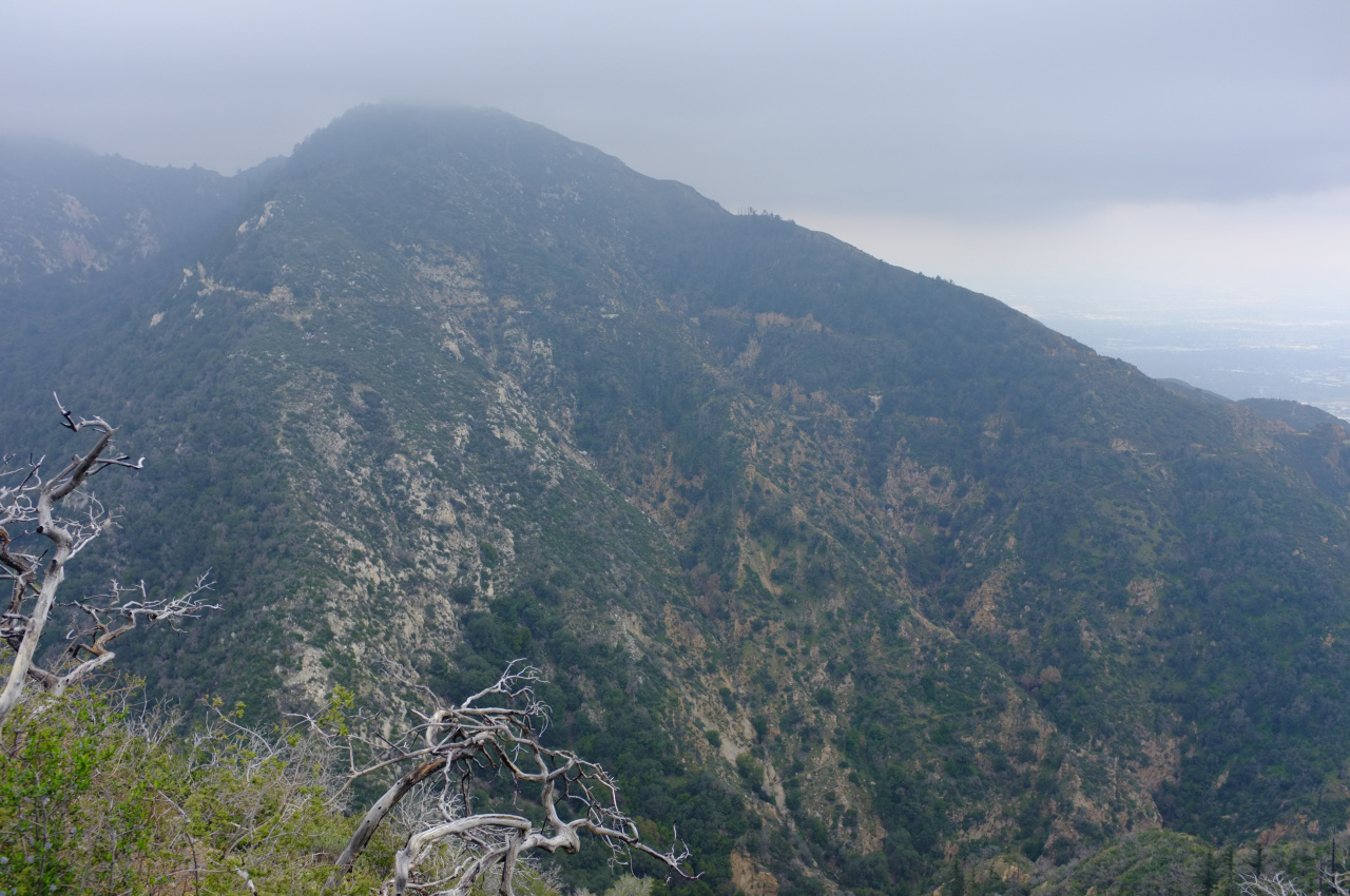
Click for the full-size original. The peak in the clouds is Mt. Lowe. I can sorta understand how the visible route of the fire road works out on a map. But there're two questions:
1. Towards the right of the image you can see a trail branch off the road and start descending to the left
2. At the bottom-right of the image you can clearly see a trail with two switchbacks
Are both of these remnants of the trail from Tom Sloane Saddle to Alpine Tavern?
In any case, I pressed on Northwards towards Brown Mt ridge. This wasn't particularly steep or loose, but to compensate the brush got considerably thicker and spikier. I pressed on, and after a bloody half mile I was on the ridge. I then visited Brown Mt just to sign the register, and came back via the trail from Tom Sloane Saddle down to Millard Canyon. That trail is well-defined and the thick branches were sawed off. It's considerably overgrown with smaller brush, however. I forgot to bring loppers, so it is still like that. Sorry. Down in the canyon, the going is (relatively) easy. A bit above Dawn Mine I was surprised to encounter a mine I've never seen before:

This is a large opening that's right at the creek, so I've no idea how I missed it previously. It's a straight shaft that goes back maybe 100ft. Walking further downstream, the trail gets better and better, eventually getting fancy things like maintained bridges. Traffic increases correspondingly.
This is a fun route! I haven't been in this area for a little while, and completely forgot just how quickly it becomes a real adventure. These mountains rock!

