Bobcat Knob and Peak 6629

TRs for the San Gabriel Mountains.
Post Reply
User avatar
Sean
Cucamonga
Posts: 3929
Joined: Wed Jul 27, 2011 12:32 pm

Post by Sean »

Now that the Williamson Rock area has been reopened, I decided to hit up Bobcat Knob via the SW ridge.

Image

Buckhorn campground was still closed for the season. So I parked outside the exit gate and walked down to the Burkhart Trail. The stream through the campground was flowing swiftly.

Image

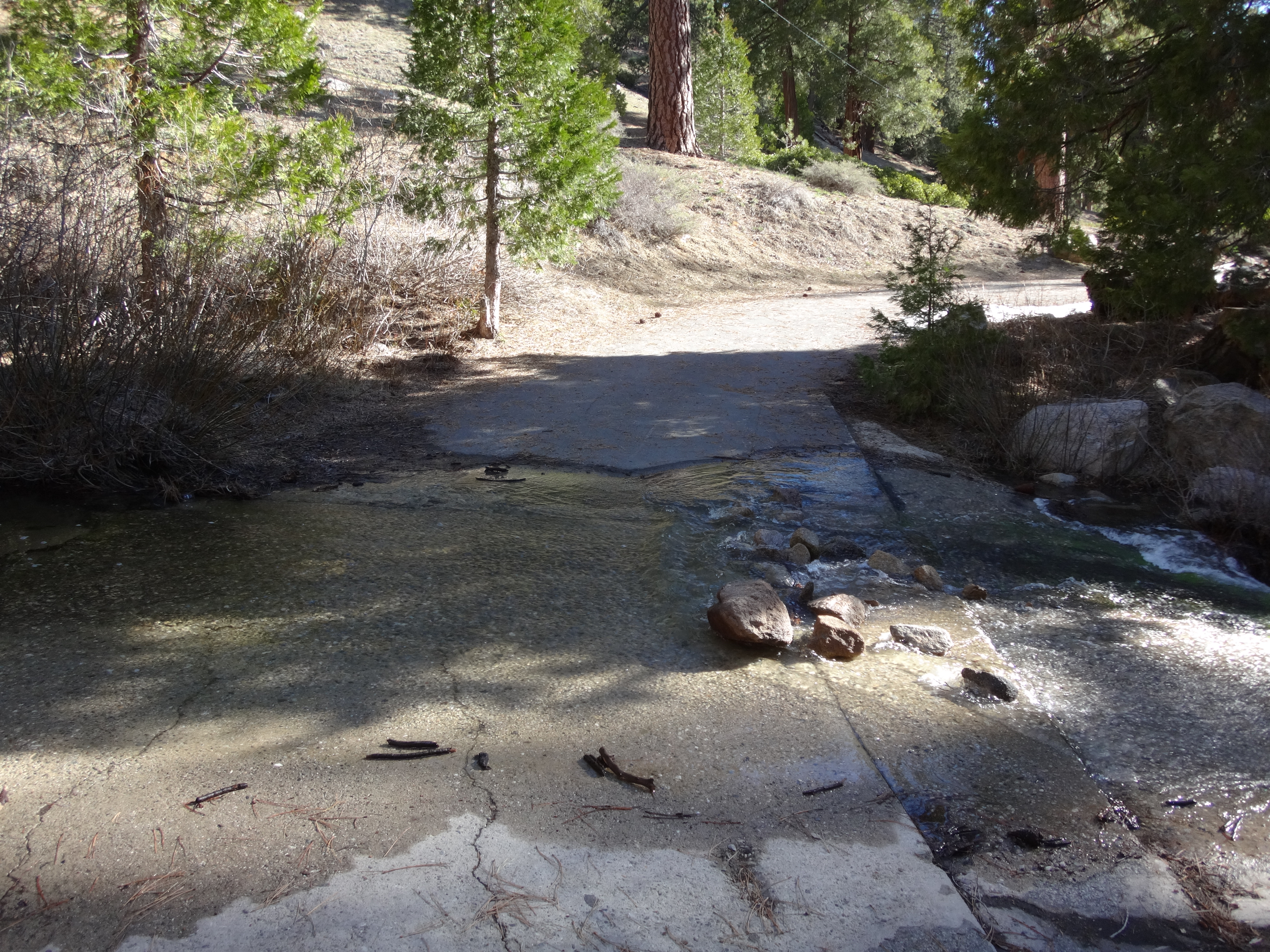
I had to get my feet wet even before reaching the trailhead, because the creek covered a bit of the road.

Image

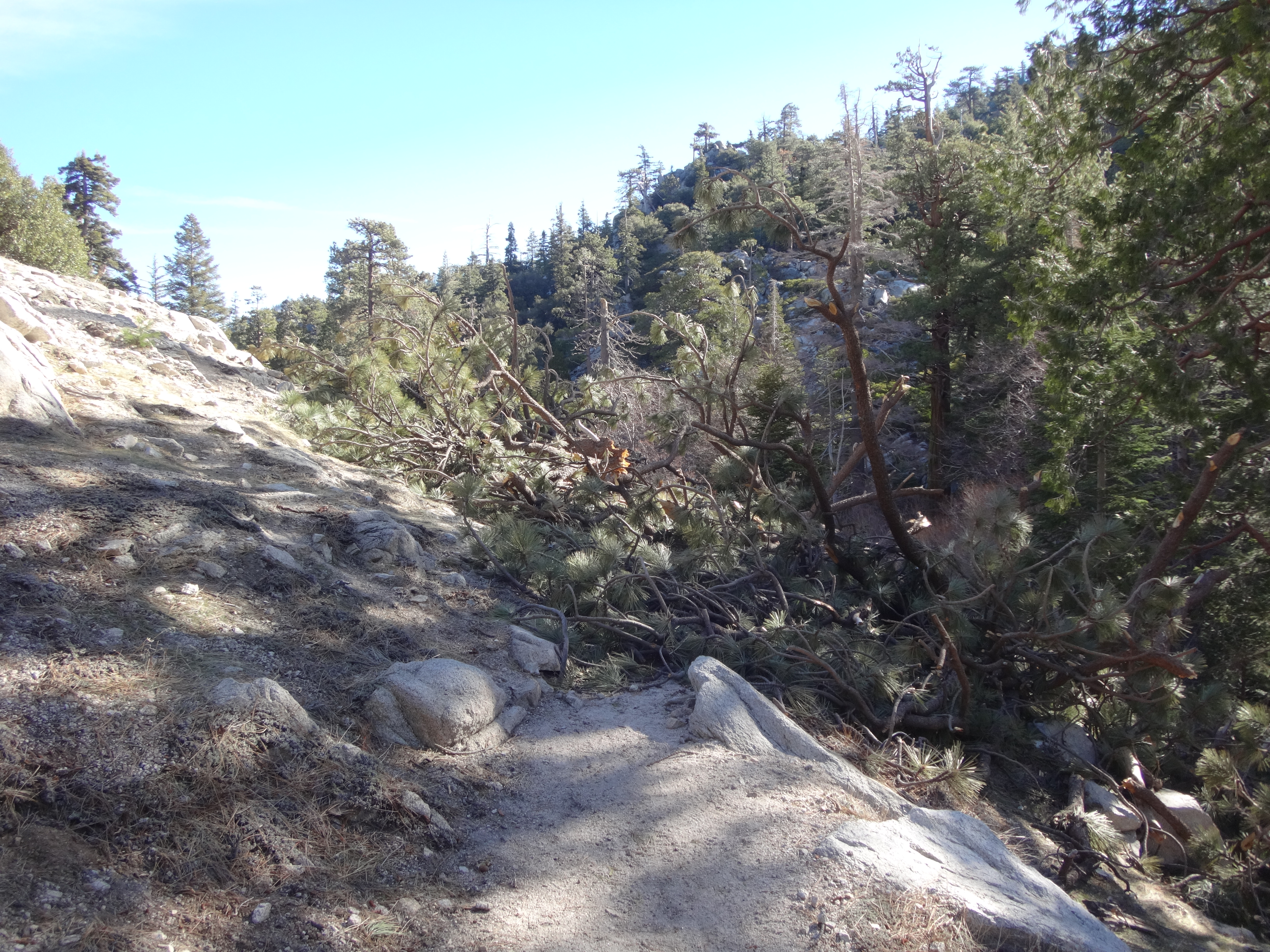
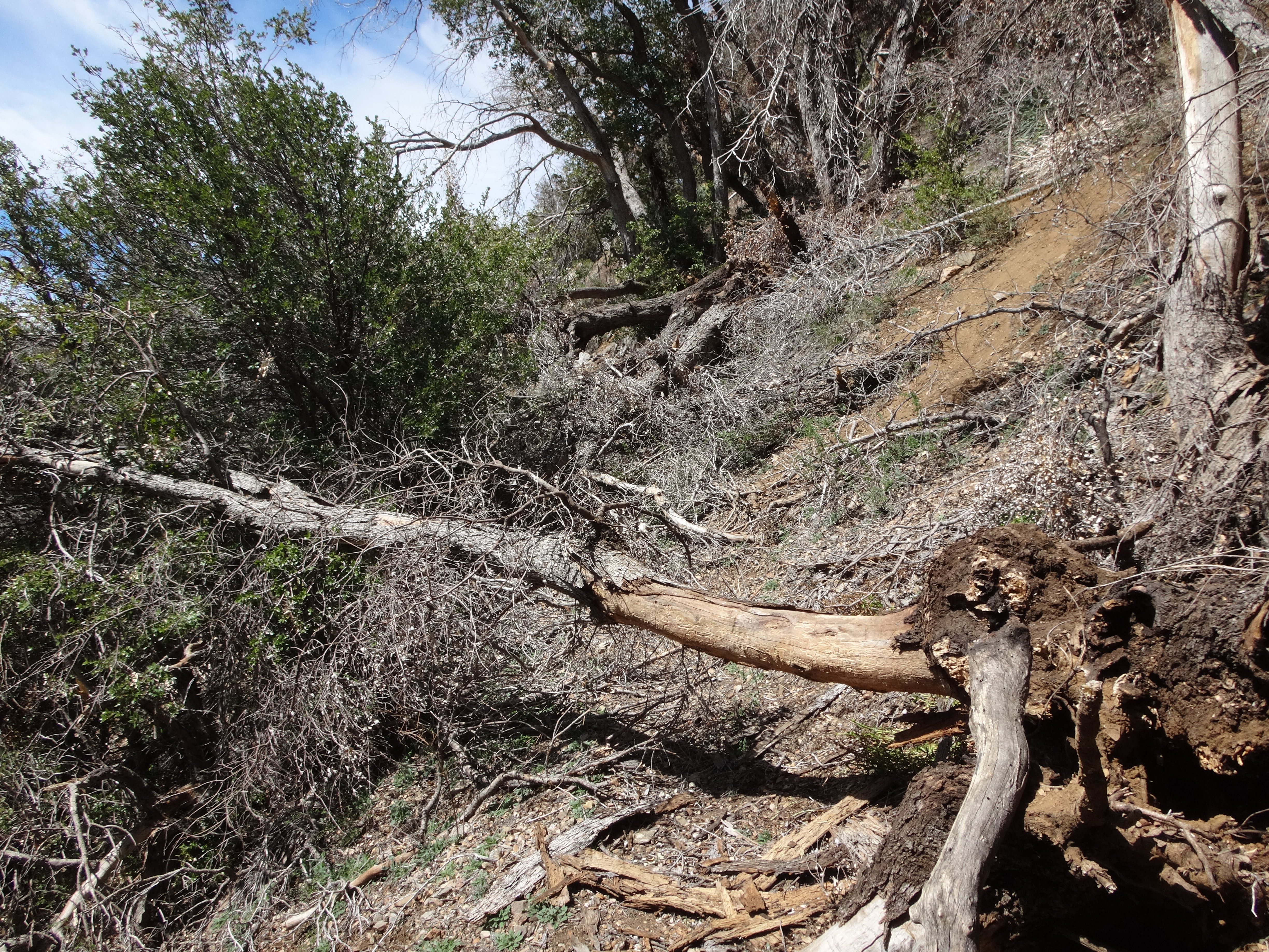
Nature continues to reclaim the Burkhart Trail. Throughout the day I encountered several tree obstacles.

Image

Image

About a mile into the trail, a clear view of my destination opened up through the canopy.

Image

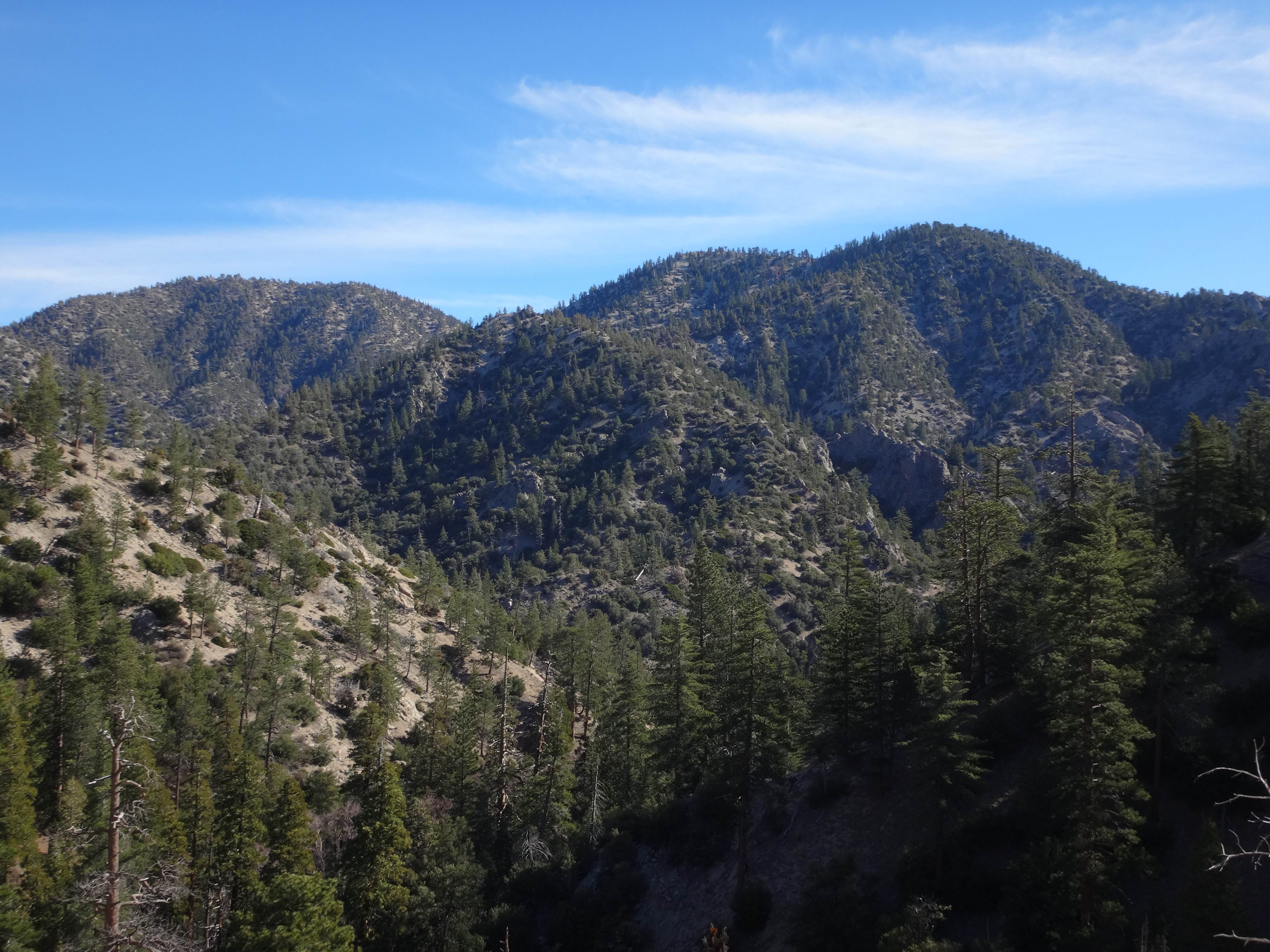
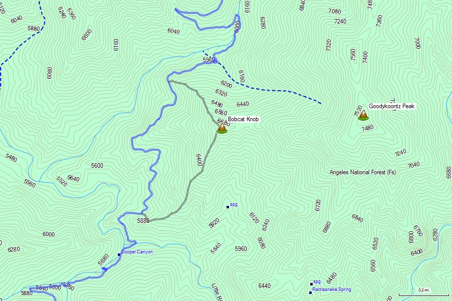
Bobcat Knob (6709') is a small bump in the Pleasant View Ridge Wilderness. Sierra Club folk often bag it en route to Goodykoontz Peak. Having done Goodykoontz twice already from the other side, I figured I'd skip it this time and make the Knob the highlight of this NHPS adventure.

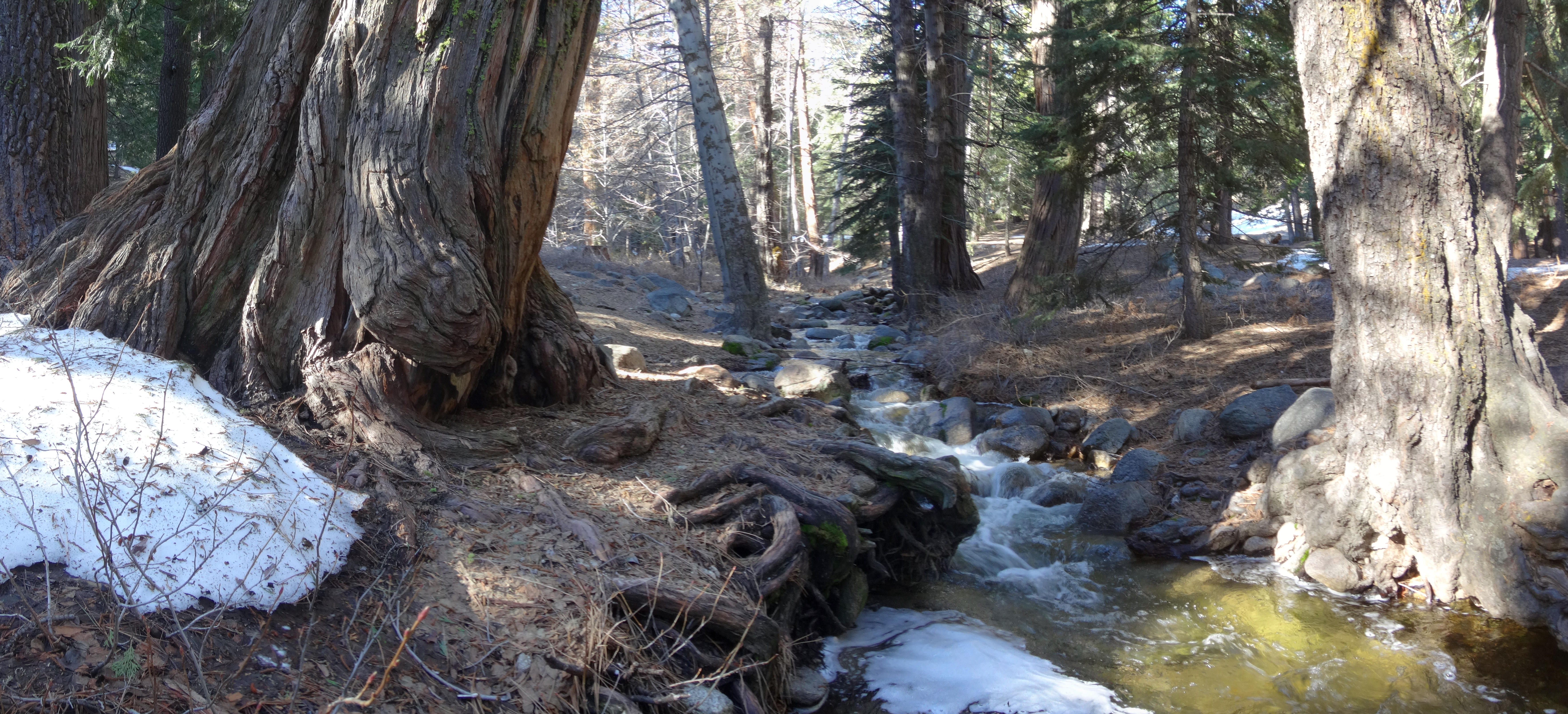
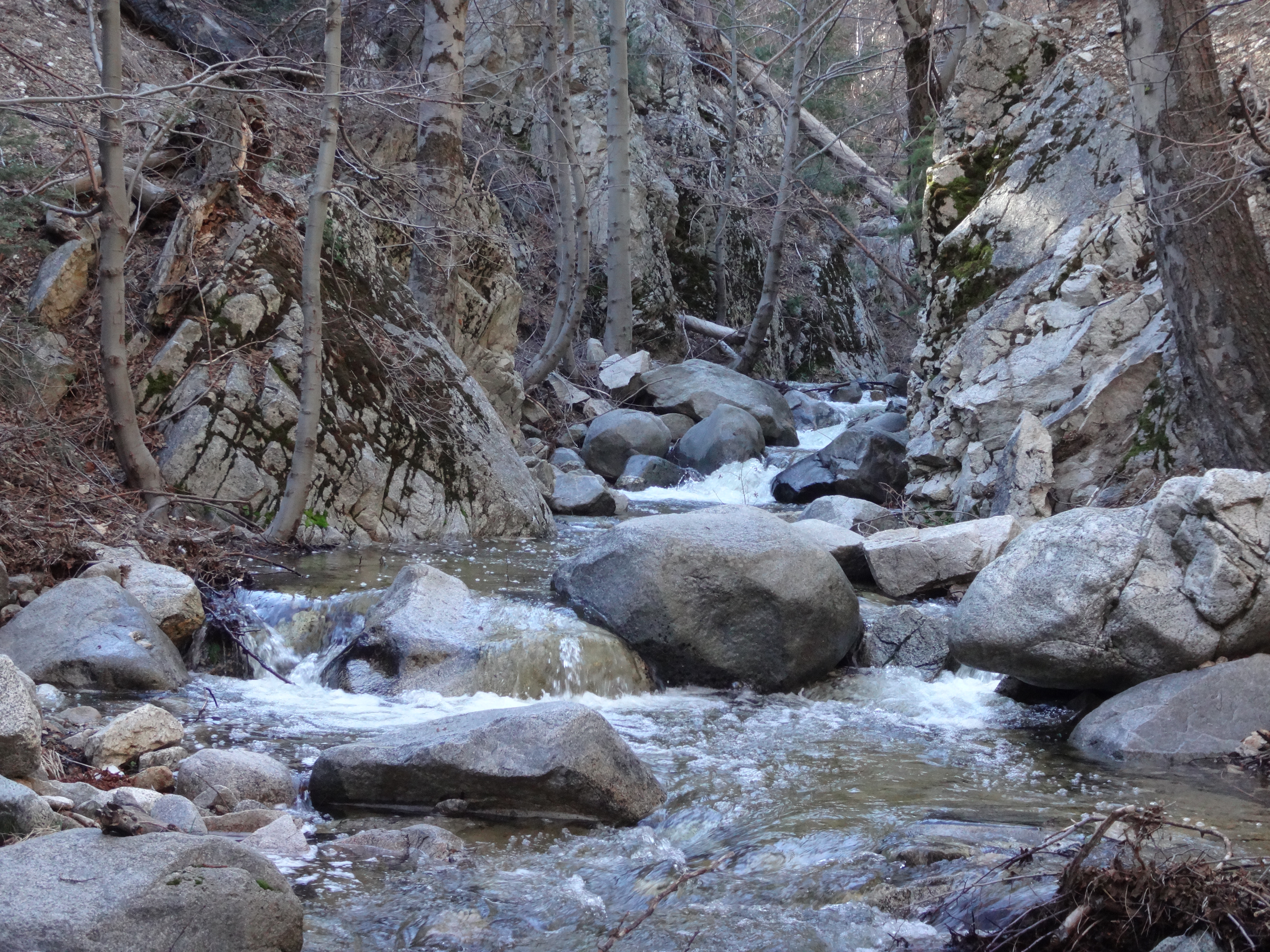
Down in Cooper Canyon, the first stream crossing looked improbable without getting feet soaked or slipping on wet rocks and logs.

Image

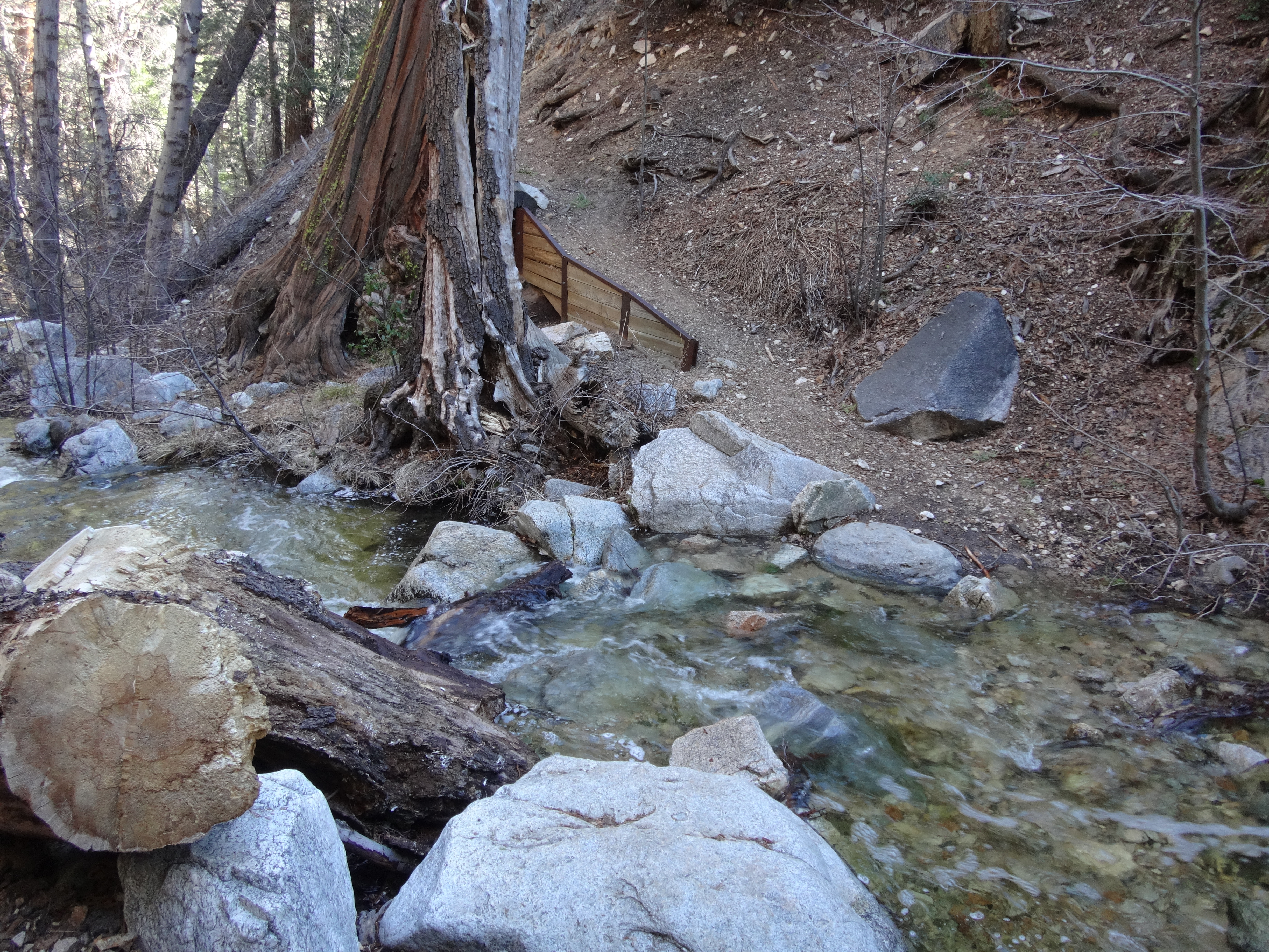
Upstream I found a better crossing and managed to stay dry.

Image

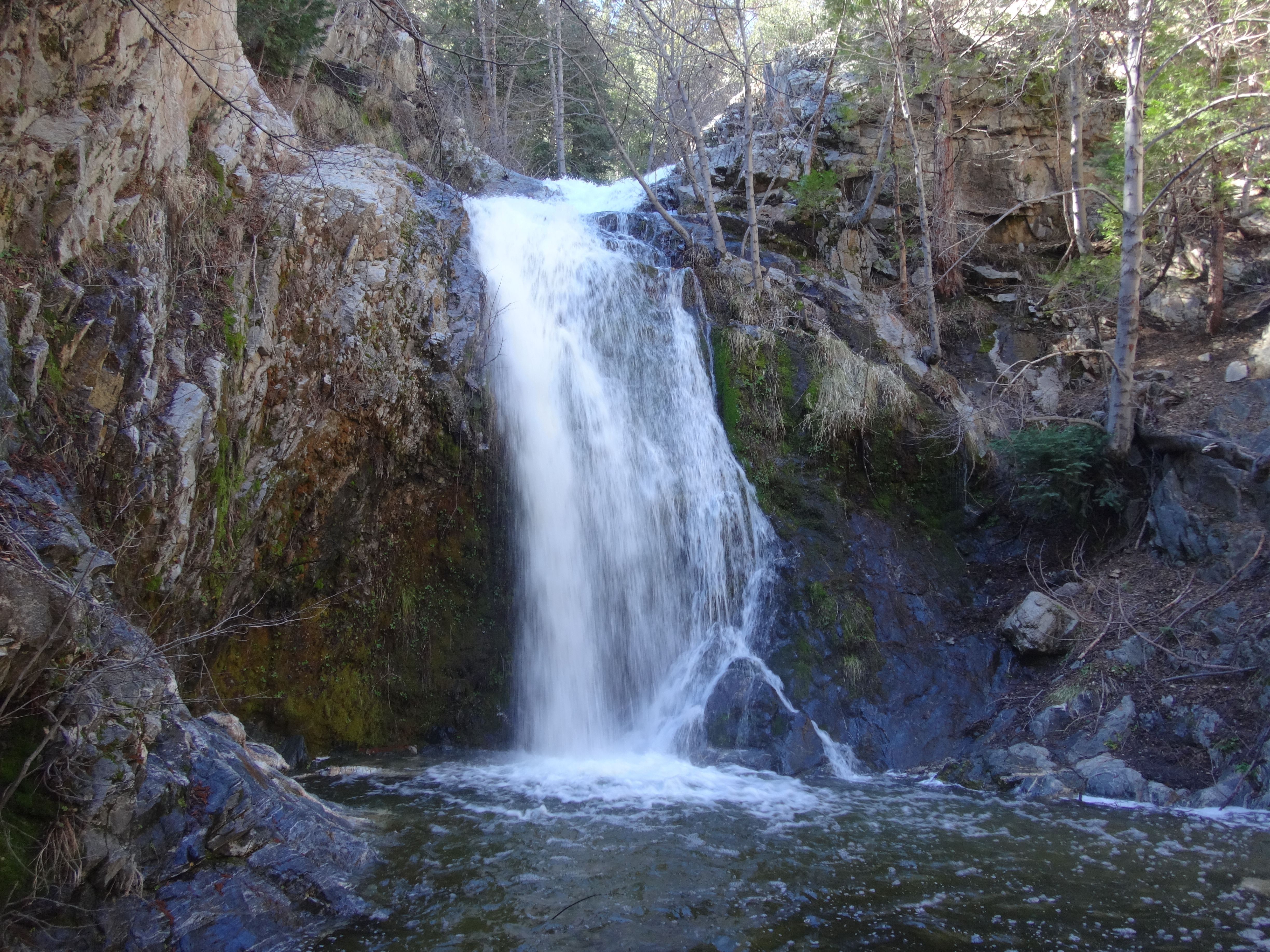
Cooper Canyon Falls demanded a quick visit. I had never seen it with so much water.

Image

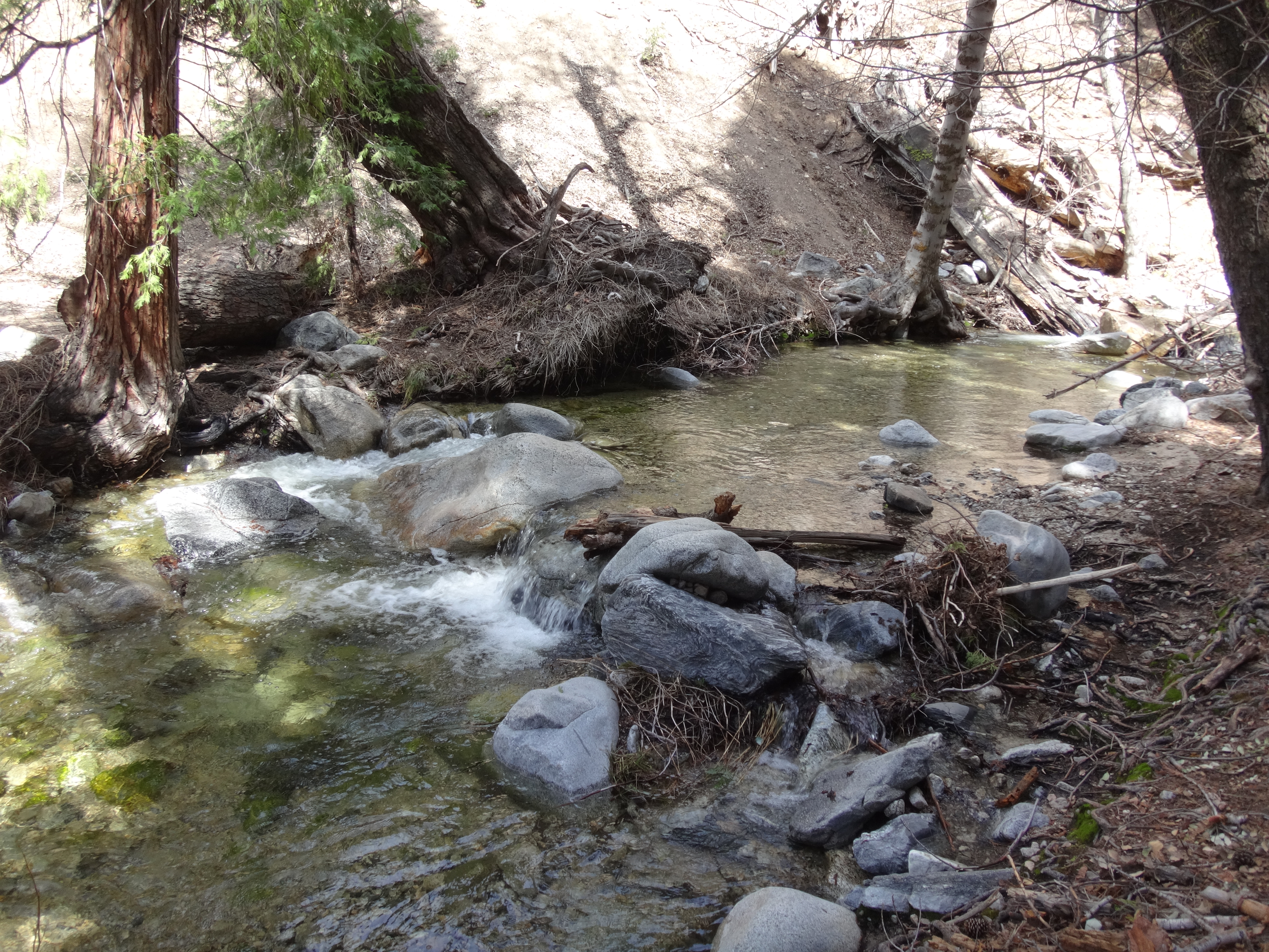
The Little Rock Creek crossing was also blocked by water. But a few yards upstream there was a better way. Though the logs here were unstable.

Image

Despite being reopened, the Rattlesnake Trail looked like crap at the junction with Burkhart. I avoided it and continued 0.2 miles around to the other side of the ridge, where I then found a nice gully-let to ascend.

Image

This got me atop Bobcat's SW ridge.

Image

The XC climb from trail to peak was a stiff 1000' of gain in 0.6 miles. I passed a few rock features and briefly contemplated a side-scramble.

Image

Image

Short on time though, I saved the rock climbing for a future date.

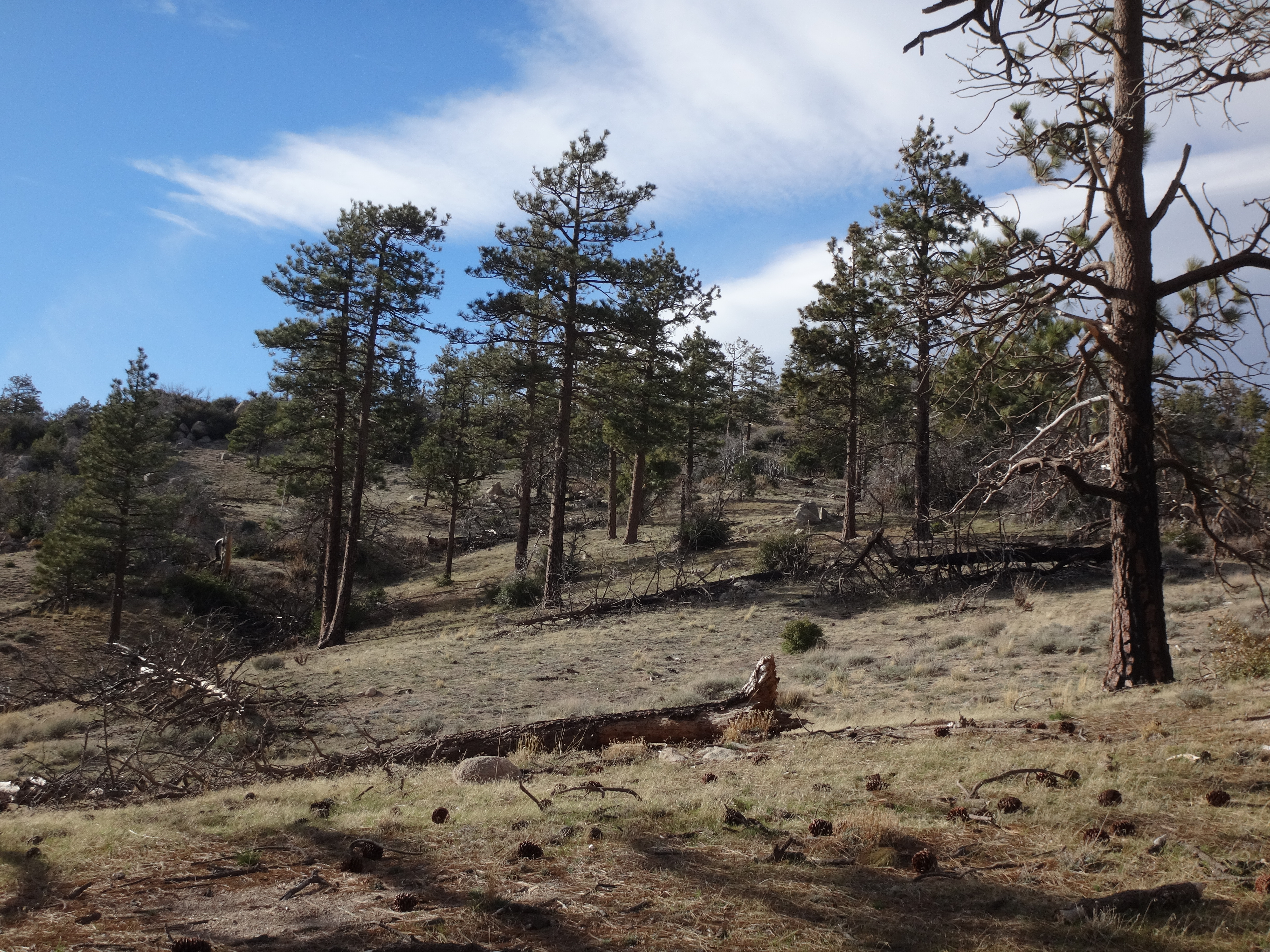
The ridge contained a periodic animal trail. Occasionally I ducked around or through trees and bushes. Nothing terrible. Around noon I reached the summit.

Image

Image

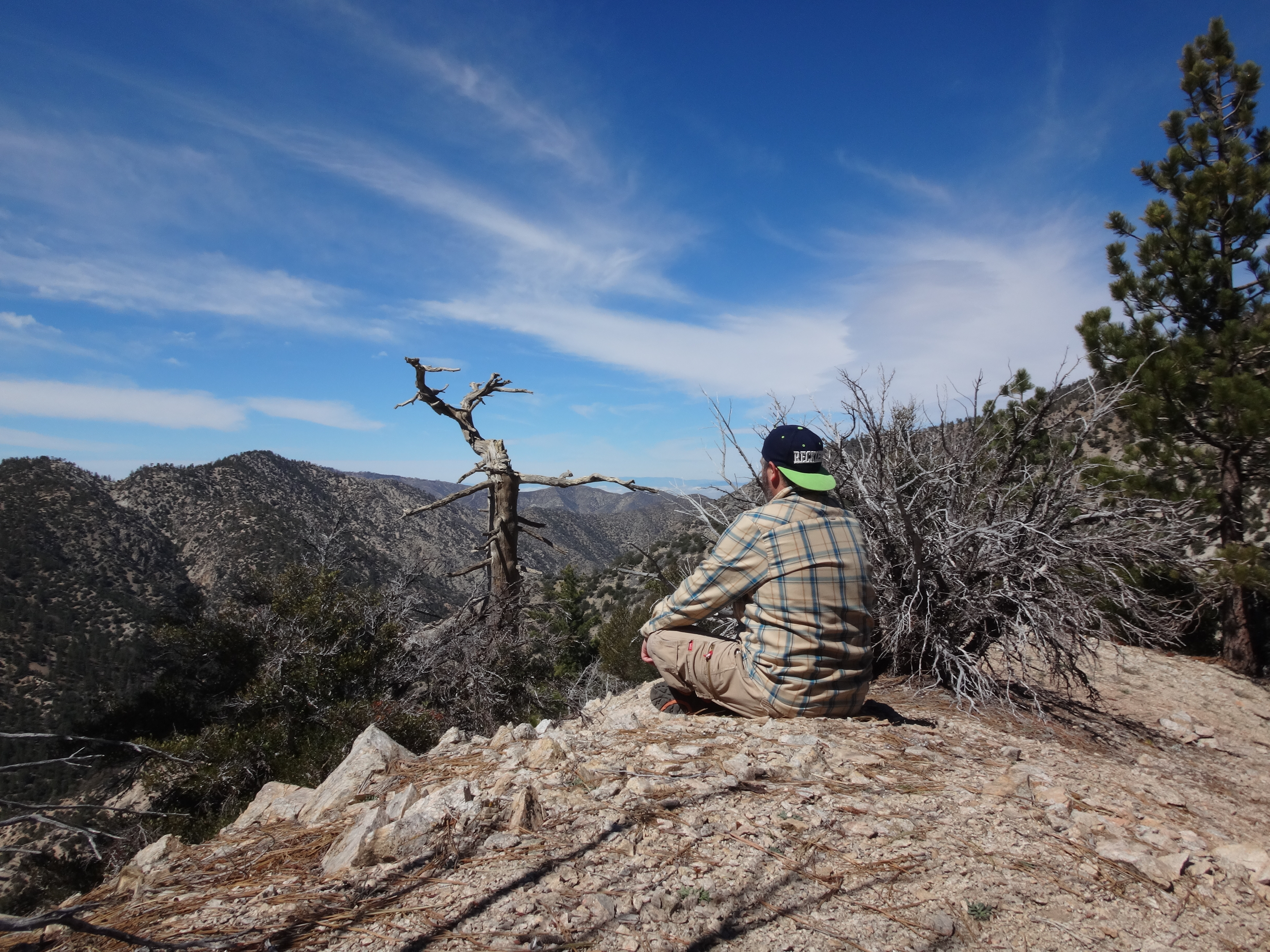
I ate lunch and checked out the views. To the south Kratka Ridge still held some snow.

Image

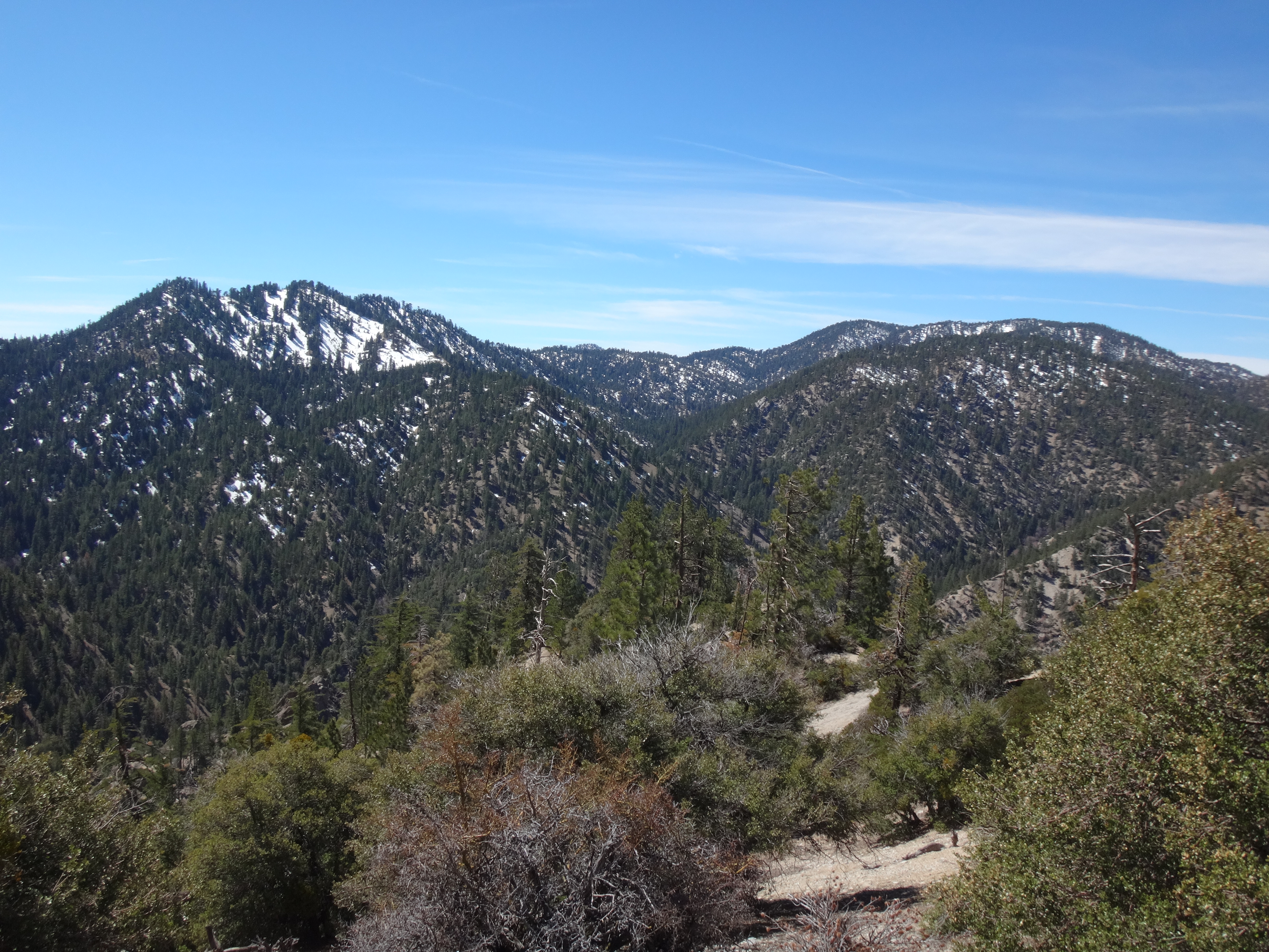
Apart from a little cold wind, the day was perfect for hanging out in the mountains. On the way down, I took the NW ridge, with big Will Thrall Peak directly across the canyon and Sierra Club cairns sporadically positioned along the route.

Image

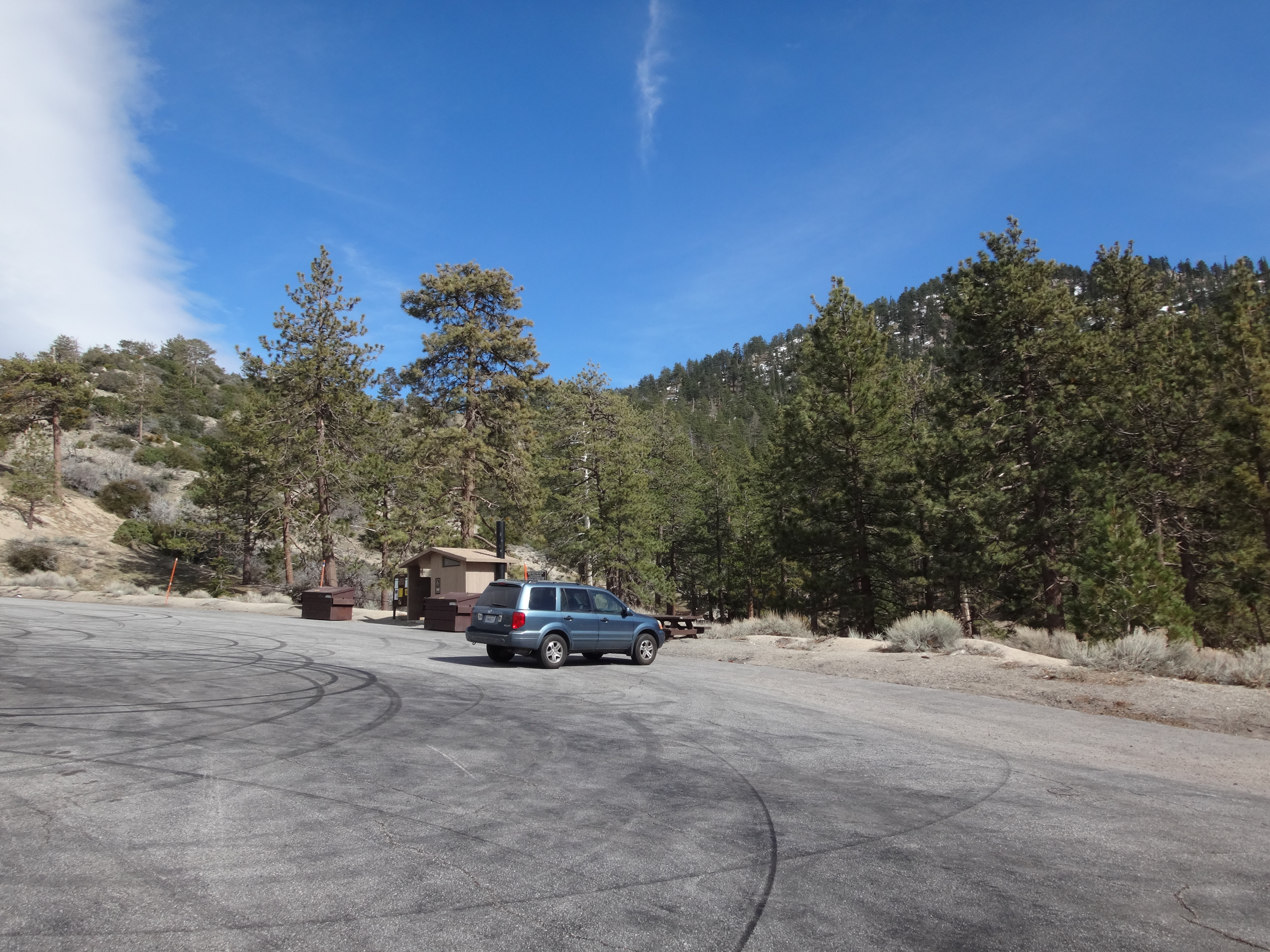
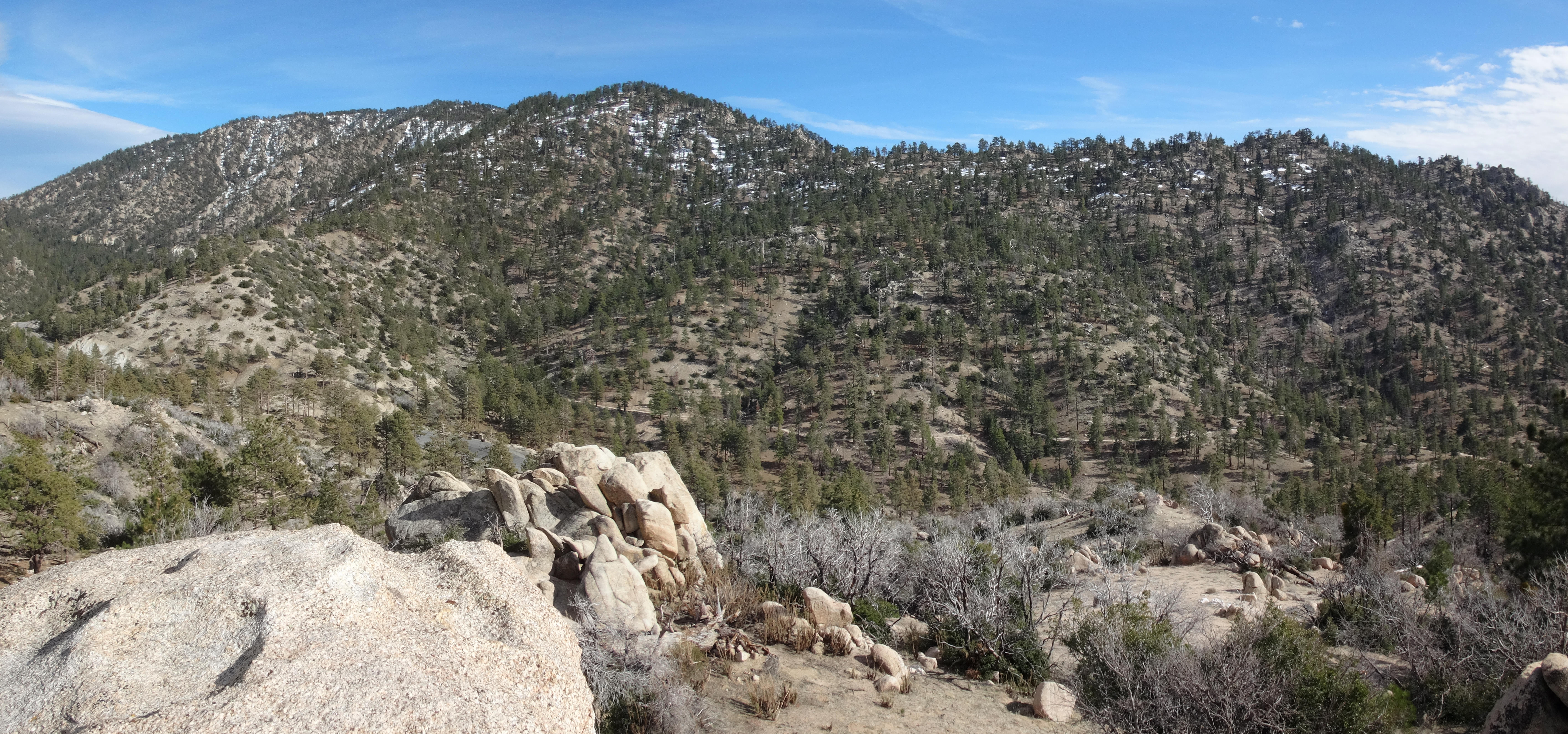
Back at the car, I drove to ACH MM 54.10 for a bonus hike. The large turnout east of Three Points offers a toilet and picnic tables. Nearby is a PCT highway-crossing.

Image

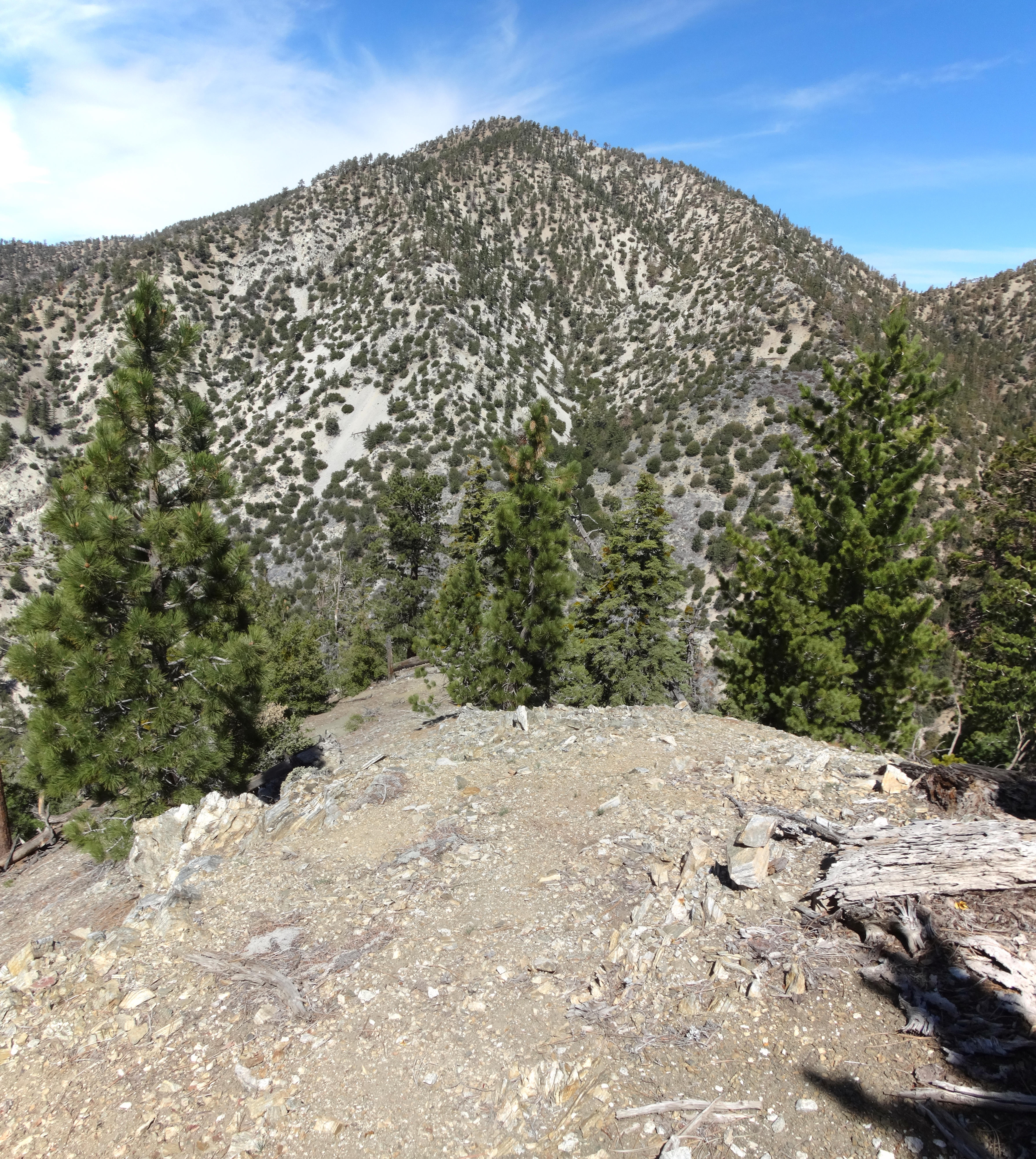
I started for Peak 6629 on the other side of the road.

Image

It's probably easiest to make a beeline up the slope from the road. But I used the trail to gain a little elevation before going cross-country.

Image

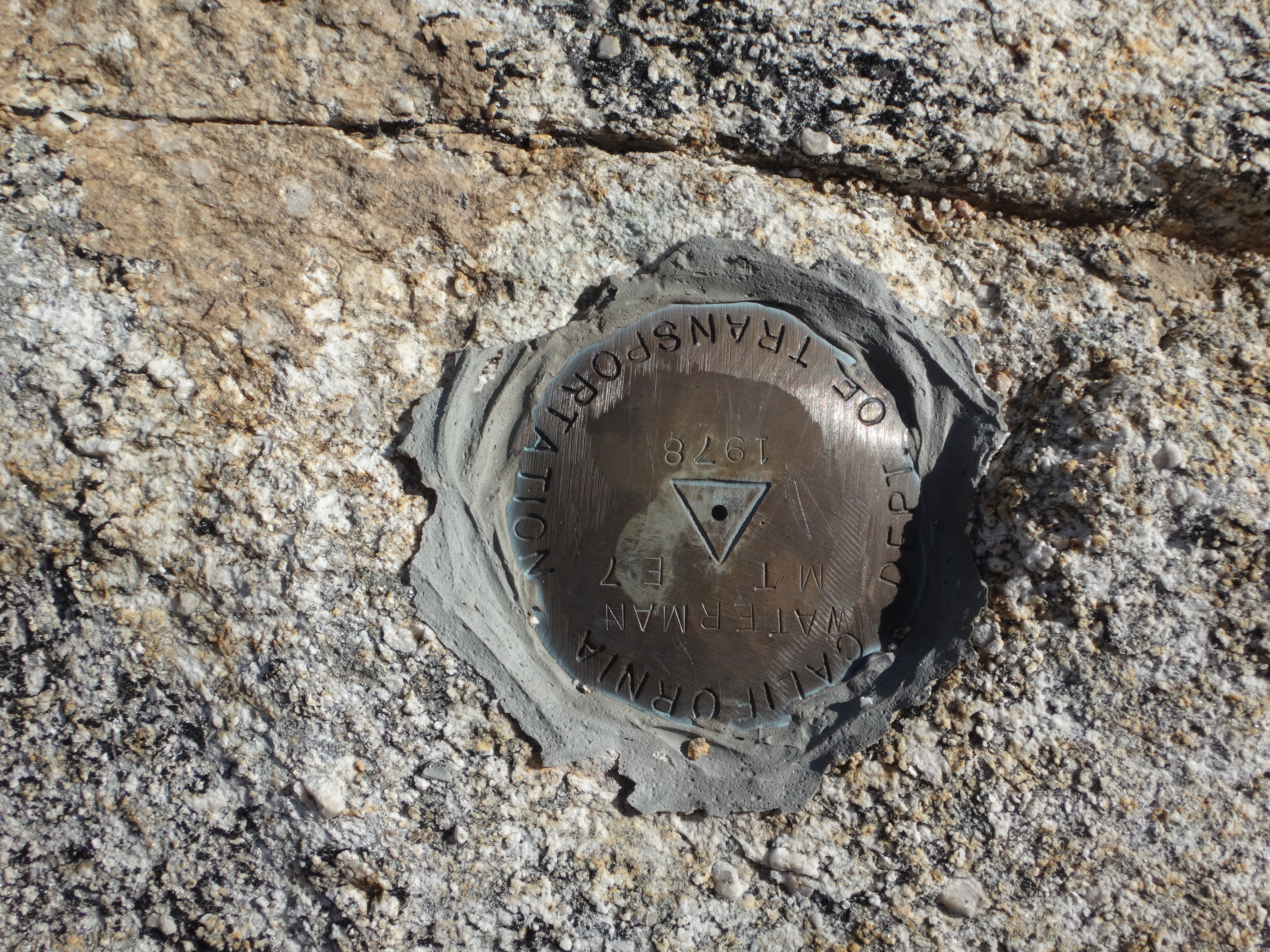
The gain was only 300' up fairly moderate terrain. DOT surveyors visited the summit in 1978.

Image

Other bumps along this ridge had rock formations which could be surmounted fairly easily. I climbed a couple of them to check out the views.

Image

Picked up and packed out from Bobcat Knob: 3 plastic bottles, 1 glass bottle, 2 aluminum cans, a shoelace, a sock, a glove, 2 bottle caps.

Image

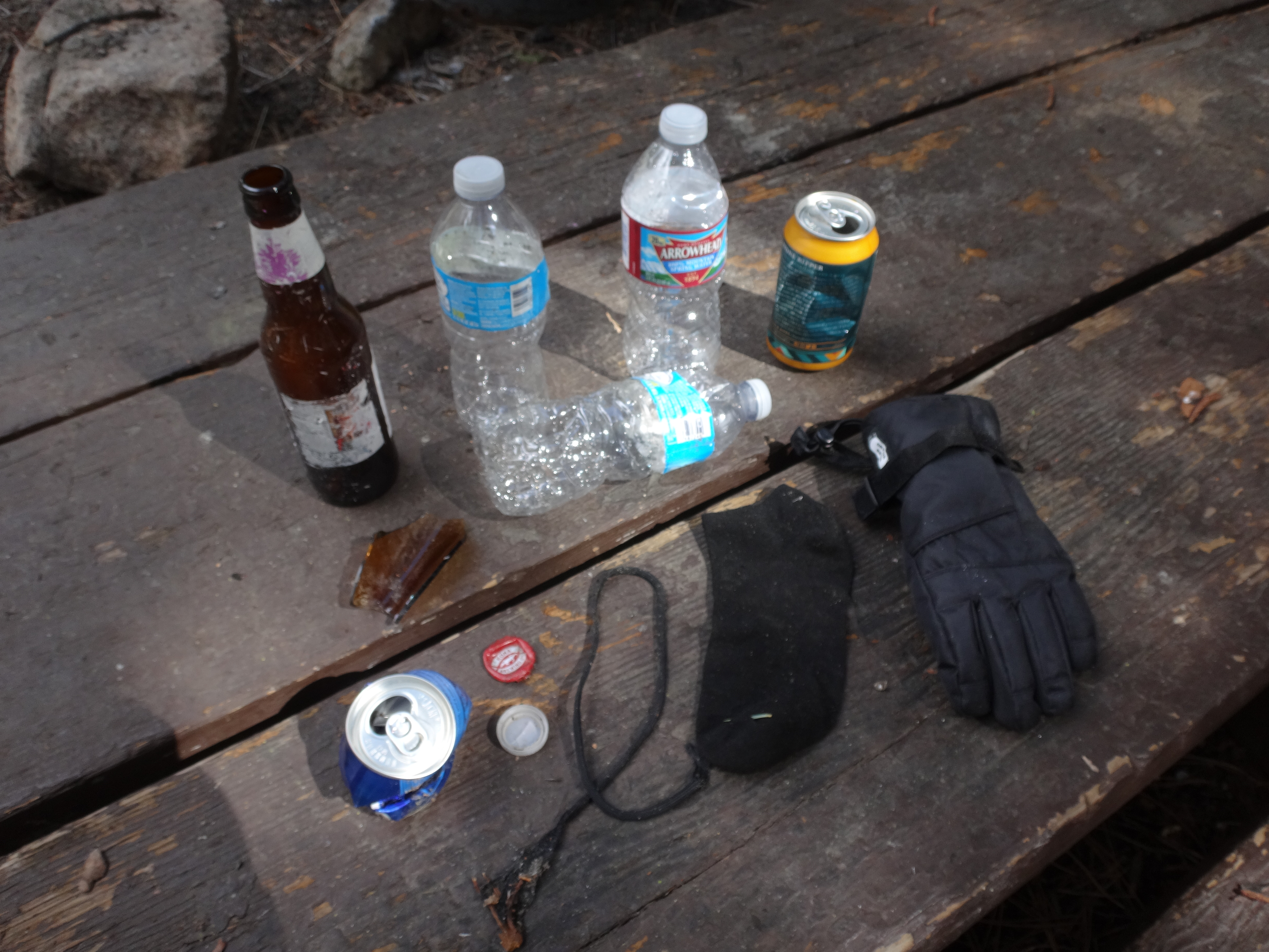
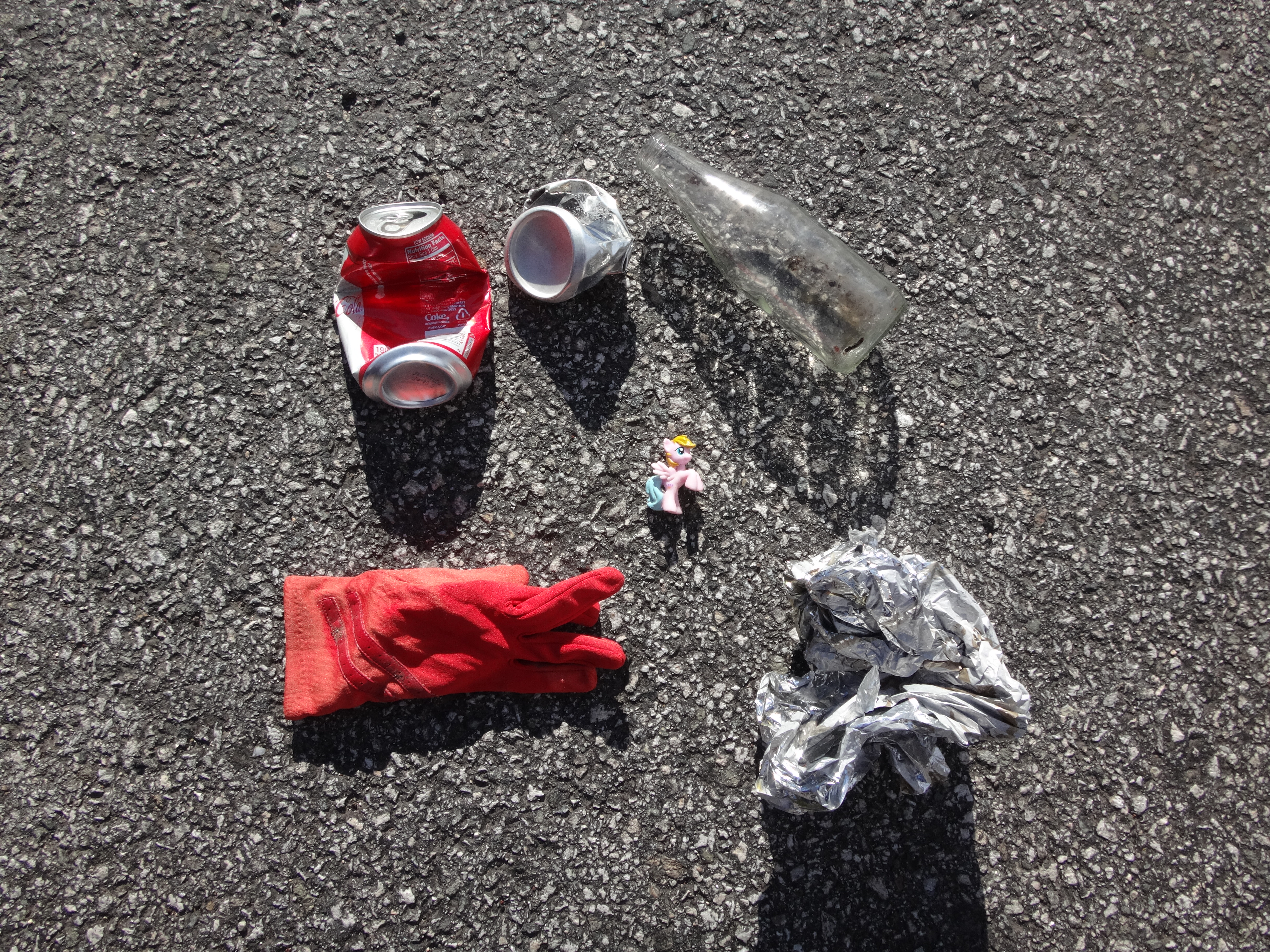
From 6629: 2 aluminum cans, 1 glass bottle, a glove, a balloon, and a My Little Pony figurine.

Image
User avatar
HikeUp
Posts: 3905
Joined: Thu Sep 27, 2007 9:21 pm

Post by HikeUp »

Nice TR. Love that area.

Topo shows your peak to be 6709' and Goodykoontz is considered at 7558' (high point south of point marked on your topo.

http://caltopo.com/map.html#ll=34.36953 ... o=r&n=0.25
User avatar
Sean
Cucamonga
Posts: 3929
Joined: Wed Jul 27, 2011 12:32 pm

Post by Sean »

HikeUp wrote: Nice TR. Love that area.

Topo shows your peak to be 6709' and Goodykoontz is considered at 7558' (high point south of point marked on your topo.

http://caltopo.com/map.html#ll=34.36953 ... o=r&n=0.25
Thanks. I fixed it and replaced the map. I forgot that Goodykoontz is the bump south of the higher point. Why would HPS do that, anyway?
User avatar
HikeUp
Posts: 3905
Joined: Thu Sep 27, 2007 9:21 pm

Post by HikeUp »

Sean wrote: Why would HPS do that, anyway?
Don't know. I would guess because it is at the end of the ridge and has good views of Williamson Rock. Maybe the views from the higher peaklet to the north aren't as good. I never went up that ridge from Goodykoontz so I don't know. I ascended the north ridge of 6709 and then over to Goodykoontz. Descended the same route. The south ridge route to 6709 was at the time in the froggy snowflake closure zone. They've lifted the closure?
User avatar
Sean
Cucamonga
Posts: 3929
Joined: Wed Jul 27, 2011 12:32 pm

Post by Sean »

HikeUp wrote: They've lifted the closure?
Yeah, the order expired in January. I even called the Ranger District to confirm that it hasn't been renewed.
User avatar
HikeUp
Posts: 3905
Joined: Thu Sep 27, 2007 9:21 pm

Post by HikeUp »

8 years ago that tree in your summit selfie had more limbs. I guess it is even more dead now.

Image
User avatar
AW~
Posts: 2059
Joined: Mon Oct 01, 2007 12:00 pm

Post by AW~ »

Cool. Love that mention of NHPS....what a waste of time it would have been to summit.
User avatar
Uncle Rico
Posts: 1413
Joined: Thu Mar 20, 2008 7:48 pm

Post by Uncle Rico »

Sean wrote:
HikeUp wrote: They've lifted the closure?
Yeah, the order expired in January. I even called the Ranger District to confirm that it hasn't been renewed.
Nice trip Sean. The Forest Service doesn't seem to be going out of its way to advertise the re-opening.
User avatar
Sean
Cucamonga
Posts: 3929
Joined: Wed Jul 27, 2011 12:32 pm

Post by Sean »

Uncle Rico wrote: The Forest Service doesn't seem to be going out of its way to advertise the re-opening.
Maybe they want to fix up the trail before inviting in the public.
User avatar
Uncle Rico
Posts: 1413
Joined: Thu Mar 20, 2008 7:48 pm

Post by Uncle Rico »

From this, I'd say the Forest Service is going to, or has already re-closed the area. No Order posted yet, but you can see where they are going with this. You must have caught the ANF folks off guard Sean.

https://www.fs.usda.gov/alerts/angeles/alerts-notices
User avatar
psykokid
Posts: 80
Joined: Fri Mar 18, 2016 1:15 am

Post by psykokid »

Uncle Rico wrote: From this, I'd say the Forest Service is going to, or has already re-closed the area. No Order posted yet, but you can see where they are going with this. You must have caught the ANF folks off guard Sean.

https://www.fs.usda.gov/alerts/angeles/alerts-notices
That's a bummer. I have a few friends of the rock climbing variety that were hoping to make it up to Williamson Rock before the re-instituted the closure.
User avatar
psykokid
Posts: 80
Joined: Fri Mar 18, 2016 1:15 am

Post by psykokid »

found the updated forest order for the williamson rock closure: https://www.fs.usda.gov/Internet/FSE_DO ... 536828.pdf

Looks like they have it extended until the end of 2018 this time whereas before it was an annual thing they renewed at the start of each year. Bummer..
Post Reply