Baldora (or is it Widco?)

TRs for the San Gabriel Mountains.
Post Reply
User avatar
dima
Posts: 1319
Joined: Wed Feb 12, 2014 1:35 am

Post by dima »

I woke up early on Sunday with vague plans concerning the old mines below San Antonio Ridge. Every possible option would involve ascending to Coldwater Saddle on the Heaton Flat trail, then traversing along the old Coldwater Canyon trail to just behind the Widman Ranch. So I just decided to do that part, and figure out the rest later.

I got to the trailhead before dawn, and the East Fork canyon was full of fog. This hung pretty low, so once up on the ridge I was looking down at it, and admiring the nice moonlit view of Rattlesnake Peak

Image

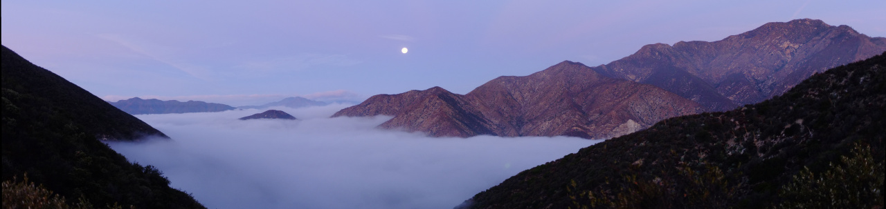
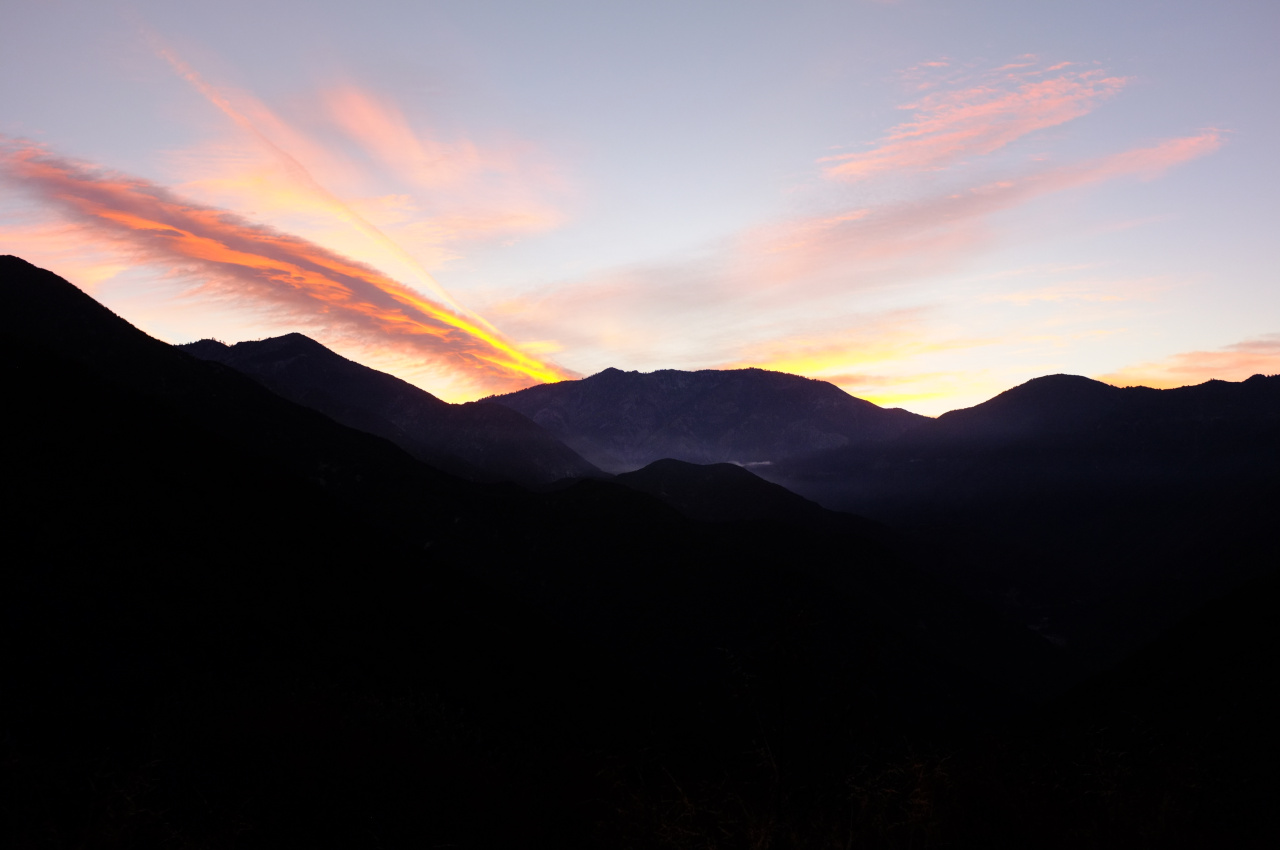
As I ascended the ridge, the sky above Ontario ridge brightened, and the backlighting made the clouds in that area cool

Image

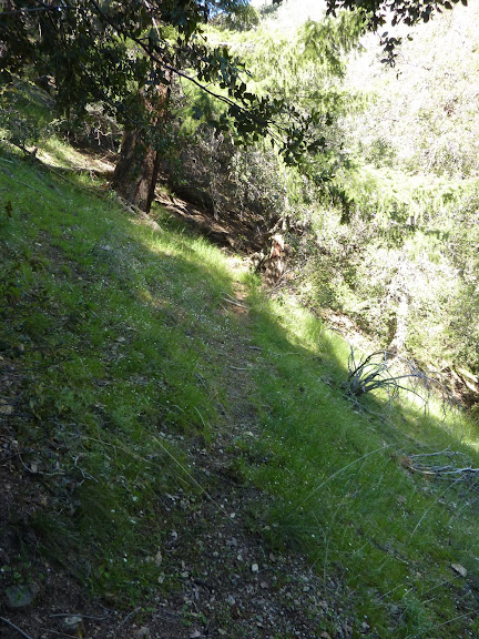
I made it to the saddle a bit past dawn, and found the entrance to the old Coldwater Canyon trail. I've never taken this trail before, and had no idea what condition it was in. Turns out the trailbed itself is in ok shape: there are a few washouts, but it's passable. The real issue is the brush. This trail hasn't been maintained in years, and it's choked off in many places. I brought my loppers with me, so the plan of the day became clear: I would clean up the trail, and visit the closest mine: Baldora (Widco?). The cleaned-up trail would make a future visit to the further mines more viable as a day trip.

OK then. From the trail, one can see the remnant of an old trail East of Coldwater Canyon

Image

This is on a ridge that doesn't go anywhere. Presumably it used to connect to something? Bighorn Ridge maybe? A bit past that, Widman Ranch comes into view. They have a pool!

Image

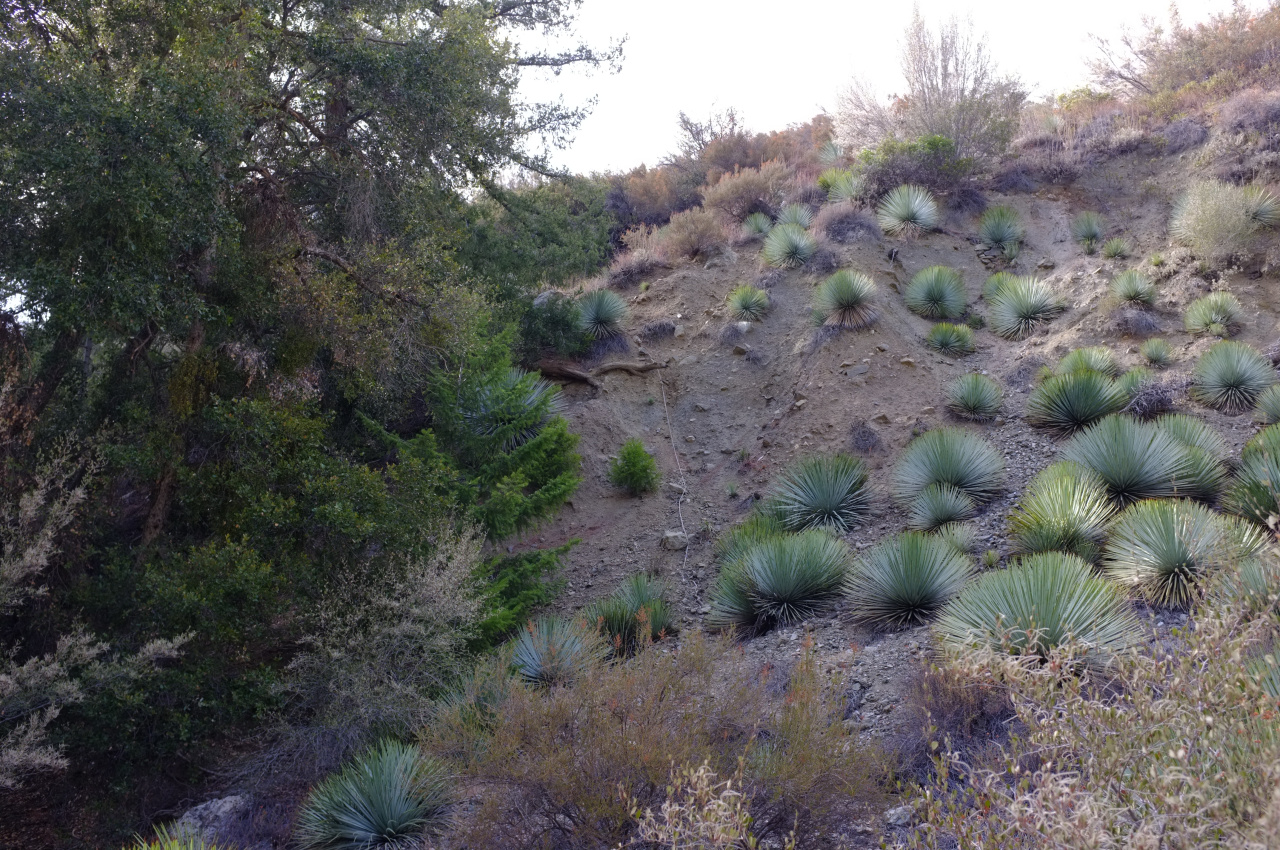
The trail work was time-consuming, but I was making good progress. Towards the end, the trail contours around a wide gully, and the old trail turns into an old road. Surprisingly, this make it significanly more difficult to pass: the yucca LOVE this old roadbed. The resulting yucca alley looks like this:

Image

I cut back the yucca where it was necessary, but in places where a bypass was in place, I left them alone: it just took too much time. The road ends unceremoniously in a washout, and a very old fixed rope is in place to aid in descent:

Image

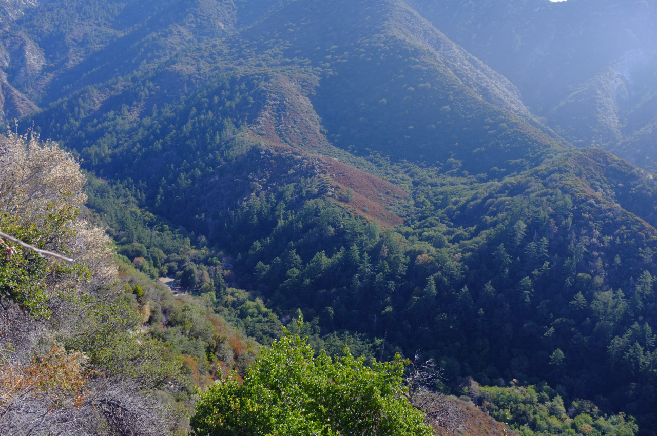
Finally, I was in the riverbed, where the going was easy. Coldwater Canyon has lots of water right now. Dry Gulch has none. Going upstream I found a cool treehouse

Image

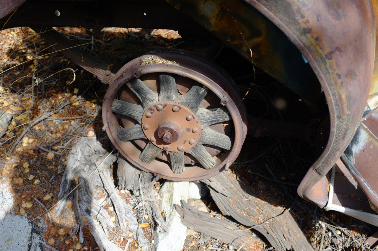
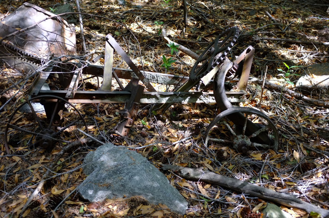
Probably used by people at the Widman Ranch. Going up into Dry Gulch, I soon found an old truck

Image

Check out the wooden spokes!

Image

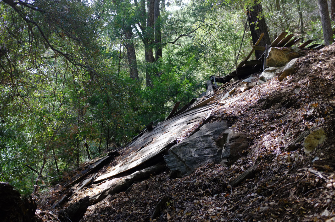
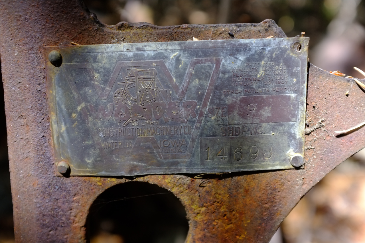
Walking more, I arrived at the mine site. There's a lot of stuff here. The first structure has collapsed:

Image

The second structure has collapsed

Image

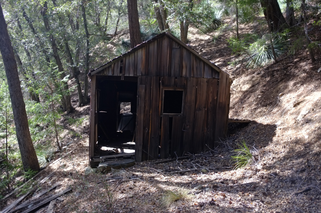
But the third structure is just fine!

Image

Image

Image

Image

I looked around for an open shaft, but found none. The topo shows two tunnels. The lower one isn't there. The upper one is high up on a steep and loose slope, and I wasn't feeling it. There are rails going seemingly nowhere, and maybe a shaft was in that area

Image

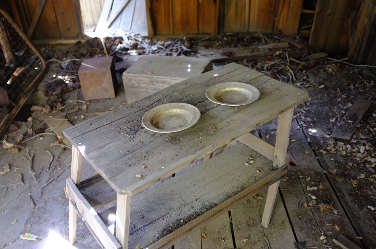
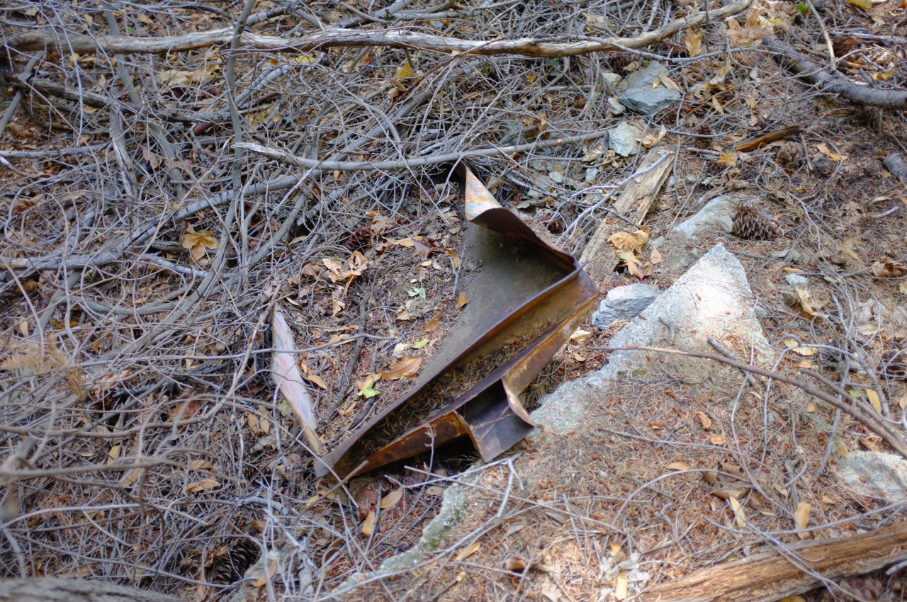
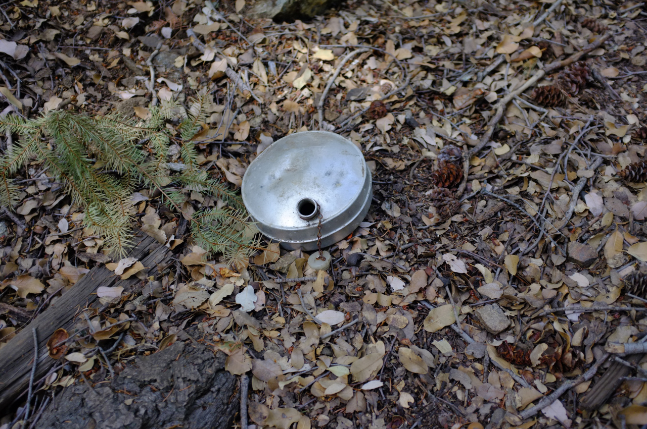
There's a ton of cool stuff scattered around

Image

Image

Image

Image

Image

Image

Image

Image

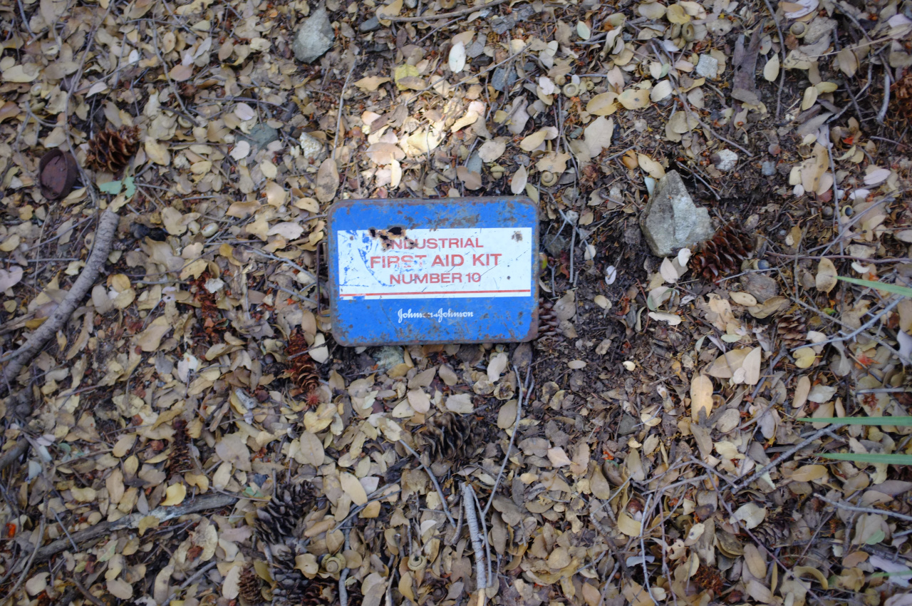
Maybe the warranty is still good?

I was feeling pretty satisfied that lots of cool stuff was found, and that nothing more interesting is up here. Then I found an old bowling pin

Image

In any case, I walked down to the border of the Widman inholding to check out their signs

Image

and then walked back the way I came. Back on the Heaton Flat trail ridge, I found this guy

Image

Image

Can anybody ID?

So that's that. If anyone has any business in that area, I'd go sooner rather than later. Probably that trail is in its best shape it's going to be for a while.
User avatar
Girl Hiker
Posts: 1318
Joined: Fri Apr 04, 2014 7:46 am

Post by Girl Hiker »

It's interesting to see what hidden treasures you find and wow!
you found a Johnson & Johnson industrial first aid kit. I wonder how old that it? I work for J & J never seen one of those lol
A cool report!
Nice sunrise picture!
Did you climb up the tree house? I would have :)
User avatar
RichardK
Posts: 727
Joined: Sun Sep 30, 2007 12:33 pm

Post by RichardK »

The spider looks like a tarantula. It's amazing what is tucked away in the San Gabes. People have been in those mountains for a couple of centuries now. A gasoline powered weed whacker with a blade instead of a string will clear a lot of trail in a hurry. The picture of the moon over fog filled valleys is really nice.
User avatar
tekewin
Posts: 1194
Joined: Thu Apr 11, 2013 5:07 pm

Post by tekewin »

Awesome trip, Dima. I've seen that trail on the map but there haven't been any recent reports out that way. There are a lot of interesting mine remains.
User avatar
Ze Hiker
Posts: 1430
Joined: Mon Jul 28, 2008 7:14 pm

Post by Ze Hiker »

Nice exploration :)

In regards to the trail you saw, there was an old trail from Coldwater canyon up to Big Horn Ridge as mention by John Robinson in his book. In fact, one of the old historical maps of the area (really cool maps btw, have more information than current) details the "Highline Trail" which begins all the way at Stanley-Miller Mine, wraps around to Allison Mine, then the saddle, then the trail you were one, then the old trail you saw, then all the way to Cattle Canyon, and I believe up again south of Lookout Mtn!

I checked out the beginning of this trail once. You can find it past the fort you saw. See here http://socalhikes.com/2010/05/east-fork ... ploration/

This is part of that trail, which would eventually lead to the part you saw:

Image

I had to turn around to head to Eagle mine. I would have loved to continue on and explore how far this trail would go, could you make it up to Big Horn Ridge easily? (Actually I think on my trip up Big Horn Ridge from Cattle Canyon, I saw remnants of this same trail just on the west side of the ridge).

You should check it out :)
User avatar
HikeUp
Posts: 3847
Joined: Thu Sep 27, 2007 9:21 pm

Post by HikeUp »

He's alive!!!
User avatar
dima
Posts: 1319
Joined: Wed Feb 12, 2014 1:35 am

Post by dima »

girlhiker70 wrote: you found a Johnson & Johnson industrial first aid kit. I wonder how old that it? I work for J & J never seen one of those lol
I suspect that's from a later visitor, not the miner. The only dated reference to that first aid kit I can find is from the 1970s::

https://news.google.com/newspapers?nid= ... 06,3771940
girlhiker70 wrote: Did you climb up the tree house? I would have :)
I didn't. Those Widman folk seem unfriendly, and I had the mine on my mind. But you should go check it out!
wrote: In regards to the trail you saw, there was an old trail from Coldwater canyon up to Big Horn Ridge as mention by John Robinson in his book. In fact, one of the old historical maps of the area (really cool maps btw, have more information than current) details the "Highline Trail" which begins all the way at Stanley-Miller Mine, wraps around to Allison Mine, then the saddle, then the trail you were one, then the old trail you saw, then all the way to Cattle Canyon, and I believe up again south of Lookout Mtn!
Interesting. Which map is this? Back in ~2005 I was at Allison Mine, and somewhere around there I recall a trail going west with a clear sign that said that it went to "Stanley-Miller mine". On a subsequent trip I tried to find the trail and sign again, but they just weren't there. Do you recall seeing anything? I don't remember how good the trail looked, but I'm 100% sure a sign was there.
wrote: I checked out the beginning of this trail once. You can find it past the fort you saw.... I saw remnants of this same trail just on the west side of the ridge).

You should check it out :)
Will do.
User avatar
psykokid
Posts: 80
Joined: Fri Mar 18, 2016 1:15 am

Post by psykokid »

Nice pics and some cool finds.

The sunrise Sunday morning (once you were above the marine layer) was pretty spectacular. I was heading up register ridge again for giggles and hit the Summit of Harwood about 5 min before sunrise. Almost got blown over once I hit the summit though, the wind was fierce up high..

The "treehouse" is actually a deer stand. If you go back to that area and look there are more than likely sight lines cleared, radiating out from the stand..
User avatar
Ze Hiker
Posts: 1430
Joined: Mon Jul 28, 2008 7:14 pm

Post by Ze Hiker »

In this link you can get the .kml to loads up old topo quadrants (need to click on each to download and show it). Enjoy!

http://hikingscience.blogspot.com/2010/ ... pping.html
User avatar
AW~
Posts: 2038
Joined: Mon Oct 01, 2007 12:00 pm

Post by AW~ »

Nice....I always think I'll head out that way to check out elevation 5200-5600 of Coldwater canyon to see if there is a waterfall there. Maybe I can get someone to go out there and check it out...hehehe...there might be a cabin in the mix that way. There is a 'Smith Cabin' on a map.
User avatar
dima
Posts: 1319
Joined: Wed Feb 12, 2014 1:35 am

Post by dima »

So the deer stand is for hunting? You hang out up there waiting for deer to walk by?

AW: which map has a "Smith Cabin"? I looked at all the USGS 7.5" topos and they only have old trails.
User avatar
AW~
Posts: 2038
Joined: Mon Oct 01, 2007 12:00 pm

Post by AW~ »

dima wrote: AW: which map has a "Smith Cabin"? I looked at all the USGS 7.5" topos and they only have old trails.
http://www.lagoldmines.com/images/12topo2.jpg
User avatar
psykokid
Posts: 80
Joined: Fri Mar 18, 2016 1:15 am

Post by psykokid »

dima wrote: So the deer stand is for hunting? You hang out up there waiting for deer to walk by?
Pretty much sums it up.

Long story: You go out and scout an area well before deer season to see which game trails are being used. Once you narrow down an area where you think deer might be coming through you build your stand in advance so that the deer are used to it being there. Once the season opens you hang out in the stand and wait for one to happen by and hope you get off a good shot.
User avatar
scottawr
Posts: 115
Joined: Tue Nov 12, 2013 12:41 pm

Post by scottawr »

I've Brennan wanting to head out that was and check
Out the Widco and eagle mines. I feel like that area of the san gabes still has a lot of stuff hidden away.
User avatar
Sewellymon
Posts: 97
Joined: Tue Feb 12, 2008 8:55 pm

Post by Sewellymon »

Always enjoyed exploring the terrain and mines above Widman Ranch (mid- 70's). Sometimes I'd prefer taking the longer dirt road up Cow and Cattle Canyon .. 10 miles I recall? Bummer that approach is off limits....
User avatar
missy
Posts: 83
Joined: Thu Jul 31, 2014 2:14 am

Post by missy »

Cool find! I think the Smith Cabin refer to Charlie Smith the miner of the Gold Dollar and Eagle mines and former manager of Rincon Camp Resort? He was asleep in his cabin when a giant avalanche took him and his cabin down to his death. I'd be interested in that Bighorn Ridge trail. Crazy how it was a popular trail back in the day but now completely vanished.
User avatar
CrazyHermit
Posts: 343
Joined: Mon Sep 07, 2015 1:03 pm

Post by CrazyHermit »

Awesome photos. That mine's name is Widco AND Baldora. Not too many people go there anymore. Great to see some recent shots.
User avatar
dima
Posts: 1319
Joined: Wed Feb 12, 2014 1:35 am

Post by dima »

CrazyHermit wrote: Awesome photos. That mine's name is Widco AND Baldora. Not too many people go there anymore. Great to see some recent shots.
Did you ever find the adit? I'm assuming the rails used to switchback quite far uphill. Yes?
User avatar
CrazyHermit
Posts: 343
Joined: Mon Sep 07, 2015 1:03 pm

Post by CrazyHermit »

dima wrote:
CrazyHermit wrote: Awesome photos. That mine's name is Widco AND Baldora. Not too many people go there anymore. Great to see some recent shots.
Did you ever find the adit? I'm assuming the rails used to switchback quite far uphill. Yes?
The tunnel is probably covered over by brush. Here's what it looked like in 1993...
baldora_tunnel.jpg
User avatar
wesweswes
Posts: 54
Joined: Tue Feb 12, 2019 10:59 pm

Post by wesweswes »

What's the deal with Widman ranch: is it still kept up and used? I did some internet searching and found an NF application to maintain a road to the place, so I guess people still live there??
User avatar
CrazyHermit
Posts: 343
Joined: Mon Sep 07, 2015 1:03 pm

Post by CrazyHermit »

According to the forest service site there's a trail that goes from Widman Ranch to the Eagle Mine. Must be a very old post though ....

The Gold Dollar Trail is 1.4 miles long. It begins at Widman Ranch and ends at Eagle Mine. The trail is open for the following uses: Hiking
User avatar
Sean
Posts: 3749
Joined: Wed Jul 27, 2011 12:32 pm

Post by Sean »

wesweswes wrote: What's the deal with Widman ranch: is it still kept up and used?
Yes, there is usually someone living there. Try to avoid the section of road passing through the property.
User avatar
Sean
Posts: 3749
Joined: Wed Jul 27, 2011 12:32 pm

Post by Sean »

CrazyHermit wrote: According to the forest service site there's a trail that goes from Widman Ranch to the Eagle Mine. Must be a very old post though
I've seen remnants of that trail, but I don't recommend trying to follow it.
Post Reply