It was my last week of being unemployed, yes I once again joined the rest of the working stiffs. I skipped the unusual sights at the annual Claremont parade and drove to Mammoth instead, arriving five minutes after the ranger station closed for the day. As a consolation, the Mammoth Brewing Company had a live band playing outdoors so it was a nice place to hang out for a while. I had a 395 and something else that was not remarkable enough to remember the name but the vibe was cool.
Tuesday I was second in line for permits and scored the last of four for route AA10, John Muir Trail North of Devil's Postpile. Officially it starts from the Agnew Meadows shuttle stop, but I went all the way to Rainbow Falls and walked from there. Technically that part is a dayhike due to my permit.....
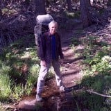
After an uninspiring trip to the falls I walked to the top of the Postpile, I had visited that spot a few years ago. Finally heading north, I escaped the crowds once I passed the Minaret Falls trail and then it was just me and the mosquitoes. Lots of them. All over the place. Everywhere I walked. They kept me from taking breaks and really appreciating the nice views, since water was involved in most of that. I did see quite a few southbound hikers along the route, trying to make it to Red's before the grill closed. My first night was near the Shadow Creek bridge crossing, which is also a bailout point since another trail goes from there back to Agnew Meadows. I had a huge campsite all to myself, except the skeeters didn't go away when it cooled off like they are supposed to do. I had to kill about six more when I scrambled into the tent that evening.
Wednesday I was up and ready to go in record time, I'm usually very slow in the mornings but this day hit the trail by 7am. This was a time for the iconic views of Banner Peak, which towers over both Garnet and Thousand Island Lake. I took a nice long lunch break at TI, where the PCT rejoins the JMT for the trip to Yosemite. But I had a big day planned, heading over Island Pass and Donahue Pass still ahead of me. Island was easy from this side, although it's not marked and the only way I even knew it existed was due to the Halfmile app on my phone. Coming from the other side it's more like a real pass since I had quite a bit of downhill to the Rush Creek junction. From there I saw lots of water while I was trying to figure out exactly where Donahue Pass was hiding. I managed to get my feet wet a few times but not enough to make me change my socks. Going up Donahue took just about forever and I lost the trail in the snow near the top - fortunately there were people milling about up there. Down from there was more of the same, I completely lost the trail at the bottom of a snow field so another hiker and I pulled out our phones to use the GPS apps while locating the trail. I'm glad I went this direction, that's a lot of sunny uphill for the traditional southbound route. After another wet crossing of Lyell Creek I wandered down through the woods and found a camp spot at the crowded bridge crossing. This was a long day, nearly 12 hours total on trail for 15 miles.
Thursday promised to be an easy day, with a few hundred feet of downhill and then miles of nearly level walking through Lyell Canyon. I planned to catch the 4:10 bus from Tuolumne Meadows back to Mammoth and after two longer days I was almost a full day ahead of schedule. The walk through the canyon was outstanding, for long periods of time all I could hear was water in the creek, birds singing and my own footsteps. That is truly living... After a few hours I saw more people, including plenty of dayhikers out to see the sights. Since the signage is actually pretty bad I asked for help when I was looking at signs pointing to Tuolumne in two different directions. I got to the campground before noon so I had lots of time to kill. I had a hot dog and fries from the grille and then walked around the meadows for a couple hours before hanging out with the PCT hikers. The demographic in that area is interesting, the two outside picnic table areas are obviously split between tourists and hikers.
Total for the trip about 38 miles including playing tourist at TM. Highest point 11,050 at Donahue Pass, lowest about 7,500 for Rainbow Falls.
Pics below:

Rainbow Falls. I didn't see a nice show of color this day.

Devil's Postpile tourist shot.

Rosalie Lake, maybe my favorite rest stop ever.

Shadow Creek falls, camped about 100 feet from here. Quite noisy.

Garnet Lake, Banner Peak in the background.

Long lunch break at Thousand Island Lake.

Unnamed lake at Island Pass. Lots of tadpoles swimming around the shores.

Sierra staircase going up Donahue Pass. Lots of flowers blooming too.

Entering Yosemite. I'm a native Californian, took me 54 years to get here.

Lyell Glacier, headwaters of Lyell Creek.

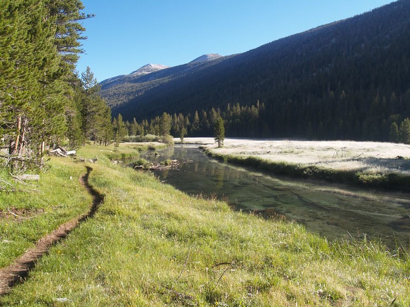
Trail near Lyell Creek in the morning. Peaceful easy feelin'.

Cooling my feet in Tuolumne River. This is also where I dropped the Nikon into the water.

Lembert Dome in Tuolumne Meadows area.

Tuolumne River, Cathedral Peak in the distance.