South-approach Stoddard Report and Loss of Access...!!

TRs for the San Gabriel Mountains.
Post Reply
User avatar
hikeandhike
Posts: 46
Joined: Mon Sep 09, 2013 7:20 pm

Post by hikeandhike »

Video of the hike:

(Sorry, shaky in the beginning with the wind, smoother after)

Image

I’ve always been intrigued by the sharp ridgeline running south to north right along Mt. Baldy road, just south east of the firestation. I scrambled up it once in the past, just to look around, but didn’t get to actually hike the trail. Came across this link on SummitPost

(http://www.summitpost.org/stoddard-peak/282203), which describes taking the ridge to Peak 4324, then following it to Stoddard Peak. Armed with this knowledge, I took the opportunity to hike this ridge.
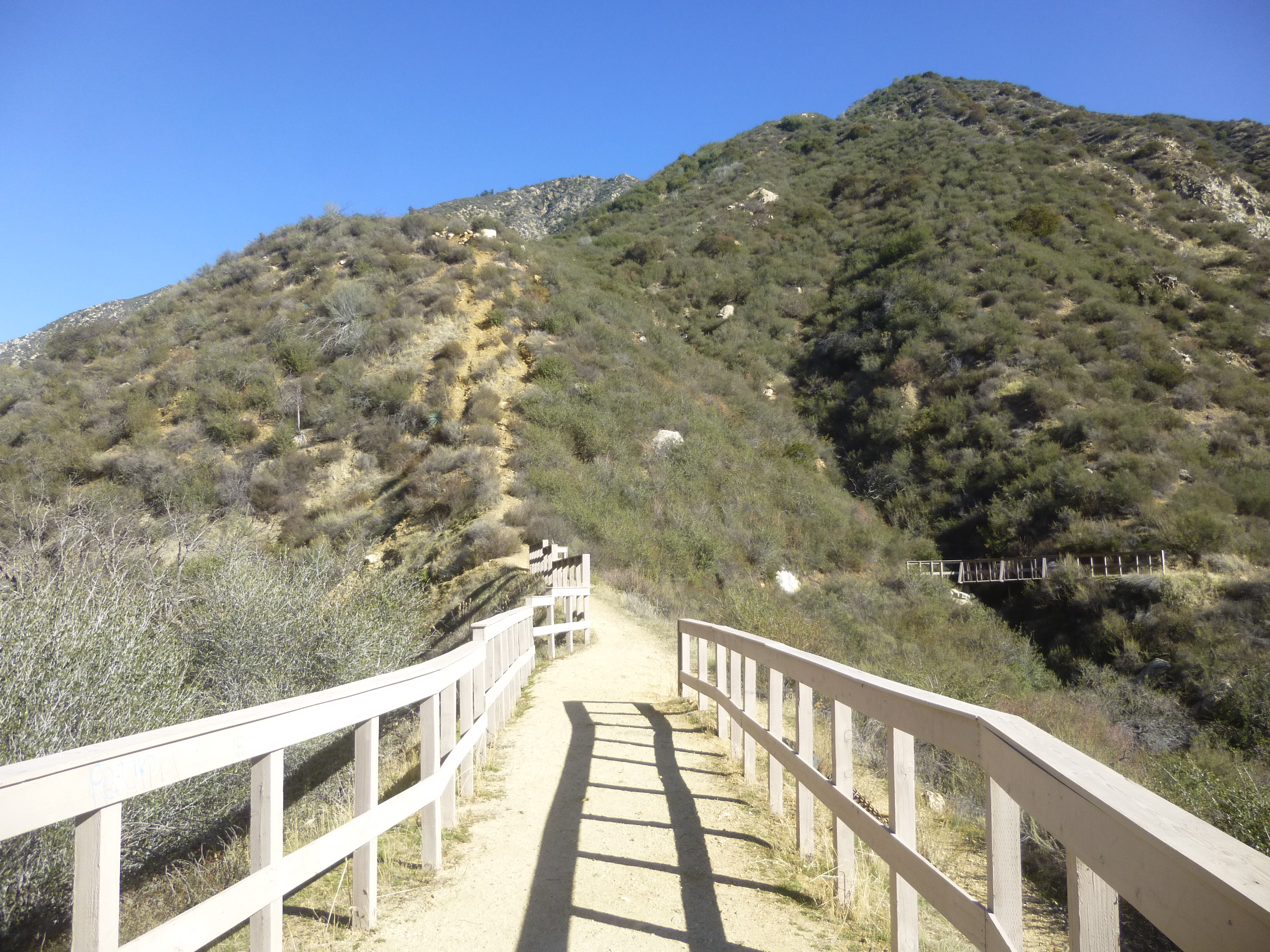
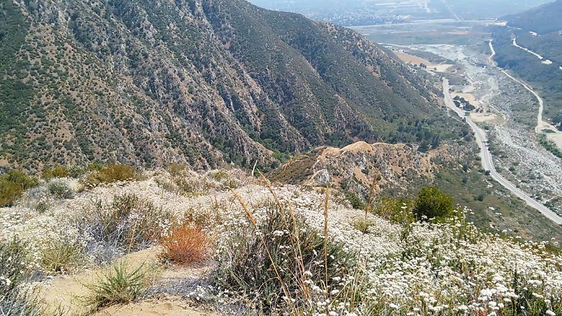
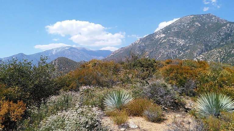
The trail starts near an interpretive signpost just SE of the firestation. I took this all the way to the ridgeline (watch for the intersection in the trail going southeast or you’ll go too far north). The ridge sharply climbs for roughly ½ mile, gaining a lot of elevation. The trail is fairly clear here, and decently wide, but very, very steep, and offers nice views of the Stoddard Creek Canyon, and just a hint of the many waterfalls (often dry) trickling into it and through it through the dense foliage below. The view back into Upland would have been outstanding, except for a thick carpet of smog, visible in the video.
There are a few planted trees along this ridge, struggling to survive in the exposed sun and dry heat, no more than a foot tall at best. I took several breaks along this portion of the hike, thankful for the large supply of water I brought. At times, the incline would have forced me to almost crawl up, were it not for my trekking pole.

Image

Eventually, I reached a series of saddles and false summits. The going became noticeably easier in terms of elevation gain, but the trail was rough and fairly overgrown at parts. A plant that looks frightenly like Poodle Dog Bush is in abundance along one portion and there is no escaping it. I’m familiar with Poison Oak, but have only seen warning signs about Poodle Dog Bush, and hopefully this wasn’t it.
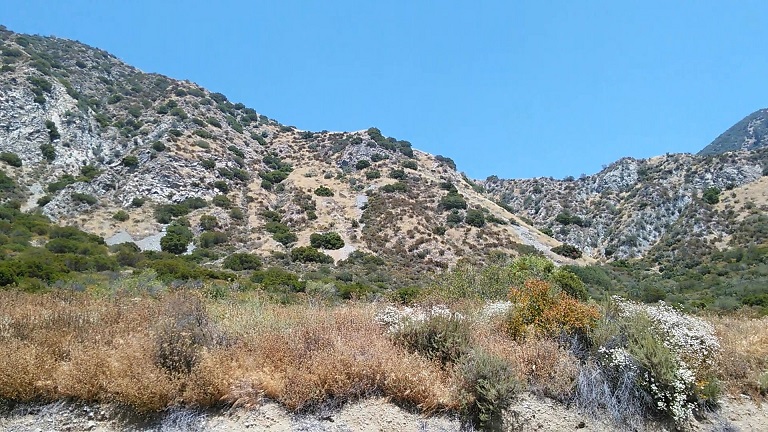
Finally made it to the Peak 4324 summit. There are several small rock cairns marking it but otherwise it’s empty. Nice views to be had here of the Cucamonga foothills to the East, Stoddard Creek Canyon below, through San Antonio Canyon both south and north, and Mt. Baldy due north.

Image

After another break for photos and videos, I kept on going, confident that Stoddard Peak was close. Should have relied more on my GPS, because I was a little farther away then I thought. Eventually, the path became mostly blocked with thick brush with thorns. After attempting to hack through this with the pole, I called it a day and headed back. In my video, I falsely thought I had possibly made Stoddard Peak, but the actual peak is visible, about a 30 minute hike ahead of me. Darn! I later reviewed the area on Google Earth, it looks like the trail does continue on, but is overgrown at the part I stopped at. A decent machete would get through it quickly.
The descent was somewhat nerve-wracking but far less exhausting than the uphill climb. Eventually made it back down to my car, for a total time of 3 hours. Roughly 2 hours up, 1 hour back down from the Peak 4324.

Access:
Interestingly, this area may no longer be accessible to hikers, including the many hidden waterfalls back along Stoddard Creek. I encountered a couple of folks in a truck at the bottom of the hill, who informed me they had just purchased the canyon and roughly half of the ridgeline. I was a little surprised by this, given the public access to both portions that has been enjoyed by many for years, but they showed me a cellphone photo land map boundary and discussed their plans to start building a road, then a home back in the canyon very soon. They also mentioned planning to place signs forbidding trespassing along the area too, but stated they would be open to giving individual hikers permits at times. They also stated they would continue to allow the firestation crew to hike the ridgeline trail as part of their training routine. They are aware of the many waterfalls back in the canyon (they showed me video of them flowing as of a few days back), as well as the marked vandalism problems at the mouth of Stoddard. They had reportedly secured both water and mineral rights to the canyon too. It would really stink to lose access to these thin but impressive waterfalls (http://www.thehikersway.com/hiking-by-a ... yon-falls/)

Did a little background digging after returning home. Looks like that land was previously managed by the “Grieve Catherine Family Trust.” I can’t find anymore information on it, other than it isn’t on Forest Service land. Perhaps that trust finally sold to someone?

Image
The red box I added, and is close to the area they showed me on their phone. May not be 100% accurate but in general area.

While I’m happy to hear this family plans to clean up the mess left by vandals, I’m sorry to hear public access to the waterfalls and this impressive ridgeline will likely be lost forever. There is no signage up at this time, yet. I wonder if the long history of public access would play a role in securing access, via an easement or something similar, to either the waterfalls and/or the ridgeline. I wouldn’t hold my breath though. Glad to tackle this ridgeline before it is possibly closed forever.
User avatar
Sean
Cucamonga
Posts: 3773
Joined: Wed Jul 27, 2011 12:32 pm

Post by Sean »

Nice write-up. I came down this ridge from Stoddard awhile back. It does get a little brushy in one or two spots. I think you have to skirt the ridgetop to avoid the worst of it.

If the canyon mouth gets closed, you can scramble up the other fireman's trail starting from the viewing platform north of the station.
User avatar
JeffH
Posts: 1166
Joined: Sun Nov 28, 2010 7:09 am

Post by JeffH »

Sean wrote: If the canyon mouth gets closed, you can scramble up the other fireman's trail starting from the viewing platform north of the station.
Is that the trail you can see from Baldy Road? I've noticed it, seems to terminate at a bridge a ways up the canyon.
"Argue for your limitations and sure enough they're yours".
Donald Shimoda
User avatar
AW~
Posts: 2040
Joined: Mon Oct 01, 2007 12:00 pm

Post by AW~ »

good tr, thanks...given the status quo, I think this place would already be closed by the forest service....for fire danger ;-) ....Good to know the private owners are willing to seek a solution to access.
User avatar
Sean
Cucamonga
Posts: 3773
Joined: Wed Jul 27, 2011 12:32 pm

Post by Sean »

JeffH wrote: Is that the trail you can see from Baldy Road?
You can see it from Baldy Road. You can access it using the short, Joatngna nature trail next to the station. Maybe this will help.


Image

Image
(Fireman's west trail, seen from the Lookout platform.
User avatar
hikeandhike
Posts: 46
Joined: Mon Sep 09, 2013 7:20 pm

Post by hikeandhike »

Sean wrote:
JeffH wrote: Is that the trail you can see from Baldy Road?
You can see it from Baldy Road. You can access it using the short, Joatngna nature trail next to the station. Maybe this will help.


Image

Image
(Fireman's west trail, seen from the Lookout platform.

Hey. great images, thank you!

Have you taken Fireman's West? Is it as steep as the south approach?
User avatar
Sean
Cucamonga
Posts: 3773
Joined: Wed Jul 27, 2011 12:32 pm

Post by Sean »

hikeandhike wrote: Have you taken Fireman's West? Is it as steep as the south approach?
I took it once a few years ago. Went up the west side and down the south side. It's very steep, comparable to the south side. I believe the steepness is even more sustained, so that you gain more in a shorter distance. But I haven't been on it in awhile, so I can't tell you about the current condition of the footing.
User avatar
Mountain Falls Ranch
Posts: 1
Joined: Mon Sep 19, 2016 5:25 pm

Post by Mountain Falls Ranch »

I happen to run across your post on our conversation about my property. You are correct about the fact that I did purchase the "Grieve Catherine Trust" Land. However, you got the boundary lines wrong it is the whole square, the northeast quarter of township 13. The boundary lines look more like this.

Image

Much larger than you had marked!

You're also right about all the vandalism & trespassing that has been happening on the property and me trying to stop all the destruction. Just to name a few: I have people graffiting all the rocks, graffiting & carving into trees, axing down large old growth oak trees, stealing the ferns & the white sage. People have also built long circular tracks for dirt biking & dug up all the native plants then left it open to erosion, fires being started, people shooting guns up and down the canyon and using the trees as target practice, and leaving their trash everywhere! It's really sad...

The property is completely posted with no trespassing signs P.C. 602

My goal is to bring it back, clean everything up, restore it, and protect it! Eventually my family and I will call it home.
User avatar
Hikin_Jim
Posts: 4686
Joined: Thu Sep 27, 2007 9:04 pm

Post by Hikin_Jim »

Mountain Falls Ranch wrote: . However, you got the boundary lines wrong it is the whole square, the northeast quarter of township 13. The boundary lines look more like this.
Actually that's section 13.

If you were to fully call it out it would be:
NE Quarter, Section 13, Township 1 North, Range 8 West, San Bernardino Baseline and Meridian (SBBM).

Surveying in the US is generally done from an initial point and then Townships of 6 miles each are drawn out going north and south and ranges are drawn out 6 miles each east and west. Each 6 mi by 6 mi Township and Range is broken down into 36 sections of roughly 1 square mile each. I say roughly because there are a lot of exceptions. The sections are numbered 1 - 36. The start at the top right corner, proceed west, then drop down a mile and proceed east and so on until they get to section 36 at the bottom right corner of the township and range.

Probably waaaaay more survey trivia than you ever wanted to know, lol. I'm a map geek, and I can't help myself. :)

That is so crappy that people are just trashing the place. I'm really pleased to hear that you're trying to turn things around.

HJ
User avatar
HikeUp
Posts: 3853
Joined: Thu Sep 27, 2007 9:21 pm

Post by HikeUp »

Each 8 mi by 8 mi Township and Range is broken down into 36 sections of roughly 1 square mile each.
8x8=64
36x1x1=36
huh?
User avatar
Hikin_Jim
Posts: 4686
Joined: Thu Sep 27, 2007 9:04 pm

Post by Hikin_Jim »

What's a matter buddy? Can't deal with the new "common core" math?

6 miles on a side. I'll correct it. It must have been late. :lol:

HJ
User avatar
HikeUp
Posts: 3853
Joined: Thu Sep 27, 2007 9:21 pm

Post by HikeUp »

Hikin_Jim wrote: What's a matter buddy? Can't deal with the new "common core" math?

6 miles on a side. I'll correct it. It must have been late. :lol:

HJ
I'm getting old, so I wanted to do a sanity check. :D
User avatar
Hikin_Jim
Posts: 4686
Joined: Thu Sep 27, 2007 9:04 pm

Post by Hikin_Jim »

I think I was getting confused with how they break up a section. Each section is broken into 8 portions of 80 acres each, for a total of 640 acres per section.
Image

HJ
User avatar
HikeUp
Posts: 3853
Joined: Thu Sep 27, 2007 9:21 pm

Post by HikeUp »

So each portion comes with two mules?
User avatar
Elwood
Posts: 612
Joined: Fri Aug 15, 2008 5:23 pm

Post by Elwood »

Image
?? ??
User avatar
Hikin_Jim
Posts: 4686
Joined: Thu Sep 27, 2007 9:04 pm

Post by Hikin_Jim »

HikeUp wrote: So each portion comes with two mules?
Exactly! :lol:

But seriously, now you know how they came up with the "40 acres and a mule" promise. It's based on the American public lands survey methodology. You start at an initial point and define a baseline (east/west) and a meridian (north/south). From there you map out your 6 mi x 6 mi townships and ranges. Each township/range is broken down into 36 square mile sections (approximately a square mile; there are significant variations). Each section can then be further subdivided into 16 smaller portions of 40 acres each. Basically, the politicians were promising 1/16th of a public land section to each voter and the means to pull a plow to farm it. It was the full employment act of its day. I'd vote for that! ;)

HJ
User avatar
Hikin_Jim
Posts: 4686
Joined: Thu Sep 27, 2007 9:04 pm

Post by Hikin_Jim »

Elwood wrote: Image
?? ??
Elwood, so you're looking at Section 3, Township 1 North, Range 11 West, San Bernardino Baseline and Meridian (SBBM). This means that you are 60 (10 x 6) to 66 miles (11 x 6) west of Colonel Henry Washington's 1852 Initial Point near the summit of San Bernardino Peak. Exactly how far you are depends on where in the township/range you are. All surveys in Southern California are based on that point on San Bernardino Peak (well, with a few subsequent tweaks, but basically). The remains of his "monument" (a tower created for I believe better visibility) are still there to this day.

Now, notice the section to the south, Section 10, which I have highlighted in red. https://caltopo.com/m/KGN8 Note how there are some rectangles near Big Santa Anita Dam. These are private land that protrude into the Angeles National Forest. Pay attention to their dimensions. Yep, the one on the left is 80 acres (1/8th of a Section) and the one on the right, just below the dam is 40 acres (1/16th of a Section). So, a lot of property continues to this day to be governed by the Public Lands Survey System (PLSS) that was basically enacted by the Land Ordinance of 1785 which was created by a committee of the Continental Congress. Instrumental in that committee was one Thomas Jefferson of Virginia. Who says a forward thinking man can't leave his mark on history? Jefferson and the committee's work in 1784 and 1785 still governs how land is legally defined, purchased, and sold in the United States.

Map geekily yours,

HJ
User avatar
Elwood
Posts: 612
Joined: Fri Aug 15, 2008 5:23 pm

Post by Elwood »

Awesome data! Note that the mule:acre ratio is higher in this particular section though.
User avatar
Uncle Rico
Posts: 1402
Joined: Thu Mar 20, 2008 7:48 pm

Post by Uncle Rico »

Elwood wrote: Awesome data! Note that the mule:acre ratio is higher in this particular section though.
Not to dredge up old posts (actually, I guess it is to dredge up old posts), but looking back on this, I feel the humor in this post was not given appropriate appreciation. ?
User avatar
HikeUp
Posts: 3853
Joined: Thu Sep 27, 2007 9:21 pm

Post by HikeUp »

Don't be an ass. :)
User avatar
Sean
Cucamonga
Posts: 3773
Joined: Wed Jul 27, 2011 12:32 pm

Post by Sean »

It's been nearly four years, people. Can we give @Elwood some appreciation already?

Scroll up and "like" his post!
User avatar
Elwood
Posts: 612
Joined: Fri Aug 15, 2008 5:23 pm

Post by Elwood »

Joke grenade with a particularly long fuze. These are the bane of Mrs. Elwood’s existence.
Post Reply