I've been doing a lot of group hikes this year, but it's often nice to get out by yourself. I think the mountains are best enjoyed - savored - in solitude. That also means I can get up as early as I want, which in my case is very early indeed. I was out of bed at 4:00am and on the Icehouse Canyon trail by 6:00am; but on the way up I noticed there was still plenty of light a half hour before dawn, so next time I'll get moving even earlier.
I finally, twenty years late, packed a trail notebook where I could record notes and details and times and stuff, so for once I have a pretty accurate idea of my schedule for the morning (and morning it was, pretty much, as I was back to my car by 1:00pm). Also, the timestamps on the photos help determine what time I did what.
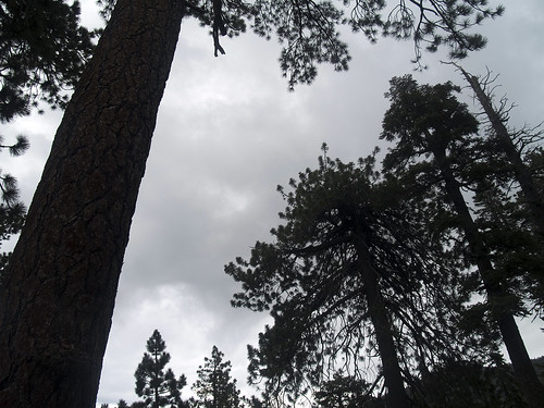
I got to Icehouse Saddle at 7:45 and the weather was looking grim:
However, for the rest of the morning it mostly made threatening faces, but never bothered me.
I passed two people on the way up and met another three dudes at the Saddle; then three joggers appeared before they continued running up the Three Tees Trail. I didn't see anyone else on the trail after that, except for some people breaking camp at Kelly's Camp, until I was heading back down from the summit.
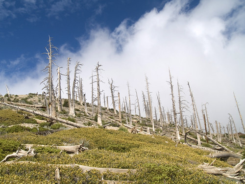
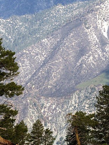
Just above Kelly's Camp I got my first taste of the weird desolation of the ridge between Ontario and Bighorn:
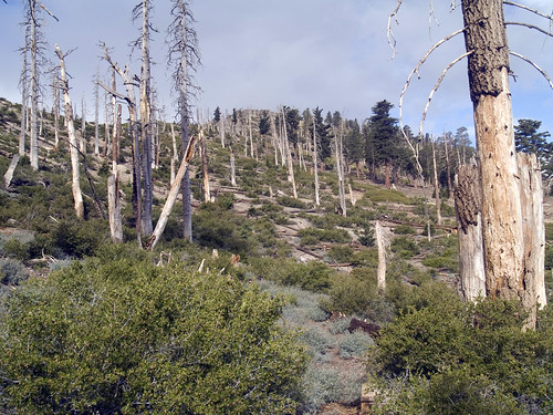
It got even more beautiful the higher I went. It really is the strangest, most unique landscape I have seen in Southern California:
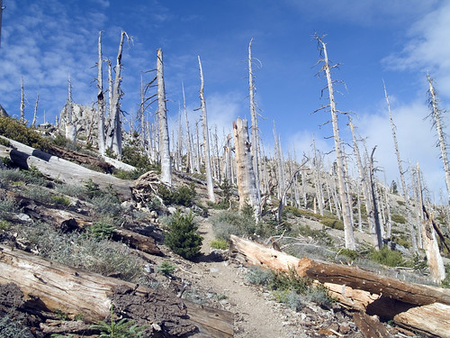
I kept wondering what killed all those trees. Was it just nasty winter weather?
While clouds swirled around Cucamonga Peak, they never really bothered me, hiking further west. In fact, for most of the time the sky above was perfectly clear and even when I stopped at the top I didn't need to put on my wind shell.
I got to the summit at 9:20, which was pretty fast, for me, I thought. I wasn't bothered by the false summits on the ridge as I was well-prepared for them after reading about them on this board as well as other trip reports.
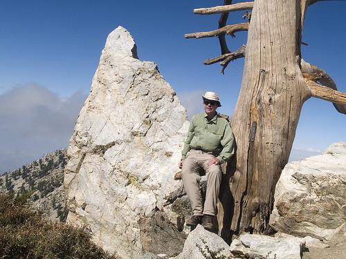
I had eaten a sandwich at the Saddle, but by the time I got to the summit my appetite had left me and it was all I could do to choke down a granola bar. The register that had been placed at the summit a year ago had been filled that morning, when someone (probably a camper from Kelly's Camp) wrote that he watched the sunrise from there. I scribbled "simonov - 9:20," as that was all the room that was left.
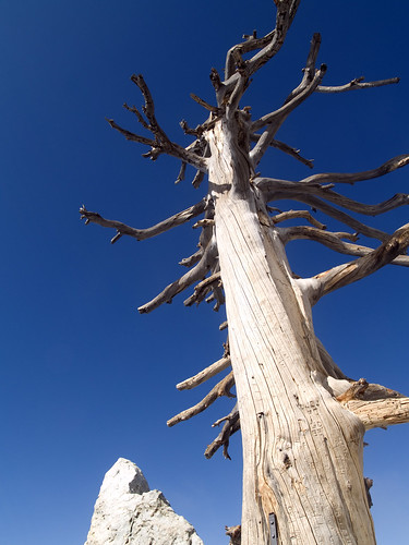
In addition to the traditional summit self portrait, I shot an arty pic of the distinctive snag and rock:
I was delayed on my way down when my camera storage card filled up. I had to stand by the side of trail deleting photos from a year before to make room, and then after one or two more photos the card would fill up again. Finally I noticed I had the photo mode set to camera RAW format, which is about 15MBytes per image. Jaysus. So I fixed that and even after I did I only had room for 33 more shots, which was about as much as we ever had in the old days with film, but which now felt perilously inadequate for the trip down.
For much of the trip along the ridge I could look down on the Bear Flat Trail, where Fight On was laboring that morning:
I passed more and more people as I continued down, mostly Koreans, and while it never really got very hot, I was still glad I climbed up Icehouse Canyon before 8:00 in the morning. It's a long grind up to the Saddle, and an even longer grind back down, but the country above the Saddle is so wild and beautiful it's well worth it. Also, I filled a water bottle at Columbine Spring on the way down, which was a pleasant break from Costa Mesa tap water.
I arrived back at the parking lot at 1:00pm. My feet hurt, but not as much as usual. I think it was the combination of heavy boots and day-pack weight that gave me some relief from my usual sore feet.
Looking at my calendar, I noticed this upcoming weekend appears to be open, so I think I will have a go at Cucamonga Peak if the weather is friendly.
More photos available here.