Oakwilde access: 2015 edition

TRs for the San Gabriel Mountains.
Post Reply
User avatar
dima
Posts: 1311
Joined: Wed Feb 12, 2014 1:35 am

Post by dima »

So I've been wanting to explore the difficult section of the Arroyo Seco: Brown Mountain Dam to Switzers. To do that, I've been searching for a relatively non-painful access point to the canyon bottom in that section. In theory, the Gabrielino runs the whole way, with several connecting trails, but none of that has been true since 2009. I've checked out the CCC ridge and Dark Canyon trail, and some random canyon from the fire station. Those all work, but are more bushwhacky than I want. Next on the list was an approach that looked promising from aerial imagery: ridge down to the powerline tower next to Twin Canyon, then... something else. I mentioned this to Sean, who produced a photo he took on an earlier trip that showed what looks to be a trail below the towers. And this was confirmed by aerial imagery:

http://binged.it/1NQnPTe

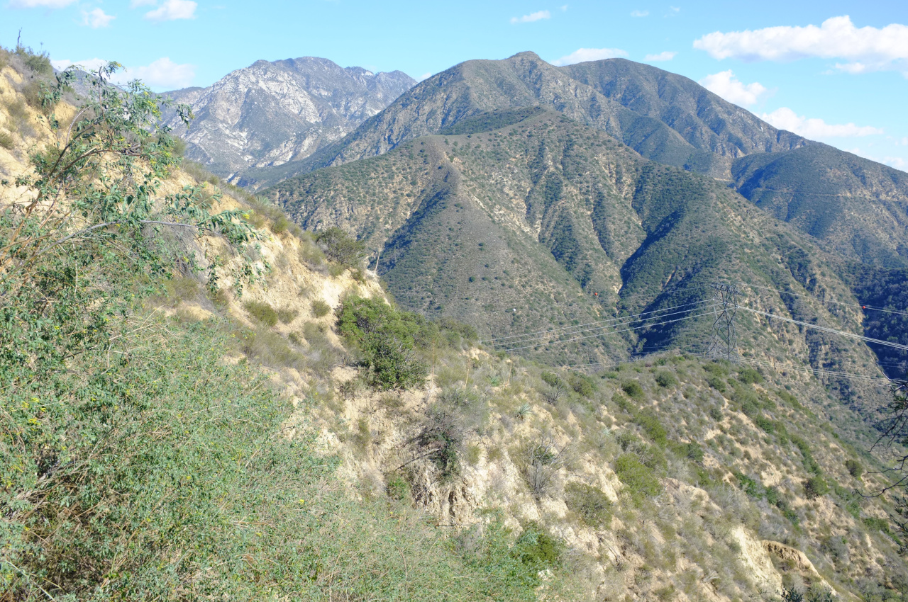
Armed with this info, I went over there to check this out, and it's just the quick route I was looking for. The route starts on a pullout-less section of the highway, and the ridge down looks like this:

Image

The ridge route from the highway to the power lines (ridge on the North edge of Twin Canyon) is an old roadbed:

Image

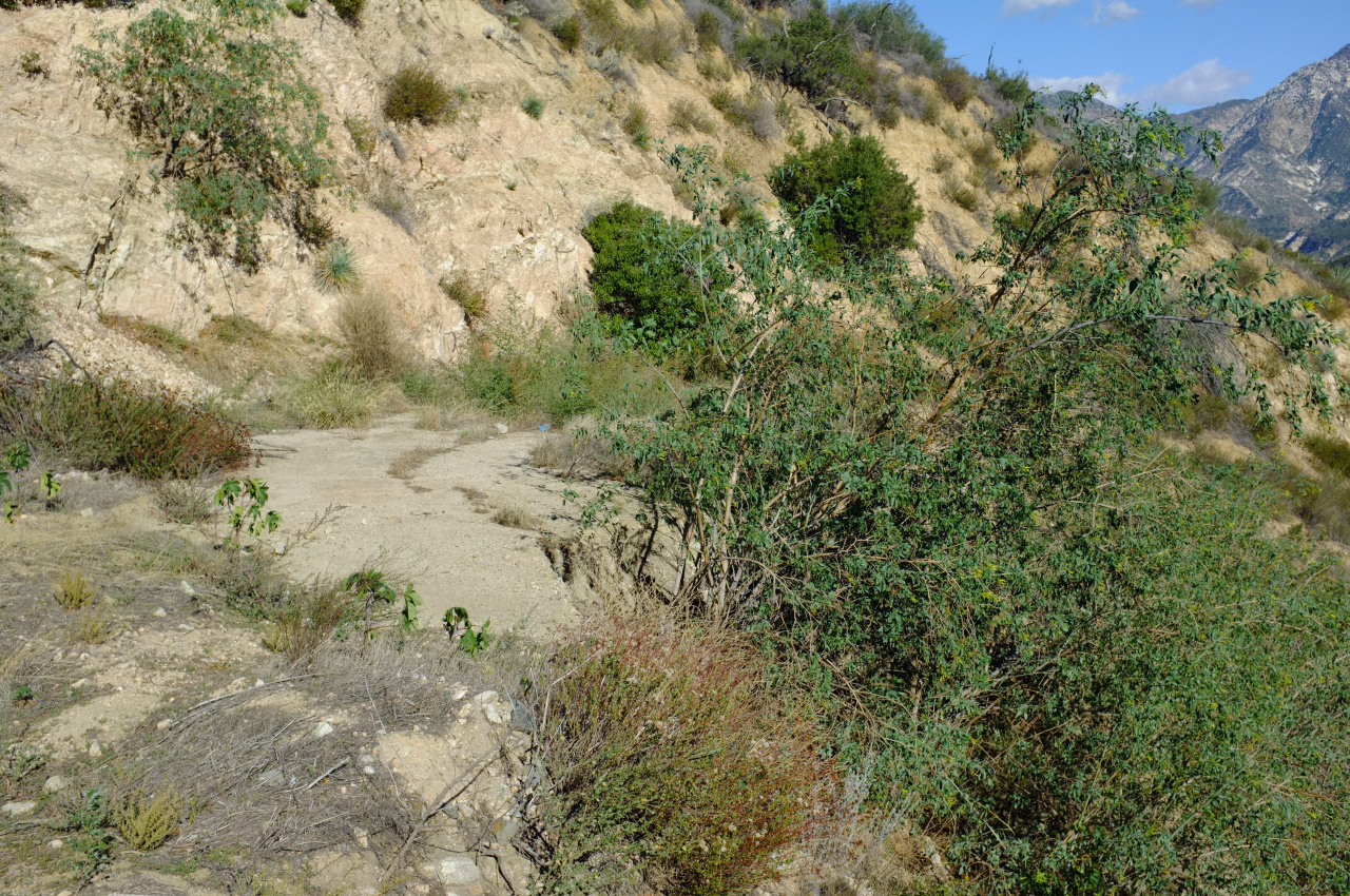
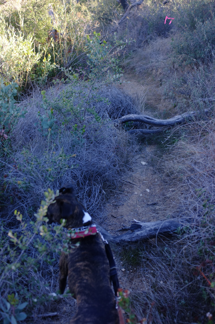
This is overgrown, but mostly with plants of the soft non-poky and non-poisonous variety, so it's easy going. Once at the towers you leave the ridge to the North (away from Twin Canyon). Here is a slightly-overgrown flagged trail with several switchbacks:

Image

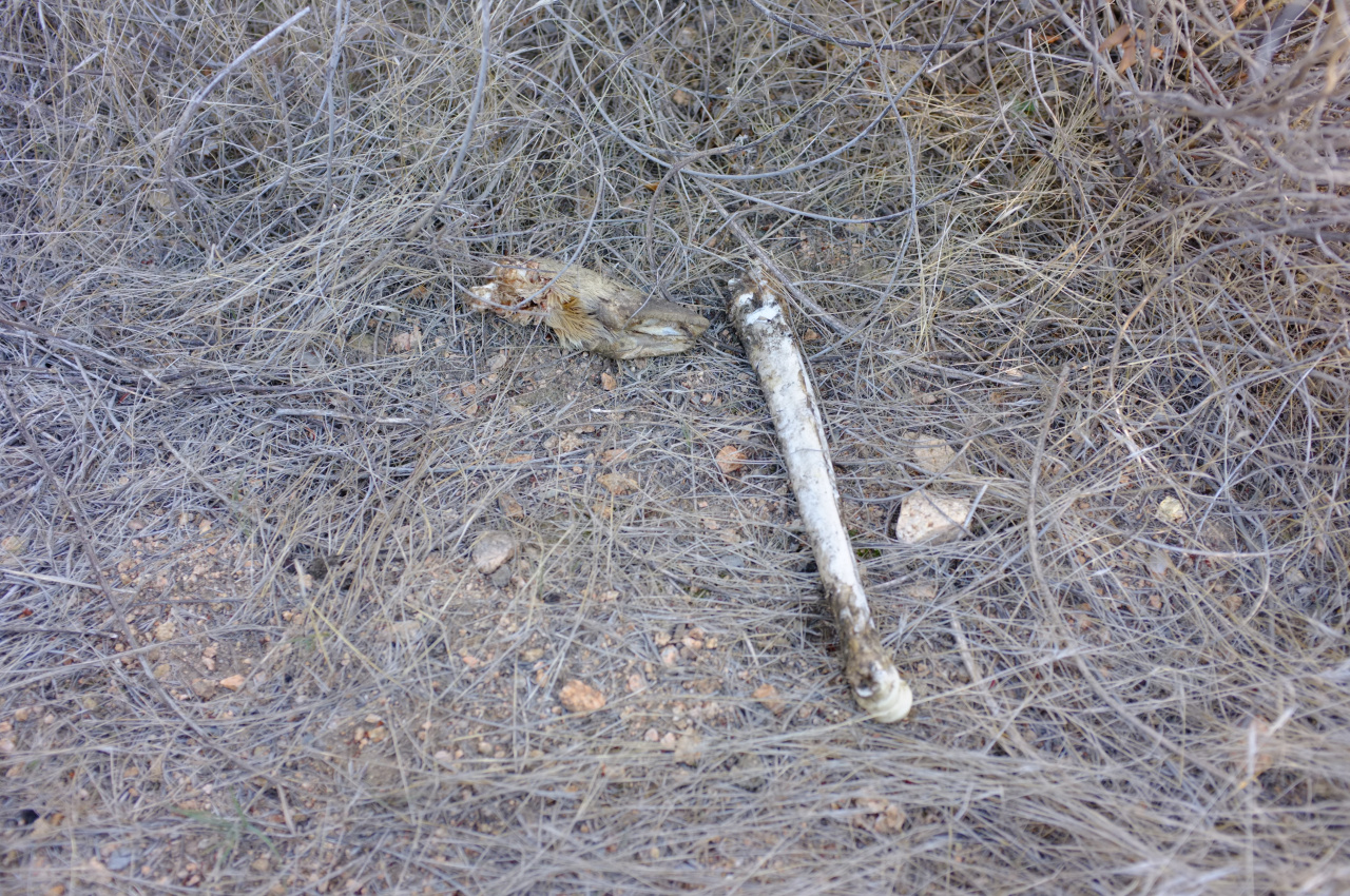
Some didn't make it:

Image

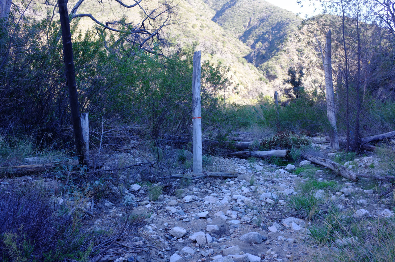
This eventually ends up in a steep gully, which has fixed ropes in it to aid in the descent. The gully drops you off at the mouth of Dark Canyon, at Oakwilde:

Image

There I met two hikers who bushwhacked their way from Switzers. They were surprised to find out that the Gabrielino trail doesn't exist in that area, and disappointed to learn that Oakwilde doesn't exist anymore either. Their report of the conditions upstream is that the Gabrielino is in good condition until it drops into the river, at which point it's a heavy bushwhack.

I then walked down to check out the bypass around the Brown Mountain Dam; it has been worked on, and is in great condition. The river is currently dry in that area, and the Oakwilde - Dam section is very easy going.

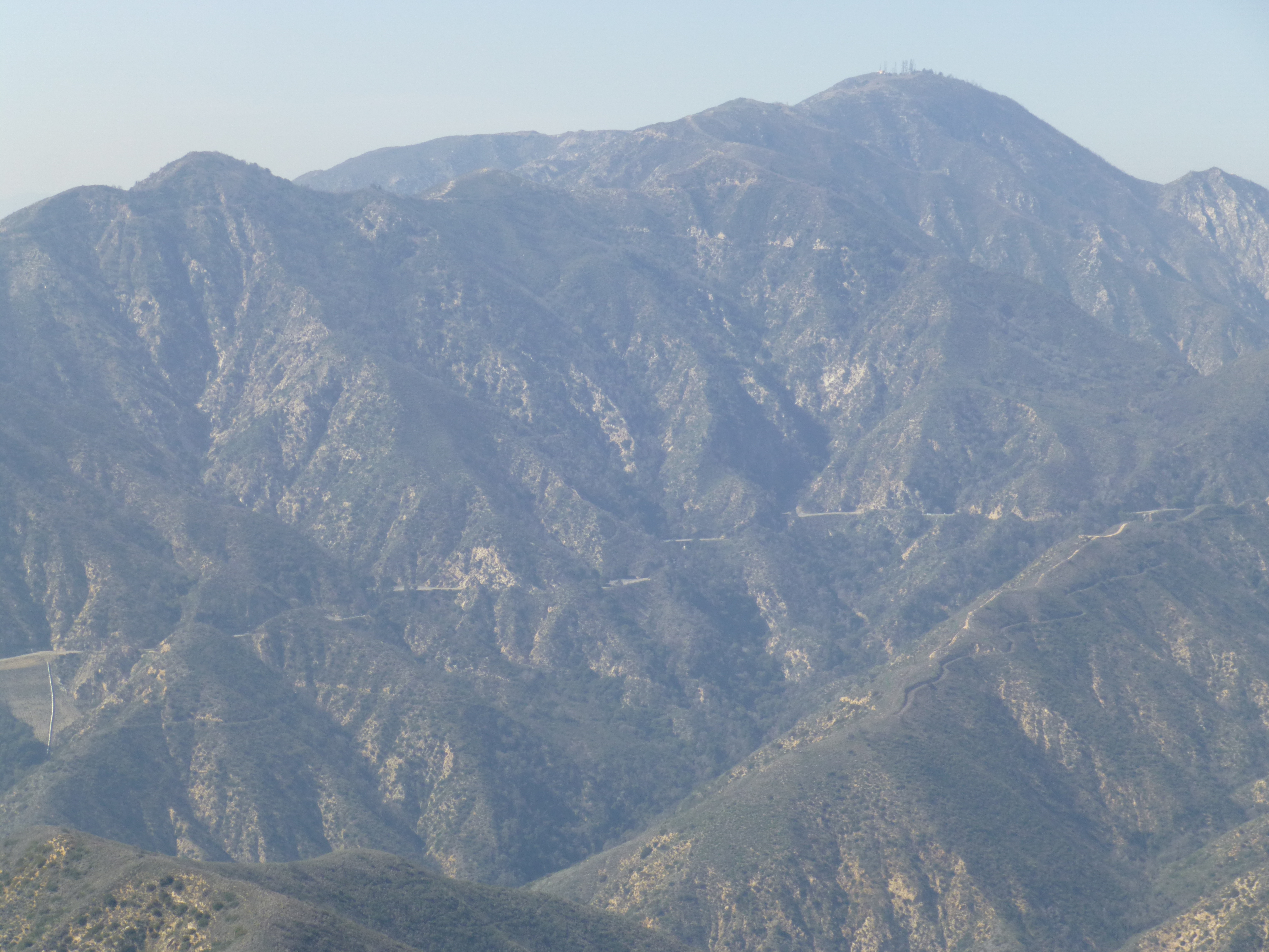
I got what I wanted, and turned back the way I came at this point. Looking back at the ACH, one could see several long road cuts below the highway. I'm guessing they all connected to the road running down from the CCC ridge, since you can see the cuts pop up periodically at a similar height to each other. A (large) photo showing some of this: https://gal.secretsauce.net/travels/San ... d_cuts.jpg
User avatar
walker
Posts: 248
Joined: Mon Apr 08, 2013 11:14 pm

Post by walker »

Nice report, Dima. Thanks for the update. I've been wanting to revisit the area via that access.

There used to be a one-car turnout right there where that ridge route starts, but it is now completely walled off since they redid everything after the station fire.

I visited the dam bypass trail from Paul Little this weekend. I was happy to see that whoever is working on that section of trail has removed that hideous chain link fence that used to run beside the trail above the gorge. I hope they don't reinstall some such thing in the future.

Perhaps things are in motion to prepare this area to reopen eventually. I just saw a notice that a mtn bike group is slated to do trail work on Ken Burton trail this weekend, so maybe little by little we'll regain more access options in the area.

Before the fire, I tried hiking the old roadcuts in your photo. It was so thick with brush that progress was difficult but a pretty good stretch was hikable. Heading in the direction of Woodwardia and Dark Canyon, there were some dangerous cliffed out washouts in some side canyons, so I never made it the entire length of the road. I'd be interested to see how easy travel is along that roadcut now. I had assumed that this was the original route of the road before they built the bridges along the current route of the road, does anybody know if that's true?
User avatar
Sean
Posts: 3725
Joined: Wed Jul 27, 2011 12:32 pm

Post by Sean »

dima wrote: Looking back at the ACH, one could see several long road cuts below the highway. I'm guessing they all connected to the road running down from the CCC ridge, since you can see the cuts pop up periodically at a similar height to each other.
Thanks for the report. Maybe those road cuts were for when they built the bridge footings. I doubt it connects with the Dark Canyon Road, but it might have connected with the e-tower road.

I looked at some old maps. It doesn't look like the ACH has ever been rerouted in that area.
User avatar
walker
Posts: 248
Joined: Mon Apr 08, 2013 11:14 pm

Post by walker »

I wonder if it might have been some kind of temporary service road or some access to Oakwilde or to help build electrical towers or Brown Mtn. Dam?

Here's my crude attempt to trace the route of the old road cuts.

https://caltopo.com/m/85AK

The orange line is the old dark canyon trail/roadbed descending from CCC ridge.

The red line starts at Dima's access ridge. It more or less corresponds to the segment of this old road cut I've hiked.

The green part may exist in segments, but I'm pretty sure some parts are totally washed away. I've been on the first bend of it from the bottom of dark canyon and I've seen further sections of it from CCC ridge but I've never gotten around to connecting the dots. Anybody game?
User avatar
Sean
Posts: 3725
Joined: Wed Jul 27, 2011 12:32 pm

Post by Sean »

The Dark Canyon Road dropped from the ACH at the now-called CCC Ridge to the streambed in Upper Dark Canyon, then it followed the bed down to Oakwilde. There were cabins in there. There is no other road out of Oakwilde on the early topo maps except of course for the main Arroyo Seco road down to Altadena. Below are images from the 1939 map, shortly after the highway was constructed. Plus a picture I took looking up Dark Canyon from a little above Oakwilde. In the distance you can see some old road cuts, which I believe is the Dark Canyon Road before it hits the streambed, which is bending slightly leftward.

Image

Image

Image

Image
User avatar
Sean
Posts: 3725
Joined: Wed Jul 27, 2011 12:32 pm

Post by Sean »

walker wrote: Here's my crude attempt to trace the route of the old road cuts.

https://caltopo.com/m/85AK
I dug up some pics from Feb. 2013 that I took during a traverse of Brown Mtn. The mysterious road cuts are visible below the ACH.

Image

Image
User avatar
Sean
Posts: 3725
Joined: Wed Jul 27, 2011 12:32 pm

Post by Sean »

More research has unearthed some history about road construction in Dark Canyon. In 1913 Pacific Light & Power (later acquired by Edison) ran the Big Creek power line through the area. They would have built access roads to install the towers.

Before that was an attempt in1873 to handcut a wagon road from LA to the desert. According to this article the work stopped at Dark Canyon.
Post Reply