
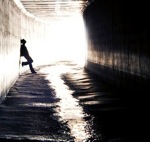
Posted this originally over at summitpost, but Taco let me know I might have more luck posting it on this board. Anyhow, a friend and I are looking to hike from Vincent Gap, down the East Fork of the San Gabriel River, then out at the East Fork Ranger Station. Neither of us have any experience with this area, so I was looking for anyone who had recently been up (or down) for current conditions.
I read AT's report about the lower portion below the bridge, and I've checked out Chris Brennen's write-up. From what most people say, I should be ready for 2 things:
1. Rattlesnakes
and
2. Poison Oak
If there are any other recommendations on following the trail and/or advice, it would be greatly appreciated.
Thanks in advance,
Gusto
Vincent Gulch Trail (East Fork)
-
FIGHT ON
I don't know much about that route other than what AlanK posted several days ago. Some guy with a bike almost had a bad time there. I would read as much about it as I could before I went.
-
friendowl

- Posts: 137
- Joined: Fri Sep 28, 2007 9:23 am
the east fork is beautiful.my recommendation would be to JUST GO
its more fun when you dont really know what to expect....
pretend in your head that your in a life and death rambo type situation
and your being chased by the enemy..you have only one option
make it to the east fork parking lot for evacuation or die
bug spray would be one thing id hate to be without
-
FIGHT ON
DUDE! I GOT IT!! You been up there right? I got an idea! Lets you and me make a bet. I bet us two can start at Vincent Gap and get to the ef parking lot before any three guys on here can shoot us! Of course it would be like paint ball, no real bullets.friendowl wrote:the east fork is beautiful.my recommendation would be to JUST GO
its more fun when you dont really know what to expect....
pretend in your head that your in a life and death rambo type situation
and your being chased by the enemy..you have only one option
make it to the east fork parking lot for evacuation or die
bug spray would be one thing id hate to be without
Maybe we should give them the 10 minute head start!
-
AW~

- Posts: 2126
- Joined: Mon Oct 01, 2007 12:00 pm
I think the dayhike is a lot easier now than it was then, if you are going from Vincent Gap. As far as terrain goes, this is one of the easiest in terms of the lack of flies, the lack of dense brush(assuming one does not navigate into it), and a massive amount of camping spots. Of course it is still a long way and a long car shuttle to boot...its just a matter of being prepared as with any remote hike...the possibility of an overnight stay while small as it is, travel through water(plenty of low water crossings),etc.
There should be no worry about obstacles/water current. There is a use trail pratically the whole length, although you see a path darting up and just have to rely that it will work out much better than staying creekside. Fish Fork & Iron Fork are readily recognized.I dont know about rattlesnakes...follow the use trails and the likelyhood of an encounter is minimal...I havent had a lot of encounters with them period, just 4, and 3 of those were creekside. Note: Awareness is good, so its not a matter of wondering if there is a snake on the other side of some view-obscuring boulder.
Poision oak: Well I guess it cant be understated as some people are quite suspectible, but this route shouldnt have any that blocks a path or anything like that.
Anyways, very doable in a dayhike. 7-12 hours, start early from Vincent Gap, like 5:15 am as the sun does penetrate the canyon and you are leaving from a strenuous trailhead(for example Baden-Powell to Heaton or Baldy to Heaton) If you have a water filter I would use that instead of packing a lot of water. I have read concern of the mineral content of the water and that it clogs filters, but I find it sort of a reach. If one cant filter this water, no point in having a filter.
Lastly(whew), there is the whole permit deal. I have 2 of them now, and have to get one online. S&R is at http://www.sdmrt.com/guests/operations.php, the last one & August 28, 2006 one are ones I saw from the same route.
-
Kit Fox

- Posts: 152
- Joined: Tue Dec 25, 2007 11:33 am
-
Gusto
- Posts: 6
- Joined: Sun Jul 06, 2008 1:36 pm
Thanks to all for the great advice and knowledge. I don't think I'll be dressing up like Rambo this time, but maybe I'll sport a red headband just for fun.... I'm a ultralight fanatic, so I won't be carrying the gigantic knife either (sorry).
Hopefully will report back with some pics after Saturday.
Gusto
Hopefully will report back with some pics after Saturday.
Gusto

-
oldmtnman
- Posts: 2
- Joined: Thu Apr 04, 2013 6:39 am
Anyone hiked from Vincent Gap to Heaton Flat via the San Gabriel River recently? Looking for any surprises, haven't been there in awhile..
-
davantalus
- Posts: 203
- Joined: Mon Jun 08, 2009 9:09 am
I've done it three times... but the most recent was about two years ago now. The car shuttle takes forever and I'm guessing that not much has changed. I can give you some advice on campspots but they're mostly obvious.
-
Phil B
- Posts: 101
- Joined: Wed Oct 03, 2007 12:47 pm
Seems like it was 2005 when I last did this one, I loved the hike through the canyon/narrows ect. but davantalus is dead right the car shuttle sucks.
Pics : http://philbrown.smugmug.com/Other/Vinc ... &k=zzFRdgw
Pics : http://philbrown.smugmug.com/Other/Vinc ... &k=zzFRdgw
-
Taco

- Snownado survivor
- Posts: 6227
- Joined: Thu Sep 27, 2007 4:35 pm
Easy stuff. Planning to run it in a while, if that gives you any idea of the terrain. Trail kinda goes away around The Narrows or so, and/or north of Fish Fork. Buncha easy crossings. Northern part gets hot. Takes a long time.
-
NOMAN668
- Posts: 16
- Joined: Wed Feb 01, 2012 5:10 pm
Howdy all.
I've never done it.
Just wondering if the trailhead to get up to Vincent is obvious from the river or if there's anything tricky to look for.
Thanks.
I've never done it.
Just wondering if the trailhead to get up to Vincent is obvious from the river or if there's anything tricky to look for.
Thanks.
-
Mike P

- Posts: 1005
- Joined: Tue Oct 02, 2007 10:48 pm
Yes, there is a sign down there that directs you to Vincent Gap:

Also, Vincent Gulch is difficult to miss if you follow your map.
Stay on the eastern side of the rocky Vincent Gulch "floodplain" as you ascend and you will soon find the trail (¼ - ½ mile) as it hops onto the eastern canyon wall/bank.
Have fun!
Also, Vincent Gulch is difficult to miss if you follow your map.
Stay on the eastern side of the rocky Vincent Gulch "floodplain" as you ascend and you will soon find the trail (¼ - ½ mile) as it hops onto the eastern canyon wall/bank.
Have fun!