Mt Williamson NE ridge

TRs for the San Gabriel Mountains.
Post Reply
User avatar
walker
Posts: 248
Joined: Mon Apr 08, 2013 11:14 pm

Post by walker »

After my original plans for last Sunday were thwarted by an apparent pot growing operation, I ended up at Islip Saddle wondering what to do with the day. Since I had never descended from Islip, I decided to hike down the South Fork trail and see what it was all about. The trail was in decent shape with a few minor washouts, but not as well traveled as I had expected. I had decided to wear my trail runners but ended up wishing I'd chosen my mountain boots as I kept stubbing my toes on rocks which forced me to go slower than I'd anticipated.

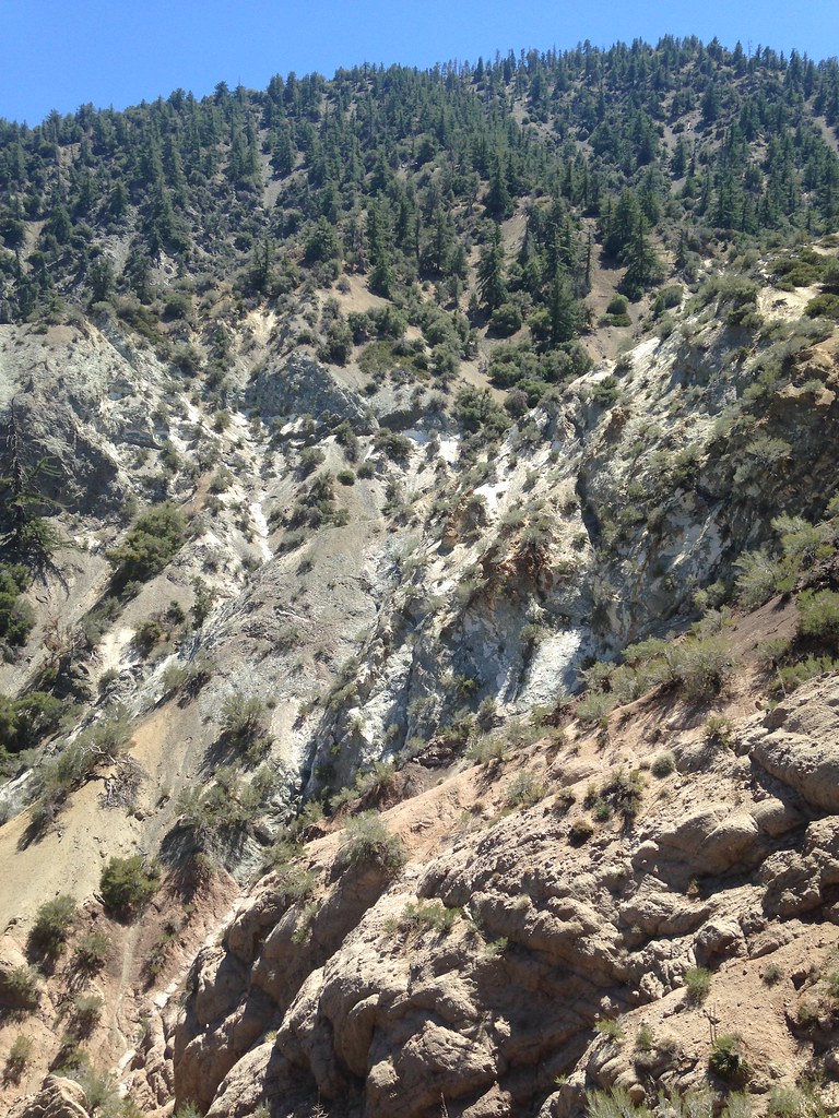
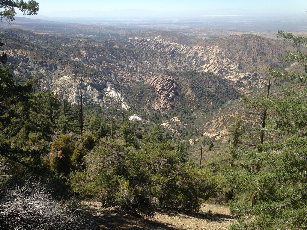
It seems as if the trail might have been intended as a road grade at one time as it certainly maintains an even grade most of the way down and contours along every side canyon that comes in. The canyon gets more rugged and rocky as you approach the lower gorge.

Image

Image

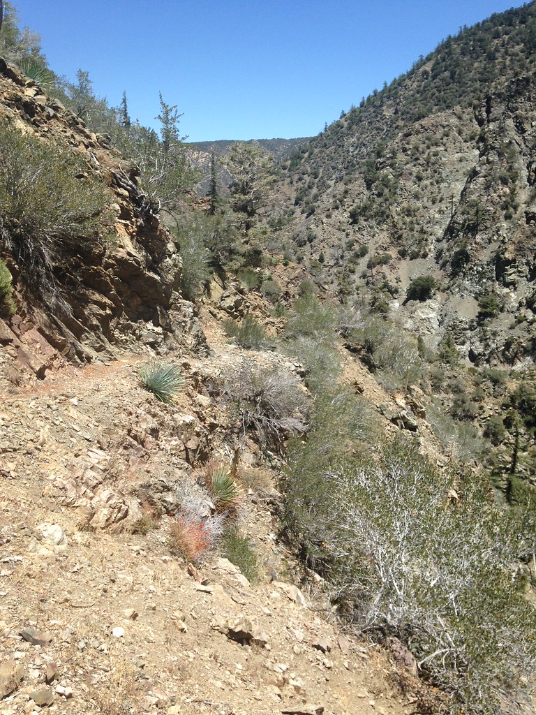
I was looking forward to getting to the creek and putting my feet in a pool of water, but alas, there was no water anywhere in sight at the bottom of the gorge. I was glad I was carrying nearly 2 gallons of water in my pack. The South Fork campground area is also a bit impacted with graffiti and trash, but not nearly as bad as some other places.

It was at this point that I didn't feel too keen on hiking back up the long, hot, rocky trail to Islip Saddle. So I came up with the brilliant idea of going along the northeast ridgeline to Mt. Williamson through the pines and all. I had no idea how much work I was about to get myself into. Actually, I had some idea but I didn't fully grasp the size and magnitude of this thing. The only way this didn't end in a rescue is because I was carrying so much water and was in fair enough shape not to collapse in exhaustion. I think it's about seven miles of ridgeline with a lot of altitude gained, lost and gained again as you negotiate a chain of minor summits on the way to Williamson.

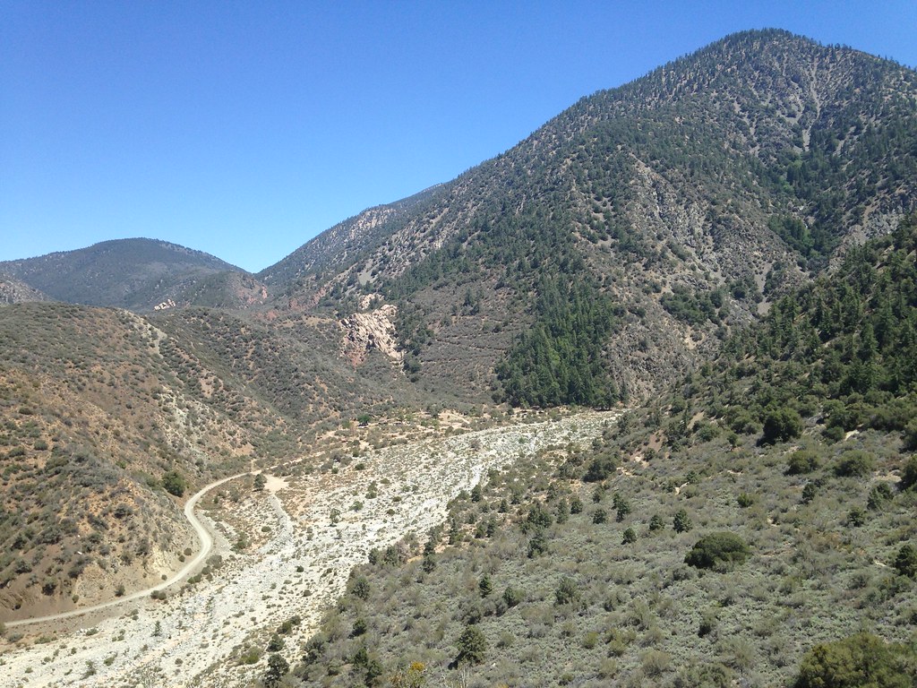
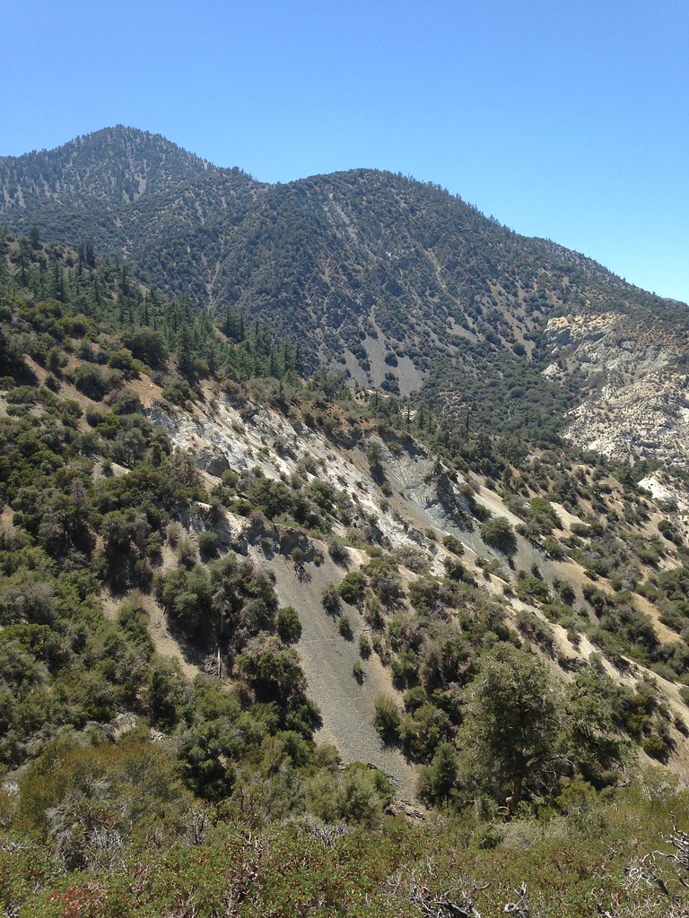
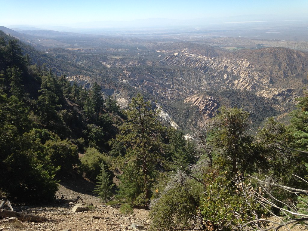
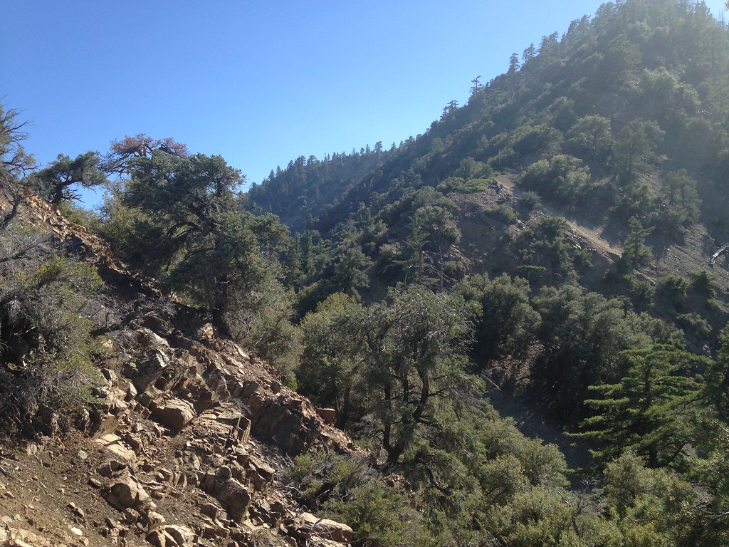
Anyway, I headed up the High Desert National Scenic Trail towards Devil's Punchbowl and enjoyed the mixture of desert and mountain country that lies along that trail. I was treated to nice views of the South Fork campground and the Manzanita Trail switchbacking up the slope above it:

Image

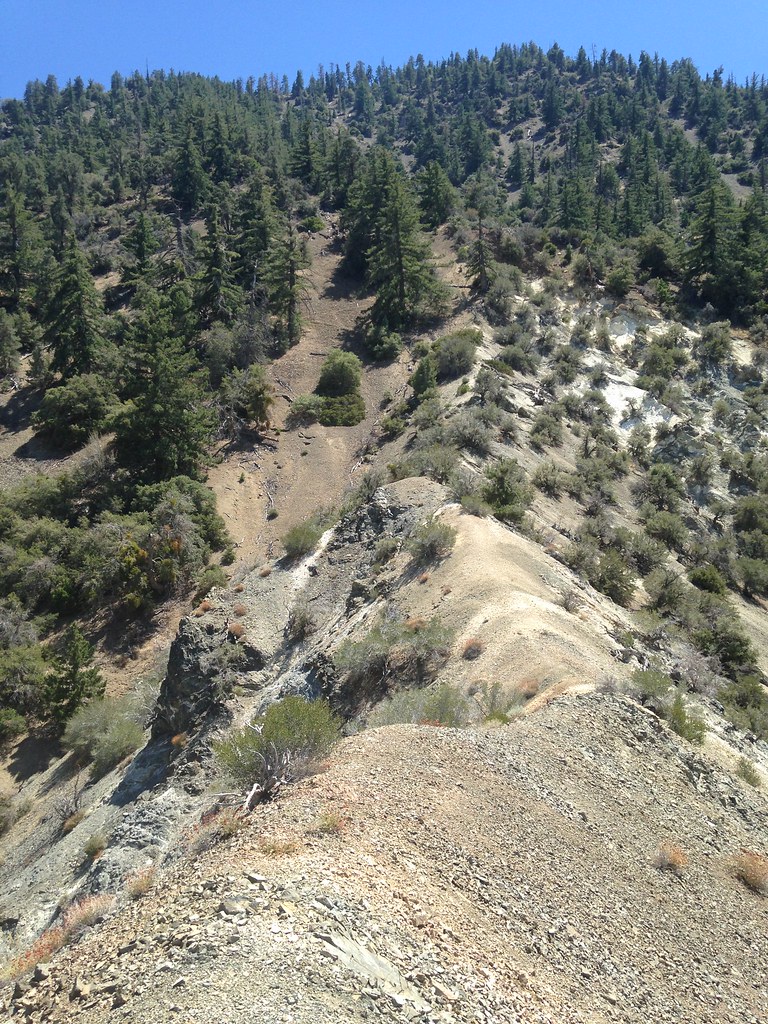
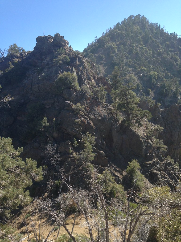
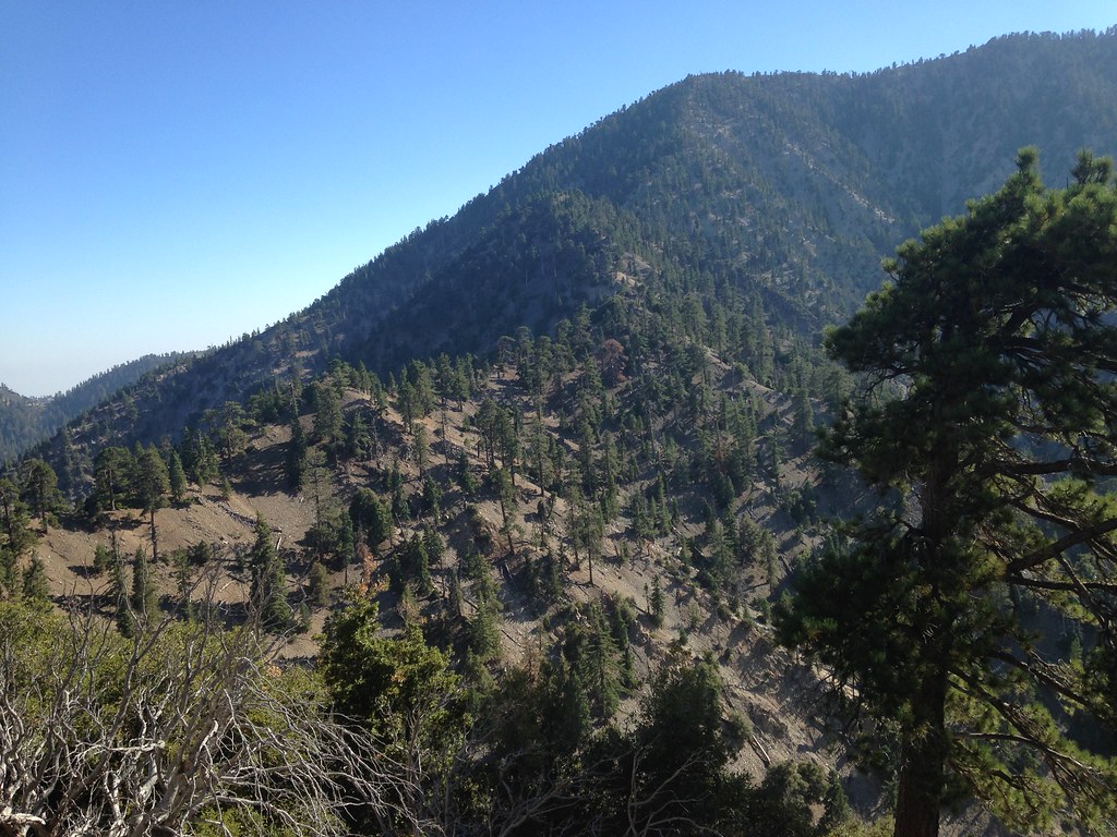
The first part of my route became visible: follow the High Desert Trail to a saddle (not visible here) and then follow a ridge made of some white, chalky, desert rock to gain the pine-covered rib descending from left to right from a corner of the first major summit along the ridge system.

Image

My target, the piney rib, begins right of center above the white cliffs and tops out in the middle of the picture:

Image

Once at the trail saddle you start to get views of the Punchbowl area:

Image

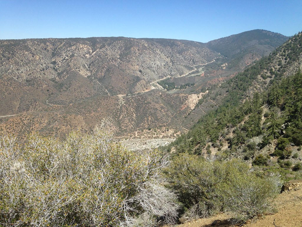
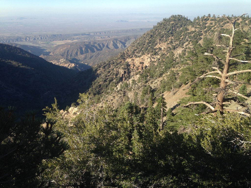
You also get a nice view of the mouth of Holcolm Canyon where it leaves the alpine zone:

Image

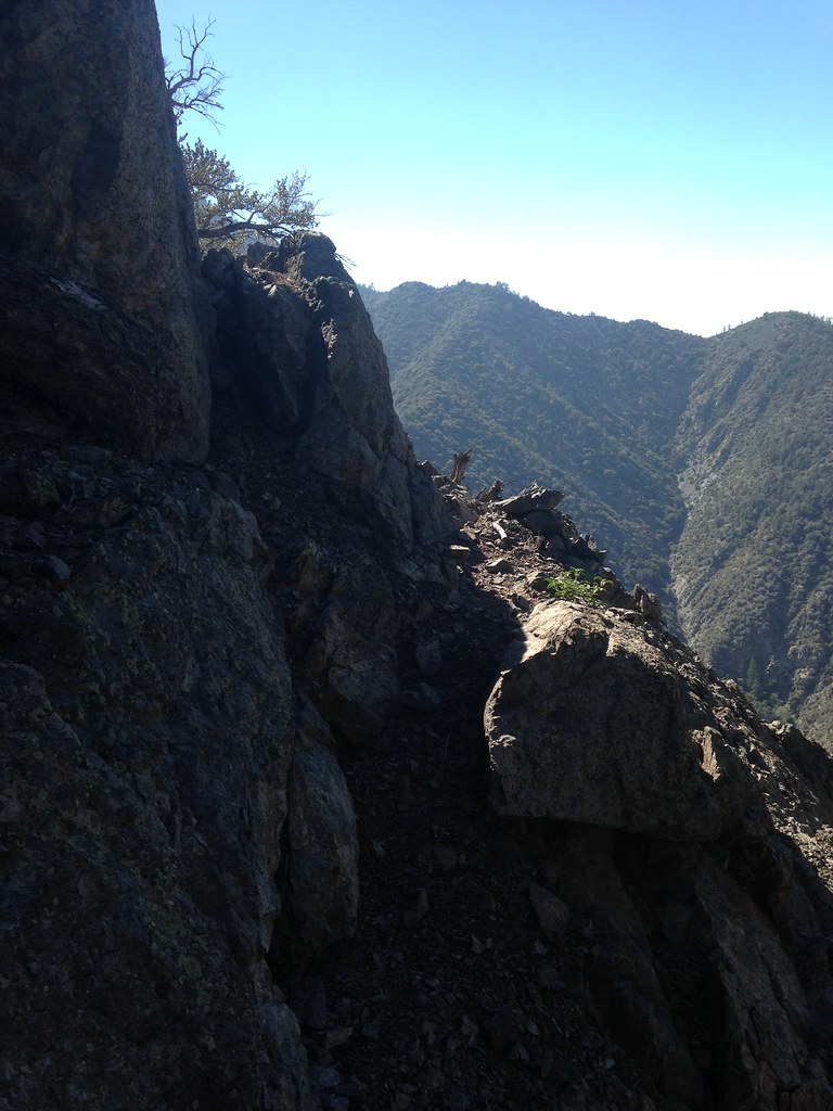
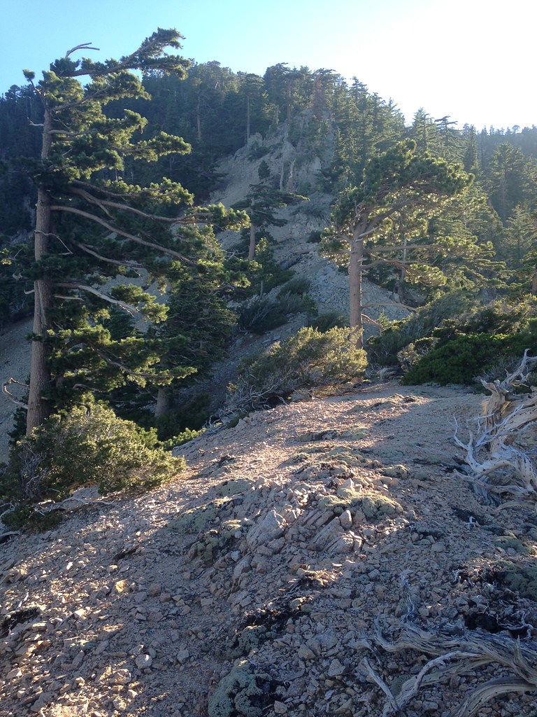
The ridge gets narrow and has some ball-bearing gravel in places so you have to pick your steps carefully in the steeper spots:

Image

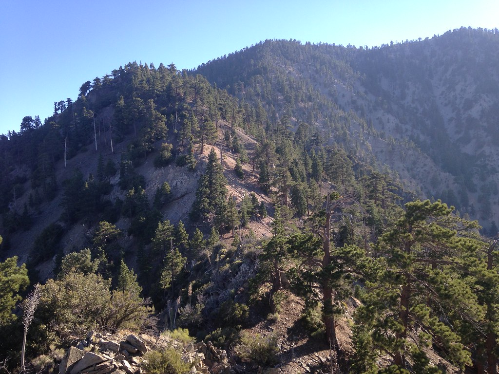
Once you gain the woods, the slope is much steeper than it looks from below and there are a number of crisscrossing animal and use trails, so you have to pick one and slowly work your way up. If you get too far to either side, you may find yourself on steep gravel slopes. However the views start to get nicer and the trees provide some shelter. The Punchbowl starts to open up below:

Image

South Fork area:

Image

For a while I was following another traveler who'd gone up the same path:

Image

Image

Eventually you get higher:

Image

And you finally arrive at the summit of Peak 6621 to discover relics of ancient civilization:

Image

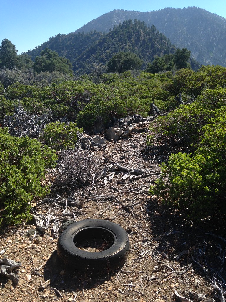
Maybe firefighters landed their helicopter there or something?

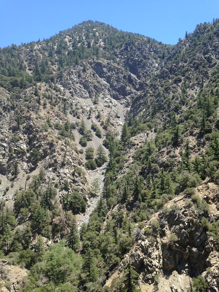
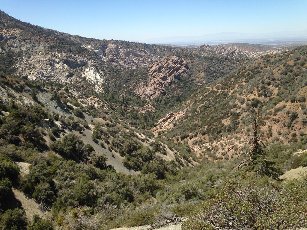
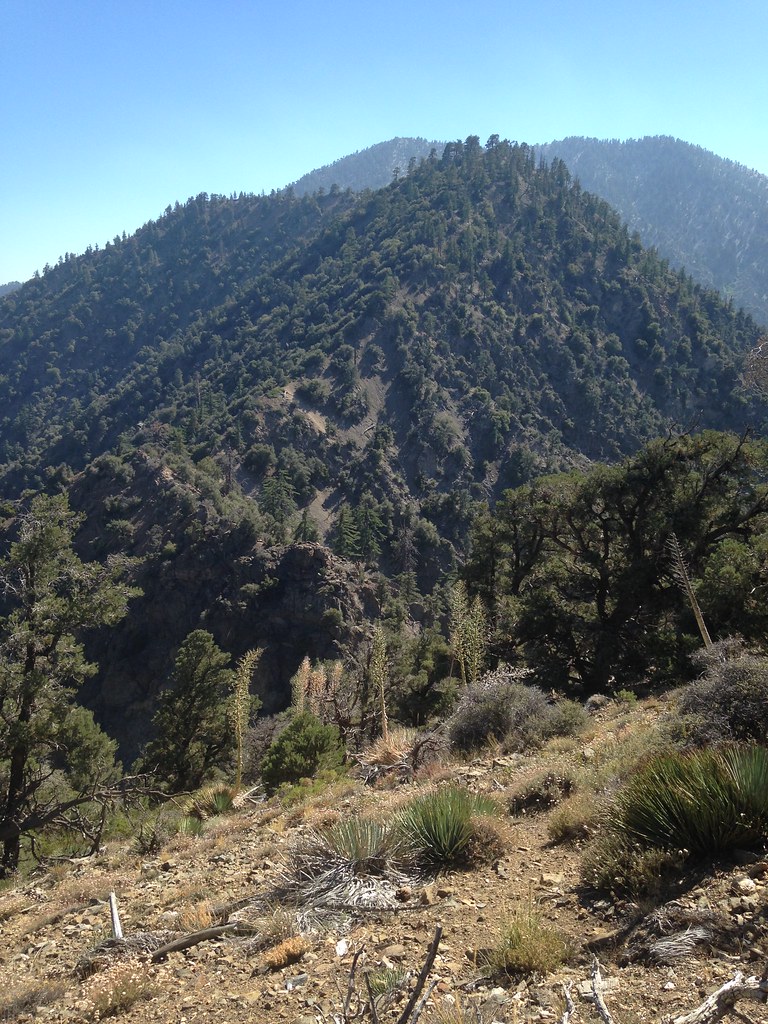
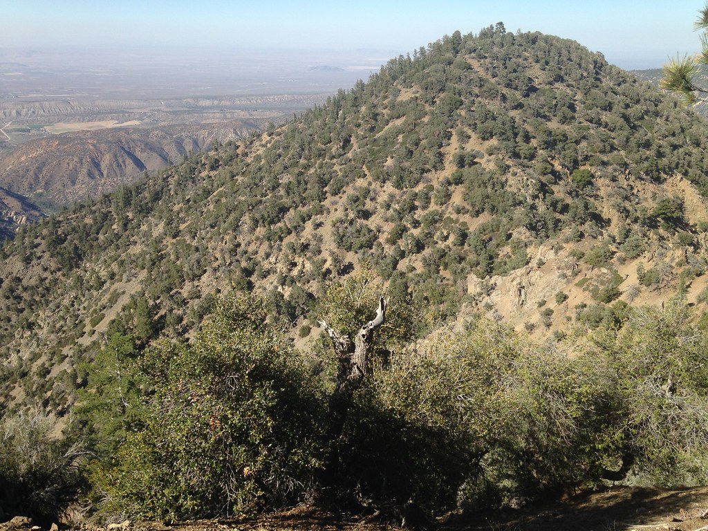
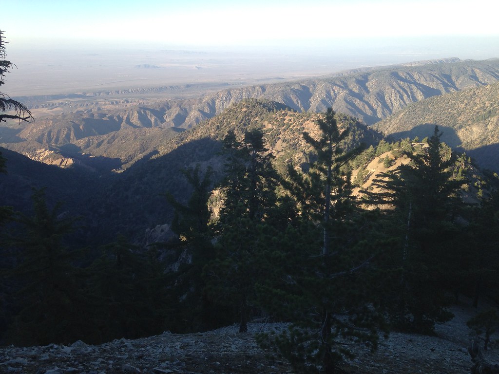
So this is the first time you get a look at what lies ahead and there are at least 4 minor ridge summits before you get to Williamson. You can see some of the major ones above and the amount of altitude that must be gained to arrive at Williamson.

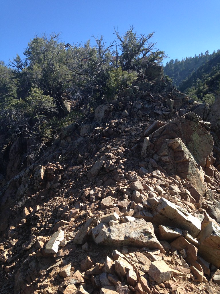
Crossing a bunch of manzanita on 6621 you descend to a rugged notch before the next peak. On both sides the canyon seems to drop away into steep rocky slopes and cliffs, and the ridge starts to pinch out:

Image

Image

When you get to the notch you can see the path to take. You either climb directly up an open chimney to a small pine or slightly right then traverse back left to the pine and follow a ledge around the corner:

Image

The route to the right:

Image

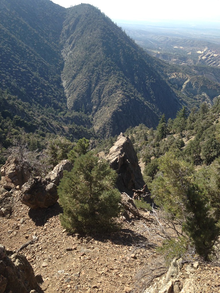
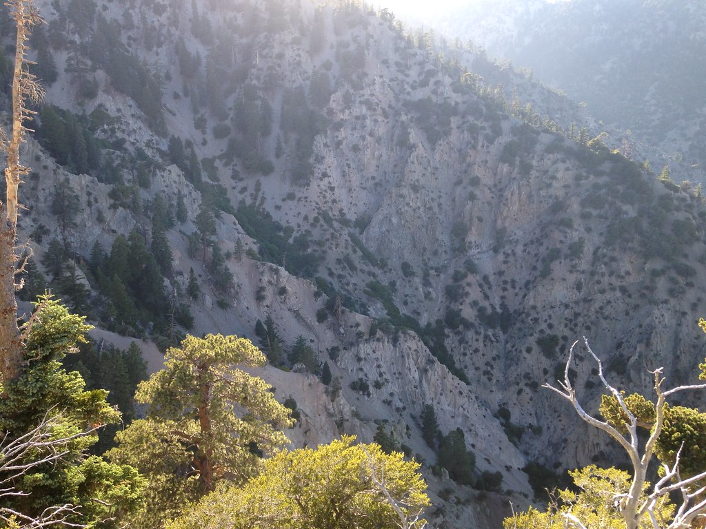
The view down into Holcolm Canyon from just above the rocks:

Image

Typical ridge conditions just beyond the notch:

Image

Image

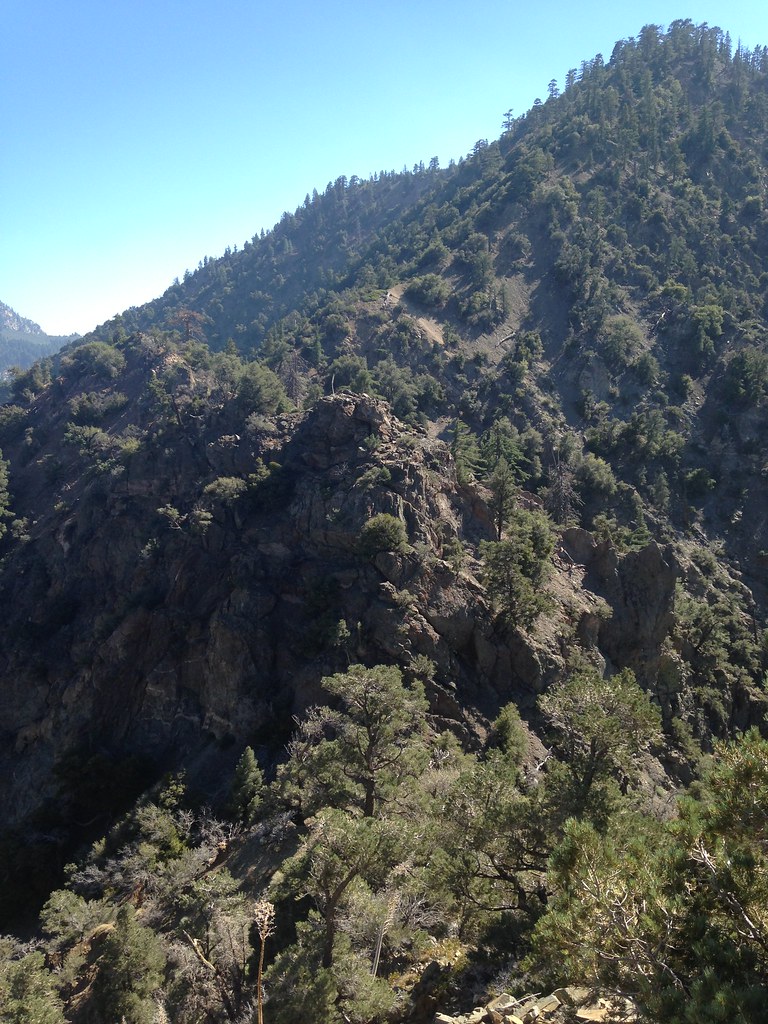
Now begins a long series of climbs, descents and traverses taking you over one summit after another. At this point a bit of a use trail also starts to show up, but sometimes it isn't all that much help.

Looking back down towards the notch, which is practically invisible here:

Image

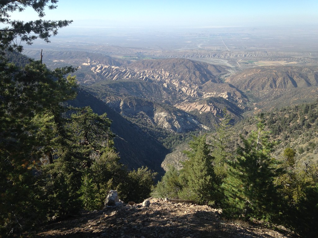
We are gaining more altitude. The San Andreas rift zone:

Image

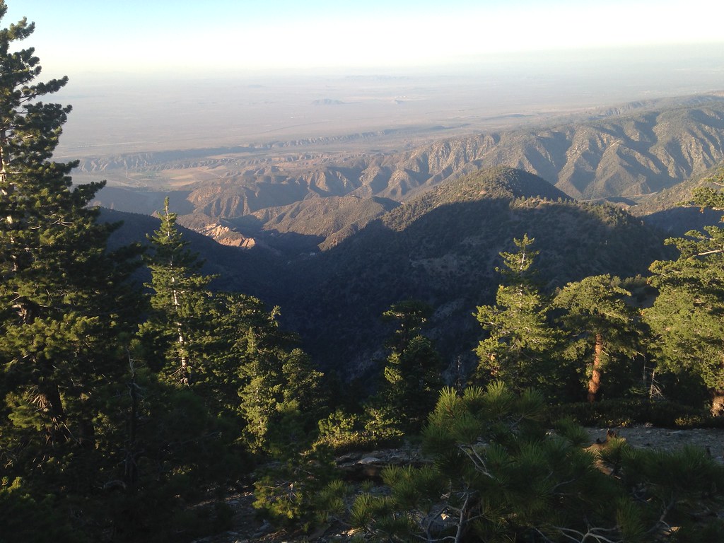
There's still a long way to go. This is the view from the unnamed peak that's nearly 7000 feet tall:

Image

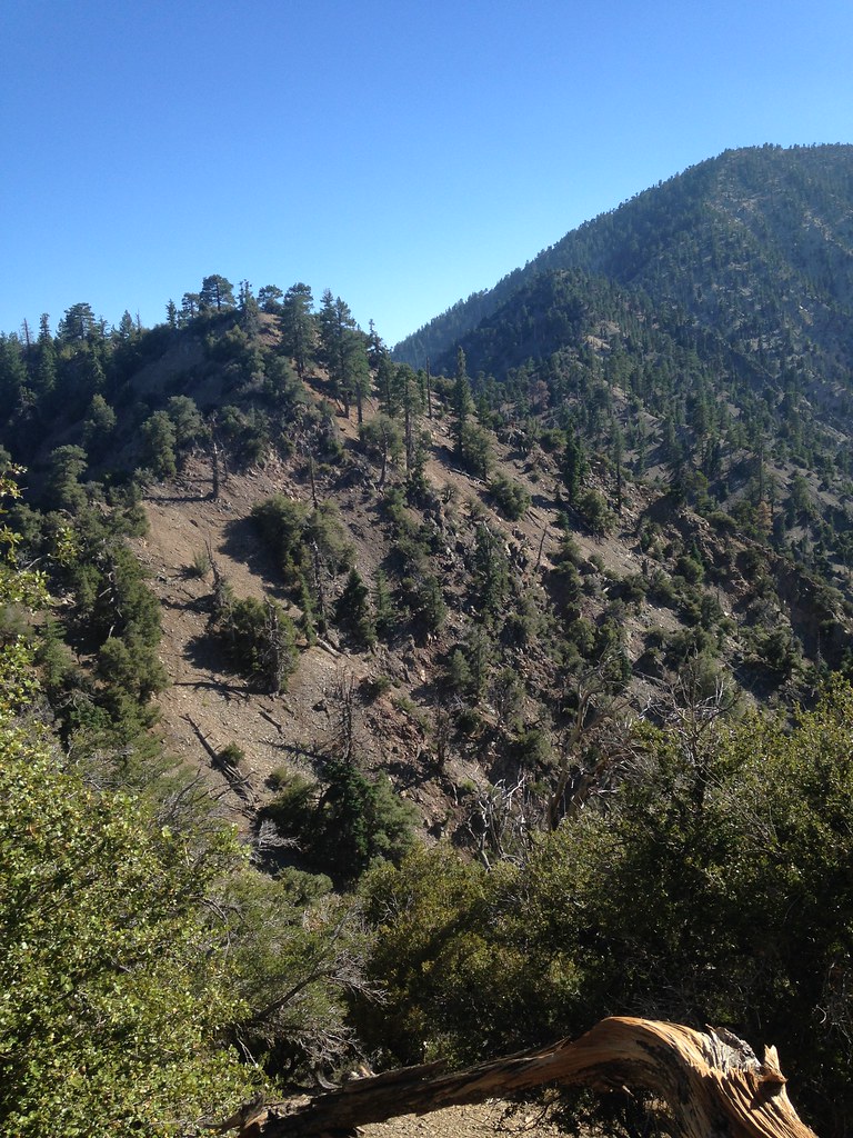
And the view from the next one, looking towards Peak 7040 and 7341 poking up behind it and Williamson on the skyline:

Image

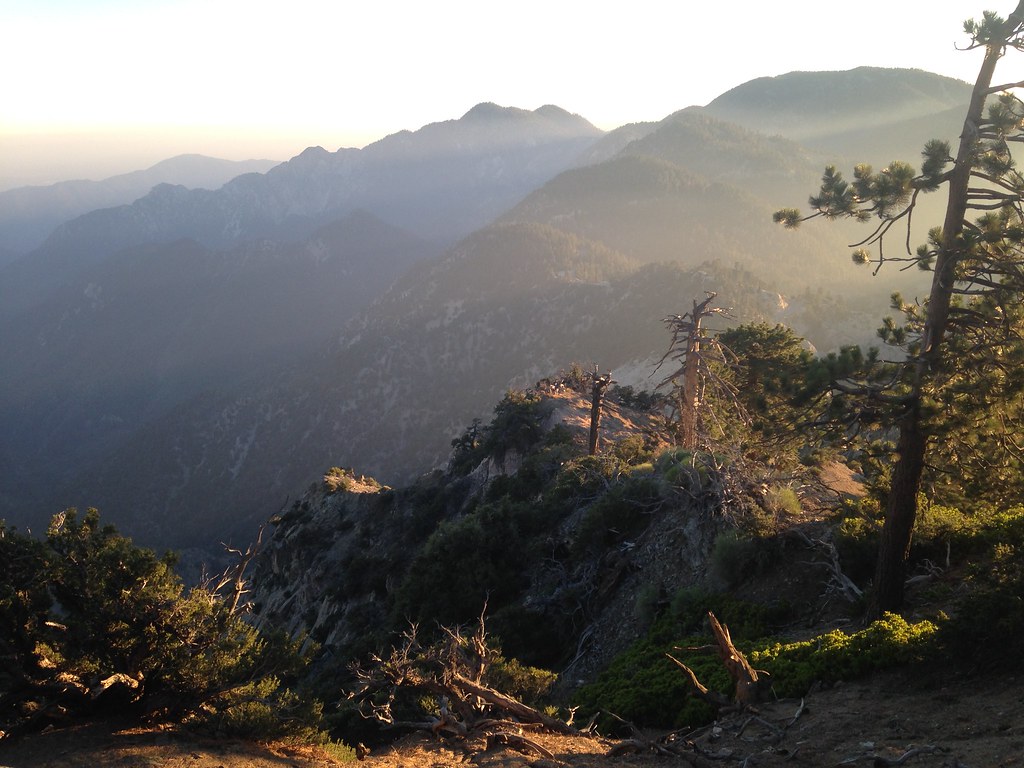
Peak 7341 ahead with the headwall of Holcolm Canyon to the right in the shadows:

Image

Here's what the Holcolm headwall looks like. Have any of you radical canyon dudes ever descended directly from the summit of Pleasant View Ridge?

Image

Looking back at some of the rolling ridge country we came up:

Image

This is where the final grunt to the summit of Williamson begins:

Image

Looking back at what we came up:

Image

Image

Having gained the summit, it's now a couple of miles and a couple thousand feet back down to the car at Islip. My efforts on this long hike were rewarded with this beautiful moment as the sun went down:

Image

In retrospect, it might be smarter to descend the ridge and return via the trail or do a car shuttle of some kind. In any case, a beautiful, rugged area which I didn't quite expect. The San Gabriels never cease to inspire and amaze me. Enjoy!
User avatar
anarchist
Posts: 75
Joined: Sat Jan 04, 2014 7:57 am

Post by anarchist »

Bravo! Well done! Great pictures of Holcolm!
User avatar
Uncle Rico
Posts: 1402
Joined: Thu Mar 20, 2008 7:48 pm

Post by Uncle Rico »

Very cool walker. Cool to see your pics of that ridgeline since I'll probably never get there to see it first hand.
User avatar
tekewin
Posts: 1195
Joined: Thu Apr 11, 2013 5:07 pm

Post by tekewin »

awesome trip and report! Looked kind of tricky around that first notch. A tough and very scenic way to get up Williamson.
User avatar
Taco
Snownado survivor
Posts: 6010
Joined: Thu Sep 27, 2007 4:35 pm

Post by Taco »

Nice shots.

Here's some info on the canyon for canyon dudes: http://ropewiki.com/Holcomb_Canyon

Odd looking rock.
User avatar
Tom Kenney
Posts: 371
Joined: Sat Sep 29, 2007 7:51 pm

Post by Tom Kenney »

WOW! Quite a journey.

I attempted the NW ridge some years ago, starting from the Burhkart/Devil's Chair junction and looping the headwall of Punchbowl Canyon. Got to the sub-peak at the Punchbowl headwall and discovered part of the plane wreckage, and also discovered that I had the flu. I encountered an exceptionally nice campsite in a notch at about 7,000' on the way up. I did a lot of class 2/3 both up and down including some scary solidified mud/gravel/scree sidehilling. Near nightfall I dropped into Punchbowl Creek and madly thrashed my way down at top speed under the misguided assumption that the gate at the park would be locked at 9:00 PM. Fortunately that was not the case.

Here's a pic looking down while on ascent:

Image
User avatar
Sewellymon
Posts: 97
Joined: Tue Feb 12, 2008 8:55 pm

Post by Sewellymon »

Where was the pot grow? Always scary to encounter them...
User avatar
walker
Posts: 248
Joined: Mon Apr 08, 2013 11:14 pm

Post by walker »

Thanks, guys!
Cool to see your pics of that ridgeline since I'll probably never get there to see it first hand.
Uncle Rico, even if you don't take the ridge route, the High Desert Trail is a really unique and interesting trail to take. I've hiked sections of it but never the whole length. It constantly transitions between pine forest, mountain stream, red rock desert, cactus and everything in between with sweeping views of the Antelope Valley and the north side of the range towering right above you. You can also visit the Devil's Chair along the way. You could make an enormous loop out of it from Buckhorn/Burkhart to Islip or vice versa, or just out and back from the Punchbowl or from South Fork. Maybe a bit hot and dry this time of year, but sometimes the cool air descends from the peaks. I've been on it in winter and it's often snowy and freezing cold then. If you haven't visited that area, it's definitely worth the trip.
I attempted the NW ridge some years ago, starting from the Burhkart/Devil's Chair junction and looping the headwall of Punchbowl Canyon.
Tom, that sounds like an awesome route. It looks even steeper than what I went up. There certainly seems to be a lot to explore up in that corner of the forest. Water is probably the biggest issue, especially in the current conditions. I was surprised at the length and depth of the ridge, it covers a lot of terrain.
Odd looking rock.
Yeah, Taco, the dark gray stuff at the notch looked rotten and crumbly, but was fairly solid once you got on it. Up high at the headwall, it turned into white, quartzy stuff that seemed more stable and solid, but the scree-filled gullies in between made the whole area kind of tricky to traverse around and into and such. It seems like those canyon guys descended from around the first ridge saddle below the headwall rather than over the edge from the summit for the big plunge.
Looked kind of tricky around that first notch.
Yes, Tekewin, I had a sinking feeling as it came into view and I descended to the saddle. The east side had a bunch of cliffs and drop offs and I could see that if it didn't go, any escape route from that point would be very tricky and involve a sketchy and dangerous scree-slide/downclimb to the South Fork Trail or a drop into Holcomb Canyon even farther away from my starting point. Fortunately, it's much easier than it looks at first, but you definitely have to mind your step since it's covered with little pebbles and gravel.
Where was the pot grow? Always scary to encounter them...
Swellymon, it was to the north or east of East Twin. I didn't actually see the plants, but I'm pretty certain that's what's going on in there. I think I was using their harvest trail, a well-defined and groomed use trail down a ridge when I bumped into a watcher. I posted about it here:

https://eispiraten.com/viewtopic.php?t=6411

It's a shame that these guys occupy much of the truly remote and majestic local backcountry. If there were more traffic in such places, maybe they'd have to look for somewhere else? In any case, from the link Taco posted, it seems like Holcomb has had its share of squatters as well.
User avatar
Tom Kenney
Posts: 371
Joined: Sat Sep 29, 2007 7:51 pm

Post by Tom Kenney »

walker wrote: Tom, that sounds like an awesome route. It looks even steeper than what I went up. There certainly seems to be a lot to explore up in that corner of the forest. Water is probably the biggest issue, especially in the current conditions. I was surprised at the length and depth of the ridge, it covers a lot of terrain.
Actually, was mostly pretty tame. Yes, very steep, and consistently so, but there was a nice use trail most of the way up the ridge west of Punchbowl Cyn. Only a couple sections of what I would call 'proto-conglomerate' (dried mud with much gravel and scree) that made it spicy.

The ridge to the east, on the way down, got more hairy. Found myself weaving among gendarmes at dusk so I decided to drop into the creek.

Your route looks like it had much more up'n'down, and overall rougher terrain.
User avatar
AW~
Posts: 2040
Joined: Mon Oct 01, 2007 12:00 pm

Post by AW~ »

Interesting and nice unique views there....I think I'll stick to the cooler temps in the rocks next time Im there though :D
Post Reply