
Vincent Gap - South Fork Campground - Baden Powell
-
Uncle Rico

- Posts: 1484
- Joined: Thu Mar 20, 2008 7:48 pm
Most excellent. I'm kinda a map nerd too and I've thought about that exact same loop, although doing it in a clock-wise direction from Islip Saddle.

-
tekewin

- Posts: 1412
- Joined: Thu Apr 11, 2013 5:07 pm
Cool loop. I haven't studied that area and didn't even know that trail connected back to Vincent Gap. Thanks for the post.
-
tarol
- Posts: 126
- Joined: Tue Nov 06, 2007 12:28 pm
Nice! How many miles for the first leg from Hwy 2 to South Fork? Any water or campsites en route?
-
bschmalz
- Posts: 41
- Joined: Fri Feb 08, 2013 1:39 pm
Thanks for the replies everyone.
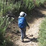
After crossing the main creek close to South Fork, we didn't have access to it again for the rest of the hike. There were two spots where we crossed seasonal springs. I don't think either had enough water for people, Callie barely got a sip out of em. I don't recall any spots to camp on the hike, it was on a pretty steep hill the entire time. The San Gabriels don't seem very friendly to backpackers.tarol wrote: Nice! How many miles for the first leg from Hwy 2 to South Fork? Any water or campsites en route?