Santiago Peak via Holy Jim Trail

Archived TRs for ranges in California.
Post Reply
User avatar
Sean
Posts: 3749
Joined: Wed Jul 27, 2011 12:32 pm

Post by Sean »

On Sunday I led a quartet (and one dog) up the Holy Jim Trail to Santiago Peak. The group included Dima (from this forum) and his dog Hank, Santiago (a Meetup friend), and my girlfriend, Cecelia. None of us had been to Santiago Peak before, and it was clear that Santiago was more excited about the adventure than the rest of us.

Image

After all, it was his peak at the end of the trail.

Image

After a 4am wake-up call, we all met at the Trabuco Canyon dirt road and caravanned to the trailhead. The road was a mess of potholes and puddles, offering a small challenge to my Honda Pilot, yet quite a wild ride for Santiago's little Mazda thin-wheeler. We all made it in one piece though after nearly five miles on that track.

At the Holy Jim trailhead there were already two groups ahead of us when we departed at 7am.

Image

The trail started off through a tree-shaded cabin community.

Image

Then we came to the "real" trailhead beyond the cabins.

Image

The trail was fairly lush and crossed the stream a few times.

Image

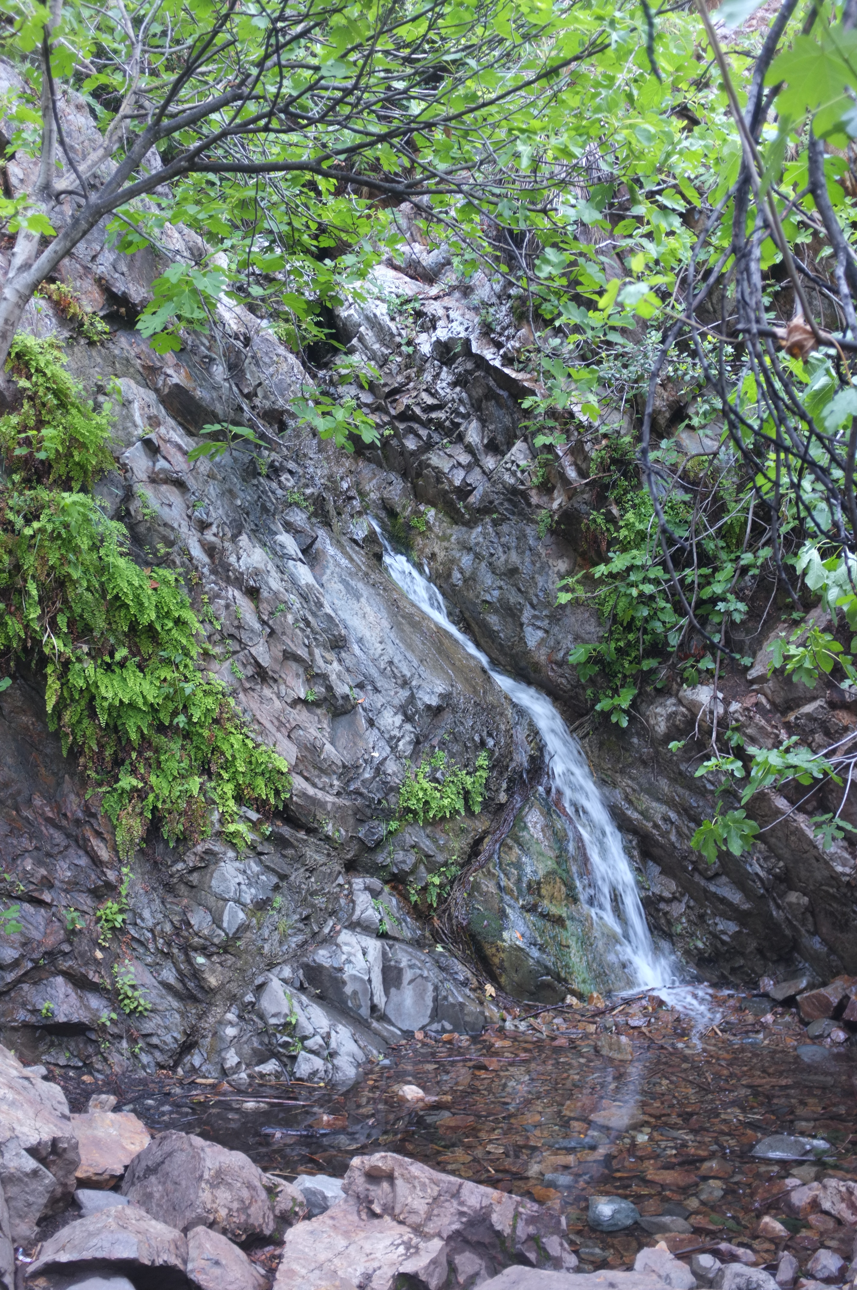
Soon we reached the split where turning right leads to the waterfall.

Image

Water cascaded down from the unseen upper reaches. Not my favorite falls, but worth the short side trip. Dima captured a really good view of it.

Image

Next we switchbacked out of the streambed, where we started heading up-canyon along the slopes.

Image

The many blooming yucca plants impressed me for some reason.

Image

It's a steady, but generally easy climb up the trail from here to the headwaters, where there was a trickling spring before the trail cuts to the right toward the Main Divide Road junction.

Image
(Dima and his dog, Hank)

Image
(at the Main Divide Rd/Holy Jim Trail junction)

At the junction I noticed a sign pointing toward the Upper Holy Jim Trail.

Image

Woo hoo! More trail, less road. Of course, we completely missed the shortcut path from the junction to the upper trail, and we ended up walking some of the road to get to where the sign directed us.

Image
(on the Upper Holy Jim Trail)

The upper trail took us around the other side of the ridge so that we could see into the Temecula Valley area. And views of Jacinto and Gorgonio opened up.

Image

Soon we reacquired the fire road and noticed our destination ahead.

Image

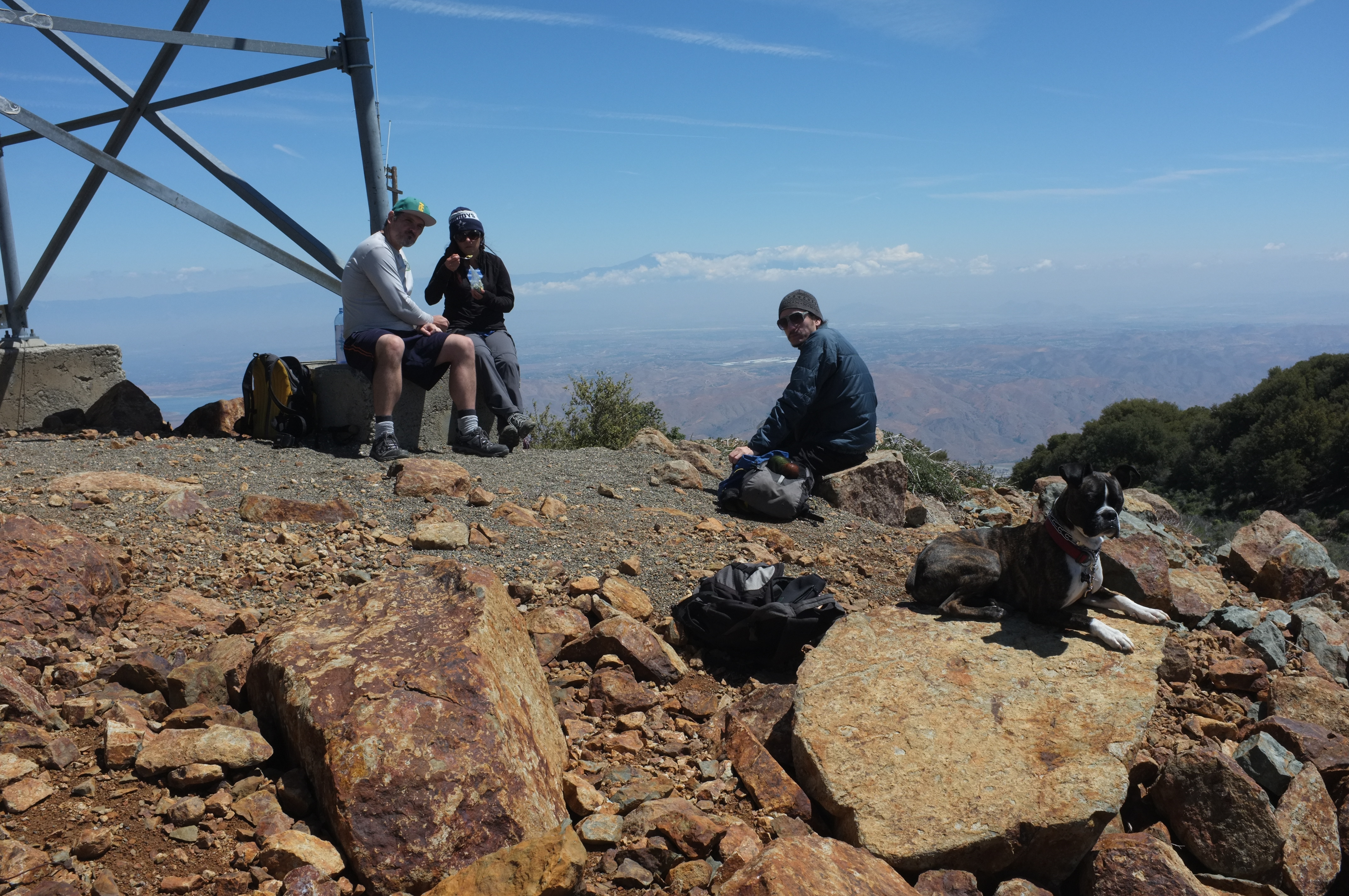
We spent quite a bit of time wandering around the tower-decorated summit area. We ate some lunch under one tower.

Image

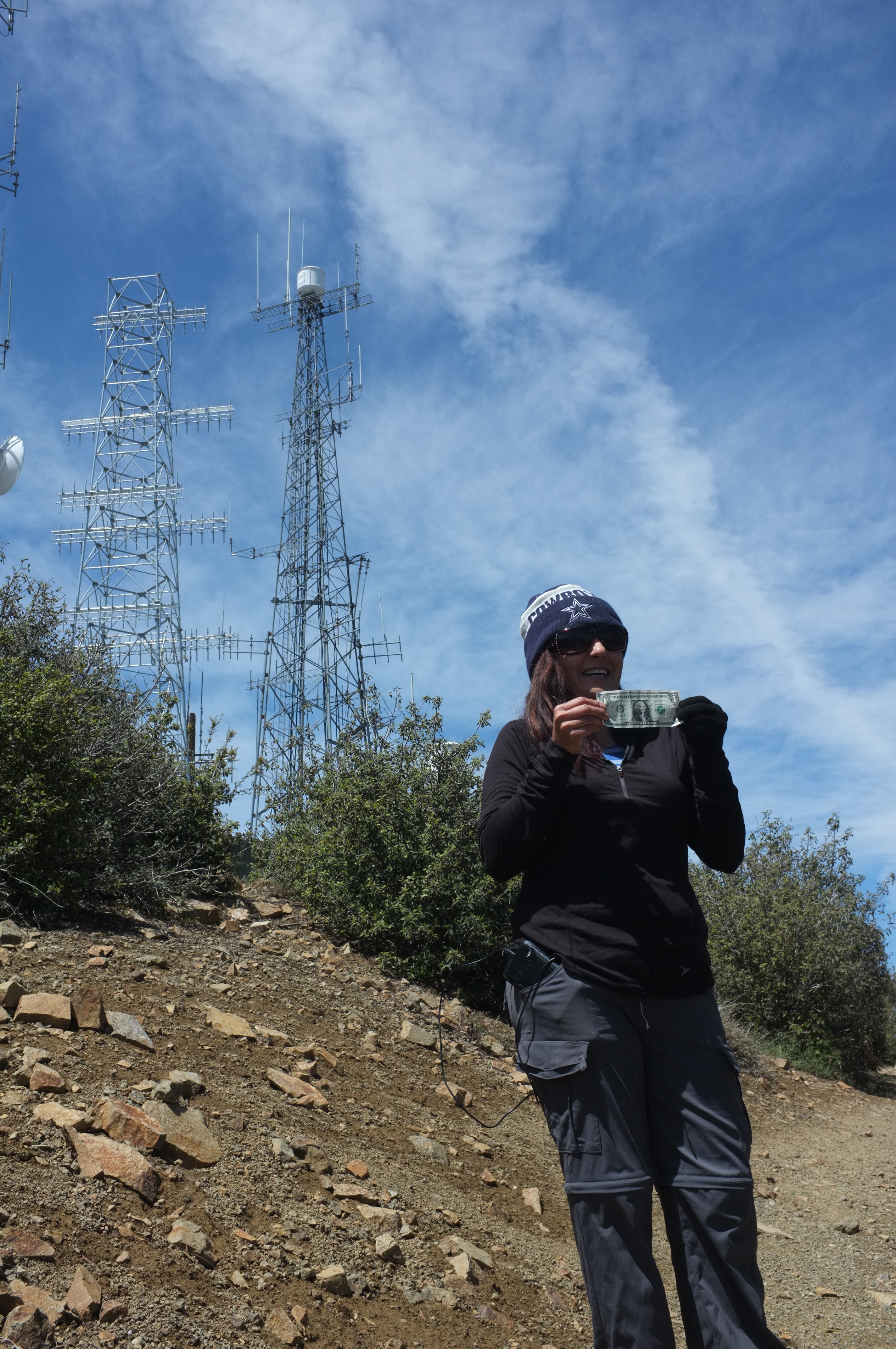
Cecelia found some money.

Image

Dima tried to unlock a door with his mind.

Image

Santiago was happy to be back on the mountain he created.

Image

And Hank found a comfy rock.

Image

The End.

Image
User avatar
scottawr
Posts: 115
Joined: Tue Nov 12, 2013 12:41 pm

Post by scottawr »

fun hike, I don't do it as often as i should its only like 15min drive from my house.

almost get run over by any mountain bikers?
User avatar
tekewin
Posts: 1194
Joined: Thu Apr 11, 2013 5:07 pm

Post by tekewin »

Nice going. Holy Jim to Santiago is a great hike, probably THE iconic OC hike. It's nice to see at least one Santa Ana waterfall still has water. I didn't know there was a shortcut to the Upper Holy Jim trail. I took the road.

Of the two Saddleback humps, I am more fond of Modjeska where you can take in views without the massive towers.
User avatar
Hikin_Jim
Posts: 4686
Joined: Thu Sep 27, 2007 9:04 pm

Post by Hikin_Jim »

Lookin' good. I have yet to make it up all the way to the peak. I've just been to the main divide road.

So, that little spring was still flowing? The one maybe halfway between the canyon bottom and the main divide road. It's an odd little spring.

HJ
User avatar
Sean
Posts: 3749
Joined: Wed Jul 27, 2011 12:32 pm

Post by Sean »

No mountain bikers on the trail that day. Once we hopped on the road, however, there were plenty of motorbikers.

Yeah, Jim, that odd spring was trickling right along the trail.

And there was water in the streambed at the Main Divide Road, just not where the "Bear Springs" sign was planted.

Keith, you can see the shortcut path very clearly from higher up on the road. Dima took it coming down and said it was okay.
User avatar
RichardK
Posts: 727
Joined: Sun Sep 30, 2007 12:33 pm

Post by RichardK »

About 16 years ago, we attempted this hike as absolute newbies. Our only source of info was Jerry Schad's Afoot and Afield in Orange County. A couple of miles into the hike we had our first ever rattlesnake encounter. The serpent was off in the bushes rattling. It scared the shit out of us and we ran a 100 feet up the trail before stopping. Next we hear a couple coming down the trail talking in very loud voices. They saw a mountain lion at a spring and turned around. They said they heard the cat in the bushes stalking them. At that point, we decided that discretion was the better part of valor and bailed on the hike. Our car, an ancient Honda Civic, bottomed out several times on the dirt road coming and going. We never made it back. Thanks for showing us what we missed.
User avatar
JeffH
Posts: 1154
Joined: Sun Nov 28, 2010 7:09 am

Post by JeffH »

Good day out there. I also have yet to make it to that peak, I keep saying one of these days.
Maybe we could do a group thing of everyone that says the same thing.
"Argue for your limitations and sure enough they're yours".
Donald Shimoda
Post Reply