
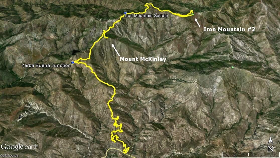
Played hooky from work on Good Friday to go goof off with teke in the San Gabriels. We went to McKinley and Iron #2 on a pleasant day on which we saw no one else out. Good times. TR with some pics for your viewing enjoyment here:
http://wildsouthland.blogspot.com/2015/ ... inley.html
A Good Friday to Climb Mt. McKinley (and Iron #2)
-
tekewin

- Posts: 1392
- Joined: Thu Apr 11, 2013 5:07 pm
Fun day, Rico. Thanks! The mystery of Trail Canyon remains as an exercise for the reader. Here are few extra photos:

Condor Peak from McKinley

Yerba Buena Ridge from McKinley

Charred tree hanging over the upper YB trail

Trail support beam, ready to be installed

Trail support beam giving in to erosion

Uncle Rico leaving the road on the north ridge of Iron #2

Western patch-nosed snake

Condor Peak from McKinley

Yerba Buena Ridge from McKinley

Charred tree hanging over the upper YB trail

Trail support beam, ready to be installed

Trail support beam giving in to erosion

Uncle Rico leaving the road on the north ridge of Iron #2

Western patch-nosed snake
-
Tom Kenney

- Posts: 386
- Joined: Sat Sep 29, 2007 7:51 pm
I was on the Yerba Buena trail about 15 years ago, and it looked like they had just started the 'restoration' work at that time. The trail was in rough shape, but had been re-cut, and some of the debris walls had been newly installed. Seems like they abandoned the effort? On that trip, we were doing the Gold->Yerba->Trail Cyn loop as a bike ride. Trail Canyon was in it's 'best shape ever', and still had considerable brush and deadfall to deal with below Tom Lucas.
Great pics, you guys! Thanks for sharing.
Great pics, you guys! Thanks for sharing.

-
tekewin
- Posts: 1392
- Joined: Thu Apr 11, 2013 5:07 pm
MikeP,
I only knew that because you identified one I ran into last year, nose to patched-nose!
I only knew that because you identified one I ran into last year, nose to patched-nose!
-
walker

- Posts: 248
- Joined: Mon Apr 08, 2013 11:14 pm
Congratulations on making it all the way up there, guys! I have yet to make it to either of those peaks. The lack of trees almost gives you the feeling of a desert range in that area, nice solitude.
I was in Trail Canyon about a month ago and hiked up to about 1/2 mile beyond Tom Lucas. Up to that point the trail was in surprisingly good shape and no problem at all aside from a few stream crossings where the main trail wasn't entirely self-evident. I turned back because of lack of time, but it didn't look like the trail got suddenly worse or anything. However, I did get myself stuck in the bushes at one point when I tried to follow the old route of the trail from before the fire and had to back out and follow the new path. The canyon has changed somewhat.
For the loop, maybe it would be best to ascend Trail Canyon and descend the Gold Canyon Road to take care of any uncertain sections on the way up before you're committed to the whole loop.
-
Uncle Rico

- Posts: 1484
- Joined: Thu Mar 20, 2008 7:48 pm
Thanks for that update on conditions in Trail Canyon walker. It doesn't sound as bad as we imagined. I agree with you that the way to do the loop is to ascend Trail Canyon then descend Gold Creek. Maybe tag Condor in the process for the trifecta.