Devil's Canyon Descent

TRs for the San Gabriel Mountains.
Post Reply
User avatar
Sean
Cucamonga
Posts: 3787
Joined: Wed Jul 27, 2011 12:32 pm

Post by Sean »

On Saturday Henry, Cecelia, and I decided it would be fun to scramble down Devil's Canyon from Twin Peaks Saddle to Chilao.

However, neither of them had been to Waterman before, so I first took them on the peakbagging tour.

Image

Image

Image

We then followed the trail to Twin Peaks Saddle

Image

and dropped into the beginning of Devil's Canyon.

Image

The canyon quickly encouraged Cecelia to apply gaiters to the situation.

Image

Indeed the scrambling seemed (probably was) relentless.

Image

The water flowed fairly consistently and powerfully throughout the upper reaches of the canyon. And deep pools were plentiful.

Image

Also plentiful were the ants and flies and deadfall and poison oak and poodle dog and miles and miles of zigzagging miles.

Image

But let's go back to how pretty the pools were.

Image

Just kidding -- most of them were not full of green slime.

Did I mention the waterfall? That was nice.

Image

We found a spot next to the waterfall that didn't have so many ants, and we ate lunch there.

Image

Then it was back to the scrambling.

Image

Sometimes we had to push big boulders out of the way simply to make a few feet of progress.

Image

You have a lot of time to think about weird things while plowing through Devil's Canyon for hours and hours. One nagging question that I finally answered is: why are there so many Modelo beer cans in the middle of nowhere?

Image

The answer suddenly came to me, like a poodle dog branch slap to the face, when we stumbled upon a marijuana grow site. Obviously Modelo is the pot grower's beer of choice.

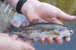
Moving on, Cecelia pointed out that I had nearly stepped on a snake.

Image

Perhaps I should pay more attention to where I'm walking, and less to my brilliant conclusions about pot growers.

Oh, we also walked underneath the root system of a very large tree.

Image

I probably stepped on some more snakes while looking up at this tree.

Finally, after what seemed like a restless fortnight, we arrived at the Devil's Canyon trail with the fresh smell of fire in the air from the nearby campground.

Image

The trail up and out to Chilao was in good condition with flowing water in the side canyons, but still the climb was slow, and we didn't reach the parking lot until after dark, having started at 7:30am.

Image
User avatar
Uncle Rico
Posts: 1402
Joined: Thu Mar 20, 2008 7:48 pm

Post by Uncle Rico »

Well, they don't call it Devil's Canyon for nothing. :twisted:
User avatar
RichardK
Posts: 727
Joined: Sun Sep 30, 2007 12:33 pm

Post by RichardK »

Sean is our ironman! I'm just glad that somebody can do it.
User avatar
Mike P
Posts: 1005
Joined: Tue Oct 02, 2007 10:48 pm

Post by Mike P »

Well done!!!
User avatar
Taco
Snownado survivor
Posts: 6010
Joined: Thu Sep 27, 2007 4:35 pm

Post by Taco »

Excellent report, senor.
User avatar
tekewin
Posts: 1195
Joined: Thu Apr 11, 2013 5:07 pm

Post by tekewin »

Cool report. I remember coming down from the West Twin that the cross country was not bad, but the debris looked thick in the canyon. How far was it down the canyon to the trail?

Maybe the forest service should post a bulletin on the hazards of grow operations, or signs next to "Bear Country" like "Grow Country".
User avatar
AW~
Posts: 2043
Joined: Mon Oct 01, 2007 12:00 pm

Post by AW~ »

Could use more Modelo, but besides that :lol: Do you think Taco buried all that treasure in an relatively known area?....We are talking gold bars...rubies...diamonds....besides the Obama memorabilia :wink:. The thing about the grow operations is I suspect they are a mask to coverup chupacabra activity.
User avatar
Joe_the_Hiker
Posts: 10
Joined: Mon Mar 30, 2015 8:50 pm

Post by Joe_the_Hiker »

Hey Sean, Joseph here from Josephine Peak. Cool to see you did Devil's Canyon! Anyway, here is a link I found on Inyo's site.
http://www.fs.usda.gov/detail/inyo/aler ... rdb5324909


Happy Trails!
User avatar
walker
Posts: 248
Joined: Mon Apr 08, 2013 11:14 pm

Post by walker »

Congratulations, Sean. That's a long slog once you get down into it.

A few years back, I did this as a solo loop hike. I parked at Devil's Canyon trailhead, then walked across the hwy past Chilao visitor center and took the trail that heads towards Horse Flats and Bandido then parallels the road over to Three Points and around to Twin Peaks saddle. From there I planned to descend Devil's Canyon to the trail and back to my car.

On the descent, I tried to stay a bit high on the south side of the canyon to stay in the pines and avoid the brambles along the creek. Probably wasn't any easier than the creekbed though, as I got into some interesting crossings of side canyons. Found a nice water source there in a couple of them.

At some point I decided to rejoin the canyon bottom and was headed that way when I heard a radio playing very close by and right ahead of me, some folky guitar and harmonica number. I'll bet it was that grow operation you came across, but manned at the time. I was thrashing through a bunch of leaves and the music stopped. I figured a fellow mountain traveler, backpacker or hunter probably wouldn't be listening to a radio in the backcountry, so I decided to stick to higher ground and avoid the creek bottom.

I backtracked up the side a ways and tried to make my way quietly along the canyon in the direction I had been going. I'd be interested to hear what others would do in this situation. Now that I've read the Inyo warning linked to above, I can see why they'd recommend going back the way you came, but in this case, I'd come a great distance already and could see the ridgetop ahead where my car was waiting.

I ended up hopping over a shoulder and bypassing a couple of creek bends on a game trail and then paying an unintended visit to the peculiar and interesting dry lakebed/meadow below peak 4915. It was a horrendous and claustrophobia-inducing brush brunch buffet to get there, so I don't exactly recommend the detour. But once at the lakebed/meadow travel was easy. I gained the ridge of 4915 and near a very ancient looking cairn descended due west into the creek and came out a short distance above the trail junction with the creek. This allowed me to bypass most of the lower stretch of canyon which judging from your pictures and my experience must have seemed like miles and miles of weed whacking.

At the end of this exhausting trek I ascended the trail as darkness fell without a headlamp. It seemed like it took forever to hike up that trail in the dark. If I ever try this again, I might start the day by riding a bicycle up the highway from the trailhead to three points and definitely bring a headlamp. Traveling with buddies like you did is probably a lot smarter too. Sections of this can be very slow going and who knows what you'll run into.
User avatar
Sean
Cucamonga
Posts: 3787
Joined: Wed Jul 27, 2011 12:32 pm

Post by Sean »

tekewin wrote: How far was it down the canyon to the trail?
If you were able to follow the streambed from Twin Peaks Saddle to the Devil's Canyon Trail, it would be about 4.5 miles. But you can't do that. Note the "cross" in cross-country, because this canyon requires serious crossing back and forth, back and forth, in order to dodge obstacles, including poison oak and poodle dog. Total actual distance traveled in the canyon was probably more like 5.5 or more miles. And the scrambling doesn't ease up until you reach the use path coming up from the campground. So the last half-mile or mile is fairly easy if you can follow the path.
User avatar
Sean
Cucamonga
Posts: 3787
Joined: Wed Jul 27, 2011 12:32 pm

Post by Sean »

Joe_the_Hiker wrote: Hey Sean, Joseph here from Josephine Peak. Cool to see you did Devil's Canyon! Anyway, here is a link I found on Inyo's site.
http://www.fs.usda.gov/detail/inyo/aler ... rdb5324909


Happy Trails!
Hi Joseph! Thanks for the link. Luckily this was an inactive grow site. It looked recently abandoned, perhaps within the last year or two judging by the state of the camping gear. There was an extensive network of hoses and drip lines. And the site was near a strong-flowing tributary emptying into Devil's Canyon from the south. I suspect it was the drainage from Pt. 6649.
User avatar
tekewin
Posts: 1195
Joined: Thu Apr 11, 2013 5:07 pm

Post by tekewin »

Thanks for the detail. That is a long way to be in a wild canyon.
User avatar
Sean
Cucamonga
Posts: 3787
Joined: Wed Jul 27, 2011 12:32 pm

Post by Sean »

walker wrote: At some point I decided to rejoin the canyon bottom and was headed that way when I heard a radio playing very close by and right ahead of me, some folky guitar and harmonica number. I'll bet it was that grow operation you came across, but manned at the time. I was thrashing through a bunch of leaves and the music stopped. I figured a fellow mountain traveler, backpacker or hunter probably wouldn't be listening to a radio in the backcountry, so I decided to stick to higher ground and avoid the creek bottom.
Yeah, sounds like you happened upon the growers. From your route description it sounds like you took a similar south-slope bypass that we took to avoid a particularly troublesome section of the streambed. Unfortunately the common sense detour here puts you right in the middle of the grow operation.

I think you did the right thing by thinking logically about the situation and trying to avoid the backcountry musicians.

Having encountered a few of these defunct grow sites, I frequently wonder how I would handle a situation like yours. First of all, you definitely want to remain calm and think things through. Don't talk. Tread as lightly and soundlessly as possible. Move away from the growers, if not backward, then to the side and around. If you are carrying a knife, make it ready to use. And most importantly, if you encounter the growers, play dumb and act like you think they are hikers or campers.
User avatar
Sean
Cucamonga
Posts: 3787
Joined: Wed Jul 27, 2011 12:32 pm

Post by Sean »

Also, any time you are wandering around in the middle of nowhere, especially in canyons with streams and springs, take note of any garbage you see. A propane tank in the middle of nowhere is a good sign that there might be a grow site nearby. A gully full of trash, fertilizer bags, backpacks, etc.

Of course, black hoses are the most obvious. The hoses sometimes stretch for a mile or more upstream from a grow site.
User avatar
naresha
Posts: 1
Joined: Fri Apr 10, 2015 8:06 pm

Post by naresha »

Great report! A few of us did this hike last June (much lesser water but many more wildflowers), this TR brought back memories. We started at about 10 am, followed the stream for the most part, and hadn't made it down to the bottom by sunset. Once it got dark, we still had about a mile to go, and we figured the best option in the dark was to continue to stick to the stream and wade through it with our headlamps. Extremely slow going, and I think it was 1 am when we made it back up to Chilao.

We must have taken a route that bypassed the grow site, or we passed it at night---four pairs of eyes and ears, and we saw nothing out of place. I'm glad we had one less thing to worry about.
Post Reply