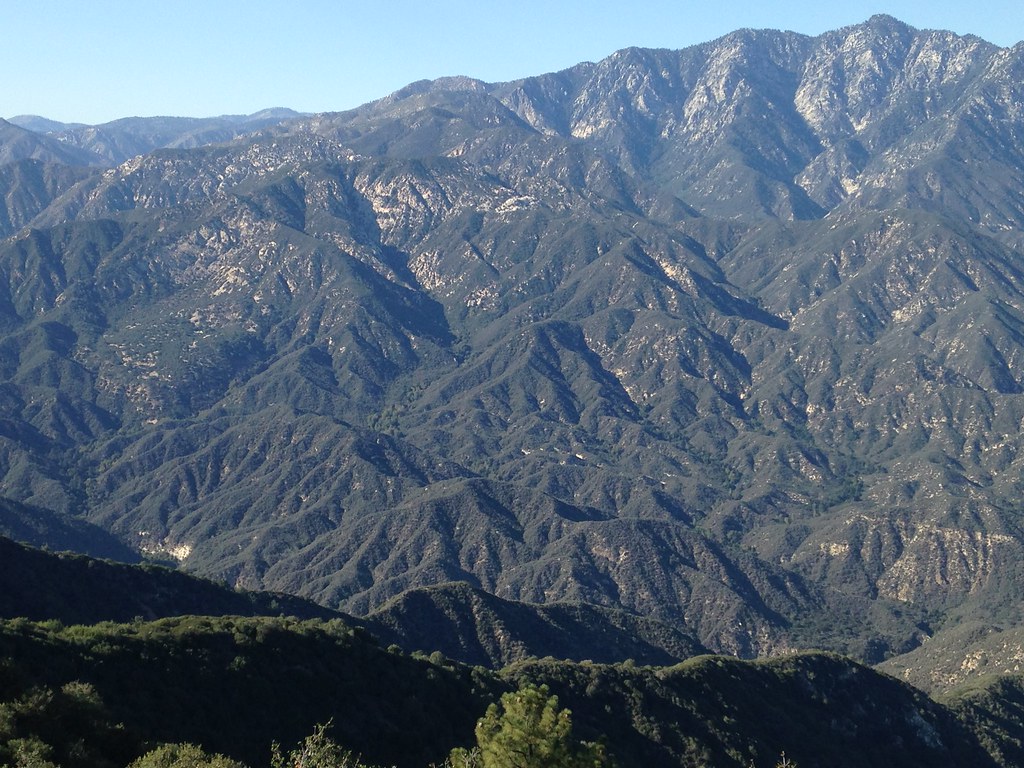
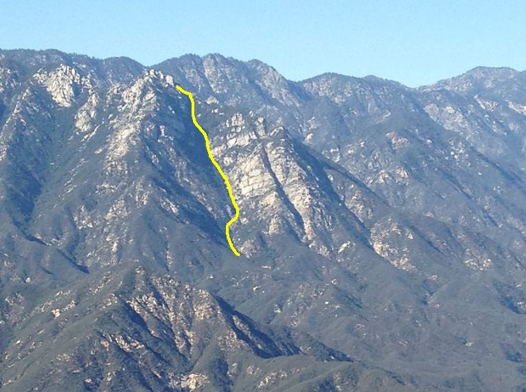
Bear Creek via Smith Saddle 3/23/15

TRs for the San Gabriel Mountains.
Post Reply
User avatar
AW~
Posts: 2064
Joined: Mon Oct 01, 2007 12:00 pm

Post by AW~ »

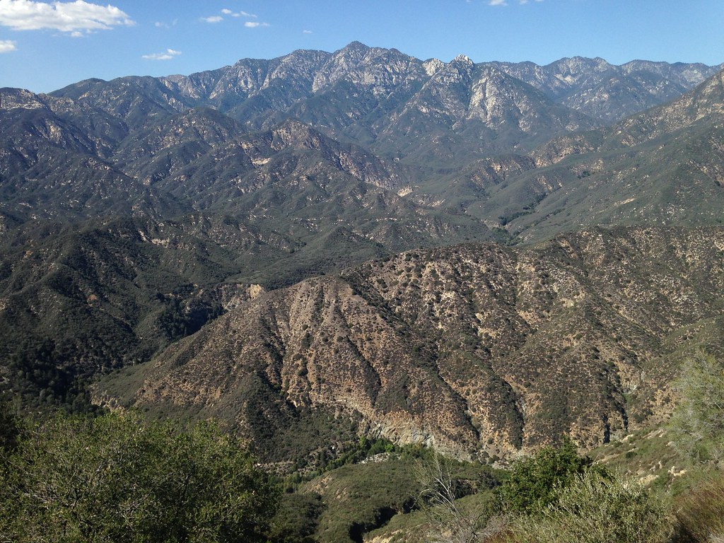
Started at first light up the saddle and down to Bear Creek on a nice spring day. The hills still green, but very little water and only then at a considerable distance from the car. Just before getting to Bear Creek, the drainage the trail has been following turns kind of brush free, so I went down to Bear Creek that way, finding 2 tall downclimbs. The creek itself had a decent amount of flow and the flood plain was winterized and very clear. A lot of sand in the clear river.

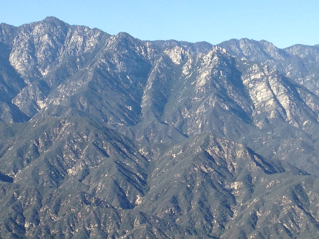
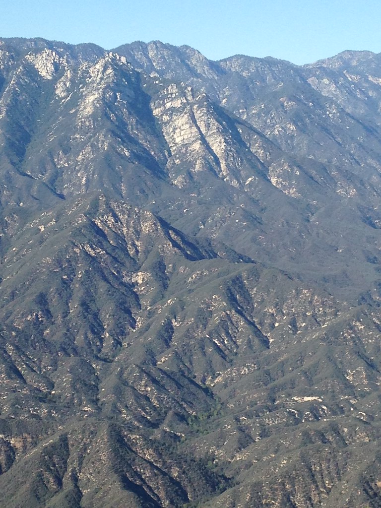
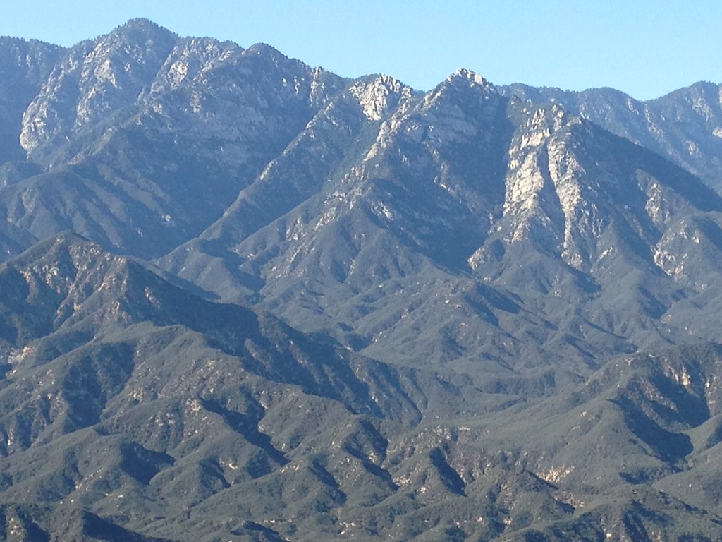
Got back to the car at 2:45 pm, so it was about 8 hours of total travel, but there was a lot of idling in that time too trying to solve some terrain questions that plague this area. One of them being how do you get to triplet rocks from Bear Creek, because while its confounding in that its brushy, but still looks doable lol. Maybe hope springs eternal.

sunrise over marine-layered hwy39
Image

heading down to bear creek
Image

manzanita forest
Image

Smith mountain
Image

Offtrail into the drainage
Image

Flowers high on rock cliff
Image

heading back out
Image
User avatar
walker
Posts: 248
Joined: Mon Apr 08, 2013 11:14 pm

Post by walker »

Nice trip, AW. Looks like an early start is best for getting up and over the saddle before the sun starts really cooking the first couple miles of trail.
One of them being how do you get to triplet rocks from Bear Creek, because while its confounding in that its brushy, but still looks doable lol. Maybe hope springs eternal.
I've pondered that very question while sitting on Smith mountain or the saddle. Did you ever consider one of the northern gullies leading to notches in the ridge between East Twin and Triplet? Some of the gullies look almost entirely brush free, or at least of a more piney vegetation type, but they're steep as an avalanche chute, probably loose and deadly treacherous. Then again, even getting into position to check it out would involve some epic, Herculean bush-whack action, not to mention ascending Bear creek to reach the northwest branch. That could be problematic if waterflow is high. If I remember correctly, the canyon is a bit of a granite-walled gorge just above where the trail meets the creek. Did you drop in above that? Thanks for posting!
User avatar
AW~
Posts: 2064
Joined: Mon Oct 01, 2007 12:00 pm

Post by AW~ »

walker wrote: Did you ever consider one of the northern gullies leading to notches in the ridge between East Twin and Triplet? Some of the gullies look almost entirely brush free, or at least of a more piney vegetation type, but they're steep as an avalanche chute, probably loose and deadly treacherous. Then again, even getting into position to check it out would involve some epic, Herculean bush-whack action, not to mention ascending Bear creek to reach the northwest branch. That could be problematic if waterflow is high. If I remember correctly, the canyon is a bit of a granite-walled gorge just above where the trail meets the creek. Did you drop in above that? Thanks for posting!
I dropped into Bear Creek very close to where the trail meets the creek. It is just before that the trail does not follow the creek coming down from Smith saddle...to avoid those 2 tall downclimbs/scrambles. It would be possible to stay above Bear Creek and on the pk5495 side and not be completely murdered in brush. I did go up the Bear Creek, turning around about a mile shy of the north(northwest) fork of Bear Creek since the scenicity dropped preciptiously. I wouldnt recommend depending on Bear Creek to do much because like you said, there is a waterflow question and also that it accumulates water. Just this year it happens that there was a big flash and deposit of sand, but usually its pools and vegetation. Speaking of vegetation, the sand looks to be overgrown before anyone blinks.

The approach to triplet would start from just downstream of where the trail meets Bear Creek....following the triplet side of Bear Creek just above the canyon. I think pk 3220 can be obtained with some loppers here or there, albeit the person ascending would need some serious help as to where to go from a spotter. Once thats solved, it would be trouble to the 4000 elevation for sure....but again, some of the brush is not spooky and theres a drainage on the left side of pk 3220 that might help out going up.
User avatar
Taco
Snownado survivor
Posts: 6036
Joined: Thu Sep 27, 2007 4:35 pm

Post by Taco »

I think of this 'problem' all the time. There's that 500ft or so granite wall on the east face of Triplet's south ridge that I always look at whenever I'm within view. Many nights staring at it from GMR and elsewhere. I call it the Zebra Wall, for the stripes of different rock types that split it up. Could be 600ft tall along tis longest axis or whatever. Enormous pain in the ass to get there. I'd come in from the top, rapp down the gully, and go up and out. Or, reach Triplet, go down the south ridge, and rapp down to the base of the wall. Man, what an adventure that would be. Lotta weight, maybe. Sorry, off-topic.

Walker mentioned the north side gullies, and I still think that's the 'easiest' way up. No brush. Maybe if we ever received enough snow, one could crampon up em with relative ease? Otherwise it's probably a long awful scree gully.

I tried to go up from the south via one of the canyons from West Fork. What a bitch. Screw that.

I've given up on any attempt to reach Triplet from below. Now, I simply look at canyoneering down one of the steep canyons near it after reaching it from ACH.
User avatar
Ze Hiker
Posts: 1432
Joined: Mon Jul 28, 2008 7:14 pm

Post by Ze Hiker »

walker wrote: Did you ever consider one of the northern gullies leading to notches in the ridge between East Twin and Triplet? Some of the gullies look almost entirely brush free, or at least of a more piney vegetation type, but they're steep as an avalanche chute, probably loose and deadly treacherous. Then again, even getting into position to check it out would involve some epic, Herculean bush-whack action, not to mention ascending Bear creek to reach the northwest branch. That could be problematic if waterflow is high.
I've been in and looked down those gullies and I think they are definitely doable. The problem is of course getting to them. I always wondered if the least resistance would be to drop down of Hwy 39 at the curve (past Crystal Lake) which would place you near the confluence of the two branches of the creek.
User avatar
walker
Posts: 248
Joined: Mon Apr 08, 2013 11:14 pm

Post by walker »

Hey, Taco, you really can't beat the quantity and quality of info that has accumulated on this forum. Hats off!

AW, thanks for the details about conditions on both sides of the creek and in the creek itself. It's very helpful. On one visit there, I checked out the mouth of the drainage you mentioned that empties from the 3220 side. From what I saw at the time, the lower drainage was a dense brush-choked thicket of prickly brambles without many gaps. Maybe it opens up higher up when the gradient is steeper, so ascending the ridge like you suggest and maybe finding the drainage further up could go.

Now that you mention it, on the 5495 side it looks like you could traverse over a couple of lumps and rejoin Bear Creek somewhat below the confluence of the upper forks, but it could be a brush-fest for sure, and that's before you even get started.

Ze, you read my mind! I was scoping out the approach from Hwy 39 and I guess the drawback is that it's very committing once you drop in without much in the way of an easy alternate escape route. There seem to be some waterfalls down low in the canyon directly below that curve. You'd have to stay on the ridge, find a way around them or bring gear to descend them. The last push back up to regain hwy 39 after hiking to Triplet and back could be a killer. That said, looking at the terrain you'd travel through once you're down there, there would be much more time spent under canopy of alders or traveling through pine forest, and therefore I think I would enjoy the trip more regardless of whether or not I actually reached the destination.

Another crazy hike in the area would be to park near Buckhorn, head for Twin Peaks, descend towards Bear Creek from Twin Peaks Saddle, meet up with the north gullies to Triplet, climb Triplet and return to Twin Peaks via the ridgeline. At least you'd only have to do the ridge once! Either way, it seems like one heck of a wild backcountry adventure even to get close to it.
User avatar
tekewin
Posts: 1259
Joined: Thu Apr 11, 2013 5:07 pm

Post by tekewin »

I've done a little homework on the possible alternative routes mentioned with a different approach from Buckhorn. See Caltopo map...

http://caltopo.com/m/6416

Red + Green = approach from Smith saddle. This looks too long and I don't know if the climb from the east face is possible (especially for me). Doesn't look promising.

Yellow = Drop off 39 at a turnout and follow Bear Creek to the scree slope.
Loss 2749'
Gain 3452'
Total Gain RT 6201'+
One way 3.92 miles, RT 7.84 miles

Blue = Buckhorn down a gully to Bear Creek, around bumps to the scree slope.
Loss 3199'
Gain 2785'
Total Gain RT 5984'+
One way 4.25 miles, RT 8.5 miles

What the yellow and blue routes share is a 2500' gain over the last 1.2 miles up scree and dirt! That slope has to be class 3+, but maybe hugging the tree line on the left side of it would give you some natural anchors.

Buckhorn looks like it might be the best non-ridge option, but you also have to watch out for "grow friends" in the area.

Every option looks like an absolute bitch. Google Earth can't see long sections of Bear Creek for the trees and vegetation. Those sections could be snarls or just canopy. Can't tell without going there.

The ridge at Ze's pace is about 15 hours. If the alternate routes are an average 1/2 per hour, then you are not saving much. If they are 3/4 mile per hour, Buckhorn could be around 11.3 hours. That might be worth it.
User avatar
SGBob
Posts: 101
Joined: Wed Jan 07, 2015 12:47 pm

Post by SGBob »

Thanks for the pics, especially the poppies. I'm a native plant nerd and it's cool to see some wild poppies that are unlikely to have been genetically contaminated by the poppies ubiquitous in seed packs now a days. I just may head up there to get a seed pod this spring.
User avatar
Ze Hiker
Posts: 1432
Joined: Mon Jul 28, 2008 7:14 pm

Post by Ze Hiker »

The ridge at my 'fast' pace (when I'm alone) is around 10-11 hours. I can't imagine the blue line (even more cross country) is a faster route! I am curious about yellow though. I think that has the best shot (or some variation).
User avatar
tekewin
Posts: 1259
Joined: Thu Apr 11, 2013 5:07 pm

Post by tekewin »

Ze, thanks for the feedback. I don't know if any of these are reasonable alternatives to an unreasonable destination. Haha.

Can you tell from the yellow line if the top of the scree slope, where it hits the ridge, is past the drop down point for the final gully?

I can't tell if the path is straight up at that point or if you need to drop down the other side first.

I don't know if I ever want to attempt this, but I find the analysis fascinating.
User avatar
_kick_rocks_
Posts: 49
Joined: Tue Mar 31, 2015 5:53 pm

Post by _kick_rocks_ »

All this talk about how difficult triplet Rock is from Bear Creek makes me want to do it. Unfortunately, I've dropped down to Bear Creek from Islip Saddle and just looking at those Ridges makes me tired. South Gully is the closest thing I can see on google maps that looks legit. I'll definitely keep this post in mind if and when I ever get around to it. You got a nice picture of the Manzanita Forest! Kudos!
User avatar
Ze Hiker
Posts: 1432
Joined: Mon Jul 28, 2008 7:14 pm

Post by Ze Hiker »

tekewin wrote: Ze, thanks for the feedback. I don't know if any of these are reasonable alternatives to an unreasonable destination. Haha.

Can you tell from the yellow line if the top of the scree slope, where it hits the ridge, is past the drop down point for the final gully?

I can't tell if the path is straight up at that point or if you need to drop down the other side first.

I don't know if I ever want to attempt this, but I find the analysis fascinating.
The yellow line is one gully west of the final gully. I would maybe not use the gullies, but the ridges in between. The trees would hopefully indicate better footing. I think based on slope shading they are also a little less likely to have steep sections. But its all a guess.
User avatar
walker
Posts: 248
Joined: Mon Apr 08, 2013 11:14 pm

Post by walker »

Hey Tekewin,

Thanks for compiling that info. I was exploring another entry route from the north a bit to the west of your "buckhorn" line when I ran into undesirable company, but travel was so easy along that path that I'd like to get back and explore the "narco-harvest" route some more in the fall or winter if we ever get one.

Meanwhile, I rode my bike up Pine Mountain today and got some nice views of the south side of Triplet ridge.

It looks pretty imposing and awesome from there. The south gully looks pretty dang intimidating. Here are some pictures for inspiration.

The southern approach via Bear Canyon:

Image

The ridge:

Image

Which one's the southern gully route?

Image

afternoon light:

Image

Extra credit, Mermaids:

Image

Hey, I saw Tekewin and Dima's entries from 2014 in the Pine Mt. register book too!
User avatar
tekewin
Posts: 1259
Joined: Thu Apr 11, 2013 5:07 pm

Post by tekewin »

Walker,

This is the south gully I was looking at, but it looks more difficult than the east side to me, and probably more work to get to the base.

Image

Is mermaids peak 4654 between the two mermaids canyons?
User avatar
walker
Posts: 248
Joined: Mon Apr 08, 2013 11:14 pm

Post by walker »

This is the south gully I was looking at, but it looks more difficult than the east side to me, and probably more work to get to the base.
Given the alternatives, I think I prefer the northern approach, but Lord knows what kind of surprises you might run into on the way there. It's a long way across rugged and remote terrain.
Is mermaids peak 4654 between the two mermaids canyons?
I have to admit I'm not certain which is which. Maybe AW can fill us in?
User avatar
AW~
Posts: 2064
Joined: Mon Oct 01, 2007 12:00 pm

Post by AW~ »

Yes, the peak 4654 splits the canyons. Little Mermaid on the left(the one with the big gash in the ridge to the left of the peak) and Big Mermaid on the right. I dont know of any feasible approach to Triplet from the bottom...it would be neat if something turned up but Id set the expectations very low. We need some rain to clear up some paths with all that deadfall/branches/etc
Image
User avatar
sh44
Posts: 4
Joined: Fri Apr 27, 2018 11:23 pm

Post by sh44 »

Hey guys, I had just found this page as I had been interested in a route from somewhere around Bear Creek to Triplets. Was wondering if anyone had any updates or had tried any of the gullies/ridges from Bear Creek area? If someone would be interested in exploring a new route, I'd be down. Was looking at Google Earth and there looks like some possible gullies/ridges, but the vegetation is quite heavy on a lot of them and the few that don't seem to have substantial scree and rocks. I was looking mostly from the vantage point of Highway 39 (that curvy turn that sticks out near Crystal Lake) as a possible drop in point...
User avatar
dima
Posts: 1521
Joined: Wed Feb 12, 2014 1:35 am
Location: Los Angeles

Post by dima »

Most recently I did this:

above-bear-creek-t7590.html

walker and anarchist and AW tried the northerly approaches, and maybe you can find their TRs.
User avatar
dima
Posts: 1521
Joined: Wed Feb 12, 2014 1:35 am
Location: Los Angeles

Post by dima »

User avatar
sh44
Posts: 4
Joined: Fri Apr 27, 2018 11:23 pm

Post by sh44 »

Thanks Dima for the info, I'll take a look!
Post Reply