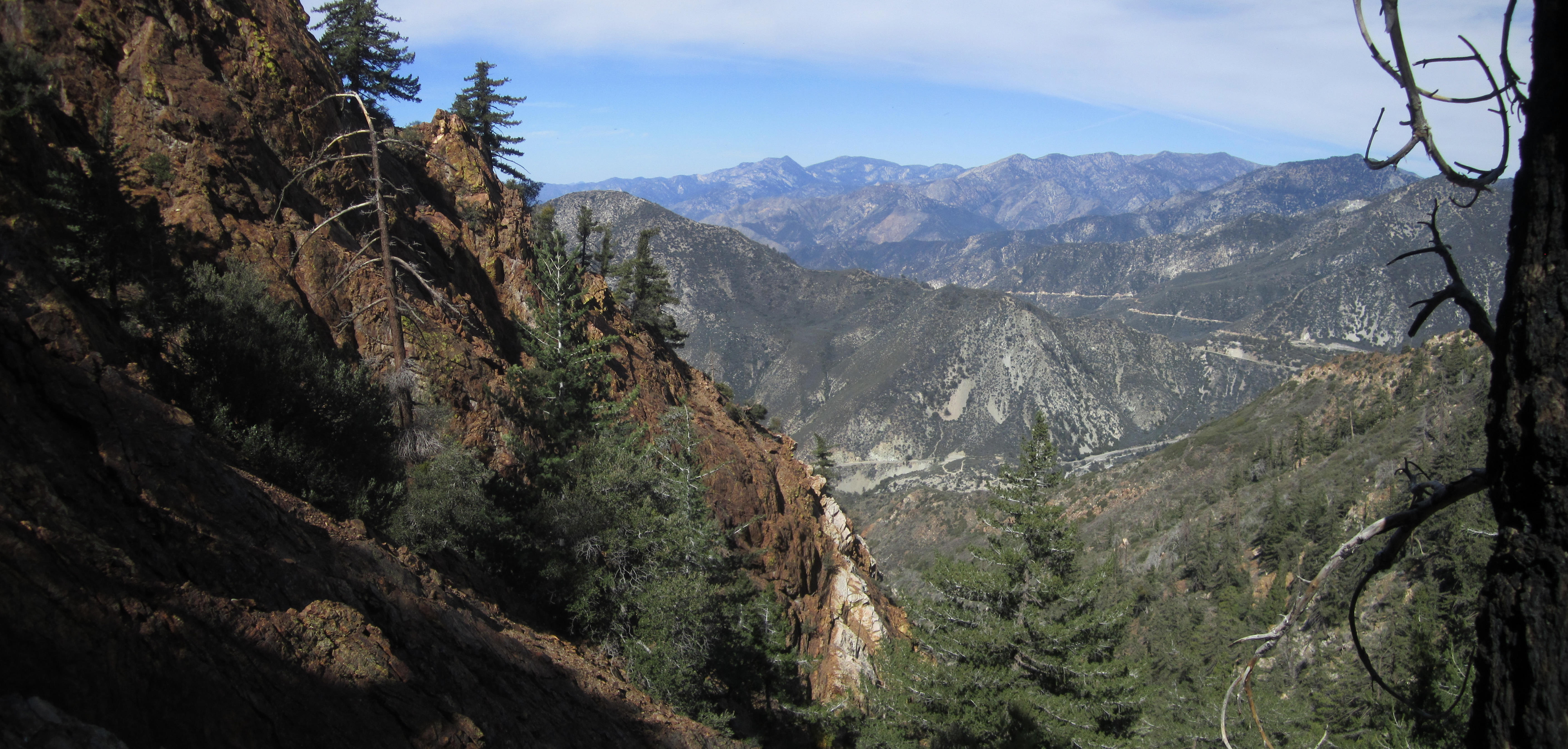
Cascade Canyon - Above the Barrett-Stoddard Road
Posted: Sun Mar 15, 2015 12:52 pm
Cascade Canyon is one of those colorful, rock-filled gullies on the west side of Ontario Peak. It can be easily viewed from the Baldy Road before the Hog Back.
Accessing Cascade is easily accomplished by walking the Barrett-Stoddard truck trail 1.6 miles. Canyoneers drop-in at this point and head down-canyon to the San Antonio creek. I once had the pleasure of watching Taco and the Machete Brothers curse and stumble their way through that stretch of wilderness. This time I decided to head upward and hope for the best.
There is actually a decent use path along the banks for a short while.

The use-path can be a challenge to find/follow in one or two spots, and it does become narrow and exposed to about 15 feet or so at one point. Then the canyon turns too rough for a trail and one must plow through the deadfall and foliage.

Appropriately named, this canyon also offers many little falls and cascades to admire.

But I was there for the amazing rock formations which I spied from along the Baldy Road.

The reddish-brown boulders and walls are truly spectacular and plentiful.


The stream disappears and reappears a couple times. Then there is a long stretch of relatively easy dry-bouldering. Some easy class 3 scrambling.

I did an exposed ledge walk along the left side of that.
But then I realized I probably could have gone straight up the fall without too much trouble, given the amount of debris available for holds.

I had the notion of climbing to Peak 6857 (SW of Ontario Peak), but I ran out of time and had to turn around maybe 400 feet from the top.

The side gully was very steep but looked good for a future re-attempt. I detoured a bit to get a nice shot of the cliffs.

On the way down I found a skull.

Accessing Cascade is easily accomplished by walking the Barrett-Stoddard truck trail 1.6 miles. Canyoneers drop-in at this point and head down-canyon to the San Antonio creek. I once had the pleasure of watching Taco and the Machete Brothers curse and stumble their way through that stretch of wilderness. This time I decided to head upward and hope for the best.
There is actually a decent use path along the banks for a short while.
The use-path can be a challenge to find/follow in one or two spots, and it does become narrow and exposed to about 15 feet or so at one point. Then the canyon turns too rough for a trail and one must plow through the deadfall and foliage.
Appropriately named, this canyon also offers many little falls and cascades to admire.
But I was there for the amazing rock formations which I spied from along the Baldy Road.
The reddish-brown boulders and walls are truly spectacular and plentiful.
The stream disappears and reappears a couple times. Then there is a long stretch of relatively easy dry-bouldering. Some easy class 3 scrambling.
I did an exposed ledge walk along the left side of that.
But then I realized I probably could have gone straight up the fall without too much trouble, given the amount of debris available for holds.
I had the notion of climbing to Peak 6857 (SW of Ontario Peak), but I ran out of time and had to turn around maybe 400 feet from the top.
The side gully was very steep but looked good for a future re-attempt. I detoured a bit to get a nice shot of the cliffs.

On the way down I found a skull.