Cascade Canyon - Above the Barrett-Stoddard Road

TRs for the San Gabriel Mountains.
Post Reply
User avatar
Sean
Cucamonga
Posts: 3783
Joined: Wed Jul 27, 2011 12:32 pm

Post by Sean »

Cascade Canyon is one of those colorful, rock-filled gullies on the west side of Ontario Peak. It can be easily viewed from the Baldy Road before the Hog Back.

Accessing Cascade is easily accomplished by walking the Barrett-Stoddard truck trail 1.6 miles. Canyoneers drop-in at this point and head down-canyon to the San Antonio creek. I once had the pleasure of watching Taco and the Machete Brothers curse and stumble their way through that stretch of wilderness. This time I decided to head upward and hope for the best.

There is actually a decent use path along the banks for a short while.

Image

The use-path can be a challenge to find/follow in one or two spots, and it does become narrow and exposed to about 15 feet or so at one point. Then the canyon turns too rough for a trail and one must plow through the deadfall and foliage.

Image

Appropriately named, this canyon also offers many little falls and cascades to admire.

Image

But I was there for the amazing rock formations which I spied from along the Baldy Road.

Image

The reddish-brown boulders and walls are truly spectacular and plentiful.

Image

Image

Image

The stream disappears and reappears a couple times. Then there is a long stretch of relatively easy dry-bouldering. Some easy class 3 scrambling.

Image

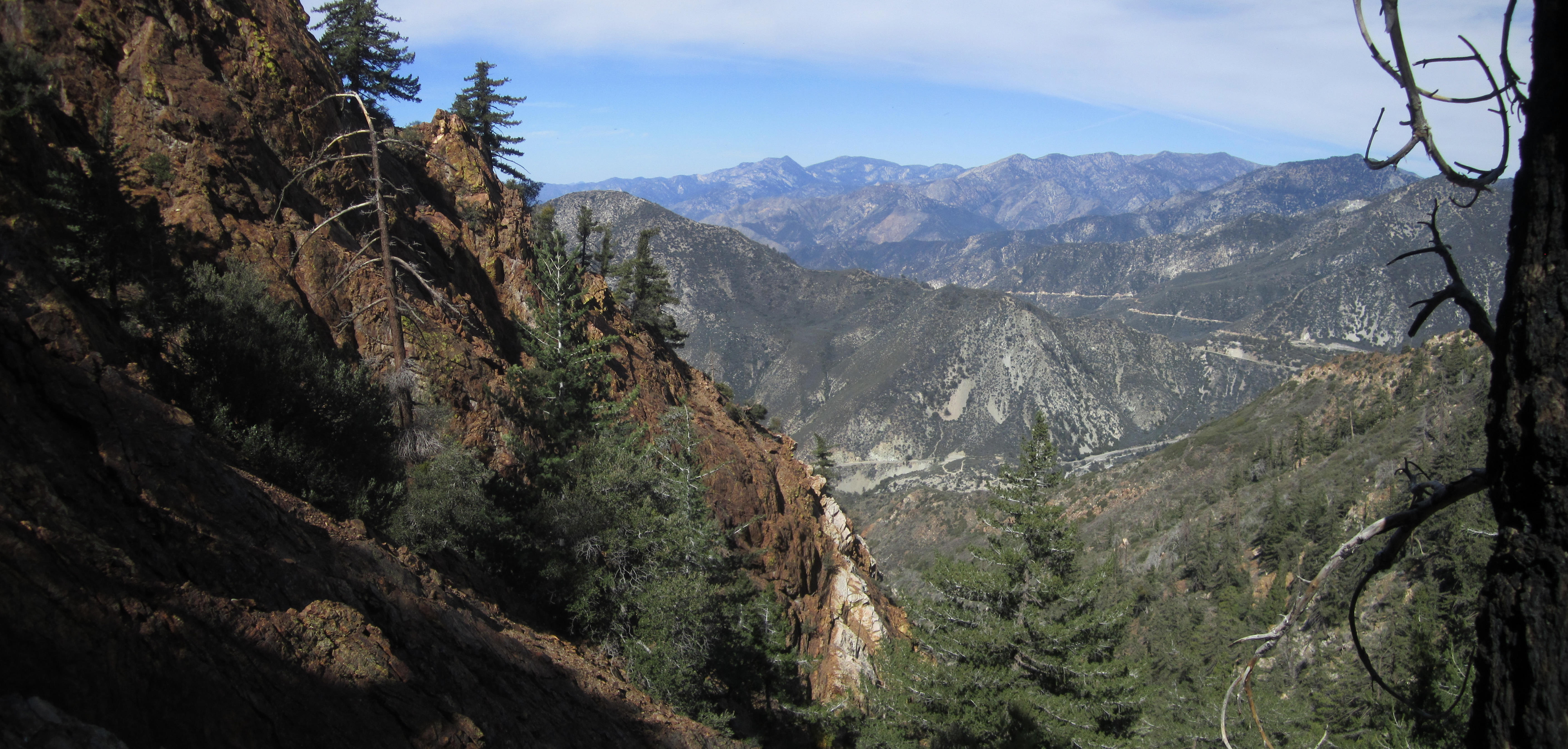
I did an exposed ledge walk along the left side of that.

But then I realized I probably could have gone straight up the fall without too much trouble, given the amount of debris available for holds.

Image

I had the notion of climbing to Peak 6857 (SW of Ontario Peak), but I ran out of time and had to turn around maybe 400 feet from the top.

Image

The side gully was very steep but looked good for a future re-attempt. I detoured a bit to get a nice shot of the cliffs.

Image

On the way down I found a skull.

Image
User avatar
Mike P
Posts: 1005
Joined: Tue Oct 02, 2007 10:48 pm

Post by Mike P »

Nice!
User avatar
Taco
Snownado survivor
Posts: 6010
Joined: Thu Sep 27, 2007 4:35 pm

Post by Taco »

Thank you! I also wanna see what the canyons and rock look like in the canyons between here and the crash site canyon.
User avatar
Sewellymon
Posts: 97
Joined: Tue Feb 12, 2008 8:55 pm

Post by Sewellymon »

The north facing walls got a fair amount of rock-climbnig action in the late 70's.

Taco- have you given the walls a serious assessment? Is there some quality up there?
User avatar
Taco
Snownado survivor
Posts: 6010
Joined: Thu Sep 27, 2007 4:35 pm

Post by Taco »

I looked at all the images and read what I could find on it. I decided against it after checking out a crag (which Johnny and I named Acid Crag) further down BS road kinda near Stoddard Peak.

I got as far as putting a rack together and packing up to solo one of the larger formations in a nearby canyon. I gave up, as the climbing there is frustrating, and usually quite loose. There is a large formation nearby with what looks like a nice crack going up a slab at the edge of a buttress with nice exposure. Probably won't return. If anyone wants to go, I'd like to have a partner. I can't bring myself to be motivated for it alone anymore.
User avatar
tekewin
Posts: 1195
Joined: Thu Apr 11, 2013 5:07 pm

Post by tekewin »

Canyons hide some amazing geology. Great photos and bonus points for the skull.
User avatar
turtle
Posts: 152
Joined: Wed Jan 27, 2010 11:35 am

Post by turtle »

Sean wrote: I had the notion of climbing to Peak 6857 (SW of Ontario Peak), but I ran out of time and had to turn around maybe 400 feet from the top.
That there is Turtle's Beak. Get with the program! :wink:

Definitely worth a visit sometime, as it's a beautifully remote perch. Lots more colorful rock on the summit, too.
User avatar
AW~
Posts: 2040
Joined: Mon Oct 01, 2007 12:00 pm

Post by AW~ »

Did you see the mine? Or is there a mine? I forget....
User avatar
Taco
Snownado survivor
Posts: 6010
Joined: Thu Sep 27, 2007 4:35 pm

Post by Taco »

Yeah, didja grab any of that blue stuff from Afghanistantario Peak?!?!
User avatar
Sean
Cucamonga
Posts: 3783
Joined: Wed Jul 27, 2011 12:32 pm

Post by Sean »

turtle wrote:That there is Turtle's Beak. Get with the program! :wink:

Definitely worth a visit sometime, as it's a beautifully remote perch. Lots more colorful rock on the summit, too.
I made it to the Beak on Sunday with my girlfriend. Such an awesome spot! Did you leave the 5-pesos coin at the camp site?

Image

I'll throw up a TR when I have more time. There is some stellar class 3/4 climbing on the north face out of Cascade Canyon.

Image
User avatar
Sean
Cucamonga
Posts: 3783
Joined: Wed Jul 27, 2011 12:32 pm

Post by Sean »

AW wrote: Did you see the mine? Or is there a mine? I forget....
I think it was Taco who told me there was a mine up there, but I didn't see one during the two trips I made up the canyon.
User avatar
Sean
Cucamonga
Posts: 3783
Joined: Wed Jul 27, 2011 12:32 pm

Post by Sean »

Taco wrote: Yeah, didja grab any of that blue stuff from Afghanistantario Peak?!?!
Some of the rocks were bluish.

Image
User avatar
CrazyHermit
Posts: 343
Joined: Mon Sep 07, 2015 1:03 pm

Post by CrazyHermit »

That canyon is well known to rock hounds. For some strange reason it's a great place to find rubies, along with less precious stones like Lapis Lazuli.

User avatar
Sean
Cucamonga
Posts: 3783
Joined: Wed Jul 27, 2011 12:32 pm

Post by Sean »

CrazyHermit wrote: That canyon is well known to rock hounds.
Looks like they only went to the lower canyon.
User avatar
Girl Hiker
Posts: 1330
Joined: Fri Apr 04, 2014 7:46 am

Post by Girl Hiker »

Cool. Isn't this the same canyon that you and I scrambled through to bag Turtle Beak a few years ago?
Post Reply