
Beta on Cloudburst Canyon (SW of South Hawkins)
-
Sean

- Cucamonga
- Posts: 4402
- Joined: Wed Jul 27, 2011 12:32 pm
I'm looking for information about the Cloudburst Canyon SW of South Hawkins. Has anyone been there? Got any beta on obstacles? Thanks in advance.
-
Taco

- Snownado survivor
- Posts: 6213
- Joined: Thu Sep 27, 2007 4:35 pm
I've only hiked around the bottom. Doesn't look technical on Google Earth. Looks like a stretch of bushwhacking a short distance up after a tributary meets it, but not much after. Probably awful bushwhacking in real life, if experience shows anything. 
-
AW~

- Posts: 2124
- Joined: Mon Oct 01, 2007 12:00 pm
Never been....Smith Mountain provides for a good look at it.
http://rickkent.net/photos/2006-11-05%2 ... G_7035.JPG
I doubt there is a rappel in there. Fierce brush between elev 3800-4200 and 4300-4600? Probably the whole route LOL. I have a photo from 2007 that looks like a lot of tree deadfall in there too from the Curve fire. Ive seen water from there walking along Hwy39 more than once(Alpine canyon as well).
-
Sean
- Cucamonga
- Posts: 4402
- Joined: Wed Jul 27, 2011 12:32 pm
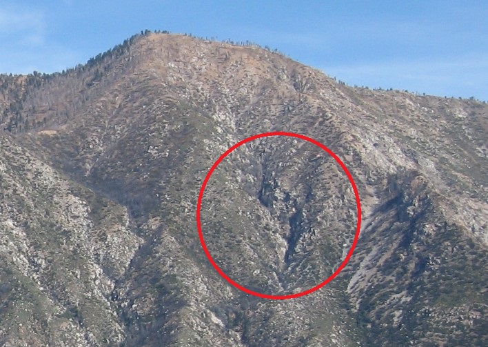
Thanks. There is a section near the top that has me wondering.

-
Taco
- Snownado survivor
- Posts: 6213
- Joined: Thu Sep 27, 2007 4:35 pm
Lost canyon ain't sheeyit compared to the stuff around Schwaterfall. :-/ Misery.
Gonna go give it a shot? Please be careful with your steep scary climb deals as always.
Gonna go give it a shot? Please be careful with your steep scary climb deals as always.