Glen Canyon Falls

TRs for the San Gabriel Mountains.
Post Reply
User avatar
missy
Posts: 83
Joined: Thu Jul 31, 2014 2:14 am

Post by missy »

After the recent socal rain we received, I decided it’d be a great chance to see Glen Canyon Falls of the West Fork San Gabriel River. Gotta make this a bike hike unless you enjoy long walks on paved roads (12.6 mi r.t.)

Indeed, it was a very pleasant smooth and scenic ride with the road following West Fork to Glen Campground. The sight of these spectacular falls merited a second visit later in the week to share the experience.

At the start of the bike ride.
Image

At about 3 miles you pass a set of 4 beautiful unnamed waterfalls on your left. They flow into the West Fork from the south.
Image

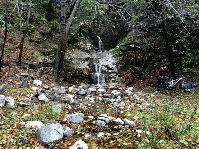
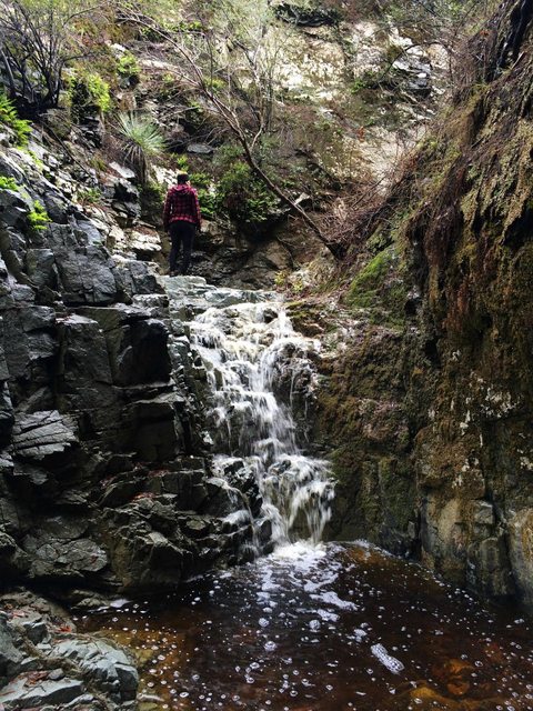
We got off our bikes to explore them. It was an easy scramble to the second fall.
Image

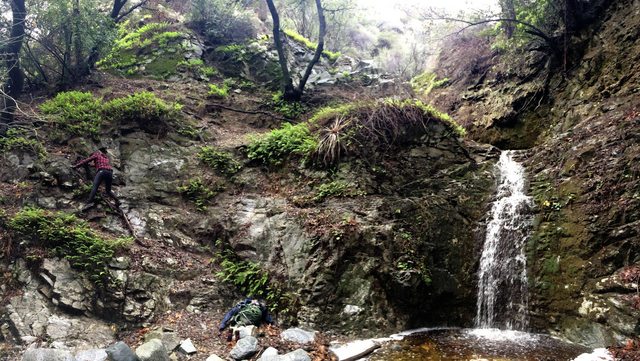
Interesting water color…..minerals?
Image

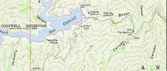
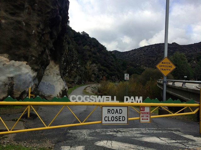
Further on the road, we passed several other mini falls flowing into West Fork. At 6.3 mi, a big empty Glen campground came into view. However when I came again this past Saturday the campground was crowded. A good portion of the campers were teenage boys (boy scouts?). We rode on past Glen campground to the Cogswell dam gate (boy that was a workout!) and then back to Glen Campground.

At Glen campground, we snatched the only available spot with a picnic table for a lunch break before hitting the Canyon. We were entertained watching the boys struggle to chop wood. A circle of them were standing around watching as one guy struggled with the ax. A good stretch of time passed by (45 minutes) and there was about two pieces cut.

We stashed our bikes and headed towards the Canyon. Its only about a quarter mile up the creek before you reach the base of the lower falls....
Image

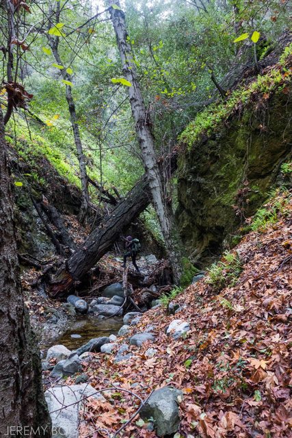
....and they were stunning.
Image

Image

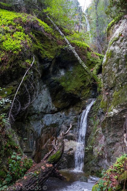
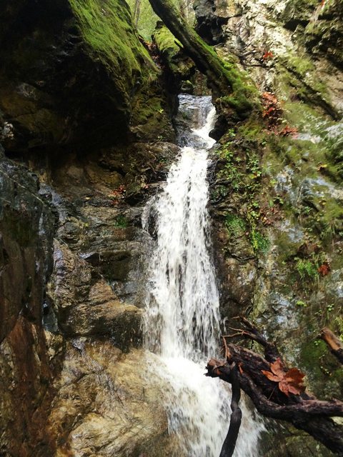
A rather large trunk sits on the left side allowing you to walk right up to the waterfall. Looks like its been there for a couple of years. From a certain angle, we were able to barely see all three falls at the same time. However I wouldn’t recommend climbing the steep slope to try to get a better view of the upper falls. But of course, I had to find that out for myself. I tried several different ways until I realized there was a rope buried underneath the dirt. It was tied to a tree half way up. I used the rope until I came to the end of it. I felt like the recent rains made the dirt more loose than usual and everything was deteriorating underneath my feet. I contemplated how long the descent was going to take and decided I had enough.

In his website, Dan Simpson wrote “Bottom line, I don't think the reward of going past the lower falls is worth the danger and risk, unless of course, you have technical canyoneering skills and equipment” Does anyone have a different experience?

So the second time I came that week, I didn’t bother trying.

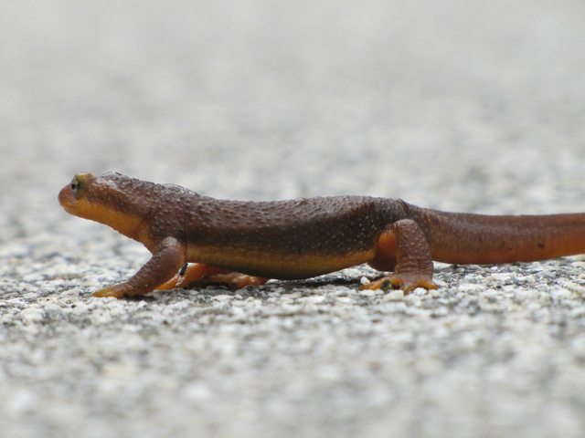
Hopping back onto our bikes we rode back to our cars, admiring all these little fellas on the road.
Image

Image
User avatar
longcut
Posts: 190
Joined: Wed Feb 02, 2011 1:40 pm

Post by longcut »

Wow missy, beautiful pictures. i havent seen those falls looking like that in years. reminds me of the old days flyfishing up there. I too have not been further up than you went and honestly that place is pretty fragile so I hope too many people dont try it. I gotta take the kids up there to see this place. thanks for sharing.

tallkan
User avatar
missy
Posts: 83
Joined: Thu Jul 31, 2014 2:14 am

Post by missy »

longcut wrote: Wow missy, beautiful pictures. i havent seen those falls looking like that in years. reminds me of the old days flyfishing up there. I too have not been further up than you went and honestly that place is pretty fragile so I hope too many people dont try it. I gotta take the kids up there to see this place. thanks for sharing.

tallkan
I agree about the climb! and thank you always for taking the time to read and appreciate my stuff. This canyon and its falls are immaculate.
User avatar
AW~
Posts: 2040
Joined: Mon Oct 01, 2007 12:00 pm

Post by AW~ »

missy wrote: In his website, Dan Simpson wrote “Bottom line, I don't think the reward of going past the lower falls is worth the danger and risk, unless of course, you have technical canyoneering skills and equipment” Does anyone have a different experience?
https://eispiraten.com/a ... riel+river

It happens to be true...You cant get back down without a 'rope'. As it happens, the 'way up' is very fragile, as in a limited number of attempts. As in I dont plan on going back there because Ive seen it and want it to exist for someone else(if it does). Its not rock climbing. There is no rock, there is no crack, there is no handhold....just a dirt slope that goes to 90 degrees for about 5 ft and then to 45 degrees which is sticking out from the vertical ground.
User avatar
missy
Posts: 83
Joined: Thu Jul 31, 2014 2:14 am

Post by missy »

AW wrote:
missy wrote: In his website, Dan Simpson wrote “Bottom line, I don't think the reward of going past the lower falls is worth the danger and risk, unless of course, you have technical canyoneering skills and equipment” Does anyone have a different experience?
https://eispiraten.com/a ... riel+river

It happens to be true...You cant get back down without a 'rope'. As it happens, the 'way up' is very fragile, as in a limited number of attempts. As in I dont plan on going back there because Ive seen it and want it to exist for someone else(if it does). Its not rock climbing. There is no rock, there is no crack, there is no handhold....just a dirt slope that goes to 90 degrees for about 5 ft and then to 45 degrees which is sticking out from the vertical ground.
Great pictures! Amazing how the canyon changes. And good to know, it definitely felt like I couldn't grab onto anything nor securely step on anything. All I was able to do was lean my weight in and the occasional tree root to hold onto. Gnarly gnarly. Admiring the lower falls was beautiful enough. Thanks for sharing that trip report!
User avatar
AW~
Posts: 2040
Joined: Mon Oct 01, 2007 12:00 pm

Post by AW~ »

Cogswell dam spillway should be open to walk on....and well worth the remaining distance from Glen camp. Past the dam the trail condition is not known to me, especially down into Devils canyon at the very end of the trail.
Id recommend any attempt at it during spring, since flowers are still blooming on the hillsides there.

Nice photos yourself...nice camera :D
Im just glad someone else sees some beauty in the West Fork SG river.
A lot of work to get something decent, but some cool remote places that may beckon to you. And yes!, the canyons/drainages can be so different from season to season. They are almost all spring-fed, and have almost no water flowing above them.
User avatar
Tom Kenney
Posts: 371
Joined: Sat Sep 29, 2007 7:51 pm

Post by Tom Kenney »

Nice pics...thanks!

IIRC, the brown color of the water is tannin from oak detritus. After a good rainy season it mellows quite a bit.
User avatar
Uncle Rico
Posts: 1402
Joined: Thu Mar 20, 2008 7:48 pm

Post by Uncle Rico »

Beautiful pics Ms. Missy. Love to see the water flowing. Nice newt(?).
IIRC, the brown color of the water is tannin from oak detritus. After a good rainy season it mellows quite a bit.
Good stuff TK. I did not know that.
Post Reply