Many years ago, my wife and I spent three days sailing around the Channel Islands on a friend's boat, and had a great time. We anchored overnight, but never actually managed to land and hike on any of the islands.
We decided to change that this year. After searching online about other people's trips to the islands, we decided to visit Santa Cruz Island, as it had established campsites, hiking trails, and less bureaucratic hassles than the other islands.
Since we didn't have our own boat, we had to get a ride on someone elses. The park currently allows Island Packers Cruises to service the islands. Campers pay $79 each for the round-trip boat ride. Camping permits are $15 per campsite per night and are issued for the park via phone or the recreation.gov reservation website. The campsites fill up fast in the summer, and we reserved ours over a month in advance.
Now there was a bit of a Catch-22 to get this working. Island Packers wouldn't give us a ride out there unless we had a camping permit, and the park wouldn't give us a camping permit unless we had a ride out there. So what did we do? Well, I'm not at liberty to divulge which entity may or may not have received inaccurate information from us in order to escape this particular Catch-22.
It would also be advised that you thoroughly read all of the information they send you in regard to the boat trip and camping. We discovered that the Scorpion Campground had water, but the Del Norte Campground had none. The Del Norte campsite was the one near Prisoners Harbor, and was the site we chose. Note that it is a three mile hike to get there from the pier, climbing about 600 feet, then dropping 300 feet, followed by another 400 foot climb to end up at 700 feet elevation. So 1000 feet total climbing, which is a nice day's work. We were staying two nights, so we would need about one gallon of water each per day, meaning six gallons total! Forty eight pounds of water! And it had to be carried up there personally; no wheeled coolers or wagons were allowed, as you would discover if you actually read all the fine print.
We decided to make three hiking trips that first day, one for gear, one return trip with an empty pack, and another for the water. We had a five gallon jug that would fit perfectly in my big old backpack, so it wouldn't be too bad. Luckily for us, it was almost-but-not-quite too late when I read the fine print regarding the boat's rules, and discovered that the largest water containers they would take were three gallons, as they had to lift these up by hand onto the pier (five gallon jugs were too heavy, I assume). Backpacks also had a 45 pound weight limit for the same reason (though five gallons of water only weighs 40 pounds). So the night before we left I went to the store and bought two 2.5 gallon water jugs, and I redistributed one or two dense, heavy items from my big pack into a day pack to make sure I'd comply. And it's a good thing that I did, because they had a scale at the dock and checked the weight of everything that went on board!
We left San Diego early for the long drive to Ventura Harbor, and arrived in plenty of time to get our gear loaded. The backpacks were stored down below in the ship's hold, the water jugs were stuffed under a bench seat near the stern, and our bottle of stove fuel was placed (per the rules) in a large metal box that was stored up on deck near the bow (unlike the diesel fuel that the ship uses, gasoline and propane fumes can ignite and are unsafe when stored below decks).
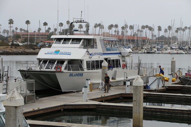
Island Packers Cruises vessel "Islander" in Ventura Harbor, loading gear at the dock.
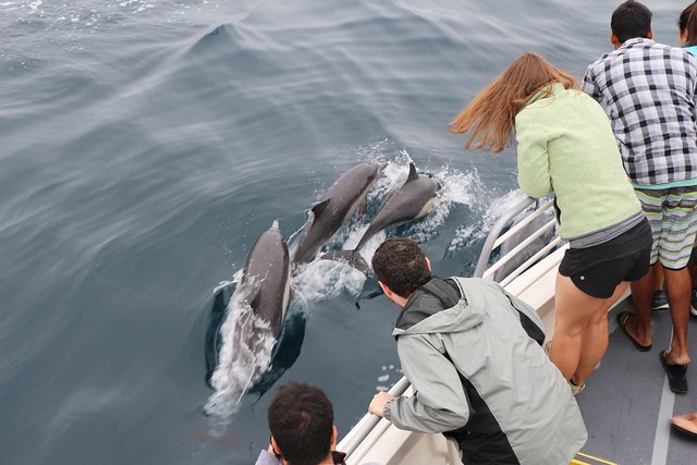
Dolphins next to the ship in the Santa Barbara Channel near Santa Cruz Island.
Dolphin Pod Video
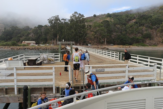
Off-loading at Prisoners Harbor Pier on Santa Cruz Island.

The majority of passengers came with a guide service and were kayaking in Prisoners Harbor.
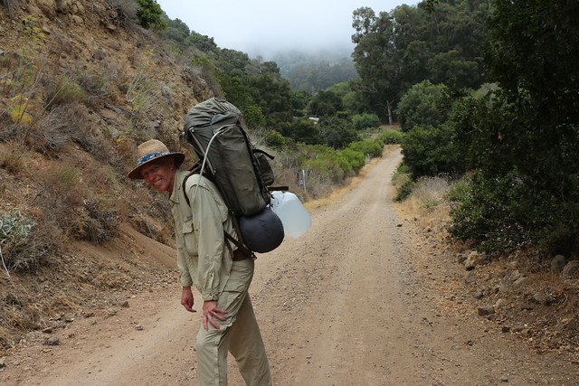
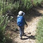
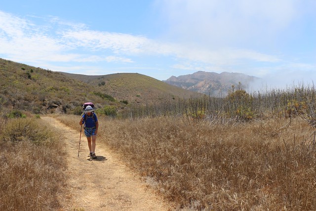
Carrying too much water on the Navy Road near Prisoners Harbor. We quickly realized that this was not a viable long-term strategy. Seventy pound packs get old really fast when trudging uphill!
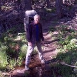
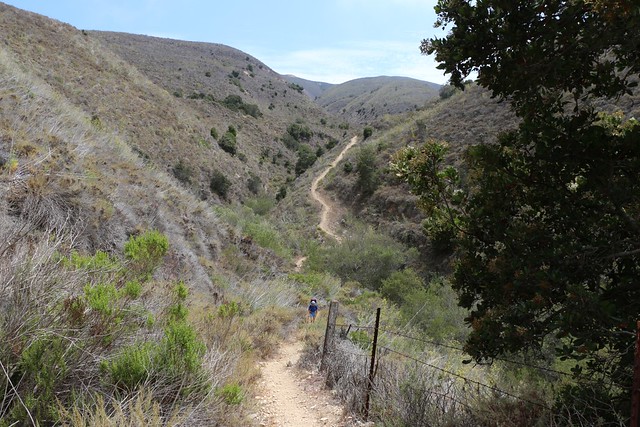
Carrying two water jugs uphill on the Navy Road above Prisoners Harbor. We stashed the jugs in the bushes and hiked on. It was too hot to carry our backpacks plus the water uphill. Once we broke through the low clouds, the sun was fierce and the shade non-existent.
We reached the intersection with the Del Norte Trail, and hung a left. Looking west is Red Peak (elev 1822 feet) in the distance.
Hiking the Del Norte Trail up from a valley. There was a trickle of water down there. They lied about no water! This made me mad, knowing that I still had to go all the way back for the two jugs. I know it wasn't much, water-wise, but I've filtered nastier water along the desert portions of the PCT. Oh well. Time to hike onward.
We made it down to the next canyon bottom where there was a tree and some shade. My wife decided to take a serious nap, as she was tired and gets overheated easily. I emptied my big backpack and set off to get the water by myself.
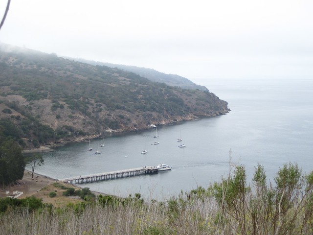
Looking back at Prisoners Harbor from the Navy Road after returning for the two jugs of water. The kayaks had been loaded on the ship and the rest of the crowd were boarding in preparation for the trip to the mainland.
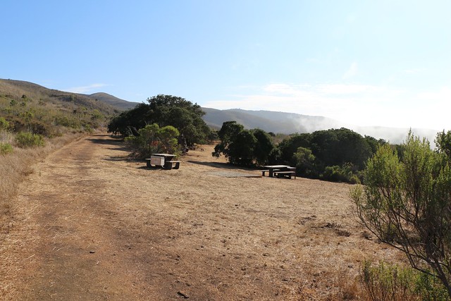
Campsites at the Del Norte Campground. There were five tent sites, with picnic tables and bear-boxes (since there are no bears on the islands, these should more accurately be called fox-boxes).
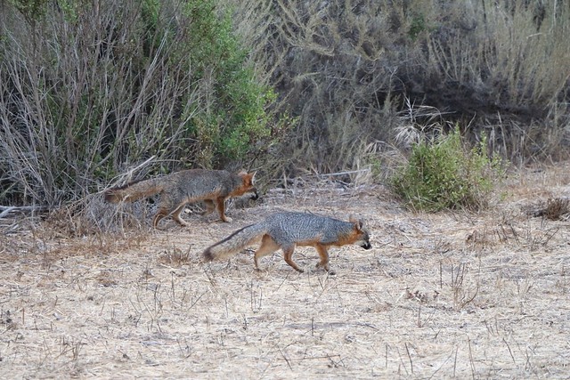
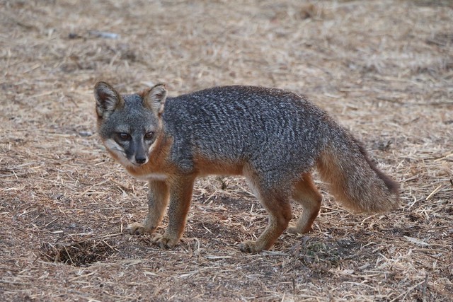
Two California Channel Island Foxes (Urocyon littoralis santacruzae) at the Del Norte Campground. These critters were looking extremely well fed. They came out to search the campground at both dawn and dusk. Nearby, we found a trail of debris that led into the brush where they often dragged their stolen loot. These island foxes have no natural predators, so over time they evolved to be smaller than the mainland variety. These campsite rogues also had little to no fear of humans, though they were wary enough, not coming much closer to us than about fifteen feet. We took way too many photos of them.
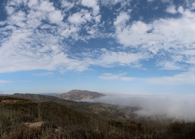
The next morning we woke up inside the clouds. Cool and moist, with little visibility. But we knew it wouldn't last. Still, we decided to start hiking uphill while it was easy. Our plan was to visit the Pacific Ocean on the south side of the island. From what I could tell on the maps, there was a road down toward Valley Anchorage that was still on the Park's side of the property boundary with the Nature Conservancy.
Another option for this trip was to spend the second day hiking the twelve miles east to Scorpion Anchorage, where we could have taken the same boat back to Ventura. We decided against it after looking at the weather reports: It was predicted to be over 90 degrees that day during the humid summer monsoon. Not a great prospect for hiking on a near-shadeless island.
So, we decided to simply day-hike and relax. Take life easy. "We be on Island Time, mon."
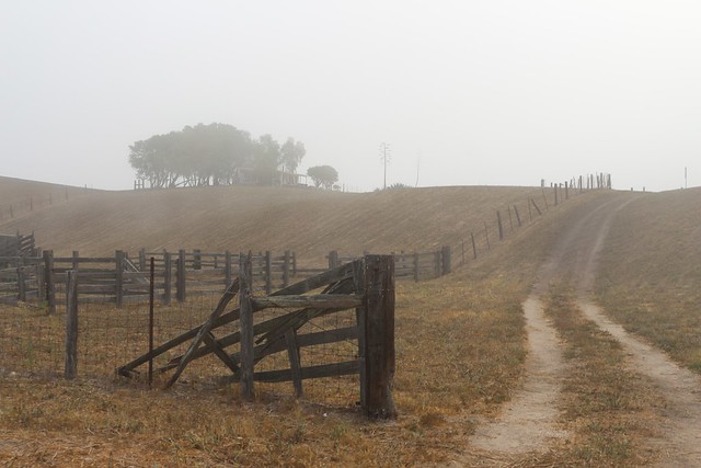
Ranger's ranch house southeast of the Del Norte Campsite. Nice place. They even had a tractor that kept the invasive fennel plants cut back (they also used it to mow the campground). It was quite scenic.
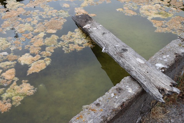
Old concrete water trough at the ranger's ranch house. There was also a nice new garden hose on a spigot with clean water! We had been lied to once again! There was plenty of water within a half mile of the campground. I hate to say this, but a reasonable person can't help but come to the conclusion that the park doesn't want the public visiting the island at all. Could this really be true? For shame!
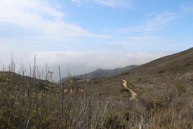
Climbing uphill toward the Navy Road as we break out into the sun.
Devils Peak (2450 feet, also called Mount Diablo) and Red Peak (1822 feet) from the Navy Road. They are both in the western part of the island which is owned by the Nature Conservancy.
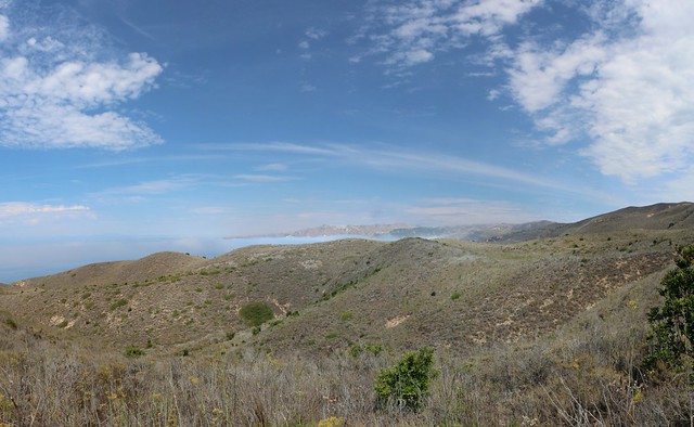
Looking south toward Valley Anchorage and the Pacific Ocean from the Navy Road.
This is where we discovered that I erred in thinking that we could descend to the Pacific Ocean via the road. There was a locked gate complete with "No Trespassing" signs. It was sad that the Nature Conservancy doesn't allow public access to the island in this area, but technically it's their property and not the public's, so we couldn't complain much. All I can really do about it is whine ineffectually here on an internet forum.
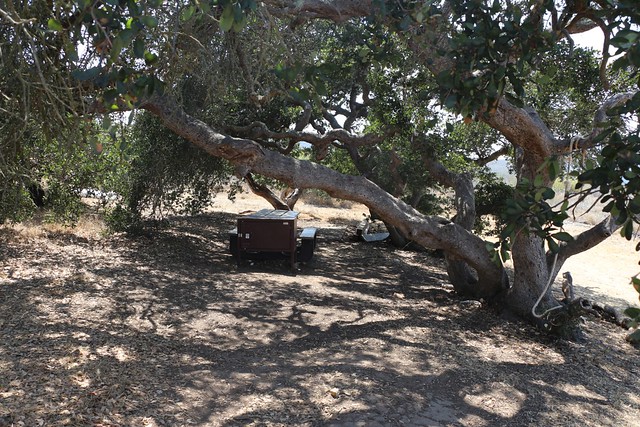
We hiked back to camp and hung out under the oak trees and read our books. Very mellow.
Looking east toward High Mount (elevation 1581 feet) from the Del Norte Trail not far from camp.
Yet another dinnertime visit by our local California Channel Island Fox representative.
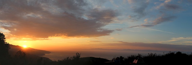
Sunset from the Campground. Yes, that's the California mainland west of Santa Barbara in the distance.
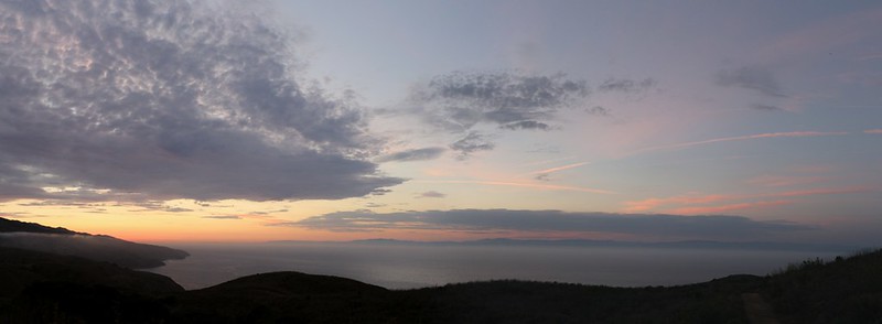
Another sunset shot. We took way too many pictures of this, as it kept changing and getting better every few minutes.
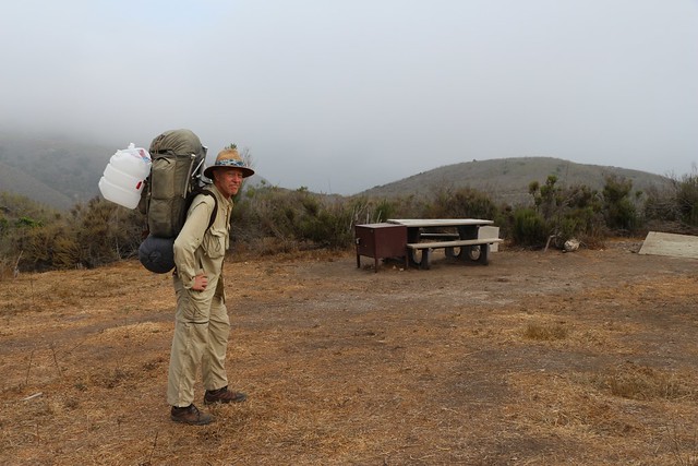
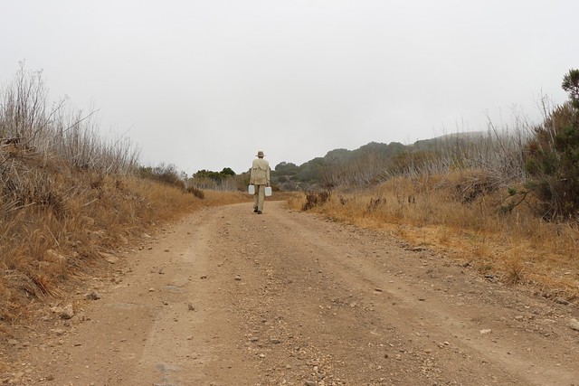
Hiking out in the morning with much-easier-to-carry empty jugs.
We hiked out early and arrived back at the harbor before the next boatload of kayakers arrived. It was hot, so my wife waded into the calm water up to her waist. While she was out there a school of tiny fish swarmed around her and tickled her legs, causing her to giggle. Little fish school video
After that we decided to simply hang out on the Prisoners Harbor pier in the quiet of the morning. Video of the creaking dock.
When the boat arrived we realized that we had to hang out all day until it left at three in the afternoon. To pass the time, and to gain some local knowledge, we signed up for the Nature Conservancy Hiking Tour. We hiked along with our guide (a guide is required) northwestward along the shore toward Pelican Bay. And, indeed, we learned many interesting things about the endemic flora and fauna on these islands. It was a nice way to spend the afternoon.
On the boat ride back, we once again came upon a large pod of dolphins, many of which were having fun surfing in the boat's wake. Seeing them was a great way to end an excellent weekend.
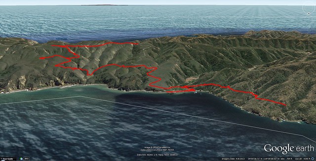
Our hiking track as seen in Google Earth.
These and other photos from the trip can be found on my Flickr page.
Caltopo Map Page