
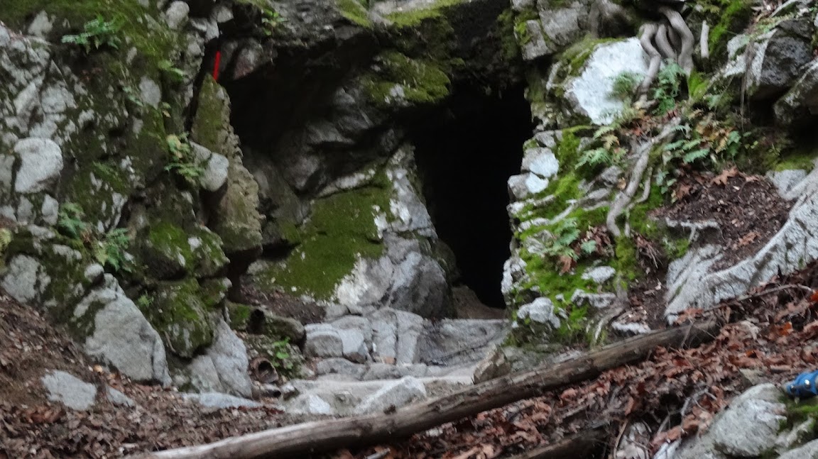
I think this trail has been discussed previously, but I didn't have any context (i.e., I hadn't been there) so it didn't resonate. But, can someone tell me where the unmarked trail at 34.198858, -118.082425 between Henninger Flats and the Idlehour Trail lead to. It's more than a use trail because it looks like its had work done on it, but I don't see it on any maps. Is this the secret passage into upper Eaton Canyon?
Approximate location here:
http://caltopo.com/map.html#ll=34.19886 ... 2&z=17&b=f
Esme Canyon Tunnel Access Path
-
Uncle Rico

- Posts: 1484
- Joined: Thu Mar 20, 2008 7:48 pm
Here's a sub-optimal phone pic of the trail I'm talking about.

-
walker

- Posts: 248
- Joined: Mon Apr 08, 2013 11:14 pm
I just saw this thing on a recent bike ride and wondered where it went myself. I thought I saw a check dam or something down in the drainage.
It's definitely not the "telephone" trail. That one is an old road extending from the spur seen around 34.1979, -188.08881 on your map.
Hmm....
It's definitely not the "telephone" trail. That one is an old road extending from the spur seen around 34.1979, -188.08881 on your map.
Hmm....
-
AW~

- Posts: 2109
- Joined: Mon Oct 01, 2007 12:00 pm
I think thats the Esme water tunnel access path from the MtWilson toll road. It ends kind of a short distance later, less than 100ft below the Idlehour trail@the real Esme canyon. Albeit thats a grungy steep 100ft so a casual person would need to return the same way they came. I say the real Esme canyon, because people take the Idlehour trail and pass by the small bridge and think Esme. Actually that small bridge drainage is a tributary to Esme.
https://eispiraten.com/a ... _3207.html
https://eispiraten.com/a ... _3207.html
-
HikeUp

- Posts: 4070
- Joined: Thu Sep 27, 2007 9:21 pm
AW is correct. Just a short spur trail to the tunnels - pics at AW's link to our report from years ago.
-
Hikin_Jim

- Posts: 4688
- Joined: Thu Sep 27, 2007 9:04 pm
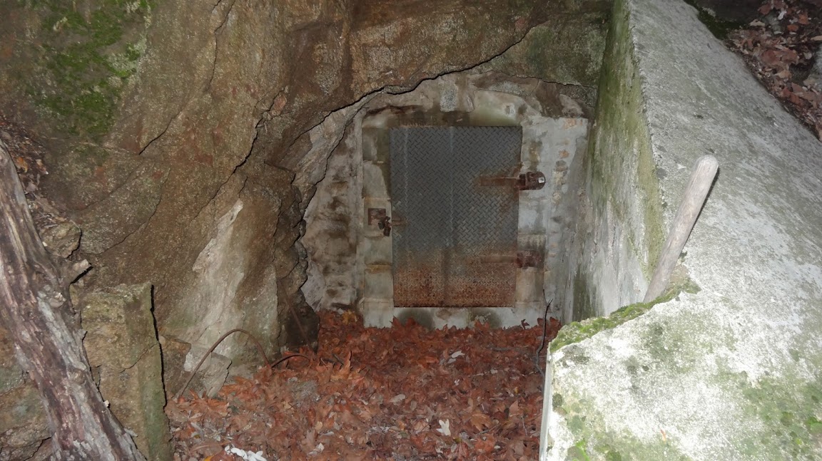
That is the trail to the water tunnel(s) that supplies water to Henninger Flats. Apparently it's dry now though.
Not much too it.
HJ
Not much too it.
HJ
-
Uncle Rico
- Posts: 1484
- Joined: Thu Mar 20, 2008 7:48 pm
Damn, what don't you guys know? Glad to have y'all as a resource. 8)
-
CrazyHermit

- Posts: 343
- Joined: Mon Sep 07, 2015 1:03 pm
There's also a third tunnel if you keep walking up that trail. At that point the trail dead ends. The locked one is a water tunnel for Henniger Flats. I got kicked out of there by a fire department guy. I'd love to see the inside of the locked one. Very possible it was converted from an old gold mine. Also farther down in that same canyon is the old Telephone Trail that takes you to the top of the last waterfall in Eaton Canyon. At that point you're officially in UPPER Eaton Canyon. You can get to the start point by walking down the Helipad Road (straight) and when it starts looping to the left around the mountain look down in the canyon, to your right. It's kind of hidden and in fairly poor shape in some places. If you continue down the road instead it leads to three or four dirt mesas they cut out to land fire helicopters, and then it circles all the way back to where you started. It's marked No Trespassing, but nobody patrols it..