SGNM Boundary

Trip planning, history, announcements, books, movies, opinions, etc.
Post Reply
User avatar
turtle
Posts: 152
Joined: Wed Jan 27, 2010 11:35 am

Post by turtle »

I've taken a stab at defining the newly declared National Monument boundary in KMZ and KML format. (Attached below.)

I created the map by painstakingly following the point by point definition provided in the proclamation. I am not at all confident that I did this in an error free manner. So please feel free to edit and improve upon the map where possible, resubmitting improved (and appropriately numbered) versions here.

A few sections of the boundary proved particularly problematic for me to interpret...

(1) The transition from 3N17 to the PCT near Magic Mountain and Mt. Gleason.

(2) Traversing Baldy Bowl near Gold Ridge Mine.

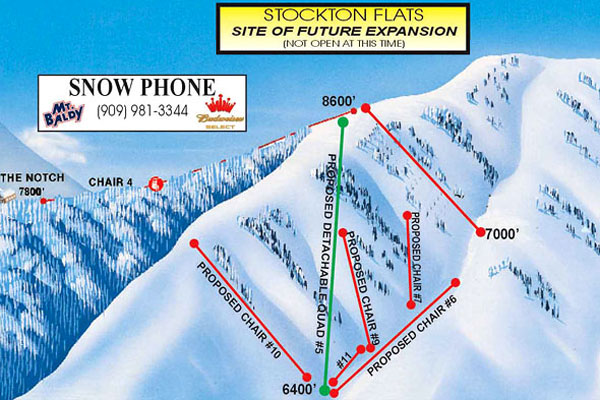
(3) Following Baldy Road "northwesterly" while maintaining a parallel offset of 100 feet in a "southeasterly" direction near Stockton Flats. :evil:

(4) Closing the boundary. (a) I defined the boundary as a PATH in Google Earth and I'm not sure it's possible to close a PATH. (b) The final step in the proclamation says to return to the Point of Beginning by travelling north along a section line. However, following an offset to the PCT, I intersected this section line north of the Point of Beginning. I altered the Point of Beginning accordingly.

Image
Click to download file
Image
Click to download file
User avatar
mattmaxon
Posts: 1137
Joined: Mon Mar 24, 2008 12:48 pm

Post by mattmaxon »

Thanks for this! I'd not paid much attention to this. Strange to me the areas that where left out of the declaration and ones that where included.
User avatar
Gene
Posts: 197
Joined: Mon Dec 26, 2011 7:54 pm

Post by Gene »

So it might all be about what they are excluding from 'protection' especially if this replaces the National Forrest and leaves those excluded portion open to development.
User avatar
walker
Posts: 248
Joined: Mon Apr 08, 2013 11:14 pm

Post by walker »

Thanks so much for taking the time to do this.

I'm scratching my head about some of this. I guess the SGR watershed is one of the main focus areas for the additional resources that are supposed to come along with this. I hope that area at least is provided some much needed TLC.

Other than that, any area that might cause a little bit of controversy seems to have been intentionally left out - most of the front range foothill areas, places with a large number of private inholdings, places containing infrastructure such as debris basins and flood control, spots with business, industrial or development interests, etc. They probably didn't want to get bogged down by ruffling too many feathers.

From what I've read, the San Bernardino county supervisors were really against it, as was Mike Antonovitch in LA County with his high-speed rail tunnel (the proposed route along Big Tujunga has mostly been left outside of the boundaries).

I'm just wondering if this means that areas outside the monument boundary that are heavily neglected and also could really use some resources do not qualify for the 3.5 million or so that has been mentioned so far.
User avatar
AW~
Posts: 2038
Joined: Mon Oct 01, 2007 12:00 pm

Post by AW~ »

Awesome work!
User avatar
hvydrt
Posts: 494
Joined: Thu Sep 27, 2007 8:18 pm

Post by hvydrt »

Good Job! I imported your file onto the USFS Map with Caltopo. Here it is>>>>>>http://caltopo.com/map?id=1E0R
User avatar
fortified
Posts: 105
Joined: Sat Mar 02, 2013 10:03 pm

Post by fortified »

THE BOUNDRY? This is but one piece of a larger picture that literally has no boundary. First, the government just stole the mountains.......and not a sound is made.... "We're from the government, and we are here to help"
The big picture? The big picture is one no one wants to believe, but when you have these actions and no one thinks twice, its game over.
THE BIGGER PICTURE?
Look at this map from the government itself. 70% of California will turn into government controlled no people zone. It is going national.
https://www.wildlife.ca.gov/Conservatio ... nnectivity

Now lets expand that to ...yes the government itself has it in plane view... The map of the future U.S.
Google "agenda 21 map" Take your pic. Chose any site you want. It is all the same map.
Now simply go to wiki for a little background
http://en.wikipedia.org/wiki/Agenda_21
You don't have to go to any wacko conspiracy sites to read this stuff. We are all blind to it in front of our eyes.
Our water rights are now gone. The government can, and will now confiscate any private property needed in the SGM. No one read the damn thing. Our beds are burning.....and we are asleep. This is not a left/right issue. This is a global movement, fought locally.
What is at stake is everything, freedom, the right to private property etc. What can be done?
Start here:
http://www.democratsagainstunagenda21.com/
User avatar
Mike P
Posts: 1005
Joined: Tue Oct 02, 2007 10:48 pm

Post by Mike P »

More info or lack thereof is in today's San Gabriel Valley Tribune and sister papers: Why was the Arroyo Seco Left Out?
User avatar
mattmaxon
Posts: 1137
Joined: Mon Mar 24, 2008 12:48 pm

Post by mattmaxon »

Why was the front county left out? Excellent question. High Desert was included to prevent any further development IMO

I agree with the posts saying debris basins, power lines, water companies etc. Have too many powerful interests behind them
User avatar
walker
Posts: 248
Joined: Mon Apr 08, 2013 11:14 pm

Post by walker »

A somewhat more informative and less geography-challenged write-up of the same info in the article can be found here:

http://www.arroyoseco.org/sgmnm.htm

Anyone else notice that peculiar sharp spear in the boundary line near Stockton Flat? Would that possibly accommodate the bottom of a ski lift in the "future expansion" that Baldy Ski Lifts has been talking about since before time began? Or was that upper northeasterly lobe shape intentionally added just to rule it out? Then again, maybe it's just because the forest road extends all the way up into that area?

One last thing, is it just me or is it too much to ask for local journalists who know which way to look to see the San Gabriel mountains?

Notice the second photo accompanying this editorial:

http://www.latimes.com/opinion/editoria ... story.html
User avatar
turtle
Posts: 152
Joined: Wed Jan 27, 2010 11:35 am

Post by turtle »

mattmaxon wrote: Why was the front county left out? Excellent question...
I agree with the posts saying debris basins, power lines, water companies etc. Have too many powerful interests behind them
I'll note there is language in the Proclamation that would seemingly allow such activities to continue unabated.

But perhaps even this language was not enough to appease.

Code: Select all

Nothing in this proclamation shall be construed to interfere with the operation or maintenance, nor with the replacement or modification within the existing authorization boundary, of existing water resource, flood control, utility, pipeline, or telecommunications facilities that are located within the monument, subject to the Secretary of Agriculture’s special uses authorities and other applicable laws. Existing water resource, flood control, utility, pipeline, or telecommunications facilities located within the monument may be expanded, and new facilities may be constructed within the monument, to the extent consistent with the proper care and management of the objects protected by this proclamation, subject to the Secretary of Agriculture’s special uses authorities and other applicable law.
User avatar
turtle
Posts: 152
Joined: Wed Jan 27, 2010 11:35 am

Post by turtle »

walker wrote: Anyone else notice that peculiar sharp spear in the boundary line near Stockton Flat? Would that possibly accommodate the bottom of a ski lift in the "future expansion" that Baldy Ski Lifts has been talking about since before time began? Or was that upper northeasterly lobe shape intentionally added just to rule it out? Then again, maybe it's just because the forest road extends all the way up into that area?
Interesting... though if Baldy's "Site of Future Expansion" diagram is to be given any weight, there would be other ski lift bases outside the spear. But maybe it would enable improvement of the access road to allow for vehicular traffic to the backside? And perhaps the construction of a ski lodge and parking area?

A Press Enterprise article, however, suggests that Baldy's manager was himself in suspense regarding the impact of the monument on his expansion plans.

Code: Select all

Robby Ellingson, general manager of Mount Baldy Ski Lifts Inc., which has permits to operate on 700 acres of National Forest Land, has said he is worried that if his resort is within the monument, it will kill plans for expansion on the mountain’s back side.
User avatar
Uncle Rico
Posts: 1394
Joined: Thu Mar 20, 2008 7:48 pm

Post by Uncle Rico »

Here's my uninformed take that will probably get me into trouble.

Seems to me that if you're going to declare the San Gabes, or a portion of them, a national monument, the front range piece is a bit of a damned if you do, damned if you don't proposition. If you include it in the monument, you're going to get hammered with the "access" and "land grab" accusations. If you exclude it, everyone's going to gripe that you left out the piece that needs additional federal funding the most.

If I was Prez and was declaring the San Gabes a national monument, I'd probably do pretty much what O did. And if folks like the San Bernardino County Board of Supervisors griped afterwards out the disparity in federal funding for the lands within the monument vs. the land outside the monument, I'd probably tell them to go fuck themselves. He, he.

Okay, back to the Wild Turkey. :twisted:
User avatar
AW~
Posts: 2038
Joined: Mon Oct 01, 2007 12:00 pm

Post by AW~ »

Another map was released, credit to the collaborative....

https://www.arcgis.com/home/webmap/view ... 89,34.8808

Also has all the forest roads if you drill down into the detail.
Post Reply